Property Information
mobile view
| Serial Number: 67:003:0001 |
Serial Life: 2018... |
|
|
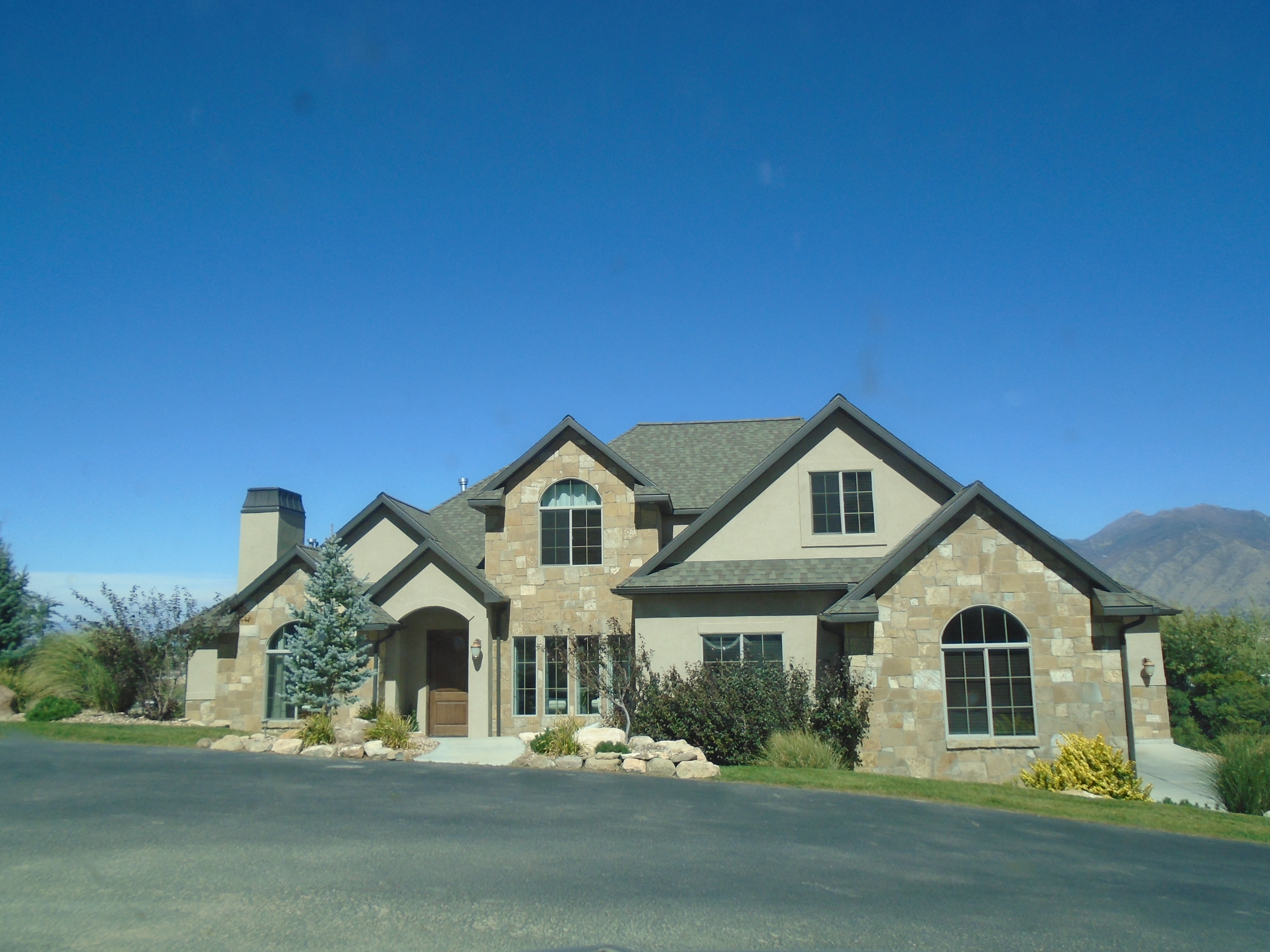 Total Photos: 1
|
| |
|
|
| Property Address: 2426 S SPANISH OAK DR - SPANISH FORK |
|
| Mailing Address: 2426 S SPANISH OAK DR SPANISH FORK, UT 84660 |
|
| Acreage: 0.791406 |
|
| Last Document:
128216-2017
|
|
| Subdivision Map Filing |
|
| Taxing Description:
LOT 1, PLAT C, MCINELLY ESTATES SUB AREA 0.791 AC.
*Taxing description NOT FOR LEGAL DOCUMENTS
|
|
- Owner Names
- Value History
- Tax History
- Location
- Photos
- Documents
- Aerial Image
| |
----- Real Estate Values ----- |
---Improvements--- |
---Greenbelt--- |
Total |
| Year |
Com |
Res |
Agr |
Tot |
Com |
Res |
Agr |
Tot |
Land |
Homesite |
Tot |
Market Value |
| 2024 |
$0 |
$253,100 |
$0 |
$253,100 |
$0 |
$657,300 |
$0 |
$657,300 |
$0 |
$0 |
$0 |
$910,400 |
| 2023 |
$0 |
$253,000 |
$0 |
$253,000 |
$0 |
$672,900 |
$0 |
$672,900 |
$0 |
$0 |
$0 |
$925,900 |
| 2022 |
$0 |
$269,800 |
$0 |
$269,800 |
$0 |
$621,100 |
$0 |
$621,100 |
$0 |
$0 |
$0 |
$890,900 |
| 2021 |
$0 |
$142,000 |
$0 |
$142,000 |
$0 |
$540,600 |
$0 |
$540,600 |
$0 |
$0 |
$0 |
$682,600 |
| 2020 |
$0 |
$123,500 |
$0 |
$123,500 |
$0 |
$487,000 |
$0 |
$487,000 |
$0 |
$0 |
$0 |
$610,500 |
| 2019 |
$0 |
$114,000 |
$0 |
$114,000 |
$0 |
$454,500 |
$0 |
$454,500 |
$0 |
$0 |
$0 |
$568,500 |
| 2018 |
$0 |
$114,000 |
$0 |
$114,000 |
$0 |
$454,500 |
$0 |
$454,500 |
$0 |
$0 |
$0 |
$568,500 |
| Year |
General Taxes |
Adjustments |
Net Taxes |
Fees |
Payments |
Tax Balance* |
Balance Due |
Tax District |
| 2025 |
$0.00 |
$0.00 |
$0.00 |
$0.00 |
|
$0.00
|
$0.00 |
150 - SPANISH FORK CITY |
| 2024 |
$0.00 |
$0.00 |
$0.00 |
$0.00 |
|
$0.00
|
$0.00 |
150 - SPANISH FORK CITY |
| 2023 |
$4,935.09 |
$0.00 |
$4,935.09 |
$0.00 |
|
$0.00
|
$0.00 |
150 - SPANISH FORK CITY |
| 2022 |
$4,841.64 |
$0.00 |
$4,841.64 |
$0.00 |
|
$0.00
|
$0.00 |
150 - SPANISH FORK CITY |
| 2021 |
$4,216.08 |
$0.00 |
$4,216.08 |
$0.00 |
|
$0.00
|
$0.00 |
150 - SPANISH FORK CITY |
| 2020 |
$3,878.54 |
$0.00 |
$3,878.54 |
$0.00 |
|
$0.00
|
$0.00 |
150 - SPANISH FORK CITY |
| 2019 |
$3,432.86 |
$0.00 |
$3,432.86 |
$0.00 |
|
$0.00
|
$0.00 |
150 - SPANISH FORK CITY |
| 2018 |
$3,551.36 |
$0.00 |
$3,551.36 |
$0.00 |
|
$0.00
|
$0.00 |
150 - SPANISH FORK CITY |
* Note: Original tax amount (Does not include applicable interest and/or fees).
| Entry # |
Date |
Recorded |
Type |
Party1 (Grantor) |
Party2 (Grantee) |
| 37393-2021 |
01/24/2021 |
02/26/2021 |
REC |
CENTRAL BANK TEE |
NELSON, RYAN S & MICHELLE |
| 11565-2021 |
01/15/2021 |
01/21/2021 |
D TR |
NELSON, RYAN S & MICHELLE |
UNITED WHOLESALE MORTGAGE LLC |
| 128216-2017 |
11/01/2017 |
12/26/2017 |
S PLAT |
MCINELLY, BRETT & KRISTIN (ET AL) |
MCINELLY ESTATES PLAT C |
Main Menu Comments or Concerns on Value/Appraisal - Assessor's Office
Documents/Owner/Parcel information - Recorder's Office
Address Change for Tax Notice
This page was created on 9/17/2024 5:40:49 AM |