Property Information
mobile view
| Serial Number: 08:008:0028 |
Serial Life: 2019... |
|
|

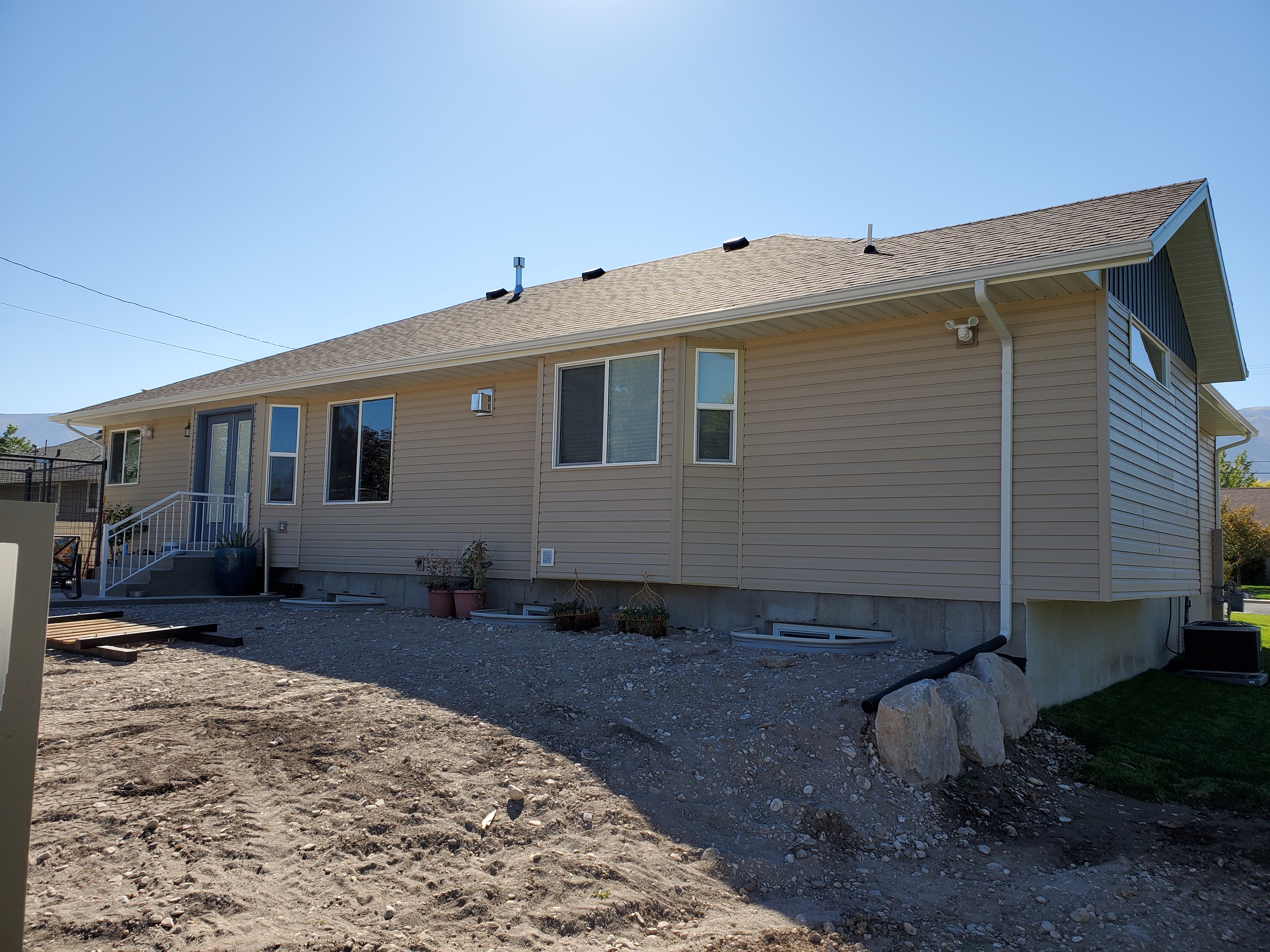
Total Photos: 2
|
| |
|
|
| Property Address: 534 W 300 SOUTH - PAYSON |
|
| Mailing Address: 534 W 300 S PAYSON, UT 84651 |
|
| Acreage: 0.317287 |
|
| Last Document:
106500-2018
|
|
| Subdivision Map Filing |
|
| Taxing Description:
COM N 89 DEG 46' 18" W 110 FT FR SW COR. BLK 11, PLAT A, PAYSON CITY SURVEY.; N 89 DEG 46' 18" W 77.5 FT; N 0 DEG 13' 42" E 93.77 FT; E 5 FT; N 0 DEG 13' 42" E 90.5 FT; S 89 DEG 46' 18" E 72.5 FT; S 0 DEG 13' 42" W 184.27 FT TO BEG. AREA 0.317 AC.
*Taxing description NOT FOR LEGAL DOCUMENTS
|
|
- Owner Names
- Value History
- Tax History
- Location
- Photos
- Documents
- Aerial Image
| |
----- Real Estate Values ----- |
---Improvements--- |
---Greenbelt--- |
Total |
| Year |
Com |
Res |
Agr |
Tot |
Com |
Res |
Agr |
Tot |
Land |
Homesite |
Tot |
Market Value |
| 2024 |
$0 |
$115,300 |
$0 |
$115,300 |
$0 |
$332,200 |
$0 |
$332,200 |
$0 |
$0 |
$0 |
$447,500 |
| 2023 |
$0 |
$115,300 |
$0 |
$115,300 |
$0 |
$342,800 |
$0 |
$342,800 |
$0 |
$0 |
$0 |
$458,100 |
| 2022 |
$0 |
$122,900 |
$0 |
$122,900 |
$0 |
$286,400 |
$0 |
$286,400 |
$0 |
$0 |
$0 |
$409,300 |
| 2021 |
$0 |
$98,300 |
$0 |
$98,300 |
$0 |
$235,700 |
$0 |
$235,700 |
$0 |
$0 |
$0 |
$334,000 |
| 2020 |
$0 |
$85,500 |
$0 |
$85,500 |
$0 |
$2,500 |
$0 |
$2,500 |
$0 |
$0 |
$0 |
$88,000 |
| 2019 |
$0 |
$73,800 |
$0 |
$73,800 |
$0 |
$2,500 |
$0 |
$2,500 |
$0 |
$0 |
$0 |
$76,300 |
| Year |
General Taxes |
Adjustments |
Net Taxes |
Fees |
Payments |
Tax Balance* |
Balance Due |
Tax District |
| 2025 |
$0.00 |
$0.00 |
$0.00 |
$0.00 |
|
$0.00
|
$0.00 |
170 - PAYSON CITY |
| 2024 |
$0.00 |
$0.00 |
$0.00 |
$0.00 |
|
$0.00
|
$0.00 |
170 - PAYSON CITY |
| 2023 |
$2,468.91 |
$0.00 |
$2,468.91 |
$0.00 |
|
$0.00
|
$0.00 |
170 - PAYSON CITY |
| 2022 |
$2,242.82 |
$0.00 |
$2,242.82 |
$0.00 |
|
$0.00
|
$0.00 |
170 - PAYSON CITY |
| 2021 |
$2,074.71 |
$0.00 |
$2,074.71 |
$0.00 |
|
$0.00
|
$0.00 |
170 - PAYSON CITY |
| 2020 |
$1,015.87 |
$0.00 |
$1,015.87 |
$0.00 |
|
$0.00
|
$0.00 |
170 - PAYSON CITY |
| 2019 |
$859.14 |
$0.00 |
$859.14 |
$0.00 |
|
$0.00
|
$0.00 |
170 - PAYSON CITY |
* Note: Original tax amount (Does not include applicable interest and/or fees).
| Entry # |
Date |
Recorded |
Type |
Party1 (Grantor) |
Party2 (Grantee) |
| 194071-2021 |
11/13/2021 |
11/18/2021 |
D TR |
GARRETT, LEANNE & DUANE R |
SECURITY SERVICE FEDERAL CREDIT UNION |
| 138343-2020 |
09/11/2020 |
09/11/2020 |
D TR |
GARRETT, LEANNE & DUANE R |
FIRST COLONY MORTGAGE CORPORATION |
| 138342-2020 |
09/10/2020 |
09/11/2020 |
WD |
PROVSTGAARD, ROBERT |
GARRETT, LEANNE & DUANE R |
| 68444-2020 |
05/14/2020 |
05/20/2020 |
WD |
GRAY, RICHARD DANIELS & ALISON WOOD TEE (ET AL) |
PROVSTGAARD, ROBERT |
| 106501-2018 |
11/06/2018 |
11/07/2018 |
N |
PAYSON CITY CORPORATION |
WHOM OF INTEREST |
| 106500-2018 |
11/06/2018 |
11/07/2018 |
QCD |
GRAY, RICHARD DANIELS & ALISON WOOD TEE (ET AL) |
GRAY, RICHARD DANIELS & ALISON WOOD TEE (ET AL) |
Main Menu Comments or Concerns on Value/Appraisal - Assessor's Office
Documents/Owner/Parcel information - Recorder's Office
Address Change for Tax Notice
This page was created on 8/11/2024 10:28:43 PM |
