Property Information
mobile view
| Serial Number: 08:042:0010 |
Serial Life: 1981... |
|
|
 Total Photos: 2
|
| |
|
|
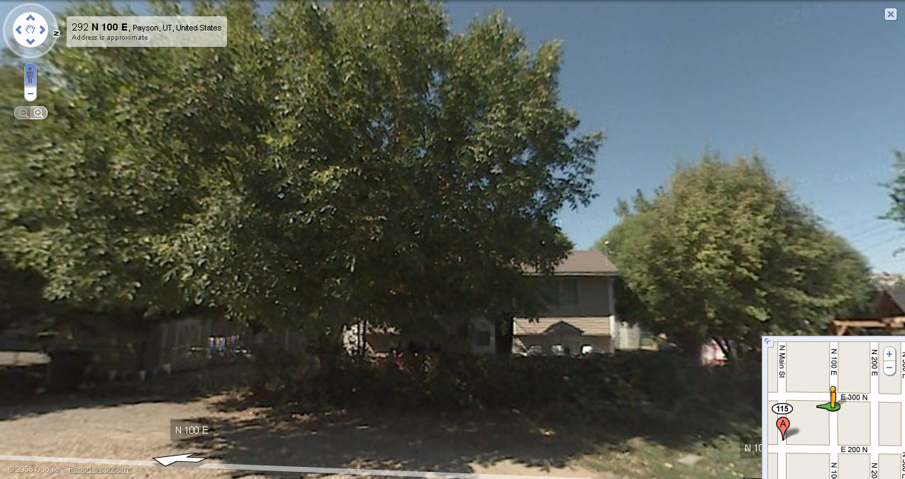
| Property Address: 285 N 100 EAST - PAYSON |
|
| Mailing Address: 285 N 100 E PAYSON, UT 84651-1803 |
|
| Acreage: 0.14 |
|
| Last Document:
19105-2004
|
|
| Subdivision Map Filing |
|
| Taxing Description:
COM. 120 FT E FROM NW COR OF LOT 7, BLK 50, PLAT A, PAYSON CITY SURVEY; S 99 FT; E 61.5 FT; N 99 FT; W 61.5 FT TO BEG.
*Taxing description NOT FOR LEGAL DOCUMENTS
|
|
- Owner Names
- Value History
- Tax History
- Location
- Photos
- Documents
- Aerial Image
| 2016... |
|
JOHNSON, MICHAEL C |
|
| 2011-2015 |
|
DRAPER, LARRY BRYAN |
|
| 2006-2010 |
|
STEEDRA LLC |
|
| 2005 |
|
DRAPER, LARRY B |
|
| 2005 |
|
DUCKWORTH, STEVEN M |
|
| 2005 |
|
STEVENSON, JOHN O |
|
| 2005 |
|
STEWART, JUSTIN J |
|
| 2004 |
|
SECRETARY OF HOUSING AND URBAN DEVELOPMENT THE |
|
| 2004NV |
|
GMAC MORTGAGE CORPORATION |
|
| 2001-2003 |
|
CORTEZ, AGUSTIN CISNEROS |
|
| 2001-2003 |
|
CORTEZ-ALMANZA, JOEL |
|
| 1995-2000 |
|
GARDNER, RENATE L |
|
| 1988-1994 |
|
BLOXHAM, RENATE L |
|
| 1987 |
|
BLOXHAM, RENATE L |
|
| 1987NV |
|
BLOXHAM, HOWARD E |
|
| 1987NV |
|
BLOXHAM, RENATE L |
|
| 1984-1986 |
|
BLOXHAM, HOWARD E |
|
| 1983 |
|
HUNT, DOUGLAS A |
|
| 1983 |
|
HUNT, MADGY |
|
| 1981-1982 |
|
HUNT, DOUGLAS A |
|
| 1981-1982 |
|
HUNT, MADGY |
|
| |
----- Real Estate Values ----- |
---Improvements--- |
---Greenbelt--- |
Total |
| Year |
Com |
Res |
Agr |
Tot |
Com |
Res |
Agr |
Tot |
Land |
Homesite |
Tot |
Market Value |
| 2024 |
$0 |
$98,000 |
$0 |
$98,000 |
$0 |
$280,500 |
$0 |
$280,500 |
$0 |
$0 |
$0 |
$378,500 |
| 2023 |
$0 |
$97,900 |
$0 |
$97,900 |
$0 |
$289,500 |
$0 |
$289,500 |
$0 |
$0 |
$0 |
$387,400 |
| 2022 |
$0 |
$104,400 |
$0 |
$104,400 |
$0 |
$255,700 |
$0 |
$255,700 |
$0 |
$0 |
$0 |
$360,100 |
| 2021 |
$0 |
$74,600 |
$0 |
$74,600 |
$0 |
$196,700 |
$0 |
$196,700 |
$0 |
$0 |
$0 |
$271,300 |
| 2020 |
$0 |
$64,900 |
$0 |
$64,900 |
$0 |
$182,500 |
$0 |
$182,500 |
$0 |
$0 |
$0 |
$247,400 |
| 2019 |
$0 |
$58,400 |
$0 |
$58,400 |
$0 |
$158,700 |
$0 |
$158,700 |
$0 |
$0 |
$0 |
$217,100 |
| 2018 |
$0 |
$49,300 |
$0 |
$49,300 |
$0 |
$142,600 |
$0 |
$142,600 |
$0 |
$0 |
$0 |
$191,900 |
| 2017 |
$0 |
$46,700 |
$0 |
$46,700 |
$0 |
$124,000 |
$0 |
$124,000 |
$0 |
$0 |
$0 |
$170,700 |
| 2016 |
$0 |
$42,200 |
$0 |
$42,200 |
$0 |
$107,800 |
$0 |
$107,800 |
$0 |
$0 |
$0 |
$150,000 |
| 2015 |
$0 |
$38,900 |
$0 |
$38,900 |
$0 |
$98,600 |
$0 |
$98,600 |
$0 |
$0 |
$0 |
$137,500 |
| 2014 |
$0 |
$35,700 |
$0 |
$35,700 |
$0 |
$85,700 |
$0 |
$85,700 |
$0 |
$0 |
$0 |
$121,400 |
| 2013 |
$0 |
$30,200 |
$0 |
$30,200 |
$0 |
$74,500 |
$0 |
$74,500 |
$0 |
$0 |
$0 |
$104,700 |
| 2012 |
$0 |
$31,400 |
$0 |
$31,400 |
$0 |
$75,500 |
$0 |
$75,500 |
$0 |
$0 |
$0 |
$106,900 |
| 2011 |
$0 |
$28,300 |
$0 |
$28,300 |
$0 |
$84,900 |
$0 |
$84,900 |
$0 |
$0 |
$0 |
$113,200 |
| 2010 |
$0 |
$30,938 |
$0 |
$30,938 |
$0 |
$89,396 |
$0 |
$89,396 |
$0 |
$0 |
$0 |
$120,334 |
| 2009 |
$0 |
$44,600 |
$0 |
$44,600 |
$0 |
$78,800 |
$0 |
$78,800 |
$0 |
$0 |
$0 |
$123,400 |
| 2008 |
$0 |
$44,600 |
$0 |
$44,600 |
$0 |
$83,500 |
$0 |
$83,500 |
$0 |
$0 |
$0 |
$128,100 |
| 2007 |
$0 |
$46,000 |
$0 |
$46,000 |
$0 |
$86,100 |
$0 |
$86,100 |
$0 |
$0 |
$0 |
$132,100 |
| 2006 |
$0 |
$27,400 |
$0 |
$27,400 |
$0 |
$66,400 |
$0 |
$66,400 |
$0 |
$0 |
$0 |
$93,800 |
| 2005 |
$0 |
$26,076 |
$0 |
$26,076 |
$0 |
$63,272 |
$0 |
$63,272 |
$0 |
$0 |
$0 |
$89,348 |
| 2004 |
$0 |
$26,076 |
$0 |
$26,076 |
$0 |
$63,272 |
$0 |
$63,272 |
$0 |
$0 |
$0 |
$89,348 |
| 2003 |
$0 |
$26,076 |
$0 |
$26,076 |
$0 |
$63,272 |
$0 |
$63,272 |
$0 |
$0 |
$0 |
$89,348 |
| 2002 |
$0 |
$26,076 |
$0 |
$26,076 |
$0 |
$63,272 |
$0 |
$63,272 |
$0 |
$0 |
$0 |
$89,348 |
| 2001 |
$0 |
$29,972 |
$0 |
$29,972 |
$0 |
$57,520 |
$0 |
$57,520 |
$0 |
$0 |
$0 |
$87,492 |
| 2000 |
$0 |
$29,972 |
$0 |
$29,972 |
$0 |
$57,520 |
$0 |
$57,520 |
$0 |
$0 |
$0 |
$87,492 |
| 1999 |
$0 |
$29,972 |
$0 |
$29,972 |
$0 |
$58,441 |
$0 |
$58,441 |
$0 |
$0 |
$0 |
$88,413 |
| 1998 |
$0 |
$29,972 |
$0 |
$29,972 |
$0 |
$58,441 |
$0 |
$58,441 |
$0 |
$0 |
$0 |
$88,413 |
| 1997 |
$0 |
$29,972 |
$0 |
$29,972 |
$0 |
$58,441 |
$0 |
$58,441 |
$0 |
$0 |
$0 |
$88,413 |
| 1996 |
$0 |
$27,309 |
$0 |
$27,309 |
$0 |
$53,249 |
$0 |
$53,249 |
$0 |
$0 |
$0 |
$80,558 |
| 1995 |
$0 |
$24,826 |
$0 |
$24,826 |
$0 |
$53,249 |
$0 |
$53,249 |
$0 |
$0 |
$0 |
$78,075 |
| 1994 |
$0 |
$14,518 |
$0 |
$14,518 |
$0 |
$42,943 |
$0 |
$42,943 |
$0 |
$0 |
$0 |
$57,461 |
| 1993 |
$0 |
$14,518 |
$0 |
$14,518 |
$0 |
$42,943 |
$0 |
$42,943 |
$0 |
$0 |
$0 |
$57,461 |
| 1992 |
$0 |
$13,319 |
$0 |
$13,319 |
$0 |
$39,397 |
$0 |
$39,397 |
$0 |
$0 |
$0 |
$52,716 |
| 1991 |
$0 |
$11,683 |
$0 |
$11,683 |
$0 |
$32,762 |
$0 |
$32,762 |
$0 |
$0 |
$0 |
$44,445 |
| 1990 |
$0 |
$11,683 |
$0 |
$11,683 |
$0 |
$32,762 |
$0 |
$32,762 |
$0 |
$0 |
$0 |
$44,445 |
| 1989 |
$0 |
$11,683 |
$0 |
$11,683 |
$0 |
$32,762 |
$0 |
$32,762 |
$0 |
$0 |
$0 |
$44,445 |
| 1988 |
$0 |
$11,683 |
$0 |
$11,683 |
$0 |
$34,017 |
$0 |
$34,017 |
$0 |
$0 |
$0 |
$45,700 |
| 1987 |
$0 |
$11,683 |
$0 |
$11,683 |
$0 |
$35,017 |
$0 |
$35,017 |
$0 |
$0 |
$0 |
$46,700 |
| 1986 |
$0 |
$11,684 |
$0 |
$11,684 |
$0 |
$35,017 |
$0 |
$35,017 |
$0 |
$0 |
$0 |
$46,701 |
| 1985 |
$0 |
$11,683 |
$0 |
$11,683 |
$0 |
$35,017 |
$0 |
$35,017 |
$0 |
$0 |
$0 |
$46,700 |
| 1984 |
$0 |
$11,800 |
$0 |
$11,800 |
$0 |
$35,367 |
$0 |
$35,367 |
$0 |
$0 |
$0 |
$47,167 |
| Year |
General Taxes |
Adjustments |
Net Taxes |
Fees |
Payments |
Tax Balance* |
Balance Due |
Tax District |
| 2025 |
$0.00 |
$0.00 |
$0.00 |
$0.00 |
|
$0.00
|
$0.00 |
170 - PAYSON CITY |
| 2024 |
$2,045.53 |
$0.00 |
$2,045.53 |
$0.00 |
|
$0.00
|
$0.00 |
170 - PAYSON CITY |
| 2023 |
$2,087.87 |
$0.00 |
$2,087.87 |
$0.00 |
|
$0.00
|
$0.00 |
170 - PAYSON CITY |
| 2022 |
$1,973.22 |
$0.00 |
$1,973.22 |
$0.00 |
|
$0.00
|
$0.00 |
170 - PAYSON CITY |
| 2021 |
$1,685.23 |
$0.00 |
$1,685.23 |
$0.00 |
|
$0.00
|
$0.00 |
170 - PAYSON CITY |
| 2020 |
$1,570.79 |
$0.00 |
$1,570.79 |
$0.00 |
|
$0.00
|
$0.00 |
170 - PAYSON CITY |
| 2019 |
$1,344.50 |
$0.00 |
$1,344.50 |
$0.00 |
|
$0.00
|
$0.00 |
170 - PAYSON CITY |
| 2018 |
$1,233.08 |
$0.00 |
$1,233.08 |
$0.00 |
|
$0.00
|
$0.00 |
170 - PAYSON CITY |
| 2017 |
$1,121.64 |
$0.00 |
$1,121.64 |
$0.00 |
|
$0.00
|
$0.00 |
170 - PAYSON CITY |
| 2016 |
$992.15 |
$0.00 |
$992.15 |
$0.00 |
|
$0.00
|
$0.00 |
170 - PAYSON CITY |
| 2015 |
$915.74 |
$0.00 |
$915.74 |
$0.00 |
|
$0.00
|
$0.00 |
170 - PAYSON CITY |
| 2014 |
$802.71 |
$0.00 |
$802.71 |
$0.00 |
|
$0.00
|
$0.00 |
170 - PAYSON CITY |
| 2013 |
$724.65 |
$0.00 |
$724.65 |
$0.00 |
|
$0.00
|
$0.00 |
170 - PAYSON CITY |
| 2012 |
$751.05 |
$0.00 |
$751.05 |
$0.00 |
|
$0.00
|
$0.00 |
170 - PAYSON CITY |
| 2011 |
$776.44 |
$0.00 |
$776.44 |
$0.00 |
|
$0.00
|
$0.00 |
170 - PAYSON CITY |
| 2010 |
$804.80 |
$0.00 |
$804.80 |
$0.00 |
|
$0.00
|
$0.00 |
170 - PAYSON CITY |
| 2009 |
$781.66 |
$0.00 |
$781.66 |
$0.00 |
|
$0.00
|
$0.00 |
170 - PAYSON CITY |
| 2008 |
$754.78 |
$0.00 |
$754.78 |
$0.00 |
|
$0.00
|
$0.00 |
170 - PAYSON CITY |
| 2007 |
$772.03 |
$0.00 |
$772.03 |
$0.00 |
|
$0.00
|
$0.00 |
170 - PAYSON CITY |
| 2006 |
$609.12 |
$0.00 |
$609.12 |
$0.00 |
|
$0.00
|
$0.00 |
170 - PAYSON CITY |
| 2005 |
$617.67 |
$0.00 |
$617.67 |
$0.00 |
|
$0.00
|
$0.00 |
170 - PAYSON CITY |
| 2004 |
$619.39 |
$0.00 |
$619.39 |
$0.00 |
|
$0.00
|
$0.00 |
170 - PAYSON CITY |
| 2003 |
$562.18 |
$0.00 |
$562.18 |
$0.00 |
|
$0.00
|
$0.00 |
170 - PAYSON CITY |
| 2002 |
$548.72 |
$0.00 |
$548.72 |
$0.00 |
|
$0.00
|
$0.00 |
170 - PAYSON CITY |
| 2001 |
$547.28 |
$0.00 |
$547.28 |
$0.00 |
|
$0.00
|
$0.00 |
170 - PAYSON CITY |
| 2000 |
$541.41 |
($443.64) |
$97.77 |
$0.00 |
|
$0.00
|
$0.00 |
170 - PAYSON CITY |
| 1999 |
$519.40 |
($427.63) |
$91.77 |
$0.00 |
|
$0.00
|
$0.00 |
170 - PAYSON CITY |
| 1998 |
$506.56 |
($288.78) |
$217.78 |
$0.00 |
|
$0.00
|
$0.00 |
170 - PAYSON CITY |
| 1997 |
$558.74 |
$0.00 |
$558.74 |
$0.00 |
|
$0.00
|
$0.00 |
170 - PAYSON CITY |
| 1996 |
$501.51 |
($250.75) |
$250.76 |
$0.00 |
|
$0.00
|
$0.00 |
170 - PAYSON CITY |
| 1995 |
$485.79 |
$0.00 |
$485.79 |
$0.00 |
|
$0.00
|
$0.00 |
170 - PAYSON CITY |
| 1994 |
$549.84 |
$0.00 |
$549.84 |
$0.00 |
|
$0.00
|
$0.00 |
170 - PAYSON CITY |
| 1993 |
$499.37 |
$0.00 |
$499.37 |
$0.00 |
|
$0.00
|
$0.00 |
170 - PAYSON CITY |
| 1992 |
$447.37 |
$0.00 |
$447.37 |
$0.00 |
|
$0.00
|
$0.00 |
170 - PAYSON CITY |
| 1991 |
$397.06 |
$0.00 |
$397.06 |
$0.00 |
|
$0.00
|
$0.00 |
170 - PAYSON CITY |
| 1990 |
$397.52 |
$0.00 |
$397.52 |
$0.00 |
|
$0.00
|
$0.00 |
170 - PAYSON CITY |
| 1989 |
$399.60 |
$0.00 |
$399.60 |
$0.00 |
|
$0.00
|
$0.00 |
170 - PAYSON CITY |
| 1988 |
$410.89 |
$0.00 |
$410.89 |
$0.00 |
|
$0.00
|
$0.00 |
170 - PAYSON CITY |
| 1987 |
$421.08 |
$0.00 |
$421.08 |
$0.00 |
|
$0.00
|
$0.00 |
170 - PAYSON CITY |
| 1986 |
$398.75 |
$0.00 |
$398.75 |
$0.00 |
|
$0.00
|
$0.00 |
170 - PAYSON CITY |
| 1985 |
$388.19 |
$0.00 |
$388.19 |
$0.00 |
|
$0.00
|
$0.00 |
170 - PAYSON CITY |
| 1984 |
$366.77 |
$0.00 |
$366.77 |
$0.00 |
|
$0.00
|
$0.00 |
170 - PAYSON CITY |
* Note: Original tax amount (Does not include applicable interest and/or fees).
| Entry # |
Date |
Recorded |
Type |
Party1 (Grantor) |
Party2 (Grantee) |
| 11850-2023 |
02/17/2023 |
02/27/2023 |
R LN |
NORTHSTAR JUDGMENT RECOVERY LLC |
WHOM OF INTEREST |
| 77697-2022 |
06/17/2022 |
07/06/2022 |
N LN |
JOHNSON, MICHAEL C |
NORTHSTAR JUDGEMENT RECOVERY LLC |
| 188459-2021 |
10/28/2021 |
11/08/2021 |
REC |
FIRST AMERICAN TITLE INSURANCE COMPANY TEE |
JOHNSON, MICHAEL C |
| 188458-2021 |
10/28/2021 |
11/08/2021 |
SUB TEE |
MORTGAGE ELECTRONIC REGISTRATION SYSTEMS INC |
FIRST AMERICAN TITLE INSURANCE COMPANY SUBTEE |
| 169116-2021 |
09/27/2021 |
10/01/2021 |
D TR |
JOHNSON, MICHAEL C |
UNITED WHOLESALE MORTGAGE LLC |
| 55145-2020 |
04/22/2020 |
04/27/2020 |
QCD |
JOHNSON, KRISTINE ADA |
JOHNSON, MICHAEL C |
| 3562-2016 |
12/21/2015 |
01/14/2016 |
REC |
UTAH COMMUNITY FEDERAL CREDIT UNION TEE |
DRAPER, LARRY BRYAN |
| 109784-2015 |
12/07/2015 |
12/08/2015 |
D TR |
JOHNSON, MICHAEL C |
BANK OF AMERICAN FORK |
| 109783-2015 |
12/08/2015 |
12/08/2015 |
WD |
DRAPER, LARRY BRYAN |
JOHNSON, MICHAEL C |
| 3187-2015 |
12/04/2014 |
01/14/2015 |
QCD |
UNITED STATES OF AMERICA |
SOUTH UTAH VALLEY ELECTRIC SERVICE DISTRICT |
| 43226-2013 |
04/08/2013 |
05/03/2013 |
REC |
PNC BANK TEE |
DRAPER, LARRY B (ET AL) |
| 43225-2013 |
04/08/2013 |
05/03/2013 |
SUB TEE |
E*TRADE BANK |
PNC BANK SUCTEE |
| 27937-2013 |
03/21/2013 |
03/22/2013 |
D TR |
DRAPER, LARRY BRYAN |
UTAH COMMUNITY FEDERAL CREDIT UNION |
| 55784-2011 |
07/12/2011 |
08/08/2011 |
AS |
MORTGAGE ELECTRONIC REGISTRATION SYSTEMS INC |
E*TRADE BANK |
| 46853-2010 |
06/06/2010 |
06/07/2010 |
WD |
STEEDRA LLC BY (ET AL) |
DRAPER, LARRY BRYAN |
| 114949-2008 |
10/20/2008 |
10/22/2008 |
CT |
STATE OF UTAH |
WHOM OF INTEREST |
| 107508-2008 |
09/30/2008 |
09/30/2008 |
RESOL |
BOARD OF COUNTY COMMISSIONERS UTAH COUNTY |
WHOM OF INTEREST |
| 105776-2005 |
09/15/2005 |
09/20/2005 |
QCD |
DRAPER, LARRY B (ET AL) |
STEEDRA LLC |
| 13920-2005 |
01/21/2005 |
02/09/2005 |
D TR |
DRAPER, LARRY B (ET AL) |
E LOAN INC |
| 19105-2004 |
02/13/2004 |
02/20/2004 |
DEED |
SECRETARY OF HOUSING AND URBAN DEVELOPMENT THE |
DRAPER, LARRY B (ET AL) |
| 190904-2003 |
11/04/2003 |
12/03/2003 |
WD |
GMAC MORTGAGE CORPORATION |
SECRETARY OF HOUSING AND URBAN DEVELOPMENT THE |
| 156754-2003 |
09/22/2003 |
09/25/2003 |
TEE D |
WOODALL, JAMES H TEE (ET AL) |
GMAC MORTGAGE CORPORATION |
| 77669-2003 |
05/19/2003 |
05/22/2003 |
ND |
WOODALL, JAMES H TEE |
CORTEZ ALMANZA, JOEL (ET AL) |
| 77668-2003 |
05/16/2003 |
05/22/2003 |
SUB TEE |
GMAC MORTGAGE COMPANY |
WOODALL, JAMES SUCTEE |
| 3824-2001 |
01/09/2001 |
01/16/2001 |
REC |
USDA-RURAL DEVELOPMENT TEE |
BLOXHAM, HOWARD E |
| 99452-2000 |
12/14/2000 |
12/15/2000 |
D TR |
CORTEZ-ALMANZA, JOEL (ET AL) |
GMAC MORTGAGE CORPORATION |
| 99451-2000 |
12/14/2000 |
12/15/2000 |
WD |
GARDNER, RENATE L |
CORTEZ-ALMANZA, JOEL (ET AL) |
| 7429-1994 |
01/27/1994 |
01/27/1994 |
QCD |
BLOXHAM, RENATE L |
GARDNER, RENATE L |
| 28604-1986 |
08/07/1986 |
08/29/1986 |
ASSCWR |
BLOXHAM, RENATE L |
PAYSON CITY |
| 21757-1986 |
07/08/1986 |
07/09/1986 |
QCD |
BLOXHAM, HOWARD E |
BLOXHAM, RENATE L |
| 1126-1986 |
10/25/1985 |
01/13/1986 |
WD |
BLOXHAM, HOWARD E |
BLOXHAM, HOWARD E & RENATE L |
| 23706-1983 |
08/05/1983 |
08/08/1983 |
REL |
UNITED STATES FARMERS HOME ADMINISTRATION |
CROZIER, LARRY D & RENATE L |
| 23705-1983 |
08/05/1983 |
08/08/1983 |
REC |
UNITED STATES FARMERS HOME ADMINISTRATION TEE |
HUNT, DOUGLAS A & MADGY L |
| 23704-1983 |
07/28/1983 |
08/08/1983 |
CAN ND |
UNITED STATES FARMERS HOME ADMINISTRATION |
HUNT, DOUGLAS A & MADGY L |
| 20124-1983 |
07/01/1983 |
07/07/1983 |
D TR |
BLOXHAM, HOWARD E |
UNITED STATES FARMERS HOME ADMINISTRATION |
| 20123-1983 |
07/01/1983 |
07/07/1983 |
WD |
HUNT, DOUGLAS A & MADGY |
BLOXHAM, HOWARD E |
| 12878-1983 |
04/29/1983 |
05/03/1983 |
ND |
UNITED STATES FARMERS HOME ADMINISTRATION |
HUNT, DOUGLAS A & MADGY L |
| 25902-1980 |
07/24/1980 |
08/04/1980 |
WD |
CROZIER, LARRY D & RENATE L |
HUNT, DOUGLAS A & MADGY |
| 25632-1980 |
07/29/1980 |
07/31/1980 |
REC |
HUNT, HOLLIS S TEE |
CROZIER, LARRY D & RENATE L |
| 25119-1980 |
07/28/1980 |
07/28/1980 |
D TR |
HUNT, DOUGLAS A & MADGY L |
UNITED STATES FARMERS HOME ADMINISTRATION |
| 17903-1980 |
05/21/1980 |
05/23/1980 |
N TEE S |
HUNT, HOLLIS S TEE |
WHOM OF INTEREST |
Main Menu Comments or Concerns on Value/Appraisal - Assessor's Office
Documents/Owner/Parcel information - Recorder's Office
Address Change for Tax Notice
This page was created on 3/31/2025 4:33:53 PM |
