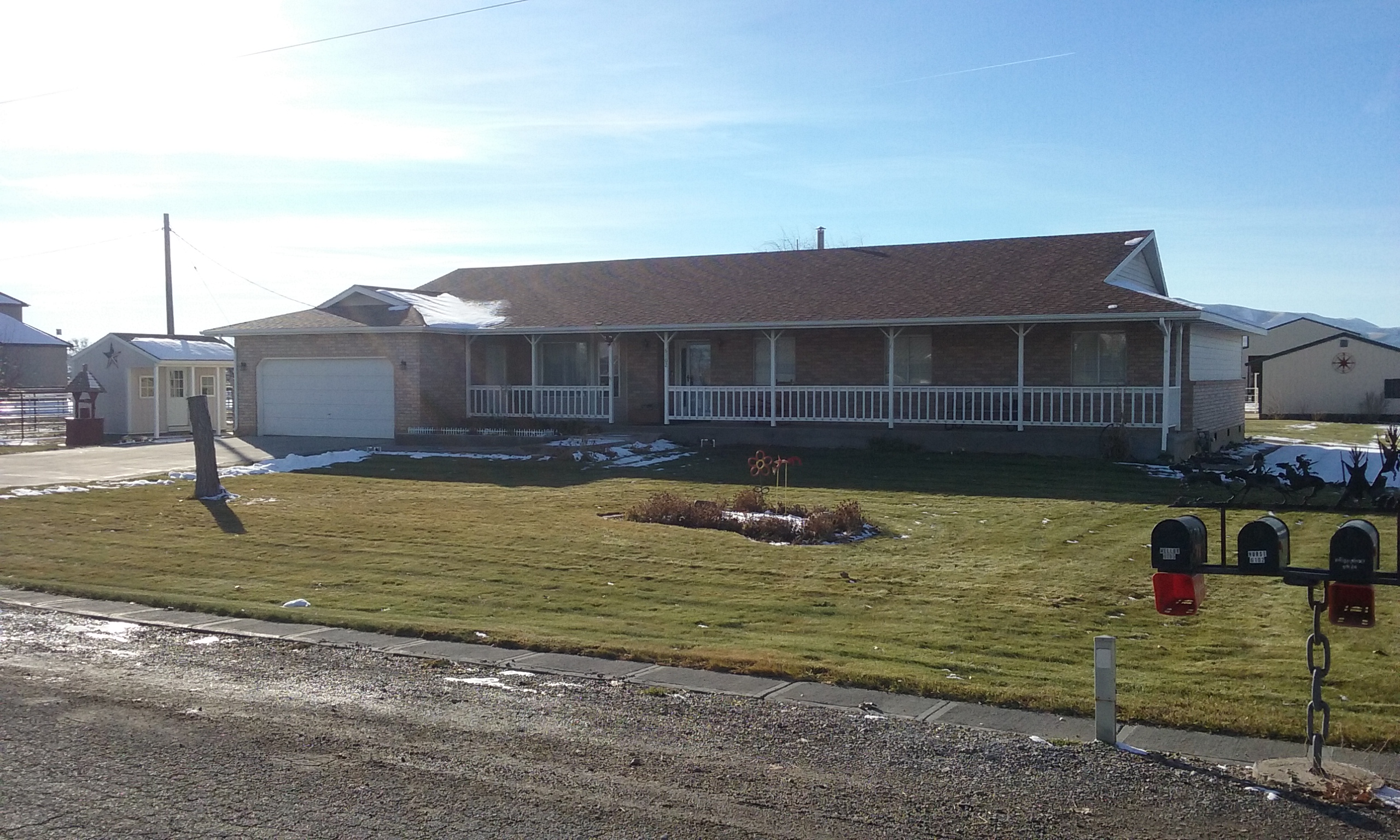
Property Information
| Serial Number: 41:808:0001 |
Serial Life: 2016... |
|
|

Total Photos: 6
|
| |
|
|
| Property Address: 6102 S 2800 WEST - SPANISH FORK DISTR |
|
| Mailing Address: 1756 S CARSON WAY SALEM, UT 84653 |
|
| Acreage: 5.461792 |
|
| Last Document:
76296-2016
|
|
| Subdivision Map Filing |
|
| Legal Description:
LOT 1, PLAT A, HURST FAMILY FARM SUB AREA 5.462 AC. |
|
- Owner Names
- Value History
- Tax History
- Location
- Photos
- Documents
- Aerial Image
| |
----- Real Estate Values ----- |
---Improvements--- |
---Greenbelt--- |
Total |
| Year |
Com |
Res |
Agr |
Tot |
Com |
Res |
Agr |
Tot |
Land |
Homesite |
Tot |
Market Value |
| 2024 |
$0 |
$246,200 |
$199,100 |
$445,300 |
$0 |
$461,100 |
$38,100 |
$499,200 |
$2,449 |
$112,000 |
$114,449 |
$944,500 |
| 2023 |
$0 |
$246,200 |
$199,100 |
$445,300 |
$0 |
$506,700 |
$36,300 |
$543,000 |
$2,246 |
$112,000 |
$114,246 |
$988,300 |
| 2022 |
$0 |
$262,500 |
$212,300 |
$474,800 |
$0 |
$397,100 |
$49,500 |
$446,600 |
$2,272 |
$112,000 |
$114,272 |
$921,400 |
| 2021 |
$0 |
$210,000 |
$124,900 |
$334,900 |
$0 |
$298,600 |
$45,000 |
$343,600 |
$2,225 |
$80,000 |
$82,225 |
$678,500 |
| 2020 |
$0 |
$175,000 |
$111,500 |
$286,500 |
$0 |
$298,600 |
$45,000 |
$343,600 |
$2,209 |
$28,000 |
$30,209 |
$630,100 |
| 2019 |
$0 |
$160,000 |
$75,900 |
$235,900 |
$0 |
$298,600 |
$47,100 |
$345,700 |
$2,214 |
$28,000 |
$30,214 |
$581,600 |
| 2018 |
$0 |
$140,000 |
$75,900 |
$215,900 |
$0 |
$277,100 |
$31,000 |
$308,100 |
$2,470 |
$28,000 |
$30,470 |
$524,000 |
| 2017 |
$0 |
$120,000 |
$75,900 |
$195,900 |
$0 |
$255,200 |
$52,900 |
$308,100 |
$2,589 |
$28,000 |
$30,589 |
$504,000 |
| 2016 |
$0 |
$90,000 |
$75,900 |
$165,900 |
$0 |
$191,600 |
$54,900 |
$246,500 |
$2,537 |
$28,000 |
$30,537 |
$412,400 |
| Year |
General Taxes |
Adjustments |
Net Taxes |
Fees |
Payments |
Tax Balance* |
Balance Due |
Tax District |
| 2025 |
$0.00 |
$0.00 |
$0.00 |
$0.00 |
|
$0.00
|
$0.00 |
120 - NEBO SCHOOL DIST S/A 6-7-8 |
| 2024 |
$3,558.96 |
$0.00 |
$3,558.96 |
$0.00 |
|
$0.00
|
$0.00 |
120 - NEBO SCHOOL DIST S/A 6-7-8 |
| 2023 |
$3,786.79 |
$0.00 |
$3,786.79 |
$0.00 |
|
$0.00
|
$0.00 |
120 - NEBO SCHOOL DIST S/A 6-7-8 |
| 2022 |
$3,377.16 |
$0.00 |
$3,377.16 |
$0.00 |
|
$0.00
|
$0.00 |
120 - NEBO SCHOOL DIST S/A 6-7-8 |
| 2021 |
$3,027.65 |
$0.00 |
$3,027.65 |
$0.00 |
|
$0.00
|
$0.00 |
120 - NEBO SCHOOL DIST S/A 6-7-8 |
| 2020 |
$2,769.02 |
$0.00 |
$2,769.02 |
$0.00 |
|
$0.00
|
$0.00 |
120 - NEBO SCHOOL DIST S/A 6-7-8 |
| 2019 |
$2,738.86 |
$0.00 |
$2,738.86 |
$0.00 |
|
$0.00
|
$0.00 |
120 - NEBO SCHOOL DIST S/A 6-7-8 |
| 2018 |
$2,516.74 |
$0.00 |
$2,516.74 |
$0.00 |
|
$0.00
|
$0.00 |
120 - NEBO SCHOOL DIST S/A 6-7-8 |
| 2017 |
$2,717.08 |
$0.00 |
$2,717.08 |
$0.00 |
|
$0.00
|
$0.00 |
120 - NEBO SCHOOL DIST S/A 6-7-8 |
| 2016 |
$2,364.23 |
$0.00 |
$2,364.23 |
$0.00 |
|
$0.00
|
$0.00 |
120 - NEBO SCHOOL DIST S/A 6-7-8 |
|
*The visual representation is a sum of taxes for the year(s) selected and is for reference only and no liability is assumed for any inaccuracies, incorrect data or variations.
|
|
* Note: Original tax amount (Does not include applicable interest and/or fees).
| Entry # |
Date |
Recorded |
Type |
Party1 (Grantor) |
Party2 (Grantee) |
| 31766-2018 |
03/13/2018 |
04/04/2018 |
N |
UTAH COUNTY |
WHOM OF INTEREST |
| 76296-2016 |
08/12/2016 |
08/12/2016 |
SP WD |
HURST, RAY LYNN & DALENE SMITH |
HURST, RAY LYNN & DALENE SMITH TEE (ET AL) |
| 18163-2016 |
02/18/2016 |
03/03/2016 |
FARM |
HURST, RAY LYNN & DALENE SMITH |
WHOM OF INTEREST |
| 16098-2016 |
02/25/2016 |
02/26/2016 |
W DECL |
HURST, RAY LYNN & DALENE SMITH (ET AL) |
WHOM OF INTEREST |
| 67722-2015 |
07/27/2015 |
07/28/2015 |
AF |
UTAH COUNTY |
WHOM OF INTEREST |
| 66310-2015 |
03/03/2015 |
07/23/2015 |
EAS |
HURST, RAY LYNN & DALENE SMITH |
HURST, RAY LYNN & DALENE SMITH |
| 66309-2015 |
04/30/2015 |
07/23/2015 |
W DECL |
HURST, DAVID R & HALEY (ET AL) |
WHOM OF INTEREST |
| 66307-2015 |
01/13/2015 |
07/23/2015 |
S PLAT |
HURST, RAY LYNN & DALENE S (ET AL) |
HURST FAMILY FARM PLAT A |
Main Menu Comments or Concerns on Value/Appraisal - Assessor's Office
Documents/Owner/Parcel information - Recorder's Office
Address Change for Tax Notice
This page was created on 1/21/2025 1:16:12 PM |