Property Information
| Serial Number: 46:989:0005 |
Serial Life: 2018... |
|
|

Total Photos: 3
|
| |
|
|
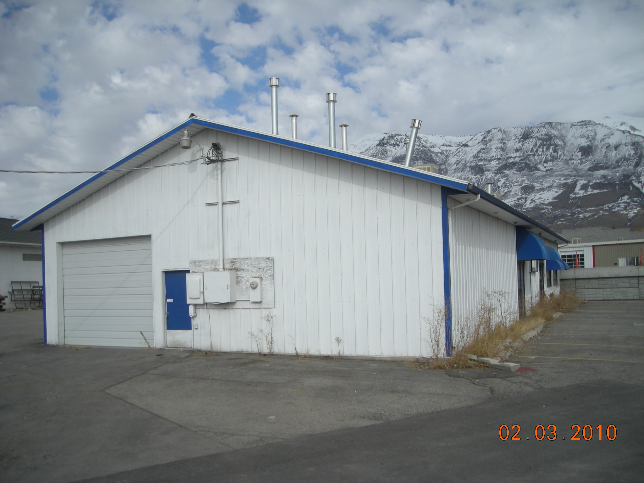
| Property Address: 470 W 220 SOUTH Unit# N-101 - PLEASANT GROVE |
|
| Mailing Address: 952 N FORT CANYON RD ALPINE, UT 84004 |
|
| Acreage: 0.017971 |
|
| Last Document:
47128-2020
|
|
| Subdivision Map Filing |
|
| Legal Description:
UNIT N-101, PLAT G, MAJESTIC MEADOWS CONDOMINIUMS. AREA 0.018 AC. |
|
- Owner Names
- Value History
- Tax History
- Location
- Photos
- Documents
- Aerial Image
| |
----- Real Estate Values ----- |
---Improvements--- |
---Greenbelt--- |
Total |
| Year |
Com |
Res |
Agr |
Tot |
Com |
Res |
Agr |
Tot |
Land |
Homesite |
Tot |
Market Value |
| 2024 |
$47,500 |
$0 |
$0 |
$47,500 |
$176,800 |
$0 |
$0 |
$176,800 |
$0 |
$0 |
$0 |
$224,300 |
| 2023 |
$46,600 |
$0 |
$0 |
$46,600 |
$173,300 |
$0 |
$0 |
$173,300 |
$0 |
$0 |
$0 |
$219,900 |
| 2022 |
$46,600 |
$0 |
$0 |
$46,600 |
$155,000 |
$0 |
$0 |
$155,000 |
$0 |
$0 |
$0 |
$201,600 |
| 2021 |
$46,600 |
$0 |
$0 |
$46,600 |
$155,000 |
$0 |
$0 |
$155,000 |
$0 |
$0 |
$0 |
$201,600 |
| 2020 |
$46,600 |
$0 |
$0 |
$46,600 |
$155,000 |
$0 |
$0 |
$155,000 |
$0 |
$0 |
$0 |
$201,600 |
| 2019 |
$46,600 |
$0 |
$0 |
$46,600 |
$136,700 |
$0 |
$0 |
$136,700 |
$0 |
$0 |
$0 |
$183,300 |
| 2018 |
$31,000 |
$0 |
$0 |
$31,000 |
$101,300 |
$0 |
$0 |
$101,300 |
$0 |
$0 |
$0 |
$132,300 |
| Year |
General Taxes |
Adjustments |
Net Taxes |
Fees |
Payments |
Tax Balance* |
Balance Due |
Tax District |
| 2025 |
$0.00 |
$0.00 |
$0.00 |
$0.00 |
|
$0.00
|
$0.00 |
070 - PLEASANT GROVE CITY |
| 2024 |
$1,922.03 |
$0.00 |
$1,922.03 |
$0.00 |
|
$0.00
|
$0.00 |
070 - PLEASANT GROVE CITY |
| 2023 |
$1,799.88 |
($41.78) |
$1,758.10 |
$0.00 |
|
$0.00
|
$0.00 |
070 - PLEASANT GROVE CITY |
| 2022 |
$1,658.36 |
$0.00 |
$1,658.36 |
$0.00 |
|
$0.00
|
$0.00 |
070 - PLEASANT GROVE CITY |
| 2021 |
$1,980.32 |
$0.00 |
$1,980.32 |
$0.00 |
|
$0.00
|
$0.00 |
070 - PLEASANT GROVE CITY |
| 2020 |
$2,020.03 |
$0.00 |
$2,020.03 |
$0.00 |
|
$0.00
|
$0.00 |
070 - PLEASANT GROVE CITY |
| 2019 |
$1,775.99 |
$0.00 |
$1,775.99 |
$0.00 |
|
$0.00
|
$0.00 |
070 - PLEASANT GROVE CITY |
| 2018 |
$1,355.68 |
$0.00 |
$1,355.68 |
$0.00 |
|
$0.00
|
$0.00 |
070 - PLEASANT GROVE CITY |
|
*The visual representation is a sum of taxes for the year(s) selected and is for reference only and no liability is assumed for any inaccuracies, incorrect data or variations.
|
|
* Note: Original tax amount (Does not include applicable interest and/or fees).
| Entry # |
Date |
Recorded |
Type |
Party1 (Grantor) |
Party2 (Grantee) |
| 47128-2020 |
02/05/2020 |
04/10/2020 |
WD |
ALL AMERICAN INVESTMENTS X LLC |
R&M FAMILY INVESTMENTS II LLC |
| 18850-2018 |
02/27/2018 |
02/27/2018 |
REC |
BANK OF AMERICAN FORK DIV OF (ET AL) |
AA DEVELOPMENT INC |
| 125123-2017 |
12/18/2017 |
12/18/2017 |
WD |
AA DEVELOPMENT INC |
ALL AMERICAN INVESTMENTS X LLC |
| 118540-2017 |
10/26/2017 |
11/30/2017 |
N |
PLEASANT GROVE CITY CORP |
WHOM OF INTEREST |
| 94853-2017 |
09/15/2017 |
09/26/2017 |
QCD |
WARBURTON, DALE L |
TRIPLE FOCUS LC |
| 84346-2017 |
06/01/2017 |
08/29/2017 |
DECLSUP |
AA DEVELOPMENT INC (ET AL) |
WHOM OF INTEREST |
| 84345-2017 |
08/11/2017 |
08/29/2017 |
C PLAT |
AA DEVELOPMENT INC (ET AL) |
MAJESTIC MEADOWS CONDO PLAT G |
Main Menu Comments or Concerns on Value/Appraisal - Assessor's Office
Documents/Owner/Parcel information - Recorder's Office
Address Change for Tax Notice
This page was created on 2/1/2025 2:47:48 AM |

