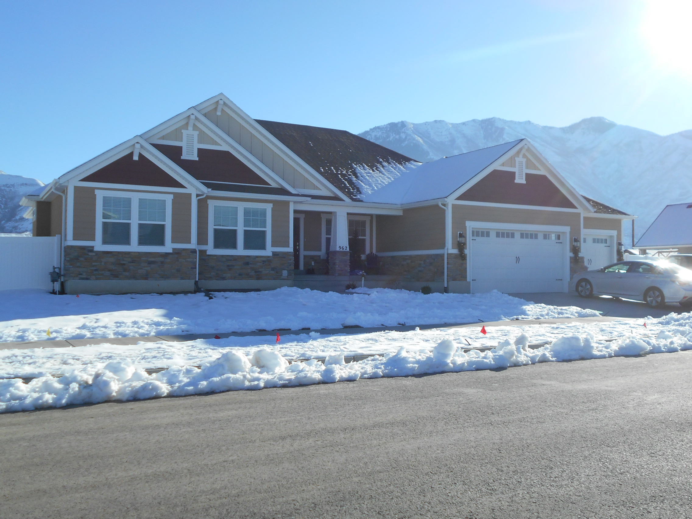
Property Information
| Serial Number: 66:560:0003 |
Serial Life: 2018... |
|
|

Total Photos: 2
|
| |
|
|
| Property Address: 962 N 550 WEST - MAPLETON
more see "Addrs" tab below..
|
|
| Mailing Address: 962 N 550 W MAPLETON, UT 84664 |
|
| Acreage: 0.435588 |
|
| Last Document:
106615-2017
|
|
| Subdivision Map Filing |
|
| Legal Description:
LOT 3, PLAT B, STONEBRIDGE SUB AREA 0.436 AC. |
|
- Owner Names
- Value History
- Tax History
- Location
- Photos
- Documents
- Aerial Image
- Addrs
| |
----- Real Estate Values ----- |
---Improvements--- |
---Greenbelt--- |
Total |
| Year |
Com |
Res |
Agr |
Tot |
Com |
Res |
Agr |
Tot |
Land |
Homesite |
Tot |
Market Value |
| 2024 |
$0 |
$299,900 |
$0 |
$299,900 |
$0 |
$446,200 |
$0 |
$446,200 |
$0 |
$0 |
$0 |
$746,100 |
| 2023 |
$0 |
$299,900 |
$0 |
$299,900 |
$0 |
$488,300 |
$0 |
$488,300 |
$0 |
$0 |
$0 |
$788,200 |
| 2022 |
$0 |
$319,800 |
$0 |
$319,800 |
$0 |
$473,200 |
$0 |
$473,200 |
$0 |
$0 |
$0 |
$793,000 |
| 2021 |
$0 |
$193,800 |
$0 |
$193,800 |
$0 |
$364,000 |
$0 |
$364,000 |
$0 |
$0 |
$0 |
$557,800 |
| 2020 |
$0 |
$171,500 |
$0 |
$171,500 |
$0 |
$350,000 |
$0 |
$350,000 |
$0 |
$0 |
$0 |
$521,500 |
| 2019 |
$0 |
$152,000 |
$0 |
$152,000 |
$0 |
$323,400 |
$0 |
$323,400 |
$0 |
$0 |
$0 |
$475,400 |
| 2018 |
$0 |
$144,200 |
$0 |
$144,200 |
$0 |
$289,000 |
$0 |
$289,000 |
$0 |
$0 |
$0 |
$433,200 |
| Year |
General Taxes |
Adjustments |
Net Taxes |
Fees |
Payments |
Tax Balance* |
Balance Due |
Tax District |
| 2025 |
$0.00 |
$0.00 |
$0.00 |
$0.00 |
|
$0.00
|
$0.00 |
140 - MAPLETON CITY |
| 2024 |
$4,188.90 |
$0.00 |
$4,188.90 |
$0.00 |
|
$0.00
|
$0.00 |
140 - MAPLETON CITY |
| 2023 |
$4,397.53 |
$0.00 |
$4,397.53 |
$0.00 |
|
$0.00
|
$0.00 |
140 - MAPLETON CITY |
| 2022 |
$4,474.46 |
$0.00 |
$4,474.46 |
$0.00 |
|
$0.00
|
$0.00 |
140 - MAPLETON CITY |
| 2021 |
$3,727.19 |
$0.00 |
$3,727.19 |
$0.00 |
|
$0.00
|
$0.00 |
140 - MAPLETON CITY |
| 2020 |
$3,602.52 |
$0.00 |
$3,602.52 |
$0.00 |
|
$0.00
|
$0.00 |
140 - MAPLETON CITY |
| 2019 |
$3,217.39 |
$0.00 |
$3,217.39 |
$0.00 |
|
$0.00
|
$0.00 |
140 - MAPLETON CITY |
| 2018 |
$3,079.75 |
$0.00 |
$3,079.75 |
$0.00 |
|
$0.00
|
$0.00 |
140 - MAPLETON CITY |
|
*The visual representation is a sum of taxes for the year(s) selected and is for reference only and no liability is assumed for any inaccuracies, incorrect data or variations.
|
|
* Note: Original tax amount (Does not include applicable interest and/or fees).
| Entry # |
Date |
Recorded |
Type |
Party1 (Grantor) |
Party2 (Grantee) |
| 72744-2019 |
07/30/2019 |
08/01/2019 |
QCD |
91275 LLC |
ARIVE HOMES LLC |
| 37029-2018 |
04/23/2018 |
04/23/2018 |
REC |
PROVO LAND TITLE COMPANY TEE |
TAYLORED LAND DEVELOPMENT LLC |
| 11131-2018 |
01/30/2018 |
02/05/2018 |
P REC |
PROVO LAND TITLE COMPANY TEE |
TAYLORED LAND DEVELOPMENT LLC |
| 116414-2017 |
11/17/2017 |
11/27/2017 |
REC |
CAPITAL COMMUNITY BANK TEE |
ARIVE HOMES LLC |
| 106615-2017 |
10/24/2017 |
10/27/2017 |
WD |
GADD, CAROL & WENDELL |
GADD, WENDELL S TEE (ET AL) |
| 103469-2017 |
10/17/2017 |
10/18/2017 |
WD |
ARIVE HOMES LLC |
GADD, CAROL & WENDELL |
| 103468-2017 |
07/28/2017 |
10/18/2017 |
QCD |
91275 LLC |
ARIVE HOMES LLC |
| 91834-2017 |
04/10/2017 |
09/19/2017 |
GEO HAZ |
SCOVILLE, MIKE |
WHOM OF INTEREST |
| 55197-2017 |
05/26/2017 |
06/07/2017 |
P REC |
PROVO LAND TITLE COMPANY TEE |
TAYLORED LAND DEVELOPMENT LLC |
| 55196-2017 |
05/23/2017 |
06/07/2017 |
SUB TEE |
SECURITY NATIONAL LIFE INSURANCE COMPANY |
PROVO LAND TITLE COMPANY SUCTEE |
| 37814-2017 |
02/17/2017 |
04/19/2017 |
SUB AGR |
91275 LLC |
CAPITAL COMMUNITY BANK |
| 37792-2017 |
04/17/2017 |
04/19/2017 |
D TR |
ARIVE HOMES LLC |
CAPITAL COMMUNITY BANK |
| 37791-2017 |
04/14/2017 |
04/19/2017 |
SP WD |
TAYLORED LAND DEVELOPMENT LLC (ET AL) |
ARIVE HOMES LLC |
| 10073-2017 |
01/05/2017 |
01/31/2017 |
S PLAT |
TAYLOR LAND DEVELOPMENT LLC (ET AL) |
STONEBRIDGE PLAT B |
521 W 1000 NORTH - MAPLETON
962 N 550 WEST - MAPLETON
Main Menu Comments or Concerns on Value/Appraisal - Assessor's Office
Documents/Owner/Parcel information - Recorder's Office
Address Change for Tax Notice
This page was created on 12/16/2024 1:28:23 AM |