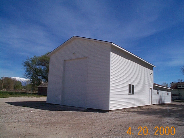
Property Information
| Serial Number: 12:036:0096 |
Serial Life: 1996-2001 |
|
|

Total Photos: 1
|
| |
|
|
| Property Address: 1200 N 700 WEST - LEHI |
|
| Mailing Address: 1325 TRINNAMON LA LEHI, UT 84043 |
|
| Acreage: 18.212772 |
|
| Last Document:
6727-1975
|
|
| Subdivision Map Filing |
|
| Legal Description:
COM S 1339.31 FT & E 667.78 FT FR NW COR. SEC. 8, T5S, R1E, SLB&M.; N 1 DEG 12' 0" W 696.29 FT; N 85 DEG 0' 16" E 854.47 FT; S 28 DEG 5' 0" E 246.16 FT; S 38 DEG 36' 0" E 590.46 FT; S 54 DEG 54' 0" W 76.87 FT; S 66 DEG 24' 0" W 149.78 FT; N 89 DEG 37' 0" W 297.12 FT; N 89 DEG 0' 0" W 300 FT; N 89 DEG 19' 0" W 220.8 FT; N 1 DEG 31' 9" W 164.32 FT; W 129.9 FT; S 1 DEG 0' 0" E 163.44 FT; N 89 DEG 29' 0" W 171.5 FT TO BEG. AREA 18.213 AC. |
|
- Owner Names
- Value History
- Tax History
- Location
- Photos
- Documents
- Aerial Image
| |
----- Real Estate Values ----- |
---Improvements--- |
---Greenbelt--- |
Total |
| Year |
Com |
Res |
Agr |
Tot |
Com |
Res |
Agr |
Tot |
Land |
Homesite |
Tot |
Market Value |
| 2001 |
$0 |
$24,131 |
$214,332 |
$238,463 |
$0 |
$93,153 |
$3,440 |
$96,593 |
$4,454 |
$24,131 |
$28,585 |
$335,056 |
| 2000 |
$0 |
$22,552 |
$200,310 |
$222,862 |
$0 |
$81,031 |
$3,440 |
$84,471 |
$4,995 |
$22,552 |
$27,547 |
$307,333 |
| 1999 |
$0 |
$44,184 |
$200,310 |
$244,494 |
$0 |
$81,031 |
$3,440 |
$84,471 |
$4,440 |
$22,552 |
$26,992 |
$328,965 |
| 1998 |
$0 |
$39,101 |
$200,310 |
$239,411 |
$0 |
$71,709 |
$3,440 |
$75,149 |
$4,166 |
$22,552 |
$26,718 |
$314,560 |
| 1997 |
$0 |
$39,101 |
$200,310 |
$239,411 |
$0 |
$71,709 |
$3,440 |
$75,149 |
$4,180 |
$22,552 |
$26,732 |
$314,560 |
| 1996 |
$0 |
$38,500 |
$200,310 |
$238,810 |
$0 |
$50,181 |
$3,440 |
$53,621 |
$5,002 |
$22,552 |
$27,554 |
$292,431 |
| Year |
General Taxes |
Adjustments |
Net Taxes |
Fees |
Payments |
Tax Balance* |
Balance Due |
Tax District |
| 2001 |
$806.83 |
$0.00 |
$806.83 |
$0.00 |
|
$0.00
|
$0.00 |
010 - LEHI CITY |
| 2000 |
$739.55 |
$0.00 |
$739.55 |
$0.00 |
|
$0.00
|
$0.00 |
010 - LEHI CITY |
| 1999 |
$705.84 |
$0.00 |
$705.84 |
$0.00 |
|
$0.00
|
$0.00 |
010 - LEHI CITY |
| 1998 |
$622.08 |
$0.00 |
$622.08 |
$0.00 |
|
$0.00
|
$0.00 |
010 - LEHI CITY |
| 1997 |
$616.34 |
$0.00 |
$616.34 |
$0.00 |
|
$0.00
|
$0.00 |
010 - LEHI CITY |
| 1996 |
$471.33 |
$0.00 |
$471.33 |
$0.00 |
|
$0.00
|
$0.00 |
010 - LEHI CITY |
|
*The visual representation is a sum of taxes for the year(s) selected and is for reference only and no liability is assumed for any inaccuracies, incorrect data or variations.
|
|
* Note: Original tax amount (Does not include applicable interest and/or fees).
| Entry # |
Date |
Recorded |
Type |
Party1 (Grantor) |
Party2 (Grantee) |
| 29110-2001 |
03/28/2001 |
03/29/2001 |
WD |
FJELLSTROM, BLAINE G & JOAN E |
FJELLSTROM, JOAN E |
| 64371-2000 |
04/11/2000 |
08/17/2000 |
Z ORDIN |
LEHI CITY |
WHOM OF INTEREST |
| 48354-1998 |
05/08/1998 |
05/14/1998 |
REC |
BANK OF AMERICAN FORK TEE |
FJELLSTROM, BLAINE G & JOAN F |
| 36255-1998 |
04/10/1998 |
04/14/1998 |
REC |
BANK OF AMERICAN FORK TEE |
FJELLSTROM, BLAINE G & JOAN E |
| 36253-1998 |
04/10/1998 |
04/14/1998 |
SUB AGR |
BANK OF AMERICAN FORK |
BANK OF AMERICAN FORK |
| 36252-1998 |
04/10/1998 |
04/14/1998 |
D TR |
FJELLSTROM, BLAINE G & JOAN E |
BANK OF AMERICAN FORK |
| 6233-1997 |
11/26/1996 |
01/27/1997 |
FARM |
FJELLSTROM, ELAINE G & JOAN E |
WHOM OF INTEREST |
| 76846-1995 |
11/06/1995 |
11/08/1995 |
RESOL |
UTAH COUNTY COMMISSIONERS |
WHOM OF INTEREST |
| 38916-1995 |
06/15/1995 |
06/20/1995 |
BLA |
THAYN, PAUL H & DORTHEA JANE K (ET AL) |
FJELLSTROM, BLAINE G & JOAN E (ET AL) |
Main Menu Comments or Concerns on Value/Appraisal - Assessor's Office
Documents/Owner/Parcel information - Recorder's Office
Address Change for Tax Notice
This page was created on 12/16/2024 7:38:05 AM |