Property Information
| Serial Number: 13:021:0064 |
Serial Life: 2020... |
|
|

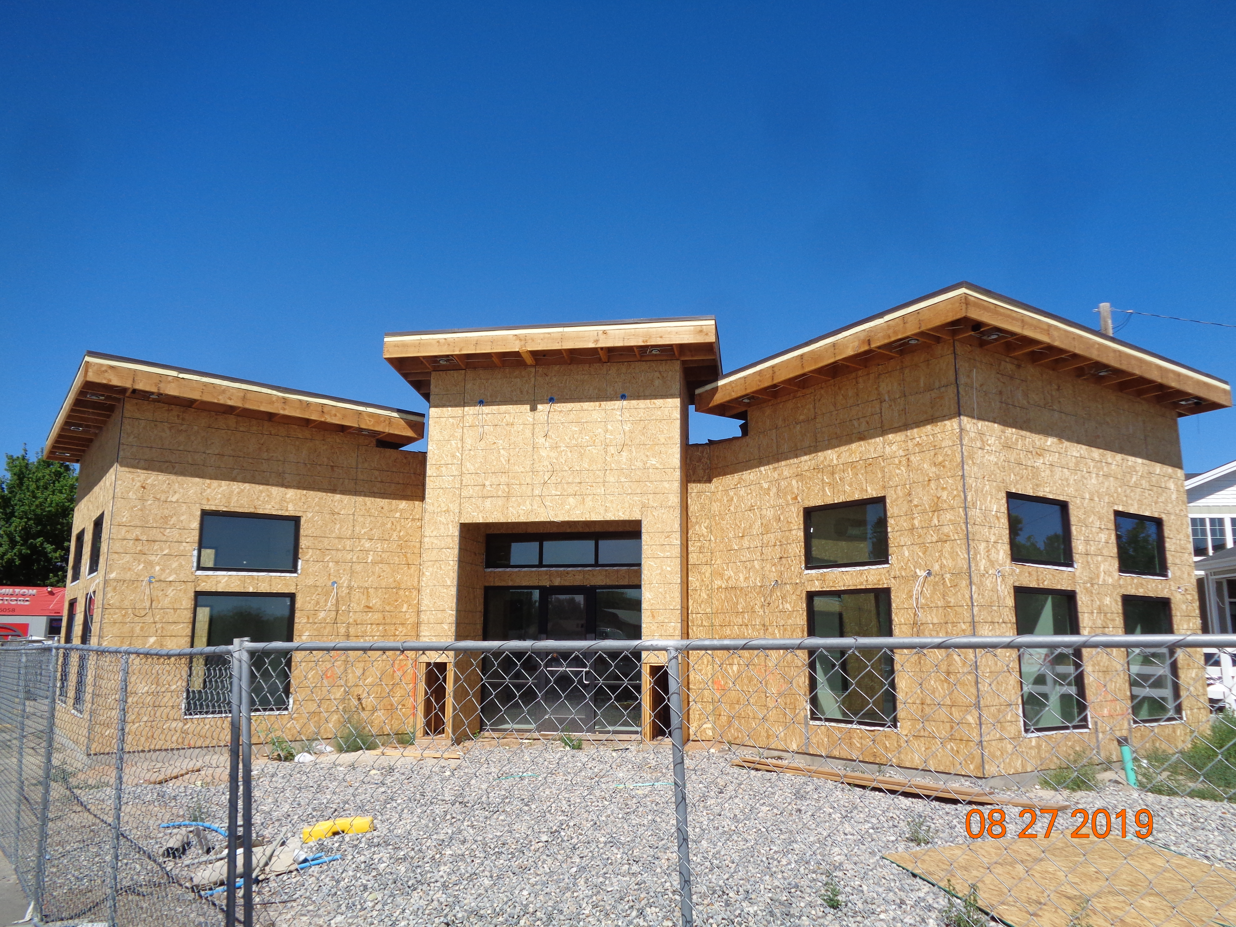
Total Photos: 2
|
| |
|
|
| Property Address: 614 W MAIN ST - LEHI |
|
| Mailing Address: 614 W MAIN ST LEHI, UT 84043-2058 |
|
| Acreage: 0.786124 |
|
| Last Document:
11436-2019
|
|
| Subdivision Map Filing |
|
| Legal Description:
COM N 89 DEG 37' 21" E 90.72 FT & S 1284.72 FT & S 0 DEG 32' 22" W 19.1 FT FR N 1/4 COR. SEC. 17, T5S, R1E, SLB&M.; S 0 DEG 32' 22" W 263.25 FT; N 89 DEG 39' 10" W 182.27 FT; N 13 DEG 49' 43" E 72.17 FT; N 19 DEG 32' 27" E 80.94 FT; N 21 DEG 29' 48" E 18.91 FT; N 44 DEG 47' 8" E 102.1 FT; N 59 DEG 30' 0" E 28.76 FT; N 73 DEG 10' 42" E 38.44 FT TO BEG. AREA 0.786 AC. |
|
- Owner Names
- Value History
- Tax History
- Location
- Photos
- Documents
- Aerial Image
| |
----- Real Estate Values ----- |
---Improvements--- |
---Greenbelt--- |
Total |
| Year |
Com |
Res |
Agr |
Tot |
Com |
Res |
Agr |
Tot |
Land |
Homesite |
Tot |
Market Value |
| 2024 |
$469,900 |
$0 |
$0 |
$469,900 |
$433,500 |
$0 |
$0 |
$433,500 |
$0 |
$0 |
$0 |
$903,400 |
| 2023 |
$476,600 |
$0 |
$0 |
$476,600 |
$439,300 |
$0 |
$0 |
$439,300 |
$0 |
$0 |
$0 |
$915,900 |
| 2022 |
$471,600 |
$0 |
$0 |
$471,600 |
$373,600 |
$0 |
$0 |
$373,600 |
$0 |
$0 |
$0 |
$845,200 |
| 2021 |
$411,100 |
$0 |
$0 |
$411,100 |
$314,700 |
$0 |
$0 |
$314,700 |
$0 |
$0 |
$0 |
$725,800 |
| 2020 |
$411,100 |
$0 |
$0 |
$411,100 |
$337,200 |
$0 |
$0 |
$337,200 |
$0 |
$0 |
$0 |
$748,300 |
| Year |
General Taxes |
Adjustments |
Net Taxes |
Fees |
Payments |
Tax Balance* |
Balance Due |
Tax District |
| 2025 |
$0.00 |
$0.00 |
$0.00 |
$0.00 |
|
$0.00
|
$0.00 |
010 - LEHI CITY |
| 2024 |
$7,719.55 |
$0.00 |
$7,719.55 |
$0.00 |
|
$0.00
|
$0.00 |
010 - LEHI CITY |
| 2023 |
$7,208.13 |
$0.00 |
$7,208.13 |
$0.00 |
|
$0.00
|
$0.00 |
010 - LEHI CITY |
| 2022 |
$6,861.33 |
$0.00 |
$6,861.33 |
$0.00 |
|
$0.00
|
$0.00 |
010 - LEHI CITY |
| 2021 |
$7,085.99 |
$0.00 |
$7,085.99 |
$0.00 |
|
$0.00
|
$0.00 |
010 - LEHI CITY |
| 2020 |
$7,390.96 |
$0.00 |
$7,390.96 |
$0.00 |
|
$0.00
|
$0.00 |
010 - LEHI CITY |
|
*The visual representation is a sum of taxes for the year(s) selected and is for reference only and no liability is assumed for any inaccuracies, incorrect data or variations.
|
|
* Note: Original tax amount (Does not include applicable interest and/or fees).
| Entry # |
Date |
Recorded |
Type |
Party1 (Grantor) |
Party2 (Grantee) |
| 129273-2019 |
12/04/2019 |
12/06/2019 |
REC |
MOUNTAIN AMERICA FEDERAL CREDIT UNION TEE |
L W HAMILTON LLC DBA (ET AL) |
| 127794-2019 |
12/03/2019 |
12/03/2019 |
ASSIGN |
L W HAMILTON LLC |
MOUNTAIN AMERICA CREDIT UNION |
| 127793-2019 |
12/03/2019 |
12/03/2019 |
D TR |
L W HAMILTON LLC |
MOUNTAIN AMERICA CREDIT UNION |
| 11437-2019 |
02/08/2019 |
02/11/2019 |
D TR |
L W HAMILTON LLC |
MOUNTAIN AMERICA FEDERAL CREDIT UNION |
| 11436-2019 |
02/08/2019 |
02/11/2019 |
WD |
L W HAMILTON L L C AKA (ET AL) |
L W HAMILTON LLC |
| 11435-2019 |
02/08/2019 |
02/11/2019 |
WD |
HAMILTON MOTORS INC AKA (ET AL) |
L W HAMILTON LLC |
Main Menu Comments or Concerns on Value/Appraisal - Assessor's Office
Documents/Owner/Parcel information - Recorder's Office
Address Change for Tax Notice
This page was created on 3/25/2025 7:35:34 AM |
