Property Information
| Serial Number: 14:049:0005 |
Serial Life: 1977-2004 |
|
|
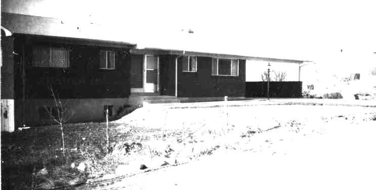
Total Photos: 1
|
| |
|
|
| Property Address: 770 LOADER DR - PLEASANT GROVE |
|
| Mailing Address: 780 LOADER DR PLEASANT GROVE, UT 84062-3118 |
|
| Acreage: 0.28 |
|
| Last Document:
6734-1965
|
|
| Subdivision Map Filing |
|
| Legal Description:
COM 3.37 CHS W & S 501/4 W 2.06 CHS & S 62 W 38 FT & S 9 55' W 375 FT FR THE NE COR OF THE SE1/4 OF SEC 28, T 5 S, R 2 E, SLM; S 9 55' W 100 FT; W 125 FT; N 9 55' E 100 FT; E 125 FT TO BEG. AREA .28. |
|
- Owner Names
- Value History
- Tax History
- Location
- Photos
- Documents
- Aerial Image
| |
----- Real Estate Values ----- |
---Improvements--- |
---Greenbelt--- |
Total |
| Year |
Com |
Res |
Agr |
Tot |
Com |
Res |
Agr |
Tot |
Land |
Homesite |
Tot |
Market Value |
| 2004 |
$0 |
$61,285 |
$0 |
$61,285 |
$0 |
$104,005 |
$0 |
$104,005 |
$0 |
$0 |
$0 |
$165,290 |
| 2003 |
$0 |
$61,285 |
$0 |
$61,285 |
$0 |
$104,005 |
$0 |
$104,005 |
$0 |
$0 |
$0 |
$165,290 |
| 2002 |
$0 |
$61,285 |
$0 |
$61,285 |
$0 |
$104,005 |
$0 |
$104,005 |
$0 |
$0 |
$0 |
$165,290 |
| 2001 |
$0 |
$61,285 |
$0 |
$61,285 |
$0 |
$104,005 |
$0 |
$104,005 |
$0 |
$0 |
$0 |
$165,290 |
| 2000 |
$0 |
$57,276 |
$0 |
$57,276 |
$0 |
$97,246 |
$0 |
$97,246 |
$0 |
$0 |
$0 |
$154,522 |
| 1999 |
$0 |
$57,276 |
$0 |
$57,276 |
$0 |
$97,246 |
$0 |
$97,246 |
$0 |
$0 |
$0 |
$154,522 |
| 1998 |
$0 |
$50,687 |
$0 |
$50,687 |
$0 |
$86,058 |
$0 |
$86,058 |
$0 |
$0 |
$0 |
$136,745 |
| 1997 |
$0 |
$50,687 |
$0 |
$50,687 |
$0 |
$86,058 |
$0 |
$86,058 |
$0 |
$0 |
$0 |
$136,745 |
| 1996 |
$0 |
$44,447 |
$0 |
$44,447 |
$0 |
$75,463 |
$0 |
$75,463 |
$0 |
$0 |
$0 |
$119,910 |
| 1995 |
$0 |
$40,406 |
$0 |
$40,406 |
$0 |
$75,463 |
$0 |
$75,463 |
$0 |
$0 |
$0 |
$115,869 |
| 1994 |
$0 |
$23,629 |
$0 |
$23,629 |
$0 |
$60,857 |
$0 |
$60,857 |
$0 |
$0 |
$0 |
$84,486 |
| 1993 |
$0 |
$23,629 |
$0 |
$23,629 |
$0 |
$60,857 |
$0 |
$60,857 |
$0 |
$0 |
$0 |
$84,486 |
| 1992 |
$0 |
$21,678 |
$0 |
$21,678 |
$0 |
$55,832 |
$0 |
$55,832 |
$0 |
$0 |
$0 |
$77,510 |
| 1991 |
$0 |
$19,016 |
$0 |
$19,016 |
$0 |
$46,952 |
$0 |
$46,952 |
$0 |
$0 |
$0 |
$65,968 |
| 1990 |
$0 |
$19,016 |
$0 |
$19,016 |
$0 |
$46,952 |
$0 |
$46,952 |
$0 |
$0 |
$0 |
$65,968 |
| 1989 |
$0 |
$19,016 |
$0 |
$19,016 |
$0 |
$46,952 |
$0 |
$46,952 |
$0 |
$0 |
$0 |
$65,968 |
| 1988 |
$0 |
$19,017 |
$0 |
$19,017 |
$0 |
$44,933 |
$0 |
$44,933 |
$0 |
$0 |
$0 |
$63,950 |
| 1987 |
$0 |
$19,017 |
$0 |
$19,017 |
$0 |
$60,683 |
$0 |
$60,683 |
$0 |
$0 |
$0 |
$79,700 |
| 1986 |
$0 |
$19,017 |
$0 |
$19,017 |
$0 |
$60,685 |
$0 |
$60,685 |
$0 |
$0 |
$0 |
$79,702 |
| 1985 |
$0 |
$19,017 |
$0 |
$19,017 |
$0 |
$60,683 |
$0 |
$60,683 |
$0 |
$0 |
$0 |
$79,700 |
| 1984 |
$0 |
$19,208 |
$0 |
$19,208 |
$0 |
$61,300 |
$0 |
$61,300 |
$0 |
$0 |
$0 |
$80,508 |
| Year |
General Taxes |
Adjustments |
Net Taxes |
Fees |
Payments |
Tax Balance* |
Balance Due |
Tax District |
| 2004 |
$1,128.10 |
$0.00 |
$1,128.10 |
$0.00 |
|
$0.00
|
$0.00 |
070 - PLEASANT GROVE CITY |
| 2003 |
$1,118.74 |
$0.00 |
$1,118.74 |
$0.00 |
|
$0.00
|
$0.00 |
070 - PLEASANT GROVE CITY |
| 2002 |
$1,033.37 |
$0.00 |
$1,033.37 |
$0.00 |
|
$0.00
|
$0.00 |
070 - PLEASANT GROVE CITY |
| 2001 |
$1,019.92 |
$0.00 |
$1,019.92 |
$0.00 |
|
$0.00
|
$0.00 |
070 - PLEASANT GROVE CITY |
| 2000 |
$990.44 |
$0.00 |
$990.44 |
$0.00 |
|
$0.00
|
$0.00 |
070 - PLEASANT GROVE CITY |
| 1999 |
$1,001.32 |
$0.00 |
$1,001.32 |
$0.00 |
|
$0.00
|
$0.00 |
070 - PLEASANT GROVE CITY |
| 1998 |
$868.83 |
$0.00 |
$868.83 |
$0.00 |
|
$0.00
|
$0.00 |
070 - PLEASANT GROVE CITY |
| 1997 |
$837.46 |
$0.00 |
$837.46 |
$0.00 |
|
$0.00
|
$0.00 |
070 - PLEASANT GROVE CITY |
| 1996 |
$725.59 |
$0.00 |
$725.59 |
$0.00 |
|
$0.00
|
$0.00 |
070 - PLEASANT GROVE CITY |
| 1995 |
$788.76 |
$0.00 |
$788.76 |
$0.00 |
|
$0.00
|
$0.00 |
070 - PLEASANT GROVE CITY |
| 1994 |
$871.19 |
$0.00 |
$871.19 |
$0.00 |
|
$0.00
|
$0.00 |
070 - PLEASANT GROVE CITY |
| 1993 |
$743.98 |
$0.00 |
$743.98 |
$0.00 |
|
$0.00
|
$0.00 |
070 - PLEASANT GROVE CITY |
| 1992 |
$683.28 |
$0.00 |
$683.28 |
$0.00 |
|
$0.00
|
$0.00 |
070 - PLEASANT GROVE CITY |
| 1991 |
$615.18 |
$0.00 |
$615.18 |
$0.00 |
|
$0.00
|
$0.00 |
070 - PLEASANT GROVE CITY |
| 1990 |
$592.73 |
$0.00 |
$592.73 |
$0.00 |
|
$0.00
|
$0.00 |
070 - PLEASANT GROVE CITY |
| 1989 |
$601.75 |
$0.00 |
$601.75 |
$0.00 |
|
$0.00
|
$0.00 |
070 - PLEASANT GROVE CITY |
| 1988 |
$592.24 |
$0.00 |
$592.24 |
$0.00 |
|
$0.00
|
$0.00 |
070 - PLEASANT GROVE CITY |
| 1987 |
$727.92 |
$0.00 |
$727.92 |
$0.00 |
|
$0.00
|
$0.00 |
070 - PLEASANT GROVE CITY |
| 1986 |
$713.19 |
$0.00 |
$713.19 |
$0.00 |
|
$0.00
|
$0.00 |
070 - PLEASANT GROVE CITY |
| 1985 |
$719.40 |
$0.00 |
$719.40 |
$0.00 |
|
$0.00
|
$0.00 |
070 - PLEASANT GROVE CITY |
| 1984 |
$713.85 |
$0.00 |
$713.85 |
$0.00 |
|
$0.00
|
$0.00 |
070 - PLEASANT GROVE CITY |
|
*The visual representation is a sum of taxes for the year(s) selected and is for reference only and no liability is assumed for any inaccuracies, incorrect data or variations.
|
|
* Note: Original tax amount (Does not include applicable interest and/or fees).
| Entry # |
Date |
Recorded |
Type |
Party1 (Grantor) |
Party2 (Grantee) |
| 478-2004 |
12/19/2003 |
01/02/2004 |
O Q T |
EDWARDS, J WAYNE & MARGENE PAGE (ET AL) |
ESTRADA, JULIO CEDAR & ANNA CAROLINA |
| 7566-1999 |
01/11/1999 |
01/21/1999 |
QCD |
WARD, WILLIAM EARL & ROSE MARIE TEE (ET AL) |
WARD, WILLIAM KARL & ROSE MARIE |
| 76846-1995 |
11/06/1995 |
11/08/1995 |
RESOL |
UTAH COUNTY COMMISSIONERS |
WHOM OF INTEREST |
Main Menu Comments or Concerns on Value/Appraisal - Assessor's Office
Documents/Owner/Parcel information - Recorder's Office
Address Change for Tax Notice
This page was created on 3/12/2025 3:15:48 AM |
