Property Information
| Serial Number: 14:072:0084 |
Serial Life: 1984... |
|
|
Total Photos: 3
|
| |
|
|
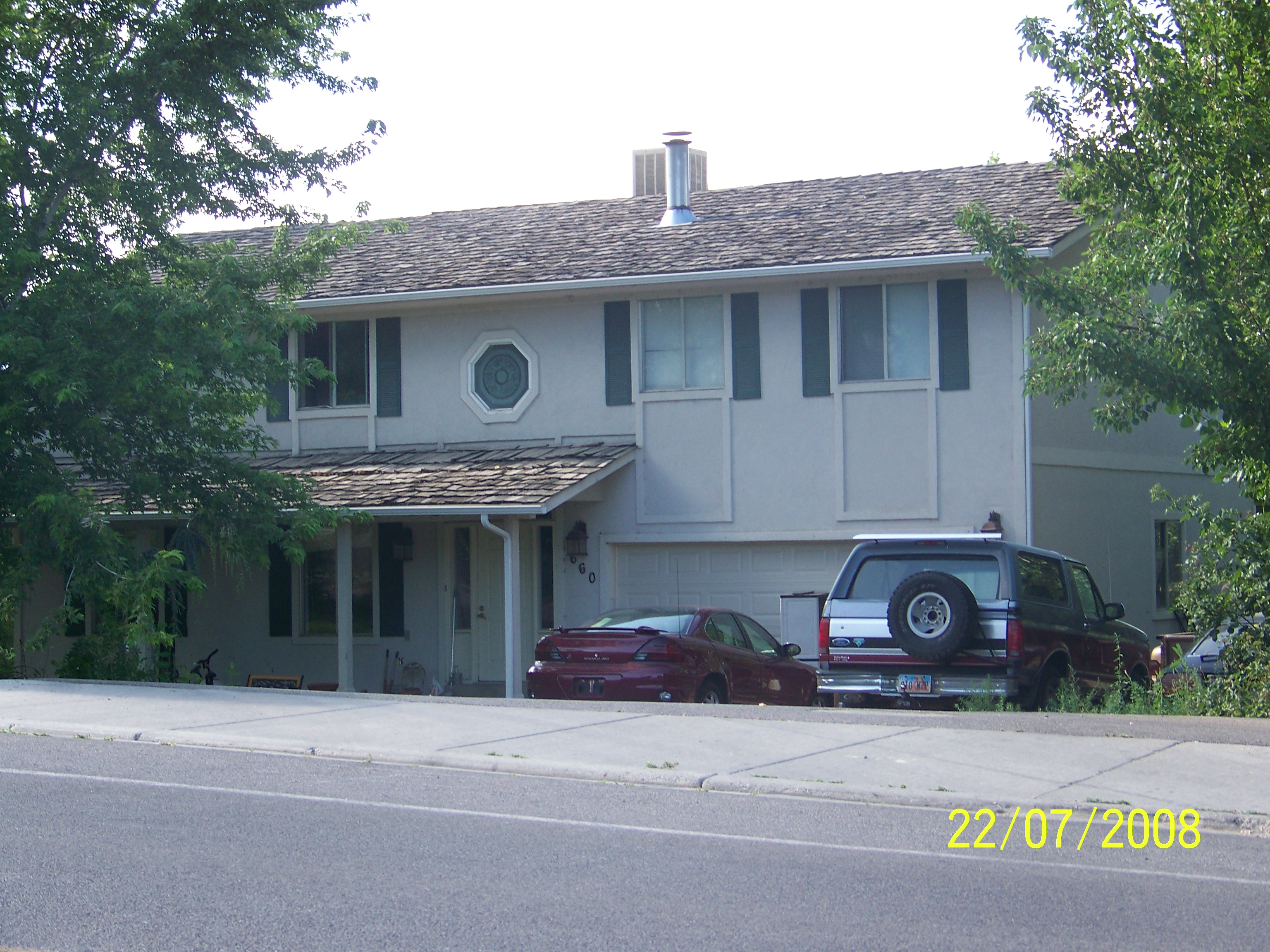
| Property Address: 660 E 400 NORTH - LINDON |
|
| Mailing Address: 660 E 400 N LINDON, UT 84042-2541 |
|
| Acreage: 0.46229 |
|
| Last Document:
29768-1988
|
|
| Subdivision Map Filing |
|
| Legal Description:
COM N 1252.79 FT & W 889.93 FT FR E 1/4 COR. SEC. 34, T5S, R2E, SLB&M.; N 89 DEG 1' 52" W 100.03 FT; N 2 DEG 47' 28" W 201.48 FT; S 89 DEG 19' 49" E 100 FT; S 2 DEG 47' 28" E 202 FT TO BEG. AREA 0.462 AC. |
|
- Owner Names
- Value History
- Tax History
- Location
- Photos
- Documents
- Aerial Image
| 2018... |
|
ANDERSON, JENNIFER |
|
| 2018... |
|
ANDERSON, ROBERT SCOTT |
|
| 2018NV |
|
ANDERSON, DEANN |
|
| 2018NV |
|
ANDERSON, JENNIFER |
|
| 2018NV |
|
ANDERSON, ROBERT MICHAEL |
|
| 2018NV |
|
ANDERSON, ROBERT SCOTT |
|
| 2012-2017 |
|
ANDERSON, DEANN |
|
| 2012-2017 |
|
ANDERSON, ROBERT MICHAEL |
|
| 2011 |
|
FEDERAL NATIONAL MORTGAGE ASSOCIATION |
|
| 2010 |
|
BUNKER, DEVIN K |
|
| 2010 |
|
BUNKER, MELISSA |
|
| 2008-2009 |
|
RAMEY, FRANK |
|
| 2008-2009 |
|
RAMEY, JUDITH |
|
| 2005-2007 |
|
BUNKER, DEVIN K |
|
| 2005-2007 |
|
BUNKER, MELISSA |
|
| 2005NV |
|
FEDERAL NATIONAL MORTGAGE ASSOCIATION |
|
| 2000-2004 |
|
SMITH, DARRIN E |
|
| 1997-1999 |
|
BRATT, KIM |
|
| 1996 |
|
ARMSTONG, BRUCE L |
|
| 1996 |
|
ARMSTONG, ELIZABETH A |
|
| 1996NV |
|
UTLEY, BRIAN |
|
| 1996NV |
|
UTLEY, VICKIE |
|
| 1995 |
|
LUCAS, IRENE KAREY |
|
| 1995 |
|
LUCAS, TED MICHAEL |
|
| 1989-1994 |
|
LUCAS, IRENE KAREY |
|
| 1989-1994 |
|
LUCAS, TED MICHAEL |
|
| 1989NV |
|
LUCAS, IRENE KAREY |
|
| 1989NV |
|
LUCAS, TED MICHAEL |
|
| 1989NV |
|
FEDERAL NATIONAL MORTGAGE ASSOCIATION |
|
| 1984-1988 |
|
TOOLEY, GEORGIA ANN |
|
| 1984-1988 |
|
TOOLEY, LAWRENCE E |
|
| |
----- Real Estate Values ----- |
---Improvements--- |
---Greenbelt--- |
Total |
| Year |
Com |
Res |
Agr |
Tot |
Com |
Res |
Agr |
Tot |
Land |
Homesite |
Tot |
Market Value |
| 2024 |
$0 |
$301,100 |
$0 |
$301,100 |
$0 |
$236,500 |
$0 |
$236,500 |
$0 |
$0 |
$0 |
$537,600 |
| 2023 |
$0 |
$301,100 |
$0 |
$301,100 |
$0 |
$221,800 |
$0 |
$221,800 |
$0 |
$0 |
$0 |
$522,900 |
| 2022 |
$0 |
$317,600 |
$0 |
$317,600 |
$0 |
$194,400 |
$0 |
$194,400 |
$0 |
$0 |
$0 |
$512,000 |
| 2021 |
$0 |
$198,500 |
$0 |
$198,500 |
$0 |
$154,300 |
$0 |
$154,300 |
$0 |
$0 |
$0 |
$352,800 |
| 2020 |
$0 |
$177,200 |
$0 |
$177,200 |
$0 |
$145,600 |
$0 |
$145,600 |
$0 |
$0 |
$0 |
$322,800 |
| 2019 |
$0 |
$151,900 |
$0 |
$151,900 |
$0 |
$135,000 |
$0 |
$135,000 |
$0 |
$0 |
$0 |
$286,900 |
| 2018 |
$0 |
$135,000 |
$0 |
$135,000 |
$0 |
$117,400 |
$0 |
$117,400 |
$0 |
$0 |
$0 |
$252,400 |
| 2017 |
$0 |
$113,900 |
$0 |
$113,900 |
$0 |
$102,100 |
$0 |
$102,100 |
$0 |
$0 |
$0 |
$216,000 |
| 2016 |
$0 |
$101,300 |
$0 |
$101,300 |
$0 |
$113,400 |
$0 |
$113,400 |
$0 |
$0 |
$0 |
$214,700 |
| 2015 |
$0 |
$101,300 |
$0 |
$101,300 |
$0 |
$113,400 |
$0 |
$113,400 |
$0 |
$0 |
$0 |
$214,700 |
| 2014 |
$0 |
$84,400 |
$0 |
$84,400 |
$0 |
$98,600 |
$0 |
$98,600 |
$0 |
$0 |
$0 |
$183,000 |
| 2013 |
$0 |
$79,300 |
$0 |
$79,300 |
$0 |
$85,700 |
$0 |
$85,700 |
$0 |
$0 |
$0 |
$165,000 |
| 2012 |
$0 |
$85,300 |
$0 |
$85,300 |
$0 |
$84,900 |
$0 |
$84,900 |
$0 |
$0 |
$0 |
$170,200 |
| 2011 |
$0 |
$88,700 |
$0 |
$88,700 |
$0 |
$91,300 |
$0 |
$91,300 |
$0 |
$0 |
$0 |
$180,000 |
| 2010 |
$0 |
$97,983 |
$0 |
$97,983 |
$0 |
$134,242 |
$0 |
$134,242 |
$0 |
$0 |
$0 |
$232,225 |
| 2009 |
$0 |
$117,400 |
$0 |
$117,400 |
$0 |
$125,500 |
$0 |
$125,500 |
$0 |
$0 |
$0 |
$242,900 |
| 2008 |
$0 |
$115,600 |
$0 |
$115,600 |
$0 |
$189,000 |
$0 |
$189,000 |
$0 |
$0 |
$0 |
$304,600 |
| 2007 |
$0 |
$83,400 |
$0 |
$83,400 |
$0 |
$221,200 |
$0 |
$221,200 |
$0 |
$0 |
$0 |
$304,600 |
| 2006 |
$0 |
$83,400 |
$0 |
$83,400 |
$0 |
$134,000 |
$0 |
$134,000 |
$0 |
$0 |
$0 |
$217,400 |
| 2005 |
$0 |
$53,500 |
$0 |
$53,500 |
$0 |
$141,765 |
$0 |
$141,765 |
$0 |
$0 |
$0 |
$195,265 |
| 2004 |
$0 |
$53,500 |
$0 |
$53,500 |
$0 |
$141,765 |
$0 |
$141,765 |
$0 |
$0 |
$0 |
$195,265 |
| 2003 |
$0 |
$53,500 |
$0 |
$53,500 |
$0 |
$141,765 |
$0 |
$141,765 |
$0 |
$0 |
$0 |
$195,265 |
| 2002 |
$0 |
$53,500 |
$0 |
$53,500 |
$0 |
$141,765 |
$0 |
$141,765 |
$0 |
$0 |
$0 |
$195,265 |
| 2001 |
$0 |
$53,500 |
$0 |
$53,500 |
$0 |
$141,765 |
$0 |
$141,765 |
$0 |
$0 |
$0 |
$195,265 |
| 2000 |
$0 |
$50,000 |
$0 |
$50,000 |
$0 |
$130,000 |
$0 |
$130,000 |
$0 |
$0 |
$0 |
$180,000 |
| 1999 |
$0 |
$50,000 |
$0 |
$50,000 |
$0 |
$130,000 |
$0 |
$130,000 |
$0 |
$0 |
$0 |
$180,000 |
| 1998 |
$0 |
$44,170 |
$0 |
$44,170 |
$0 |
$131,462 |
$0 |
$131,462 |
$0 |
$0 |
$0 |
$175,632 |
| 1997 |
$0 |
$44,170 |
$0 |
$44,170 |
$0 |
$131,462 |
$0 |
$131,462 |
$0 |
$0 |
$0 |
$175,632 |
| 1996 |
$0 |
$41,273 |
$0 |
$41,273 |
$0 |
$122,839 |
$0 |
$122,839 |
$0 |
$0 |
$0 |
$164,112 |
| 1995 |
$0 |
$37,521 |
$0 |
$37,521 |
$0 |
$122,839 |
$0 |
$122,839 |
$0 |
$0 |
$0 |
$160,360 |
| 1994 |
$0 |
$21,942 |
$0 |
$21,942 |
$0 |
$99,064 |
$0 |
$99,064 |
$0 |
$0 |
$0 |
$121,006 |
| 1993 |
$0 |
$21,942 |
$0 |
$21,942 |
$0 |
$99,064 |
$0 |
$99,064 |
$0 |
$0 |
$0 |
$121,006 |
| 1992 |
$0 |
$20,130 |
$0 |
$20,130 |
$0 |
$90,884 |
$0 |
$90,884 |
$0 |
$0 |
$0 |
$111,014 |
| 1991 |
$0 |
$17,658 |
$0 |
$17,658 |
$0 |
$64,575 |
$0 |
$64,575 |
$0 |
$0 |
$0 |
$82,233 |
| 1990 |
$0 |
$17,658 |
$0 |
$17,658 |
$0 |
$64,575 |
$0 |
$64,575 |
$0 |
$0 |
$0 |
$82,233 |
| 1989 |
$0 |
$17,658 |
$0 |
$17,658 |
$0 |
$64,575 |
$0 |
$64,575 |
$0 |
$0 |
$0 |
$82,233 |
| 1988 |
$0 |
$17,658 |
$0 |
$17,658 |
$0 |
$59,108 |
$0 |
$59,108 |
$0 |
$0 |
$0 |
$76,766 |
| 1987 |
$0 |
$17,658 |
$0 |
$17,658 |
$0 |
$68,933 |
$0 |
$68,933 |
$0 |
$0 |
$0 |
$86,591 |
| 1986 |
$0 |
$17,659 |
$0 |
$17,659 |
$0 |
$68,935 |
$0 |
$68,935 |
$0 |
$0 |
$0 |
$86,594 |
| 1985 |
$0 |
$17,658 |
$0 |
$17,658 |
$0 |
$68,933 |
$0 |
$68,933 |
$0 |
$0 |
$0 |
$86,591 |
| 1984 |
$0 |
$17,833 |
$0 |
$17,833 |
$0 |
$69,633 |
$0 |
$69,633 |
$0 |
$0 |
$0 |
$87,466 |
| Year |
General Taxes |
Adjustments |
Net Taxes |
Fees |
Payments |
Tax Balance* |
Balance Due |
Tax District |
| 2025 |
$0.00 |
$0.00 |
$0.00 |
$0.00 |
|
$0.00
|
$0.00 |
080 - LINDON CITY |
| 2024 |
$2,398.56 |
$0.00 |
$2,398.56 |
$0.00 |
|
$0.00
|
$0.00 |
080 - LINDON CITY |
| 2023 |
$2,171.92 |
$0.00 |
$2,171.92 |
$0.00 |
|
$0.00
|
$0.00 |
080 - LINDON CITY |
| 2022 |
$2,201.55 |
$0.00 |
$2,201.55 |
$0.00 |
|
$0.00
|
$0.00 |
080 - LINDON CITY |
| 2021 |
$1,829.22 |
$0.00 |
$1,829.22 |
$0.00 |
|
$0.00
|
$0.00 |
080 - LINDON CITY |
| 2020 |
$1,700.12 |
$0.00 |
$1,700.12 |
$0.00 |
|
$0.00
|
$0.00 |
080 - LINDON CITY |
| 2019 |
$1,448.40 |
$0.00 |
$1,448.40 |
$0.00 |
|
$0.00
|
$0.00 |
080 - LINDON CITY |
| 2018 |
$1,351.55 |
$0.00 |
$1,351.55 |
$0.00 |
|
$0.00
|
$0.00 |
080 - LINDON CITY |
| 2017 |
$1,186.46 |
$0.00 |
$1,186.46 |
$0.00 |
|
$0.00
|
$0.00 |
080 - LINDON CITY |
| 2016 |
$1,274.96 |
$0.00 |
$1,274.96 |
$0.00 |
|
$0.00
|
$0.00 |
080 - LINDON CITY |
| 2015 |
$1,348.65 |
$0.00 |
$1,348.65 |
$0.00 |
|
$0.00
|
$0.00 |
080 - LINDON CITY |
| 2014 |
$1,160.39 |
$0.00 |
$1,160.39 |
$0.00 |
|
$0.00
|
$0.00 |
080 - LINDON CITY |
| 2013 |
$1,129.57 |
$0.00 |
$1,129.57 |
$0.00 |
|
$0.00
|
$0.00 |
080 - LINDON CITY |
| 2012 |
$1,190.16 |
$0.00 |
$1,190.16 |
$0.00 |
|
$0.00
|
$0.00 |
080 - LINDON CITY |
| 2011 |
$1,461.29 |
($206.96) |
$1,254.33 |
$0.00 |
|
$0.00
|
$0.00 |
080 - LINDON CITY |
| 2010 |
$1,508.16 |
$0.00 |
$1,508.16 |
$0.00 |
|
$0.00
|
$0.00 |
080 - LINDON CITY |
| 2009 |
$1,446.83 |
$0.00 |
$1,446.83 |
$0.00 |
|
$0.00
|
$0.00 |
080 - LINDON CITY |
| 2008 |
$1,632.41 |
$0.00 |
$1,632.41 |
$0.00 |
|
$0.00
|
$0.00 |
080 - LINDON CITY |
| 2007 |
$1,613.15 |
$0.00 |
$1,613.15 |
$0.00 |
|
$0.00
|
$0.00 |
080 - LINDON CITY |
| 2006 |
$1,220.09 |
$0.00 |
$1,220.09 |
$0.00 |
|
$0.00
|
$0.00 |
080 - LINDON CITY |
| 2005 |
$1,260.29 |
$0.00 |
$1,260.29 |
$0.00 |
|
$0.00
|
$0.00 |
080 - LINDON CITY |
| 2004 |
$1,260.18 |
$0.00 |
$1,260.18 |
$0.00 |
|
$0.00
|
$0.00 |
080 - LINDON CITY |
| 2003 |
$1,237.95 |
$0.00 |
$1,237.95 |
$0.00 |
|
$0.00
|
$0.00 |
080 - LINDON CITY |
| 2002 |
$1,135.50 |
$0.00 |
$1,135.50 |
$0.00 |
|
$0.00
|
$0.00 |
080 - LINDON CITY |
| 2001 |
$1,134.10 |
$0.00 |
$1,134.10 |
$0.00 |
|
$0.00
|
$0.00 |
080 - LINDON CITY |
| 2000 |
$1,080.19 |
$0.00 |
$1,080.19 |
$0.00 |
|
$0.00
|
$0.00 |
080 - LINDON CITY |
| 1999 |
$1,104.35 |
$0.00 |
$1,104.35 |
$0.00 |
|
$0.00
|
$0.00 |
080 - LINDON CITY |
| 1998 |
$1,059.20 |
$0.00 |
$1,059.20 |
$0.00 |
|
$0.00
|
$0.00 |
080 - LINDON CITY |
| 1997 |
$1,055.43 |
$0.00 |
$1,055.43 |
$0.00 |
|
$0.00
|
$0.00 |
080 - LINDON CITY |
| 1996 |
$931.76 |
$0.00 |
$931.76 |
$0.00 |
|
$0.00
|
$0.00 |
080 - LINDON CITY |
| 1995 |
$1,009.43 |
$0.00 |
$1,009.43 |
$0.00 |
|
$0.00
|
$0.00 |
080 - LINDON CITY |
| 1994 |
$1,195.52 |
$0.00 |
$1,195.52 |
$0.00 |
|
$0.00
|
$0.00 |
080 - LINDON CITY |
| 1993 |
$1,055.60 |
$0.00 |
$1,055.60 |
$0.00 |
|
$0.00
|
$0.00 |
080 - LINDON CITY |
| 1992 |
$971.37 |
$0.00 |
$971.37 |
$0.00 |
|
$0.00
|
$0.00 |
080 - LINDON CITY |
| 1991 |
$754.56 |
$0.00 |
$754.56 |
$0.00 |
|
$0.00
|
$0.00 |
080 - LINDON CITY |
| 1990 |
$705.27 |
$0.00 |
$705.27 |
$0.00 |
|
$0.00
|
$0.00 |
080 - LINDON CITY |
| 1989 |
$717.60 |
$0.00 |
$717.60 |
$0.00 |
|
$0.00
|
$0.00 |
080 - LINDON CITY |
| 1988 |
$668.01 |
$0.00 |
$668.01 |
$0.00 |
|
$0.00
|
$0.00 |
080 - LINDON CITY |
| 1987 |
$747.89 |
$0.00 |
$747.89 |
$0.00 |
|
$0.00
|
$0.00 |
080 - LINDON CITY |
| 1986 |
$732.67 |
$0.00 |
$732.67 |
$0.00 |
|
$0.00
|
$0.00 |
080 - LINDON CITY |
| 1985 |
$727.16 |
$0.00 |
$727.16 |
$0.00 |
|
$0.00
|
$0.00 |
080 - LINDON CITY |
| 1984 |
$705.86 |
$0.00 |
$705.86 |
$0.00 |
|
$0.00
|
$0.00 |
080 - LINDON CITY |
|
*The visual representation is a sum of taxes for the year(s) selected and is for reference only and no liability is assumed for any inaccuracies, incorrect data or variations.
|
|
* Note: Original tax amount (Does not include applicable interest and/or fees).
| Entry # |
Date |
Recorded |
Type |
Party1 (Grantor) |
Party2 (Grantee) |
| 3288-2022 |
01/04/2022 |
01/10/2022 |
D TR |
ANDERSON, ROBERT SCOTT & JENNIFER |
DESERET FIRST CREDIT UNION |
| 112804-2021 |
06/10/2021 |
06/23/2021 |
RSUBTEE |
MORTGAGE ELECTRONIC REGISTRATION SYSTEMS INC (ET AL) |
ANDERSON, ROBERT SCOTT & JENNIFER |
| 95830-2021 |
05/17/2021 |
05/21/2021 |
D TR |
ANDERSON, ROBERT SCOTT & JENNIFER |
ROCK CANYON BANK |
| 49814-2018 |
05/30/2018 |
05/30/2018 |
REC |
DESERET FIRST FEDERAL CREDIT UNION TEE |
ANDERSON, ROBERT SCOTT & JENNIFER |
| 3358-2018 |
12/12/2017 |
01/10/2018 |
REC |
BACKMAN TITLE SERVICES LTD |
BRATT, KIM |
| 122876-2017 |
12/07/2017 |
12/12/2017 |
D TR |
ANDERSON, ROBERT SCOTT & JENNIFER |
DESERET FIRST FEDERAL CREDIT UNION |
| 119784-2017 |
11/22/2017 |
12/04/2017 |
REC |
WELLS FARGO FINANCIAL NATIONAL BANK TEE |
ANDERSON, ROBERT MICHAEL & DEANN |
| 119783-2017 |
11/22/2017 |
12/04/2017 |
SUB TEE |
MORTGAGE ELECTRONIC REGISTRATION SYSTEMS INC |
WELLS FARGO FINANCIAL NATIONAL BANK SUCTEE |
| 110131-2017 |
10/31/2017 |
11/06/2017 |
D TR |
ANDERSON, ROBERT SCOTT & JENNIFER |
DESERET FIRST FEDERAL CREDIT UNION |
| 110130-2017 |
10/31/2017 |
11/06/2017 |
WD |
ANDERSON, ROBERT MICHAEL & DEANN (ET AL) |
ANDERSON, ROBERT SCOTT & JENNIFER |
| 104439-2017 |
09/15/2017 |
10/20/2017 |
WD |
ANDERSON, ROBERT MICHAEL & DEANN |
ANDERSON, ROBERT MICHAEL & DEANN (ET AL) |
| 49365-2011 |
07/07/2011 |
07/11/2011 |
D TR |
ANDERSON, ROBERT MICHAEL & DEANN |
FIRST COLONY MORTGAGE CORPORATION |
| 49364-2011 |
07/07/2011 |
07/11/2011 |
SP WD |
FANNIE MAE AKA (ET AL) |
ANDERSON, ROBERT MICHAEL & DEANN |
| 63808-2010 |
07/29/2010 |
08/02/2010 |
TEE D |
RECONTRUST COMPANY SUCTEE (ET AL) |
FEDERAL NATIONAL MORTGAGE ASSOCIATION |
| 63807-2010 |
07/29/2010 |
08/02/2010 |
AS |
BAC HOME LOANS SERVICING LP |
FEDERAL NATIONAL MORTGAGE ASSOCIATION |
| 19858-2010 |
03/09/2010 |
03/10/2010 |
ND |
RECONTRUST COMPANY TEE |
BUNKER, DEVIN K & MELISSA |
| 19857-2010 |
03/09/2010 |
03/10/2010 |
SUB TEE |
BAC HOME LOANS SERVICING LP |
RECONTRUST COMPANY SUCTEE |
| 19856-2010 |
03/09/2010 |
03/10/2010 |
AS |
MORTGAGE ELECTRONIC REGISTRATION SYSTEMS INC |
BAC HOME LOANS SERVICING LP |
| 120240-2009 |
10/26/2009 |
11/19/2009 |
QCD |
RAMEY, FRANK & JUDITH |
BUNKER, DEVIN K & MELISSA |
| 166908-2007 |
11/26/2007 |
11/29/2007 |
TR D |
RAMEY, FRANK & JUDITH |
BUNKER, DEVIN K & MELISSA |
| 166907-2007 |
11/26/2007 |
11/29/2007 |
WD |
BUNKER, DEVIN K & MELISSA |
RAMEY, FRANK & JUDITH |
| 144794-2004 |
12/23/2004 |
12/28/2004 |
D TR |
BUNKER, DEVIN K & MELISSA |
MOUNTAIN AMERICA FEDERAL CREDIT UNION |
| 144793-2004 |
12/27/2004 |
12/28/2004 |
SP WD |
FANNIE MAE AKA (ET AL) |
BUNKER, DEVIN K & MELISSA |
| 103303-2004 |
09/07/2004 |
09/08/2004 |
TEE D |
MATHESON, STUART T SUCTEE (ET AL) |
FEDERAL NATIONAL MORTGAGE ASSOCIATION |
| 58644-2004 |
05/18/2004 |
05/21/2004 |
SUB TEE |
MORTGAGE ELECTRONIC REGISTRATION SYSTEMS INC |
MATHESON, STUART T SUCTEE |
| 52427-2004 |
05/05/2004 |
05/06/2004 |
ND |
MATHESON, STUART T SUCTEE |
SMITH, DARRIN E |
| 189585-2003 |
10/27/2003 |
12/02/2003 |
REC |
FIRST BANK OF BEVERLY HILLS TEE |
SMITH, DARRIN E |
| 189584-2003 |
10/27/2003 |
12/02/2003 |
SUB TEE |
MORTGAGE ELECTRONIC REGISTRATION SYSTEMS INC |
FIRST BANK OF BEVERLY HILLS SUCTEE |
| 139916-2003 |
08/05/2003 |
08/26/2003 |
REC |
PRINCIPAL LIFE INSURANCE COMPANY TEE |
SMITH, DARRIN E |
| 139915-2003 |
08/05/2003 |
08/26/2003 |
SUB TEE |
MORTGAGE ELECTRONIC REGISTRATION SYSTEMS INC |
PRINCIPAL LIFE INSURANCE COMPANY SUCTEE |
| 105315-2003 |
07/09/2003 |
07/14/2003 |
D TR |
SMITH, DARRIN E |
COUNTRYWIDE BANK DIV OF (ET AL) |
| 105314-2003 |
07/08/2003 |
07/14/2003 |
D TR |
SMITH, DARRIN E |
AMERICAS WHOLESALE LENDER |
| 17078-2003 |
10/21/2002 |
02/04/2003 |
SCRIVAF |
MORTGAGE ELECTRONIC REGISTRATION SYSTEMS INC (ET AL) |
WHOM OF INTEREST |
| 107147-2002 |
08/02/2002 |
09/12/2002 |
REC |
LUNDBERG, J SCOTT TEE |
SMITH, DARRIN E |
| 107146-2002 |
06/07/2002 |
09/12/2002 |
SUB TEE |
ASSOCIATES HOME EQUITY SERVICES INC |
LUNDBERG, J SCOTT SUCTEE |
| 51089-2002 |
04/18/2002 |
05/03/2002 |
REC |
LUNDBERG, J SCOTT SUCTEE |
SMITH, DARRIN E |
| 51088-2002 |
02/01/2002 |
05/03/2002 |
SUB TEE |
OPTION ONE MORTGAGE CORPORATION |
LUNDBERG, J SCOTT SUCTEE |
| 46104-2002 |
04/19/2002 |
04/24/2002 |
D TR |
SMITH, DARRIN E |
CAPITOL COMMERCE MORTGAGE CO |
| 6051-2002 |
01/10/2002 |
01/16/2002 |
D TR |
SMITH, DARRIN E |
ATHERTON MORTGAGE INC |
| 99197-2001 |
08/31/2001 |
10/01/2001 |
AS |
PRIMARY RESIDENTIAL MORTGAGE INC |
ASSOCIATES HOME EQUITY SERVICES INC |
| 100337-2000 |
12/14/2000 |
12/19/2000 |
D TR |
SMITH, DARRIN E |
PRIMARY RESIDENTIAL MORTGAGE INC |
| 5170-2000 |
01/19/2000 |
01/20/2000 |
REC |
BACKMAN-STEWART TITLE SERVICES LTD TEE BY (ET AL) |
ARMSTRONG, BRUCE L & ELIZABETH A |
| 5169-2000 |
12/16/1999 |
01/20/2000 |
SUB TEE |
FLEET MORTGAGE CORP |
BACKMAN-STEWART TITLE SERVICES LTD SUCTEE |
| 129173-1999 |
12/10/1999 |
12/15/1999 |
REC |
UNIVERSAL CAMPUS FEDERAL CREDIT UNION TEE |
ARMSTRONG, BRUCE L & ELIZABETH |
| 126856-1999 |
11/30/1999 |
12/07/1999 |
D TR |
SMITH, DARRIN E |
OPTION ONE MORTGAGE CORPORATION |
| 19225-1999 |
02/15/1999 |
02/17/1999 |
QCD |
BRATT, KIM BY ATY |
SMITH, DARRIN E |
| 71098-1996 |
08/20/1996 |
08/29/1996 |
TR D |
BRATT, KIM BY ATY |
ARMSTRONG, BRUCE L & ELIZABETH |
| 71097-1996 |
08/28/1996 |
08/29/1996 |
WD |
ARMSTRONG, BRUCE L & ELIZABETH A |
BRATT, KIM |
| 52275-1996 |
06/24/1996 |
06/24/1996 |
D TR |
ARMSTRONG, BRUCE L & ELIZABETH A |
UNIVERSAL CAMPUS FEDERAL CREDIT UNION |
| 5148-1996 |
01/03/1996 |
01/22/1996 |
REC |
SURETY TITLE AGENCY SUBTEE |
LUCAS, TED M & IRENE K |
| 5147-1996 |
12/28/1995 |
01/22/1996 |
SUB TEE |
HADLOCK, RICHARD |
SURETY TITLE AGENCEY SUBTEE |
| 5146-1996 |
01/03/1996 |
01/22/1996 |
REC |
SURETY TITLE AGENCY SUBTEE |
LUCAS, TED M & IRENE K |
| 5145-1996 |
12/28/1995 |
01/22/1996 |
SUB TEE |
HADLOCK, RICHARD |
SURETY TITLE AGENCY SUBTEE |
| 71379-1995 |
10/05/1995 |
10/20/1995 |
REC |
FIRST SECURITY BANK OF UTAH SUCTEE |
LUCAS, TED MICHAEL & IRENE KAREY |
| 71378-1995 |
10/05/1995 |
10/20/1995 |
SUB TEE |
CROSSLAND MORTGAGE CORP FOR (ET AL) |
FIRST SECURITY BANK OF UTAH SUCTEE |
| 65768-1995 |
09/28/1995 |
09/29/1995 |
D TR |
ARMSTRONG, BRUCE L & ELIZABETH A |
FLEET MORTGAGE CORP |
| 65767-1995 |
09/28/1995 |
09/29/1995 |
WD |
UTLEY, BRIAN & VICKIE |
ARMSTONG, BRUCE L & ELIZABETH A |
| 65765-1995 |
09/26/1995 |
09/29/1995 |
WD |
LUCAS, TED MICHAEL & IRENE KAREY |
UTLEY, BRIAN & VICKIE |
| 4830-1995 |
01/18/1995 |
01/24/1995 |
CAN ND |
INWEST TITLE SERVICES INC SUCTEE |
WHOM OF INTEREST |
| 4829-1995 |
01/18/1995 |
01/24/1995 |
CAN ND |
INWEST TITLE SERVICES INC SUCTEE |
WHOM OF INTEREST |
| 71325-1994 |
06/13/1994 |
09/08/1994 |
ND |
INWEST TITLE SERVICES INC SUCTEE |
LUCAS, TED M & IRENE K |
| 71324-1994 |
06/13/1994 |
09/08/1994 |
SUB TEE |
PACIFIC RIM FINANCIAL SERVICES CORPORATION COMPANY |
INWEST TITLE SERVICES INC SUCTEE |
| 71323-1994 |
06/13/1994 |
09/08/1994 |
AS |
HADLOCK, RICHARD A |
PACIFIC RIM FINANCIAL SERVICES CORPORATION COMPANY |
| 71322-1994 |
06/13/1994 |
09/08/1994 |
ND |
INWEST TITLE SERVICES INC SUCTEE |
LUCAS, TED M & IRENE K |
| 71321-1994 |
06/13/1994 |
09/08/1994 |
SUB TEE |
PACIFIC RIM FINANCIAL SERVICES CORPORATION COMPANY |
INWEST TITLE SERVICES INC SUCTEE |
| 71320-1994 |
06/13/1994 |
09/08/1994 |
AS |
PARKER INVESTMENTS BY (ET AL) |
PACIFIC RIM FINANCIAL SERVICES CORPORATION COMPANY |
| 51327-1994 |
06/13/1994 |
06/21/1994 |
ND |
INWEST TITLE SERVICES INC SUCTEE |
LUCAS, TED M & IRENE K |
| 51326-1994 |
06/13/1994 |
06/21/1994 |
SUB TEE |
PACIFIC RIM FINANCIAL SERVICES CORPORATION |
INWEST TITLE SERVICES INC SUCTEE |
| 51325-1994 |
06/13/1994 |
06/21/1994 |
AS |
PARKER INVESTMENTS |
PACIFIC RIM FINANCIAL SERVICES CORPORATION |
| 51324-1994 |
06/13/1994 |
06/21/1994 |
ND |
INWEST TITLE SERVICES INC SUCTEE |
LUCAS, TED M & IRENE K |
| 51323-1994 |
06/13/1994 |
06/21/1994 |
SUB TEE |
PACIFIC RIM FINANCIAL SERVICES CORPORATION |
INWEST TITLE SERVICES INC SUCTEE |
| 51322-1994 |
06/13/1994 |
06/21/1994 |
AS |
HADLOCK, RICHARD A |
PACIFIC RIM FINANCIAL SERVICES CORPORATION |
| 50948-1994 |
08/04/1993 |
06/20/1994 |
S PLAT |
PERRY, DEAN S & REVA W |
PERRY DEAN PLAT A |
| 85758-1993 |
11/23/1993 |
11/26/1993 |
CAN ND |
BOYCE, DAVID B SUCTEE |
LUCAS, TED MICHAEL & IRENE KAREY |
| 46244-1993 |
07/01/1993 |
07/12/1993 |
ND |
BOYCE, DAVID B SUCTEE |
LUCAS, TED MICHAEL & IRENE KAREY |
| 22794-1993 |
04/07/1993 |
04/16/1993 |
AS |
PACIFIC RIM FINANCIAL SERVICES CORPORATION COMPANY |
HADLOCK RICHARD A FAMILY TRUST |
| 22785-1993 |
04/06/1993 |
04/16/1993 |
AS |
PACIFIC RIM FINANCIAL SERVICES CORPORATION COMPANY |
PARKER INVESTMENTS |
| 16671-1993 |
02/13/1993 |
03/23/1993 |
D TR |
LUCAS, TED & IRENE K |
PACIFIC RIM FINANCIAL SERVICES CORPORATION |
| 16670-1993 |
02/13/1993 |
03/23/1993 |
D TR |
LUCAS, TED D & IRENE K |
PACIFIC RIM FINANCIAL SERVICES |
| 35208-1991 |
08/28/1991 |
09/05/1991 |
CAN ND |
BOYCE, DAVID B SUCTEE |
LUCAS, TED MICHAEL & IRENE KAREY |
| 24963-1991 |
05/31/1991 |
06/27/1991 |
ND |
BOYCE, DAVID B SUCTEE |
LUCAS, TED MICHAEL & IRENE KAREY |
| 24962-1991 |
05/31/1991 |
06/27/1991 |
SUB TEE |
FEDERAL NATIONAL MORTGAGE |
BOYCE, DAVID B SUBTEE |
| 29769-1988 |
09/30/1988 |
09/30/1988 |
D TR |
LUCAS, TED MICHAEL & IRENE KAREY |
FEDERAL NATIONAL MORTGAGE ASSOCIATION |
| 29768-1988 |
09/27/1988 |
09/30/1988 |
WD |
FEDERAL NATIONAL MORTGAGE ASSOC |
LUCAS, TED MICHAEL & IRENE KAREY |
| 17825-1988 |
06/20/1988 |
06/22/1988 |
TEE D |
ROBINSON, BRYAN C SUCTEE (ET AL) |
FEDERAL NATIONAL MORTGAGE ASSOCIATION |
| 6900-1988 |
03/14/1988 |
03/14/1988 |
REC |
EMPIRE LAND TITLE COMPANY TEE |
TOOLEY, LAWRENCE E & GEORGIA ANN |
| 4466-1988 |
01/25/1988 |
02/19/1988 |
ND |
ROBINSON, BRYAN C SUCTEE |
TOOLEY, LAWRENCE E & GEORGIA ANN |
| 4465-1988 |
01/14/1988 |
02/19/1988 |
SUB TEE |
FEDERAL NATIONAL MORTGAGE ASSOCIATION |
ROBINSON, BRYAN C SUCTEE |
| 3335-1987 |
01/02/1987 |
01/29/1987 |
REC |
DESERET FEDERAL SAVINGS & LOAN ASSOCIATION TEE |
PERRY, DEAN S & REVA W |
| 9609-1986 |
04/01/1986 |
04/02/1986 |
NI |
JORDAN, WAYNE E & F ANN |
WHOM OF INTEREST |
| 9608-1986 |
04/01/1986 |
04/02/1986 |
AS CN |
JURGENS, KURT A & JANET |
PEACOCK PROPERTIES INC |
| 27811-1985 |
08/14/1985 |
09/25/1985 |
NI |
JURGENS, KURT A & JANET |
WHOM OF INTEREST |
| 28867-1983 |
09/08/1983 |
09/22/1983 |
D TR |
TOOLEY, LAWRENCE E & GEORGIA ANN |
LINCOLN SERVICE CORPORATION |
| 13965-1983 |
05/10/1983 |
05/12/1983 |
WD |
PERRY, DEAN S & REVA W |
TOOLEY, LAWRENCE E & GEORGIA ANN |
Main Menu Comments or Concerns on Value/Appraisal - Assessor's Office
Documents/Owner/Parcel information - Recorder's Office
Address Change for Tax Notice
This page was created on 3/6/2025 9:45:03 AM |


