Property Information
| Serial Number: 35:477:0009 |
Serial Life: 2006-2011 |
|
|
Total Photos: 1
|
| |
|
|
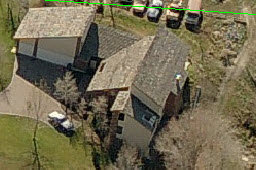
| Property Address: 2817 N 1130 WEST - PLEASANT GROVE |
|
| Mailing Address: 2817 N 1130 W PLEASANT GROVE, UT 84062-8048 |
|
| Acreage: 1.266 |
|
| Last Document:
29959-2005
|
|
| Subdivision Map Filing |
|
| Legal Description:
LOT 9, PLAT B, BRYTON ESTATES SUBDV. AREA 1.266 AC. |
|
- Owner Names
- Value History
- Tax History
- Location
- Photos
- Documents
- Aerial Image
| |
----- Real Estate Values ----- |
---Improvements--- |
---Greenbelt--- |
Total |
| Year |
Com |
Res |
Agr |
Tot |
Com |
Res |
Agr |
Tot |
Land |
Homesite |
Tot |
Market Value |
| 2011 |
$0 |
$100,000 |
$10,600 |
$110,600 |
$0 |
$267,400 |
$0 |
$267,400 |
$0 |
$0 |
$0 |
$378,000 |
| 2010 |
$0 |
$147,360 |
$7,239 |
$154,599 |
$0 |
$239,144 |
$0 |
$239,144 |
$0 |
$0 |
$0 |
$393,743 |
| 2009 |
$0 |
$146,900 |
$7,700 |
$154,600 |
$0 |
$259,500 |
$0 |
$259,500 |
$0 |
$0 |
$0 |
$414,100 |
| 2008 |
$0 |
$282,500 |
$14,800 |
$297,300 |
$0 |
$259,500 |
$0 |
$259,500 |
$0 |
$0 |
$0 |
$556,800 |
| 2007 |
$0 |
$282,500 |
$14,800 |
$297,300 |
$0 |
$259,500 |
$0 |
$259,500 |
$0 |
$0 |
$0 |
$556,800 |
| 2006 |
$0 |
$200,000 |
$14,900 |
$214,900 |
$0 |
$244,700 |
$0 |
$244,700 |
$0 |
$0 |
$0 |
$459,600 |
| Year |
General Taxes |
Adjustments |
Net Taxes |
Fees |
Payments |
Tax Balance* |
Balance Due |
Tax District |
| 2011 |
$2,737.91 |
$0.00 |
$2,737.91 |
$0.00 |
|
$0.00
|
$0.00 |
070 - PLEASANT GROVE CITY |
| 2010 |
$2,647.90 |
$0.00 |
$2,647.90 |
$0.00 |
|
$0.00
|
$0.00 |
070 - PLEASANT GROVE CITY |
| 2009 |
$2,569.09 |
$0.00 |
$2,569.09 |
$0.00 |
|
$0.00
|
$0.00 |
070 - PLEASANT GROVE CITY |
| 2008 |
$3,215.36 |
$0.00 |
$3,215.36 |
$0.00 |
|
$0.00
|
$0.00 |
070 - PLEASANT GROVE CITY |
| 2007 |
$3,088.01 |
$0.00 |
$3,088.01 |
$0.00 |
|
$0.00
|
$0.00 |
070 - PLEASANT GROVE CITY |
| 2006 |
$2,740.94 |
$0.00 |
$2,740.94 |
$0.00 |
|
$0.00
|
$0.00 |
070 - PLEASANT GROVE CITY |
|
*The visual representation is a sum of taxes for the year(s) selected and is for reference only and no liability is assumed for any inaccuracies, incorrect data or variations.
|
|
* Note: Original tax amount (Does not include applicable interest and/or fees).
| Entry # |
Date |
Recorded |
Type |
Party1 (Grantor) |
Party2 (Grantee) |
| 70959-2011 |
10/06/2011 |
10/06/2011 |
C BLA |
BARKDULL, THAD & JILL |
BURR, RICHARD LEE TEE (ET AL) |
| 19792-2010 |
03/02/2010 |
03/10/2010 |
SUB AGR |
AMERICA FIRST FEDERAL CREDIT UNION |
AMERICA FIRST FEDERAL CREDIT UNION |
| 19788-2010 |
03/05/2010 |
03/10/2010 |
D TR |
BURR, RICHARD LEE & RICHARD LEE TEE |
AMERICA FIRST FEDERAL CREDIT UNION |
| 12427-2008 |
01/25/2008 |
02/01/2008 |
TR D |
BURR, RICHARD LEE TEE |
AMERICA FIRST FEDERAL CREDIT UNION |
| 33039-2006 |
03/01/2006 |
03/21/2006 |
REC |
WESTERN COMMUNITY BANK TEE |
BRYTON ESTATES DEVELOPMENT |
| 4463-2006 |
01/06/2005 |
01/12/2006 |
BLA |
PILCH, KENNETH G |
BURR, RICHARD LEE TEE (ET AL) |
| 33710-2005 |
03/18/2005 |
03/31/2005 |
CONSENT |
CHAPPELL, CARL A & SUSAN E |
WHOM OF INTEREST |
| 31273-2005 |
03/25/2005 |
03/25/2005 |
SCRIVAF |
BACKMAN STEWART TITLE SERVICES LTD BY (ET AL) |
WHOM OF INTEREST |
| 29960-2005 |
03/15/2005 |
03/23/2005 |
CONSENT |
BRYTON ESTATES DEVELOPMENT LLC (ET AL) |
WHOM OF INTEREST |
| 29959-2005 |
01/04/2005 |
03/23/2005 |
S PLAT |
BISHOP, JARED L |
BRYTON ESTATES PLAT B |
Main Menu Comments or Concerns on Value/Appraisal - Assessor's Office
Documents/Owner/Parcel information - Recorder's Office
Address Change for Tax Notice
This page was created on 3/8/2025 4:43:10 PM |
