Property Information
| Serial Number: 38:257:0110 |
Serial Life: 2001-2010 |
|
|
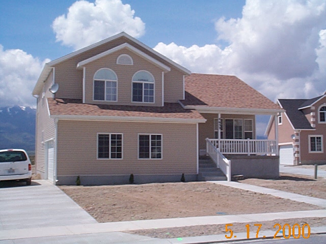
Total Photos: 1
|
| |
|
|
| Property Address: |
|
| Mailing Address: 4430 KESTREL WY EAGLE MOUNTAIN, UT 84005-4202 |
|
| Acreage: 0.011868 |
|
| Last Document:
15195-2000
|
|
| Subdivision Map Filing |
|
| Legal Description:
PART LOT 79, PHASE I, EAGLEPARK SUB DESCRIBED AS FOLLOWS:; COM S 95.27 FT & E 3093.08 FT FR W 1/4 COR. SEC. 12, T6S, R2W, SLB&M.; N 89 DEG 44' 31" W 102.6 FT; ALONG A CURVE TO R (CHORD BEARS: S 16 DEG 52' 41" W 5.22 FT, RADIUS = 205 FT); S 89 DEG 44' 31" E 104.12 FT; N 5 FT TO BEG. AREA 0.012 AC. |
|
- Owner Names
- Value History
- Tax History
- Location
- Photos
- Documents
- Aerial Image
Main Menu Comments or Concerns on Value/Appraisal - Assessor's Office
Documents/Owner/Parcel information - Recorder's Office
Address Change for Tax Notice
This page was created on 3/2/2025 2:14:37 AM |
