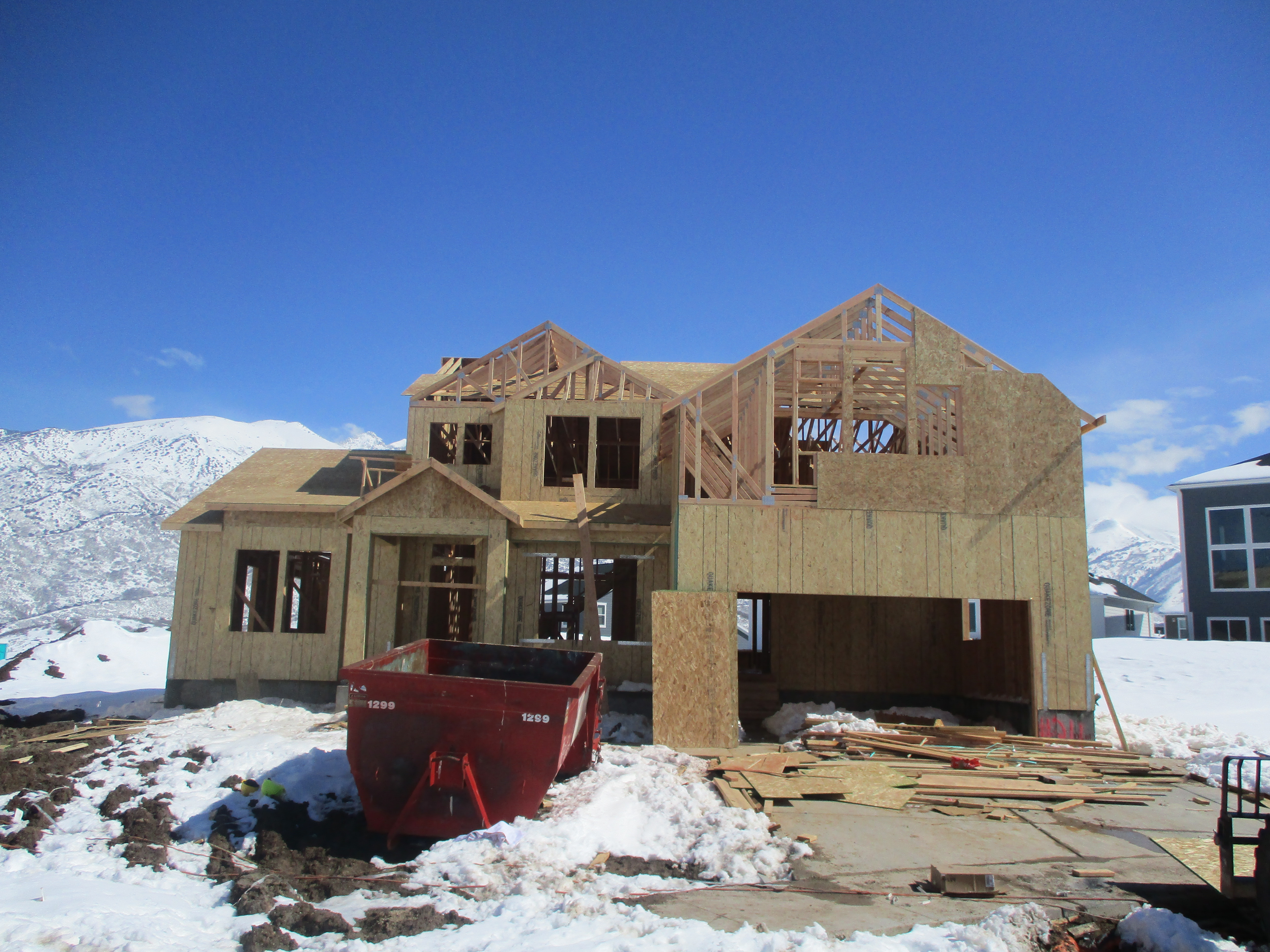
Property Information
| Serial Number: 41:909:0311 |
Serial Life: 2019... |
|
|

Total Photos: 1
|
| |
|
|
| Property Address: 14937 S WATER BIRCH CIR - DRAPER |
|
| Mailing Address: 14937 S WATER BIRCH CIR DRAPER, UT 84020 |
|
| Acreage: 0.261157 |
|
| Last Document:
67343-2019
|
|
| Subdivision Map Filing |
|
| Legal Description:
LOT 311, HIDDEN CANYON ESTATES, PHASE 3 SUB AREA 0.261 AC. |
|
- Owner Names
- Value History
- Tax History
- Location
- Photos
- Documents
- Aerial Image
| |
----- Real Estate Values ----- |
---Improvements--- |
---Greenbelt--- |
Total |
| Year |
Com |
Res |
Agr |
Tot |
Com |
Res |
Agr |
Tot |
Land |
Homesite |
Tot |
Market Value |
| 2024 |
$0 |
$297,200 |
$0 |
$297,200 |
$0 |
$578,500 |
$0 |
$578,500 |
$0 |
$0 |
$0 |
$875,700 |
| 2023 |
$0 |
$270,200 |
$0 |
$270,200 |
$0 |
$647,000 |
$0 |
$647,000 |
$0 |
$0 |
$0 |
$917,200 |
| 2022 |
$0 |
$283,200 |
$0 |
$283,200 |
$0 |
$555,200 |
$0 |
$555,200 |
$0 |
$0 |
$0 |
$838,400 |
| 2021 |
$0 |
$236,000 |
$0 |
$236,000 |
$0 |
$399,400 |
$0 |
$399,400 |
$0 |
$0 |
$0 |
$635,400 |
| 2020 |
$0 |
$188,800 |
$0 |
$188,800 |
$0 |
$414,600 |
$0 |
$414,600 |
$0 |
$0 |
$0 |
$603,400 |
| 2019 |
$0 |
$188,800 |
$0 |
$188,800 |
$0 |
$0 |
$0 |
$0 |
$0 |
$0 |
$0 |
$188,800 |
| Year |
General Taxes |
Adjustments |
Net Taxes |
Fees |
Payments |
Tax Balance* |
Balance Due |
Tax District |
| 2025 |
$0.00 |
$0.00 |
$0.00 |
$0.00 |
|
$0.00
|
$0.00 |
019 - DRAPER W/TR RIDGE, JVWC & SVSD |
| 2024 |
$4,594.32 |
$0.00 |
$4,594.32 |
$0.00 |
|
$0.00
|
$0.00 |
019 - DRAPER W/TR RIDGE, JVWC & SVSD |
| 2023 |
$4,465.98 |
$0.00 |
$4,465.98 |
$0.00 |
|
$0.00
|
$0.00 |
019 - DRAPER W/TR RIDGE, JVWC & SVSD |
| 2022 |
$4,185.13 |
$0.00 |
$4,185.13 |
$0.00 |
|
$0.00
|
$0.00 |
019 - DRAPER W/TR RIDGE, JVWC & SVSD |
| 2021 |
$3,680.97 |
$0.00 |
$3,680.97 |
$0.00 |
|
$0.00
|
$0.00 |
019 - DRAPER W/TR RIDGE, JVWC & SVSD |
| 2020 |
$3,578.55 |
$0.00 |
$3,578.55 |
$0.00 |
|
$0.00
|
$0.00 |
019 - DRAPER W/TR RIDGE, JVWC & SVSD |
| 2019 |
$1,962.76 |
$0.00 |
$1,962.76 |
$0.00 |
|
$0.00
|
$0.00 |
019 - DRAPER W/TR RIDGE, JVWC & SVSD |
|
*The visual representation is a sum of taxes for the year(s) selected and is for reference only and no liability is assumed for any inaccuracies, incorrect data or variations.
|
|
* Note: Original tax amount (Does not include applicable interest and/or fees).
| Entry # |
Date |
Recorded |
Type |
Party1 (Grantor) |
Party2 (Grantee) |
| 35082-2021 |
02/17/2021 |
02/24/2021 |
D TR |
FEIL, MARK M & MELISSA |
MOUNTAIN AMERICA FEDERAL CREDIT UNION |
| 146449-2020 |
09/16/2020 |
09/24/2020 |
REC |
MORAN, KEVIN P SUBTEE |
FEIL, MARK & MELISSA |
| 146448-2020 |
09/08/2020 |
09/24/2020 |
SUB TEE |
MORTGAGE ELECTRONIC REGISTRATION SYSTEMS INC |
MORAN, KEVIN P SUBTEE |
| 132696-2020 |
08/27/2020 |
09/01/2020 |
D TR |
FEIL, MARK M & MELISSA |
MOUNTAIN AMERICA FEDERAL CREDIT UNION |
| 1656-2020 |
01/02/2020 |
01/06/2020 |
A AGR |
DJ INVESTMENT GROUP LLC (ET AL) |
DRAPER CITY |
| 111061-2019 |
10/25/2019 |
10/28/2019 |
REC |
PROVO LAND TITLE COMPANY TEE |
WELLS FARGO |
| 67344-2019 |
07/18/2019 |
07/19/2019 |
D TR |
FEIL, MARK & MELISSA |
FIRST COLONY MORTGAGE CORPORATION |
| 67343-2019 |
06/10/2019 |
07/19/2019 |
WD |
EDGE LAND 16 LLC |
FEIL, MARK M & MELISSA |
| 9364-2019 |
02/01/2019 |
02/04/2019 |
R NI |
BODELL, RICK (ET AL) |
WHOM OF INTEREST |
| 88-2019 |
12/26/2018 |
01/02/2019 |
NI |
BODELL, RICK (ET AL) |
WHOM OF INTEREST |
| 116580-2018 |
12/10/2018 |
12/10/2018 |
SUP DTR |
EDGE LAND 16 LLC |
WELLS FARGO BANK |
| 102151-2018 |
10/16/2018 |
10/24/2018 |
ADECCOV |
EDGE LAND 16 LLC |
WHOM OF INTEREST |
| 100154-2018 |
10/16/2018 |
10/18/2018 |
GEO HAZ |
JONES, GORDON |
WHOM OF INTEREST |
| 83144-2018 |
07/18/2018 |
08/30/2018 |
S PLAT |
EDGE LAND 16 LLC |
HIDDEN CANYON ESTATES PHASE 3 |
Main Menu Comments or Concerns on Value/Appraisal - Assessor's Office
Documents/Owner/Parcel information - Recorder's Office
Address Change for Tax Notice
This page was created on 12/22/2024 6:18:27 AM |