Property Information
| Serial Number: 43:251:0001 |
Serial Life: 2018-2023 |
|
|
Total Photos: 4
|
| |
|
|
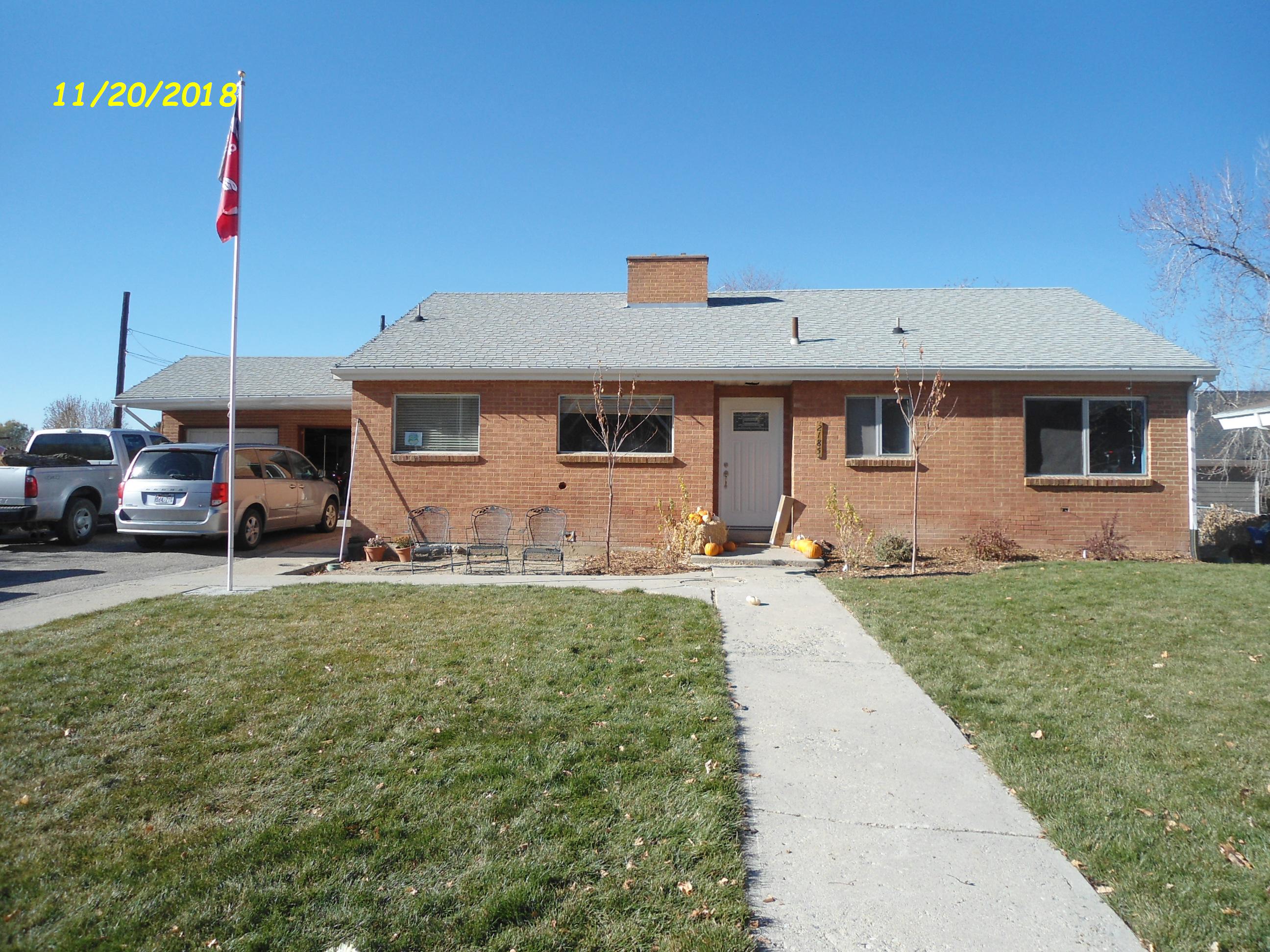
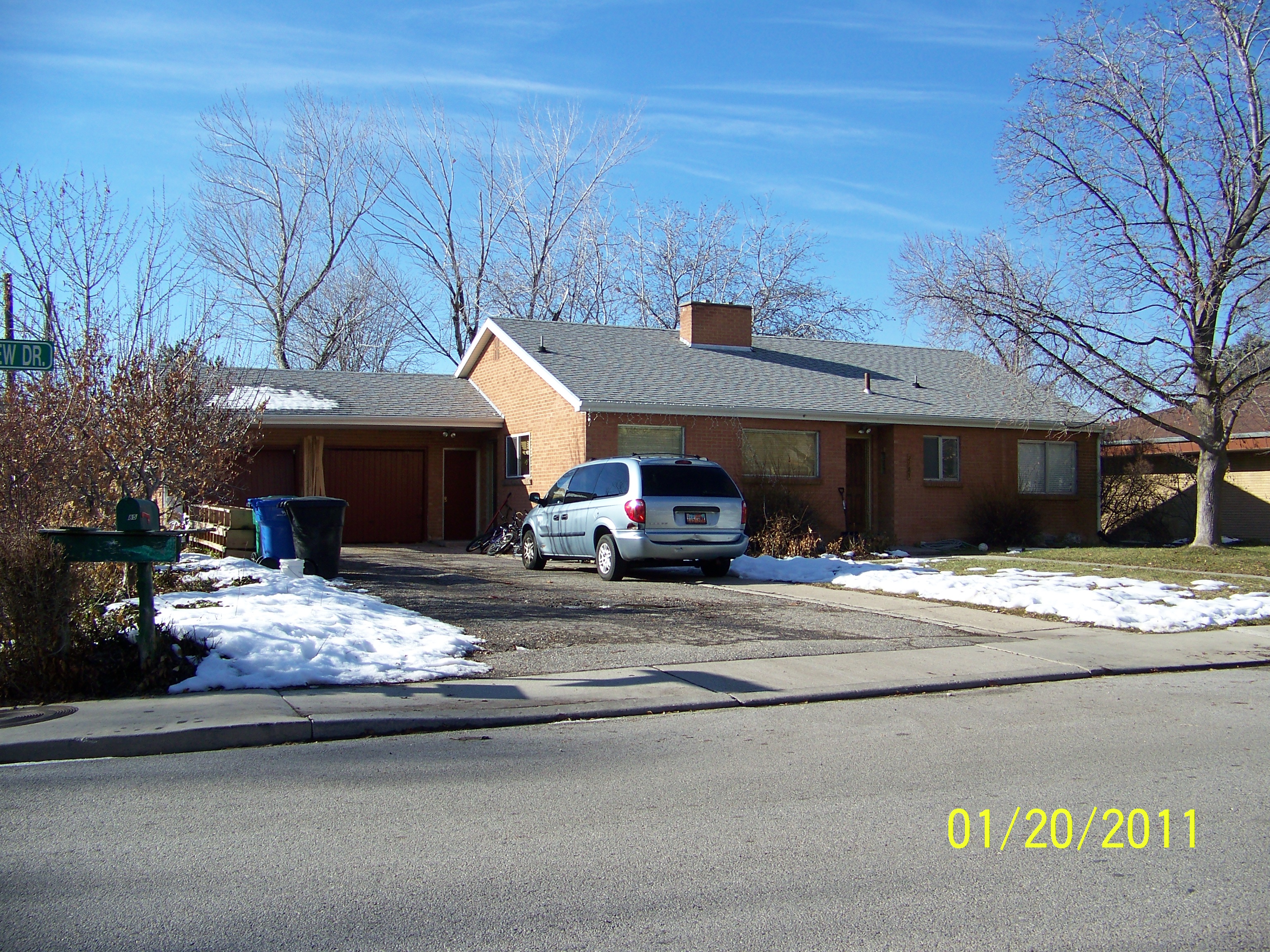
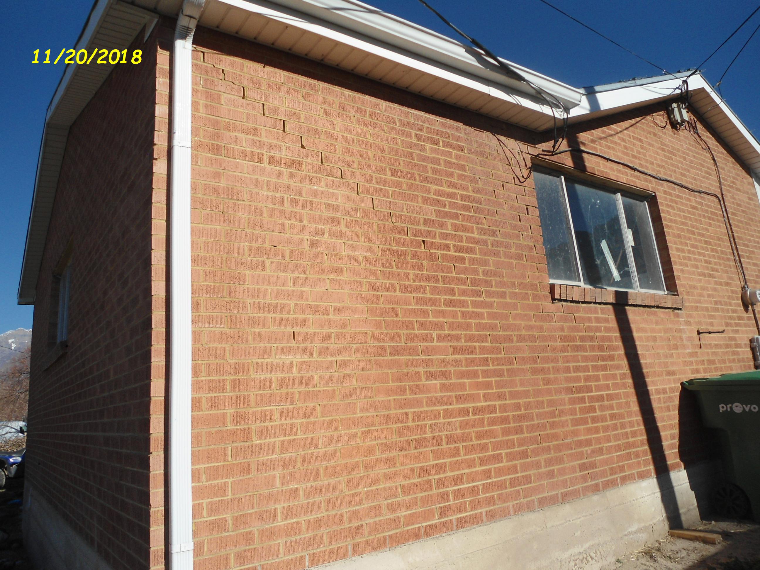
| Property Address: 2183 N TIMPVIEW DR - PROVO
more see "Addrs" tab below..
|
|
| Mailing Address: 2185 N 650 E PROVO, UT 84604-1854 |
|
| Acreage: 0.254506 |
|
| Last Document:
41610-2017
|
|
| Subdivision Map Filing |
|
| Legal Description:
LOT 1, J&M BAIRD SUB AREA 0.255 AC. |
|
- Owner Names
- Value History
- Tax History
- Location
- Photos
- Documents
- Aerial Image
- Addrs
| |
----- Real Estate Values ----- |
---Improvements--- |
---Greenbelt--- |
Total |
| Year |
Com |
Res |
Agr |
Tot |
Com |
Res |
Agr |
Tot |
Land |
Homesite |
Tot |
Market Value |
| 2023 |
$0 |
$248,200 |
$0 |
$248,200 |
$0 |
$236,000 |
$0 |
$236,000 |
$0 |
$0 |
$0 |
$484,200 |
| 2022 |
$0 |
$264,600 |
$0 |
$264,600 |
$0 |
$245,500 |
$0 |
$245,500 |
$0 |
$0 |
$0 |
$510,100 |
| 2021 |
$0 |
$203,500 |
$0 |
$203,500 |
$0 |
$194,100 |
$0 |
$194,100 |
$0 |
$0 |
$0 |
$397,600 |
| 2020 |
$0 |
$162,800 |
$0 |
$162,800 |
$0 |
$190,300 |
$0 |
$190,300 |
$0 |
$0 |
$0 |
$353,100 |
| 2019 |
$0 |
$162,800 |
$0 |
$162,800 |
$0 |
$185,800 |
$0 |
$185,800 |
$0 |
$0 |
$0 |
$348,600 |
| 2018 |
$0 |
$118,500 |
$0 |
$118,500 |
$0 |
$169,500 |
$0 |
$169,500 |
$0 |
$0 |
$0 |
$288,000 |
| Year |
General Taxes |
Adjustments |
Net Taxes |
Fees |
Payments |
Tax Balance* |
Balance Due |
Tax District |
| 2023 |
$2,744.32 |
$0.00 |
$2,744.32 |
$0.00 |
|
$0.00
|
$0.00 |
110 - PROVO CITY |
| 2022 |
$2,867.27 |
$0.00 |
$2,867.27 |
$0.00 |
|
$0.00
|
$0.00 |
110 - PROVO CITY |
| 2021 |
$2,329.82 |
$0.00 |
$2,329.82 |
$0.00 |
|
$0.00
|
$0.00 |
110 - PROVO CITY |
| 2020 |
$2,207.14 |
$0.00 |
$2,207.14 |
$0.00 |
|
$0.00
|
$0.00 |
110 - PROVO CITY |
| 2019 |
$2,095.23 |
$0.00 |
$2,095.23 |
$0.00 |
|
$0.00
|
$0.00 |
110 - PROVO CITY |
| 2018 |
$2,340.87 |
($634.11) |
$1,706.76 |
$0.00 |
|
$0.00
|
$0.00 |
110 - PROVO CITY |
|
*The visual representation is a sum of taxes for the year(s) selected and is for reference only and no liability is assumed for any inaccuracies, incorrect data or variations.
|
|
* Note: Original tax amount (Does not include applicable interest and/or fees).
| Entry # |
Date |
Recorded |
Type |
Party1 (Grantor) |
Party2 (Grantee) |
| 15859-2023 |
03/14/2023 |
03/15/2023 |
QCD |
BAIRD, MICHAEL & MELANIE (ET AL) |
BAIRD, MICHAEL & MELANIE |
| 13875-2018 |
01/29/2018 |
02/12/2018 |
REC |
UTAH COMMUNITY FEDERAL CREDIT UNION TEE |
BAIRD, JOHN R & MARGERY (ET AL) |
| 53534-2017 |
05/30/2017 |
06/02/2017 |
D TR |
BAIRD, MICHAEL & MELANIE (ET AL) |
GATEWAY MORTGAGE GROUP LLC |
| 53533-2017 |
05/30/2017 |
06/02/2017 |
WD |
BAIRD, J RUSSELL & MARGERY C |
BAIRD, YVONNE & ROBERT ALLAN (ET AL) |
| 53532-2017 |
06/02/2017 |
06/02/2017 |
P REC |
UTAH COMMUNITY FEDERAL CREDIT UNION TEE |
BAIRD, J RUSSELL & MARGERY C |
| 41610-2017 |
03/23/2016 |
05/01/2017 |
S PLAT |
BAIRD, J RUSSELL & MARGERY C |
J&M BAIRD |
2183 N TIMPVIEW DR - PROVO
2185 N TIMPVIEW DR - PROVO
Main Menu Comments or Concerns on Value/Appraisal - Assessor's Office
Documents/Owner/Parcel information - Recorder's Office
Address Change for Tax Notice
This page was created on 2/1/2025 7:46:50 AM |


