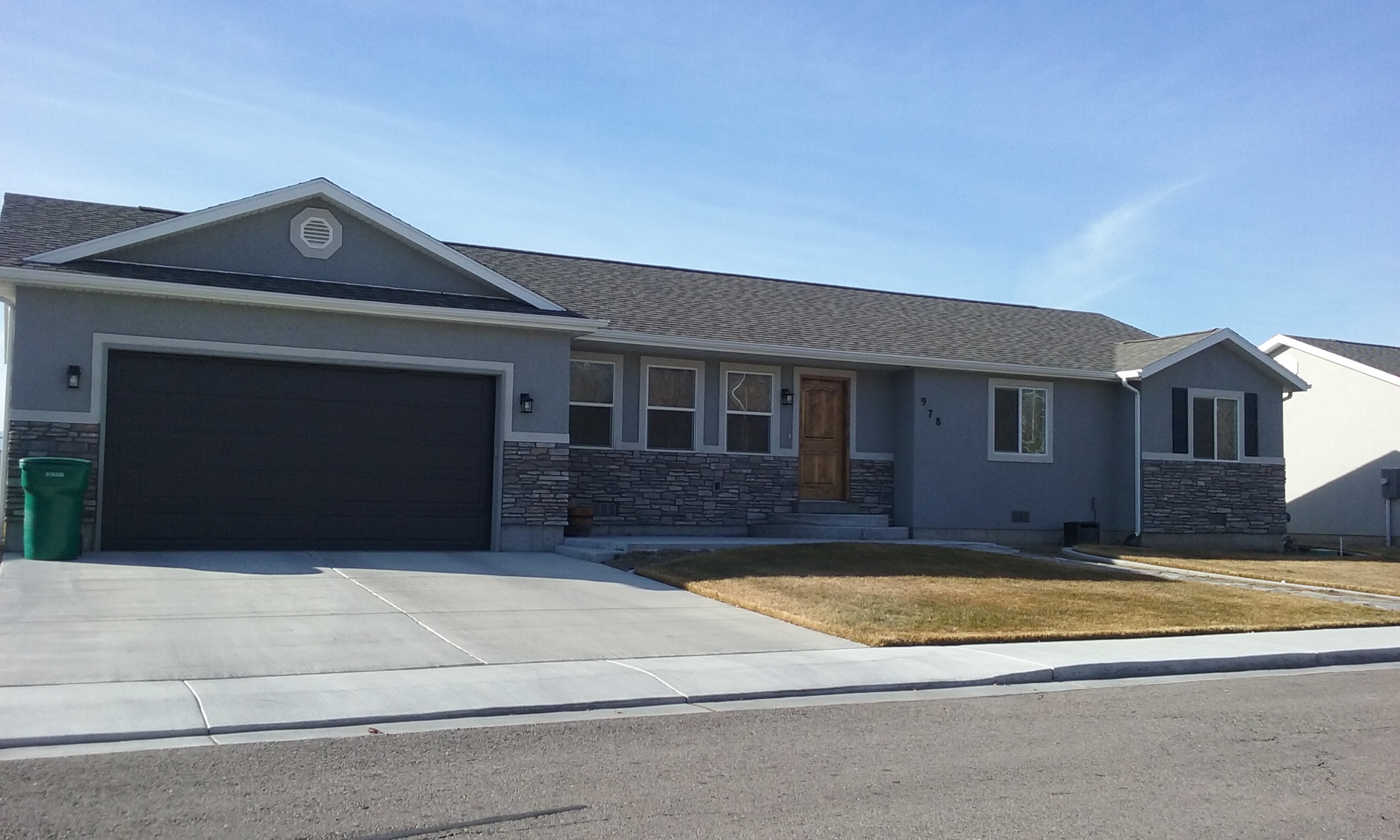
Property Information
| Serial Number: 45:488:0002 |
Serial Life: 2011... |
|
|

Total Photos: 1
|
| |
|
|
| Property Address: 978 S 190 WEST - OREM |
|
| Mailing Address: 978 S 190 W OREM, UT 84058-6830 |
|
| Acreage: 0.183564 |
|
| Last Document:
53815-2015
|
|
| Subdivision Map Filing |
|
| Legal Description:
LOT 2, LAKE RIDGE JUNIOR HIGH SCHOOL SUB AREA 0.184 AC. |
|
- Owner Names
- Value History
- Tax History
- Location
- Photos
- Documents
- Aerial Image
| |
----- Real Estate Values ----- |
---Improvements--- |
---Greenbelt--- |
Total |
| Year |
Com |
Res |
Agr |
Tot |
Com |
Res |
Agr |
Tot |
Land |
Homesite |
Tot |
Market Value |
| 2024 |
$0 |
$204,700 |
$0 |
$204,700 |
$0 |
$248,300 |
$0 |
$248,300 |
$0 |
$0 |
$0 |
$453,000 |
| 2023 |
$0 |
$204,700 |
$0 |
$204,700 |
$0 |
$252,600 |
$0 |
$252,600 |
$0 |
$0 |
$0 |
$457,300 |
| 2022 |
$0 |
$218,300 |
$0 |
$218,300 |
$0 |
$215,200 |
$0 |
$215,200 |
$0 |
$0 |
$0 |
$433,500 |
| 2021 |
$0 |
$167,900 |
$0 |
$167,900 |
$0 |
$168,100 |
$0 |
$168,100 |
$0 |
$0 |
$0 |
$336,000 |
| 2020 |
$0 |
$134,300 |
$0 |
$134,300 |
$0 |
$164,800 |
$0 |
$164,800 |
$0 |
$0 |
$0 |
$299,100 |
| 2019 |
$0 |
$124,000 |
$0 |
$124,000 |
$0 |
$164,800 |
$0 |
$164,800 |
$0 |
$0 |
$0 |
$288,800 |
| 2018 |
$0 |
$106,700 |
$0 |
$106,700 |
$0 |
$154,600 |
$0 |
$154,600 |
$0 |
$0 |
$0 |
$261,300 |
| 2017 |
$0 |
$89,500 |
$0 |
$89,500 |
$0 |
$141,900 |
$0 |
$141,900 |
$0 |
$0 |
$0 |
$231,400 |
| 2016 |
$0 |
$66,800 |
$0 |
$66,800 |
$0 |
$144,500 |
$0 |
$144,500 |
$0 |
$0 |
$0 |
$211,300 |
| Year |
General Taxes |
Adjustments |
Net Taxes |
Fees |
Payments |
Tax Balance* |
Balance Due |
Tax District |
| 2025 |
$0.00 |
$0.00 |
$0.00 |
$0.00 |
|
$0.00
|
$0.00 |
090 - OREM CITY |
| 2024 |
$2,037.55 |
$0.00 |
$2,037.55 |
$0.00 |
|
$0.00
|
$0.00 |
090 - OREM CITY |
| 2023 |
$1,913.78 |
$0.00 |
$1,913.78 |
$0.00 |
|
$0.00
|
$0.00 |
090 - OREM CITY |
| 2022 |
$1,872.59 |
$0.00 |
$1,872.59 |
$0.00 |
|
$0.00
|
$0.00 |
090 - OREM CITY |
| 2021 |
$1,742.29 |
$0.00 |
$1,742.29 |
$0.00 |
|
$0.00
|
$0.00 |
090 - OREM CITY |
| 2020 |
$1,578.10 |
$0.00 |
$1,578.10 |
$0.00 |
|
$0.00
|
$0.00 |
090 - OREM CITY |
| 2019 |
$1,465.30 |
$0.00 |
$1,465.30 |
$0.00 |
|
$0.00
|
$0.00 |
090 - OREM CITY |
| 2018 |
$1,387.57 |
$0.00 |
$1,387.57 |
$0.00 |
|
$0.00
|
$0.00 |
090 - OREM CITY |
| 2017 |
$1,261.63 |
$0.00 |
$1,261.63 |
$0.00 |
|
$0.00
|
$0.00 |
090 - OREM CITY |
| 2016 |
$1,249.31 |
$407.74 |
$1,657.05 |
$0.00 |
|
$0.00
|
$0.00 |
090 - OREM CITY |
|
*The visual representation is a sum of taxes for the year(s) selected and is for reference only and no liability is assumed for any inaccuracies, incorrect data or variations.
|
|
* Note: Original tax amount (Does not include applicable interest and/or fees).
| Entry # |
Date |
Recorded |
Type |
Party1 (Grantor) |
Party2 (Grantee) |
| 23144-2023 |
04/10/2023 |
04/13/2023 |
REC |
MORAN, KEVIN P TEE |
CARTER, CHRIS & MISTY |
| 23143-2023 |
04/04/2023 |
04/13/2023 |
SUB TEE |
MORTGAGE ELECTRONIC REGISTRATION SYSTEMS INC |
MORAN, KEVIN P SUBTEE |
| 19620-2023 |
03/30/2023 |
03/30/2023 |
D TR |
ELLIS, TAI (ET AL) |
UMORTGAGE LLC |
| 19607-2023 |
03/29/2023 |
03/30/2023 |
WD |
CARTER, CHRIS & MISTY |
ELLIS, TAI (ET AL) |
| 111064-2020 |
07/23/2020 |
07/31/2020 |
REC |
MORAN, KEVIN P SUBTEE |
CARTER, CHRIS & MISTY |
| 111063-2020 |
07/19/2020 |
07/31/2020 |
SUB TEE |
MORTGAGE ELECTRONIC REGISTRATION SYSTEMS INC |
MORAN, KEVIN P SUBTEE |
| 82303-2020 |
06/09/2020 |
06/15/2020 |
D TR |
CARTER, CHRIS & MISTY |
UTAH COMMUNITY FEDERAL CREDIT UNION |
| 53824-2015 |
06/17/2015 |
06/18/2015 |
D TR |
CARTER, CHRIS & MISTY |
UTAH COMMUNITY FEDERAL CREDIT UNION |
| 53815-2015 |
06/17/2015 |
06/18/2015 |
WD |
BOARD OF EDUCATION - ALPINE SCHOOL DISTRICT |
CARTER, CHRIS & MISTY |
| 71521-2010 |
08/25/2010 |
08/25/2010 |
S PLAT |
ALPINE SCHOOL DISTRICT |
LAKE RIDGE JUNIOR HIGH SCHOOL |
Main Menu Comments or Concerns on Value/Appraisal - Assessor's Office
Documents/Owner/Parcel information - Recorder's Office
Address Change for Tax Notice
This page was created on 12/16/2024 7:00:12 AM |