Property Information
| Serial Number: 52:091:0013 |
Serial Life: 2008-2010 |
|
|
Total Photos: 2
|
| |
|
|
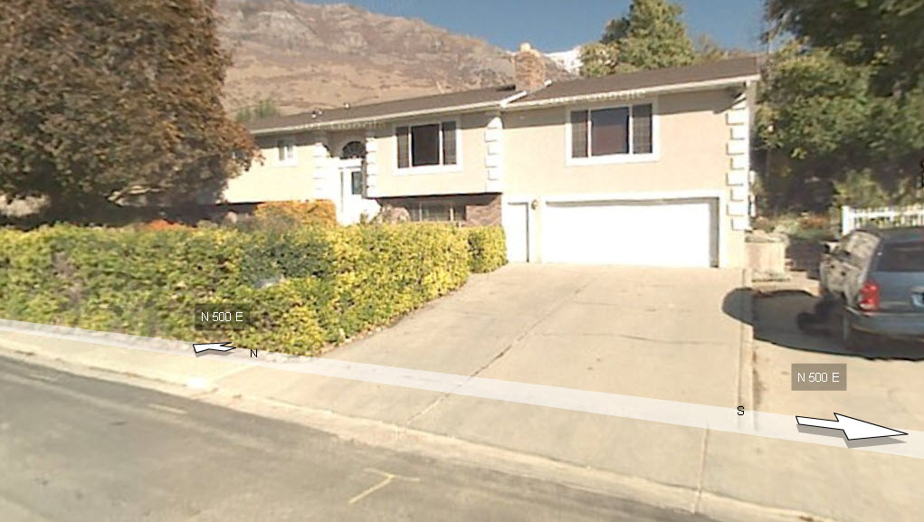
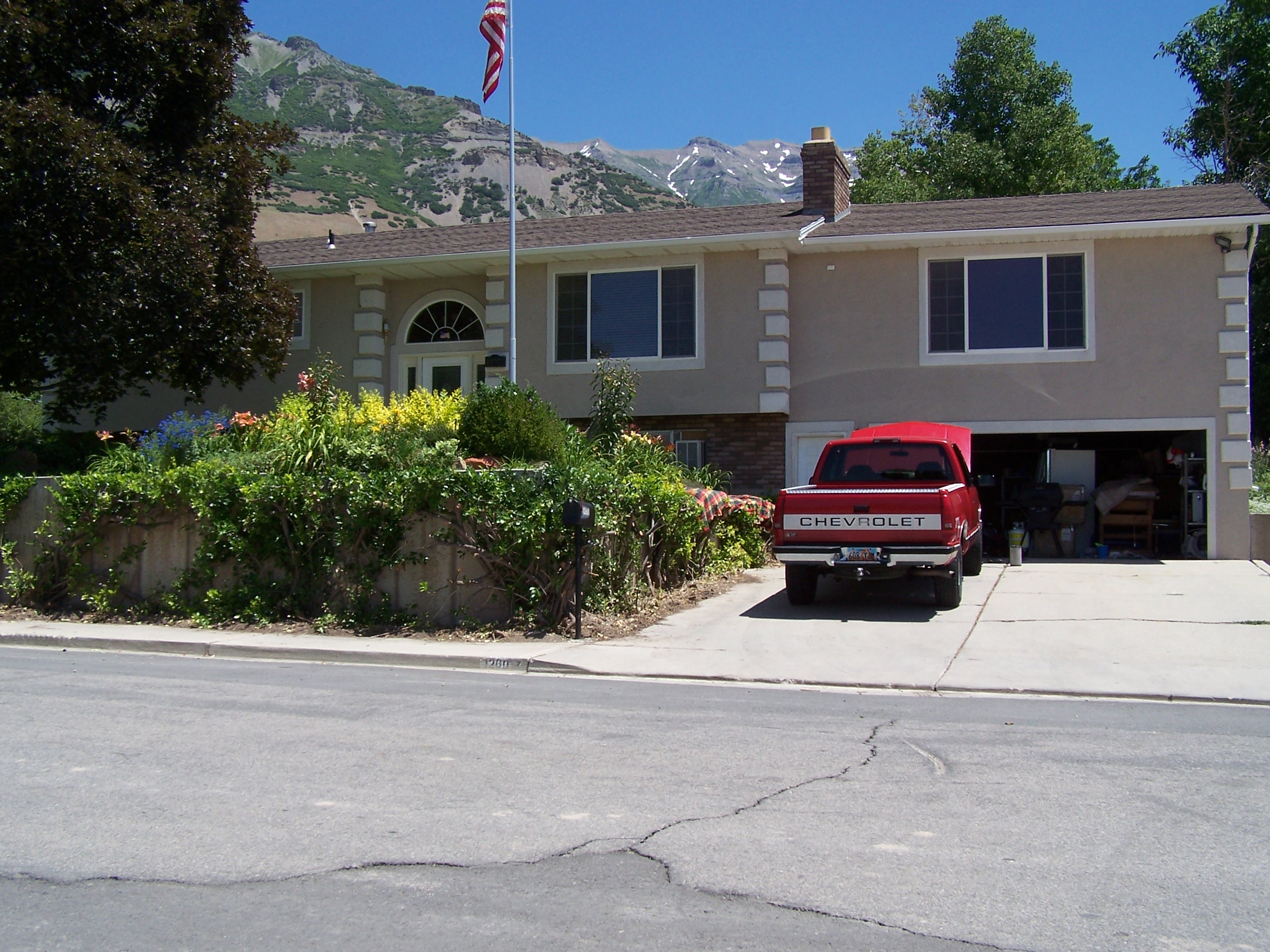
| Property Address: 1260 N 500 EAST - PLEASANT GROVE |
|
| Mailing Address: 1260 N 500 E PLEASANT GROVE, UT 84062-1820 |
|
| Acreage: 0.379 |
|
| Last Document:
53926-2007
|
|
| Subdivision Map Filing |
|
| Legal Description:
PART LOT 5, PLAT A, SUMNER ACRES SUB DESCRIBED AS FOLLOWS; COM N 50.79 FT & E 1237.62 FT FR NW COR. SEC. 21, T5S, R2E, SLB&M.; S 89 DEG 15' 0" E 142.48 FT ACTUAL COURSE = S89-15-04E 142.48; S 0 DEG 11' 59" W 116.02 FT ACTUAL COURSE = S00-12-00W 116.02; N 89 DEG 15' 0" W 129.69 FT ACTUAL COURSE = N89-15-04W 129.7; N 89 DEG 9' 56" W 12.78 FT; N 0 DEG 12' 0" E 116 FT ACTUAL COURSE = N00-12-01E 116 TO BEG TO BEG. AREA 0.379 AC. |
|
- Owner Names
- Value History
- Tax History
- Location
- Photos
- Documents
- Aerial Image
| |
----- Real Estate Values ----- |
---Improvements--- |
---Greenbelt--- |
Total |
| Year |
Com |
Res |
Agr |
Tot |
Com |
Res |
Agr |
Tot |
Land |
Homesite |
Tot |
Market Value |
| 2010 |
$0 |
$65,798 |
$0 |
$65,798 |
$0 |
$202,875 |
$0 |
$202,875 |
$0 |
$0 |
$0 |
$268,673 |
| 2009 |
$0 |
$166,300 |
$0 |
$166,300 |
$0 |
$116,100 |
$0 |
$116,100 |
$0 |
$0 |
$0 |
$282,400 |
| 2008 |
$0 |
$186,800 |
$0 |
$186,800 |
$0 |
$164,500 |
$0 |
$164,500 |
$0 |
$0 |
$0 |
$351,300 |
| Year |
General Taxes |
Adjustments |
Net Taxes |
Fees |
Payments |
Tax Balance* |
Balance Due |
Tax District |
| 2010 |
$1,780.04 |
$0.00 |
$1,780.04 |
$0.00 |
|
$0.00
|
$0.00 |
070 - PLEASANT GROVE CITY |
| 2009 |
$1,725.76 |
$0.00 |
$1,725.76 |
$0.00 |
|
$0.00
|
$0.00 |
070 - PLEASANT GROVE CITY |
| 2008 |
$1,985.48 |
$0.00 |
$1,985.48 |
$0.00 |
|
$0.00
|
$0.00 |
070 - PLEASANT GROVE CITY |
|
*The visual representation is a sum of taxes for the year(s) selected and is for reference only and no liability is assumed for any inaccuracies, incorrect data or variations.
|
|
* Note: Original tax amount (Does not include applicable interest and/or fees).
| Entry # |
Date |
Recorded |
Type |
Party1 (Grantor) |
Party2 (Grantee) |
| 91118-2010 |
10/22/2010 |
10/22/2010 |
QCD |
WALLACE, M DALE & CAROL B |
WALLACE, M DALE & CAROL B |
| 72967-2008 |
06/16/2008 |
06/24/2008 |
REC |
CITICORP TRUST BANK TEE |
WALLACE, M DALE & CAROL B |
| 72966-2008 |
06/16/2008 |
06/24/2008 |
SUB TEE |
CITIMORTGAGE INC |
CITICORP TRUST BANK SUCTEE |
| 169625-2007 |
11/30/2007 |
12/06/2007 |
MOD AGR |
WALLACE, M DALE & CAROL B |
CITI MORTGAGE INC |
| 77283-2007 |
05/17/2007 |
05/24/2007 |
QCD |
DALACO LLC |
ATWOOD, MARK KENNETH & NAN T |
| 77282-2007 |
04/23/2007 |
05/24/2007 |
QCD |
SUMNER, J FRANKLIN & JOYCE M TEE (ET AL) |
ATWOOD, MARK KENNETH & NAN T |
| 53926-2007 |
04/11/2007 |
04/13/2007 |
WD |
WALLACE, M DALE & CAROL B |
ANDERSON, KENNY J |
Main Menu Comments or Concerns on Value/Appraisal - Assessor's Office
Documents/Owner/Parcel information - Recorder's Office
Address Change for Tax Notice
This page was created on 2/8/2025 1:15:38 AM |