Property Information
| Serial Number: 55:328:0028 |
Serial Life: 2015... |
|
|
Total Photos: 2
|
| |
|
|
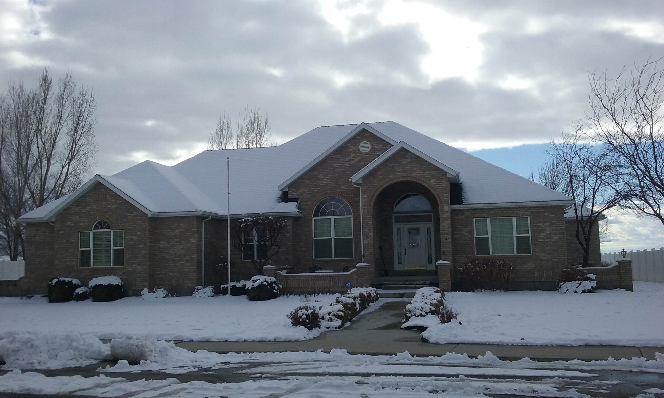
| Property Address: 982 SCENIC DR - SPANISH FORK |
|
| Mailing Address: 982 SCENIC DR SPANISH FORK, UT 84660-2903 |
|
| Acreage: 0.705096 |
|
| Last Document:
29322-2014
|
|
| Subdivision Map Filing |
|
| Legal Description:
PART LOT 19, PLAT C, WOLF HOLLOW RIDGE SUB DESCRIBED AS FOLLOWS; COM S 839.82 FT & W 843.86 FT FR E 1/4 COR. SEC. 30, T8S, R3E, SLB&M.; N 58 DEG 53' 58" W 7 FT; ALONG A CURVE TO R (CHORD BEARS: N 53 DEG 42' 3" W 101.43 FT, RADIUS = 560 FT); N 48 DEG 30' 17" W 18.84 FT; S 41 DEG 29' 43" W 7.07 FT; S 35 DEG 59' 21" W 126.99 FT; S 37 DEG 37' 47" E 110.25 FT; S 78 DEG 47' 33" E .4 FT; S 87 DEG 8' 58" E 40.34 FT; N 31 DEG 6' 2" E 141.66 FT TO BEG. AREA 0.455 AC. ALSO COM S 969.34 FT & W 1095.92 FT FR E 1/4 COR. SEC. 30, T8S, R3E, SLB&M.; N 35 DEG 59' 21" E 120.65 FT; S 37 DEG 37' 47" E 110.25 FT; N 78 DEG 47' 33" W 35.69 FT; N 83 DEG 47' 22" W 10.95 FT; N 83 DEG 19' 25" W 47.7 FT; S 61 DEG 55' 31" W 50.93 FT TO BEG. AREA 0.112 AC. ALSO COM S 1037.96 FT & W 963.39 FT FR E 1/4 COR. SEC. 30, T8S, R3E, SLB&M.; N 77 DEG 10' 15" W 18.24 FT; N 38 DEG 8' 2" W 112 FT; S 83 DEG 47' 22" E 57.95 FT; S 78 DEG 47' 52" E 36.09 FT; S 87 DEG 8' 58" E 40.34 FT; S 31 DEG 5' 47" W 89.75 FT TO BEG. AREA 0.139 AC. TOTAL AREA .705 AC. |
|
- Owner Names
- Value History
- Tax History
- Location
- Photos
- Documents
- Aerial Image
| |
----- Real Estate Values ----- |
---Improvements--- |
---Greenbelt--- |
Total |
| Year |
Com |
Res |
Agr |
Tot |
Com |
Res |
Agr |
Tot |
Land |
Homesite |
Tot |
Market Value |
| 2024 |
$0 |
$232,200 |
$0 |
$232,200 |
$0 |
$548,700 |
$0 |
$548,700 |
$0 |
$0 |
$0 |
$780,900 |
| 2023 |
$0 |
$232,100 |
$0 |
$232,100 |
$0 |
$537,300 |
$0 |
$537,300 |
$0 |
$0 |
$0 |
$769,400 |
| 2022 |
$0 |
$247,500 |
$0 |
$247,500 |
$0 |
$501,200 |
$0 |
$501,200 |
$0 |
$0 |
$0 |
$748,700 |
| 2021 |
$0 |
$145,600 |
$0 |
$145,600 |
$0 |
$436,200 |
$0 |
$436,200 |
$0 |
$0 |
$0 |
$581,800 |
| 2020 |
$0 |
$132,400 |
$0 |
$132,400 |
$0 |
$393,000 |
$0 |
$393,000 |
$0 |
$0 |
$0 |
$525,400 |
| 2019 |
$0 |
$125,000 |
$0 |
$125,000 |
$0 |
$392,100 |
$0 |
$392,100 |
$0 |
$0 |
$0 |
$517,100 |
| 2018 |
$0 |
$115,800 |
$0 |
$115,800 |
$0 |
$368,000 |
$0 |
$368,000 |
$0 |
$0 |
$0 |
$483,800 |
| 2017 |
$0 |
$97,200 |
$0 |
$97,200 |
$0 |
$368,000 |
$0 |
$368,000 |
$0 |
$0 |
$0 |
$465,200 |
| 2016 |
$0 |
$90,700 |
$0 |
$90,700 |
$0 |
$320,000 |
$0 |
$320,000 |
$0 |
$0 |
$0 |
$410,700 |
| 2015 |
$0 |
$90,700 |
$0 |
$90,700 |
$0 |
$278,300 |
$0 |
$278,300 |
$0 |
$0 |
$0 |
$369,000 |
| Year |
General Taxes |
Adjustments |
Net Taxes |
Fees |
Payments |
Tax Balance* |
Balance Due |
Tax District |
| 2025 |
$0.00 |
$0.00 |
$0.00 |
$0.00 |
|
$0.00
|
$0.00 |
150 - SPANISH FORK CITY |
| 2024 |
$4,166.96 |
$0.00 |
$4,166.96 |
$0.00 |
|
$0.00
|
$0.00 |
150 - SPANISH FORK CITY |
| 2023 |
$4,100.94 |
$0.00 |
$4,100.94 |
$0.00 |
|
$0.00
|
$0.00 |
150 - SPANISH FORK CITY |
| 2022 |
$4,068.85 |
$0.00 |
$4,068.85 |
$0.00 |
|
$0.00
|
$0.00 |
150 - SPANISH FORK CITY |
| 2021 |
$3,593.49 |
$0.00 |
$3,593.49 |
$0.00 |
|
$0.00
|
$0.00 |
150 - SPANISH FORK CITY |
| 2020 |
$3,337.89 |
$0.00 |
$3,337.89 |
$0.00 |
|
$0.00
|
$0.00 |
150 - SPANISH FORK CITY |
| 2019 |
$3,122.48 |
$0.00 |
$3,122.48 |
$0.00 |
|
$0.00
|
$0.00 |
150 - SPANISH FORK CITY |
| 2018 |
$3,022.25 |
$0.00 |
$3,022.25 |
$0.00 |
|
$0.00
|
$0.00 |
150 - SPANISH FORK CITY |
| 2017 |
$2,973.60 |
$0.00 |
$2,973.60 |
$0.00 |
|
$0.00
|
$0.00 |
150 - SPANISH FORK CITY |
| 2016 |
$2,660.47 |
$0.00 |
$2,660.47 |
$0.00 |
|
$0.00
|
$0.00 |
150 - SPANISH FORK CITY |
| 2015 |
$2,419.16 |
$0.00 |
$2,419.16 |
$0.00 |
|
$0.00
|
$0.00 |
150 - SPANISH FORK CITY |
|
*The visual representation is a sum of taxes for the year(s) selected and is for reference only and no liability is assumed for any inaccuracies, incorrect data or variations.
|
|
* Note: Original tax amount (Does not include applicable interest and/or fees).
| Entry # |
Date |
Recorded |
Type |
Party1 (Grantor) |
Party2 (Grantee) |
| 3187-2015 |
12/04/2014 |
01/14/2015 |
QCD |
UNITED STATES OF AMERICA |
SOUTH UTAH VALLEY ELECTRIC SERVICE DISTRICT |
| 34906-2014 |
05/23/2014 |
05/23/2014 |
R FARM |
UTAH COUNTY TREASURER |
WARNER, EARL H & FERN H (ET AL) |
| 29322-2014 |
04/30/2014 |
05/01/2014 |
WD |
LEWIS, JANET L TEE (ET AL) |
LEWIS, JANET L TEE |
Main Menu Comments or Concerns on Value/Appraisal - Assessor's Office
Documents/Owner/Parcel information - Recorder's Office
Address Change for Tax Notice
This page was created on 3/9/2025 12:47:01 PM |

