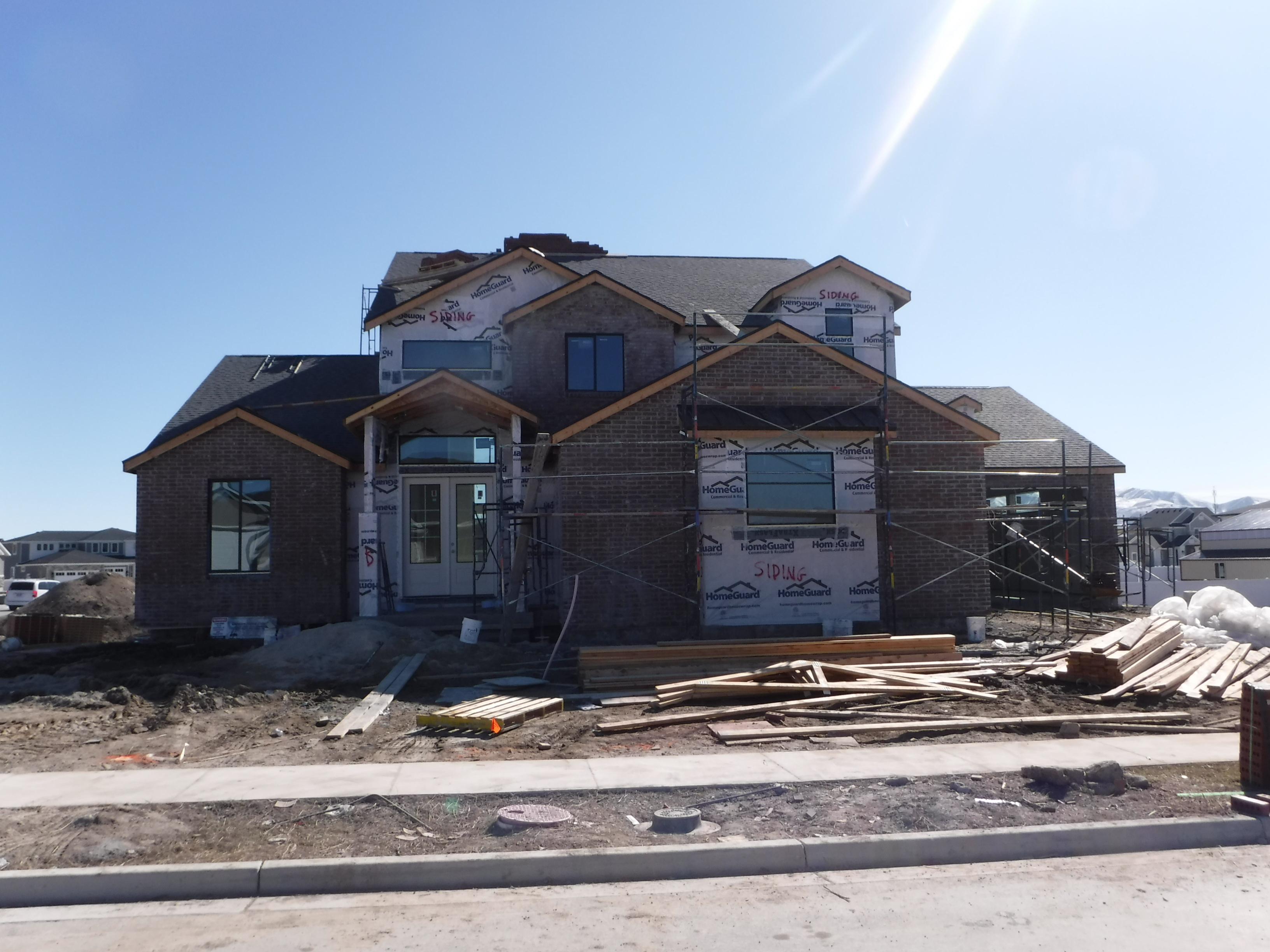
Property Information
| Serial Number: 55:841:0098 |
Serial Life: 2018... |
|
|

Total Photos: 2
|
| |
|
|
| Property Address: 581 N 2530 WEST - LEHI
more see "Addrs" tab below..
|
|
| Mailing Address: 2042 N CHURCH HILL DR SARATOGA SPRINGS, UT 84045 |
|
| Acreage: 0.525047 |
|
| Last Document:
44545-2019
|
|
| Subdivision Map Filing |
|
| Legal Description:
LOT 98, PLAT D, WILLOW PARK RIVER SUB AREA 0.525 AC. |
|
- Owner Names
- Value History
- Tax History
- Location
- Photos
- Documents
- Aerial Image
- Addrs
| |
----- Real Estate Values ----- |
---Improvements--- |
---Greenbelt--- |
Total |
| Year |
Com |
Res |
Agr |
Tot |
Com |
Res |
Agr |
Tot |
Land |
Homesite |
Tot |
Market Value |
| 2024 |
$0 |
$341,500 |
$0 |
$341,500 |
$0 |
$801,400 |
$0 |
$801,400 |
$0 |
$0 |
$0 |
$1,142,900 |
| 2023 |
$0 |
$331,600 |
$0 |
$331,600 |
$0 |
$770,800 |
$0 |
$770,800 |
$0 |
$0 |
$0 |
$1,102,400 |
| 2022 |
$0 |
$338,400 |
$0 |
$338,400 |
$0 |
$659,800 |
$0 |
$659,800 |
$0 |
$0 |
$0 |
$998,200 |
| 2021 |
$0 |
$211,500 |
$0 |
$211,500 |
$0 |
$582,200 |
$0 |
$582,200 |
$0 |
$0 |
$0 |
$793,700 |
| 2020 |
$0 |
$195,800 |
$0 |
$195,800 |
$0 |
$0 |
$0 |
$0 |
$0 |
$0 |
$0 |
$195,800 |
| 2019 |
$0 |
$195,800 |
$0 |
$195,800 |
$0 |
$0 |
$0 |
$0 |
$0 |
$0 |
$0 |
$195,800 |
| 2018 |
$0 |
$191,500 |
$0 |
$191,500 |
$0 |
$0 |
$0 |
$0 |
$0 |
$0 |
$0 |
$191,500 |
| Year |
General Taxes |
Adjustments |
Net Taxes |
Fees |
Payments |
Tax Balance* |
Balance Due |
Tax District |
| 2025 |
$0.00 |
$0.00 |
$0.00 |
$0.00 |
|
$0.00
|
$0.00 |
010 - LEHI CITY |
| 2024 |
$5,371.34 |
$0.00 |
$5,371.34 |
$0.00 |
|
$0.00
|
$0.00 |
010 - LEHI CITY |
| 2023 |
$4,771.74 |
$0.00 |
$4,771.74 |
$0.00 |
|
$0.00
|
$0.00 |
010 - LEHI CITY |
| 2022 |
$4,456.86 |
$0.00 |
$4,456.86 |
$0.00 |
|
$0.00
|
$0.00 |
010 - LEHI CITY |
| 2021 |
$4,261.89 |
$0.00 |
$4,261.89 |
$0.00 |
|
$0.00
|
$0.00 |
010 - LEHI CITY |
| 2020 |
$1,933.92 |
$0.00 |
$1,933.92 |
$0.00 |
|
$0.00
|
$0.00 |
010 - LEHI CITY |
| 2019 |
$1,860.30 |
$0.00 |
$1,860.30 |
$0.00 |
|
$0.00
|
$0.00 |
010 - LEHI CITY |
| 2018 |
$1,924.58 |
$0.00 |
$1,924.58 |
$0.00 |
|
$0.00
|
$0.00 |
010 - LEHI CITY |
|
*The visual representation is a sum of taxes for the year(s) selected and is for reference only and no liability is assumed for any inaccuracies, incorrect data or variations.
|
|
* Note: Original tax amount (Does not include applicable interest and/or fees).
| Entry # |
Date |
Recorded |
Type |
Party1 (Grantor) |
Party2 (Grantee) |
| 93428-2021 |
05/13/2021 |
05/18/2021 |
D TR |
JOHNSON, CHAD R |
ZIONS BANCORPORATION DBA (ET AL) |
| 6602-2021 |
01/09/2021 |
01/13/2021 |
MOD AGR |
JOHNSON, CHAD R |
ZIONS BANCORPORATION DBA (ET AL) |
| 119488-2019 |
11/08/2019 |
11/14/2019 |
REC |
ATLAS TITLE TEE |
JOHNSON, CHAD |
| 119487-2019 |
10/30/2019 |
11/14/2019 |
SUB TEE |
BECK, MARILYN |
ATLAS TITLE SUBTEE |
| 111331-2019 |
10/28/2019 |
10/28/2019 |
D TR |
JOHNSON, CHAD R |
ZIONS BANCORPORATION DBA (ET AL) |
| 111330-2019 |
10/28/2019 |
10/28/2019 |
WD |
JOHNSON, CHAD |
JOHNSON, CHAD R |
| 46481-2019 |
05/21/2019 |
05/24/2019 |
TR D |
JOHNSON, CHAD |
BECK, MARILYN |
| 44545-2019 |
05/20/2019 |
05/20/2019 |
WD |
LLOYD, BRANDON |
JOHNSON, CHAD |
| 78885-2018 |
08/20/2018 |
08/20/2018 |
D TR |
LLOYD, BRANDON |
HELP EVERY LIVING PERSON AND HELP OTHER PEOPLE EVERYWHERE |
| 17006-2018 |
02/20/2018 |
02/21/2018 |
TR D |
LLOYD, BRANDON |
LARSEN, STEPHEN A & SCOTT |
| 17005-2018 |
02/20/2018 |
02/21/2018 |
WD |
WILLOW PARK RIVER DEVELOPMENT INC |
LLOYD, BRANDON |
| 103346-2017 |
10/18/2017 |
10/18/2017 |
REC |
SELECT TITLE INSURANCE AGENCY INC TEE |
WILLOW PARK RIVER DEVELOPMENT INC |
| 103345-2017 |
10/18/2017 |
10/18/2017 |
RSUBTEE |
CENTRAL BANK (ET AL) |
WILLOW PARK RIVER DEVELOPMENT INC |
| 99052-2017 |
09/07/2017 |
10/06/2017 |
REC |
CENTRAL BANK TEE |
WILLOW PARK RIVER DEVELOPMENT INC |
| 56744-2017 |
07/12/2016 |
06/13/2017 |
S PLAT |
WILLOW PARK RIVER DEVELOPMENT INC |
WILLOW PARK RIVER PLAT D |
2559 W 610 NORTH - LEHI
581 N 2530 WEST - LEHI
Main Menu Comments or Concerns on Value/Appraisal - Assessor's Office
Documents/Owner/Parcel information - Recorder's Office
Address Change for Tax Notice
This page was created on 12/19/2024 8:04:14 AM |