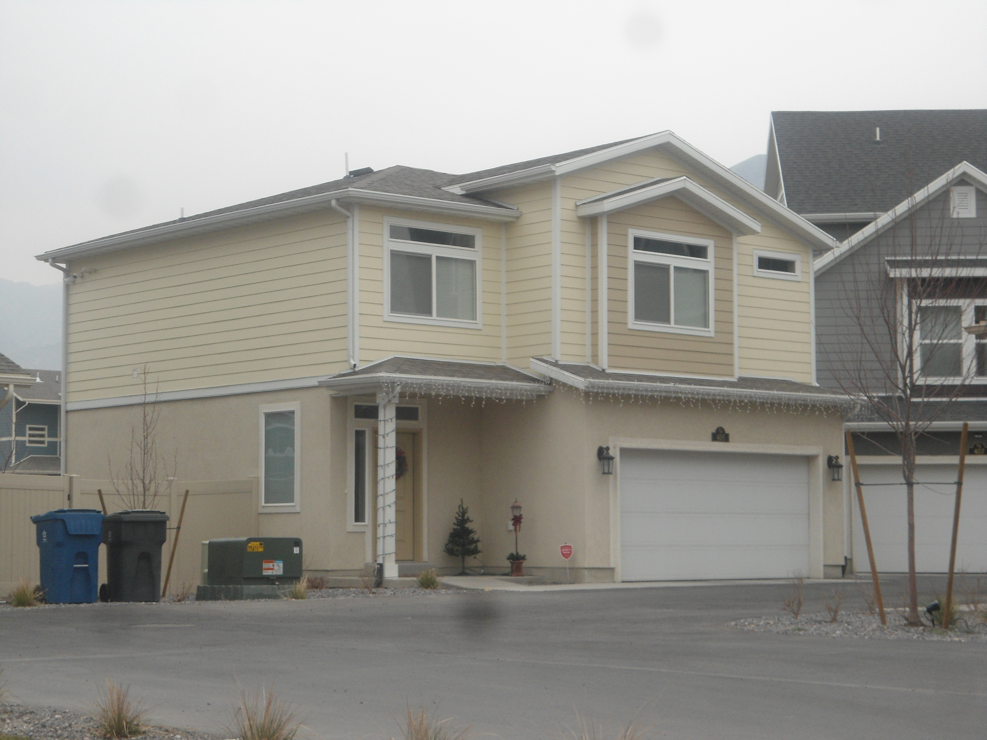
Property Information
| Serial Number: 66:531:0041 |
Serial Life: 2017... |
|
|

Total Photos: 2
|
| |
|
|
| Property Address: 405 S 740 EAST - AMERICAN FORK |
|
| Mailing Address: 2501 E PRAIRIE VIEW DR EAGLE MOUNTAIN, UT 84005 |
|
| Acreage: 0.061553 |
|
| Last Document:
34500-2017
|
|
| Subdivision Map Filing |
|
| Legal Description:
LOT 41, SOUTH POINT, PHASE 3 SUB AREA 0.062 AC. |
|
- Owner Names
- Value History
- Tax History
- Location
- Photos
- Documents
- Aerial Image
| |
----- Real Estate Values ----- |
---Improvements--- |
---Greenbelt--- |
Total |
| Year |
Com |
Res |
Agr |
Tot |
Com |
Res |
Agr |
Tot |
Land |
Homesite |
Tot |
Market Value |
| 2024 |
$0 |
$172,500 |
$0 |
$172,500 |
$0 |
$231,200 |
$0 |
$231,200 |
$0 |
$0 |
$0 |
$403,700 |
| 2023 |
$0 |
$172,500 |
$0 |
$172,500 |
$0 |
$235,900 |
$0 |
$235,900 |
$0 |
$0 |
$0 |
$408,400 |
| 2022 |
$0 |
$182,000 |
$0 |
$182,000 |
$0 |
$243,700 |
$0 |
$243,700 |
$0 |
$0 |
$0 |
$425,700 |
| 2021 |
$0 |
$121,300 |
$0 |
$121,300 |
$0 |
$191,900 |
$0 |
$191,900 |
$0 |
$0 |
$0 |
$313,200 |
| 2020 |
$0 |
$108,300 |
$0 |
$108,300 |
$0 |
$181,000 |
$0 |
$181,000 |
$0 |
$0 |
$0 |
$289,300 |
| 2019 |
$0 |
$100,200 |
$0 |
$100,200 |
$0 |
$157,800 |
$0 |
$157,800 |
$0 |
$0 |
$0 |
$258,000 |
| 2018 |
$0 |
$89,400 |
$0 |
$89,400 |
$0 |
$137,200 |
$0 |
$137,200 |
$0 |
$0 |
$0 |
$226,600 |
| 2017 |
$0 |
$78,500 |
$0 |
$78,500 |
$0 |
$67,400 |
$0 |
$67,400 |
$0 |
$0 |
$0 |
$145,900 |
| Year |
General Taxes |
Adjustments |
Net Taxes |
Fees |
Payments |
Tax Balance* |
Balance Due |
Tax District |
| 2025 |
$0.00 |
$0.00 |
$0.00 |
$0.00 |
|
$0.00
|
$0.00 |
060 - AMERICAN FORK CITY |
| 2024 |
$1,998.32 |
$0.00 |
$1,998.32 |
$0.00 |
|
$0.00
|
$0.00 |
060 - AMERICAN FORK CITY |
| 2023 |
$1,906.80 |
$0.00 |
$1,906.80 |
$0.00 |
|
$0.00
|
$0.00 |
060 - AMERICAN FORK CITY |
| 2022 |
$2,014.03 |
$0.00 |
$2,014.03 |
$0.00 |
|
$0.00
|
$0.00 |
060 - AMERICAN FORK CITY |
| 2021 |
$1,724.84 |
$0.00 |
$1,724.84 |
$0.00 |
|
$0.00
|
$0.00 |
060 - AMERICAN FORK CITY |
| 2020 |
$1,642.70 |
$0.00 |
$1,642.70 |
$0.00 |
|
$0.00
|
$0.00 |
060 - AMERICAN FORK CITY |
| 2019 |
$1,416.45 |
$0.00 |
$1,416.45 |
$0.00 |
|
$0.00
|
$0.00 |
060 - AMERICAN FORK CITY |
| 2018 |
$1,301.14 |
$0.00 |
$1,301.14 |
$0.00 |
|
$0.00
|
$0.00 |
060 - AMERICAN FORK CITY |
| 2017 |
$853.73 |
$0.00 |
$853.73 |
$0.00 |
|
$0.00
|
$0.00 |
060 - AMERICAN FORK CITY |
|
*The visual representation is a sum of taxes for the year(s) selected and is for reference only and no liability is assumed for any inaccuracies, incorrect data or variations.
|
|
* Note: Original tax amount (Does not include applicable interest and/or fees).
| Entry # |
Date |
Recorded |
Type |
Party1 (Grantor) |
Party2 (Grantee) |
| 89212-2021 |
04/28/2021 |
05/12/2021 |
REC |
FIRST AMERICAN TITLE INSURANCE COMPANY TEE |
SAGASTUME, RUBELIA & JORGE |
| 89211-2021 |
04/28/2021 |
05/12/2021 |
SUB TEE |
MORTGAGE ELECTRONIC REGISTRATION SYSTEMS INC |
FIRST AMERICAN TITLE INSURANCE COMPANY SUBTEE |
| 19276-2019 |
03/07/2019 |
03/08/2019 |
ADECCOV |
SOUTH POINT OWNERS ASSOCIATION |
WHOM OF INTEREST |
| 70851-2017 |
07/25/2017 |
07/25/2017 |
REC |
COTTONWOOD TITLE INSURANCE AGENCY INC TEE |
OAKWOOD HOMES OF UTAH LLC |
| 67781-2017 |
07/03/2017 |
07/13/2017 |
ASASAGR |
OAKWOOD HOMES OF UTAH LLC |
CLAYTON PROPERTIES GROUP II INC |
| 40374-2017 |
04/13/2017 |
04/27/2017 |
REC |
CENTRAL BANK TEE |
BLACK SAND DEVELOPMENT LLC |
| 34501-2017 |
04/10/2017 |
04/11/2017 |
D TR |
SAGASTUME, RUBELIA & JORGE |
CITYWIDE HOME LOANS |
| 34500-2017 |
04/10/2017 |
04/11/2017 |
SP WD |
OAKWOOD HOMES OF UTAH LLC |
SAGASTUME, RUBELIA & JORGE |
| 97353-2016 |
09/29/2016 |
10/03/2016 |
ADECCOV |
OAKWOOD HOMES OF UTAH LLC |
WHOM OF INTEREST |
| 68509-2016 |
07/25/2016 |
07/26/2016 |
GEO HAZ |
LENT, GLEN K |
WHOM OF INTEREST |
| 61699-2016 |
07/05/2016 |
07/06/2016 |
EAS |
OAKWOOD HOMES OF UTAH LLC |
COMCAST OF CALIFORNIA/MASSACHUSETTS/MICHIGAN/UTAH LLC |
| 60433-2016 |
06/21/2016 |
07/01/2016 |
DECL |
OAKWOOD HOMES OF UTAH LLC |
WHOM OF INTEREST |
| 60432-2016 |
01/12/2016 |
07/01/2016 |
S PLAT |
OAKWOOD HOMES OF UTAH LLC (ET AL) |
SOUTH POINT PHASE 3 |
Main Menu Comments or Concerns on Value/Appraisal - Assessor's Office
Documents/Owner/Parcel information - Recorder's Office
Address Change for Tax Notice
This page was created on 12/19/2024 5:22:39 PM |