Property Information
| Serial Number: 09:051:0010 |
Serial Life: 2021... |
|
|
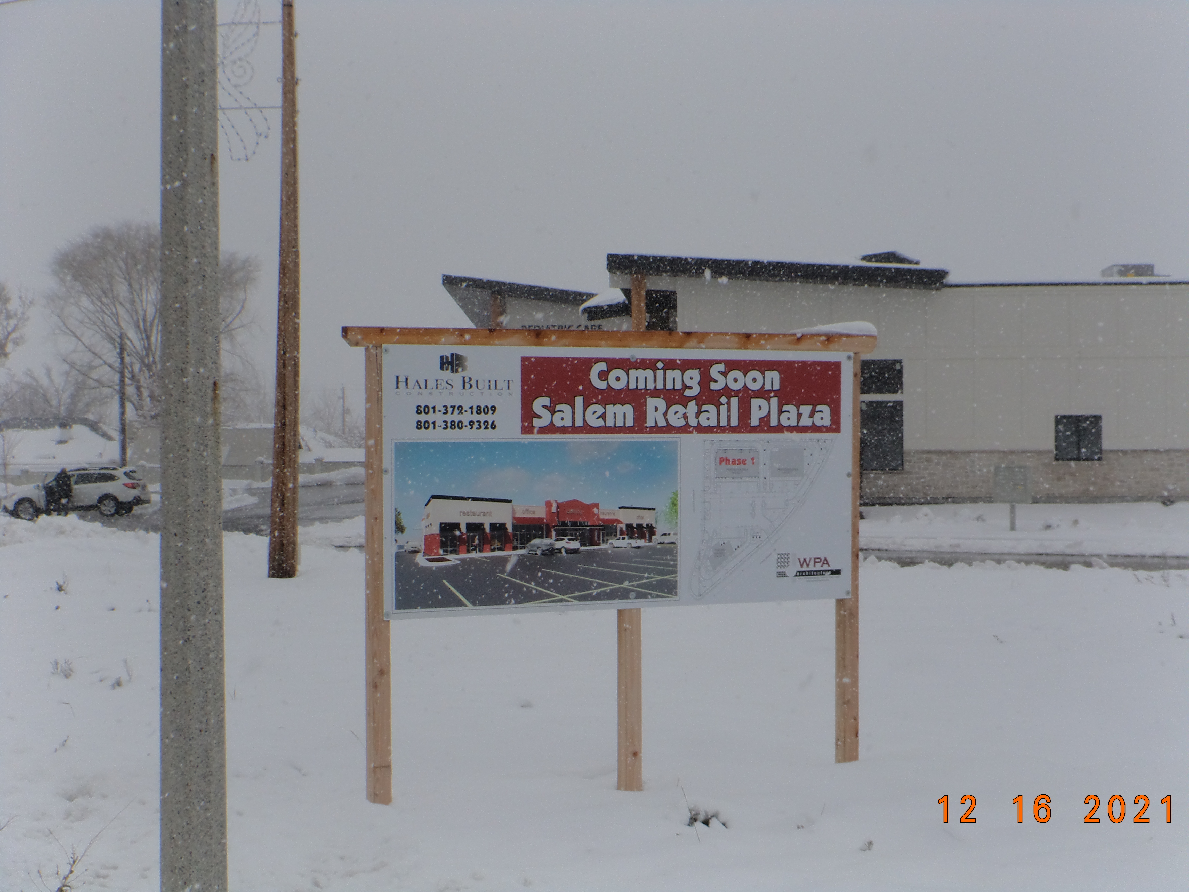
Total Photos: 1
|
| |
|
|
| Property Address: |
|
| Mailing Address: %LEE, ADAM POP BOX 713 SALEM, UT 84653 |
|
| Acreage: 1.752398 |
|
| Last Document:
167653-2020
|
|
| Subdivision Map Filing |
|
| Legal Description:
COM N 0 DEG 32' 47" W 940.92 FT & E 602.04 FT FR SW COR. SEC. 1, T9S, R2E, SLB&M.; S 89 DEG 16' 16" E 392.98 FT; ALONG A CURVE TO R (CHORD BEARS: S 36 DEG 25' 35" W 113.83 FT, RADIUS = 708.03 FT); ALONG A CURVE TO R (CHORD BEARS: S 51 DEG 59' 23" W 215.74 FT, RADIUS = 721.67 FT); S 60 DEG 35' 10" W 193.75 FT; ALONG A CURVE TO R (CHORD BEARS: S 69 DEG 34' 16" W 6.25 FT, RADIUS = 20 FT); N 90.81 FT; ALONG A CURVE TO L (CHORD BEARS: N 13 DEG 3' 0" E 75.81 FT, RADIUS = 178 FT); N 0 DEG 45' 17" E 162.13 FT TO BEG. AREA 1.752 AC. |
|
- Owner Names
- Value History
- Tax History
- Location
- Photos
- Documents
- Aerial Image
| |
----- Real Estate Values ----- |
---Improvements--- |
---Greenbelt--- |
Total |
| Year |
Com |
Res |
Agr |
Tot |
Com |
Res |
Agr |
Tot |
Land |
Homesite |
Tot |
Market Value |
| 2025 |
$800,700 |
$0 |
$0 |
$800,700 |
$0 |
$0 |
$0 |
$0 |
$0 |
$0 |
$0 |
$800,700 |
| 2024 |
$674,400 |
$0 |
$0 |
$674,400 |
$0 |
$0 |
$0 |
$0 |
$0 |
$0 |
$0 |
$674,400 |
| 2023 |
$496,600 |
$0 |
$0 |
$496,600 |
$0 |
$0 |
$0 |
$0 |
$0 |
$0 |
$0 |
$496,600 |
| 2022 |
$496,600 |
$0 |
$0 |
$496,600 |
$0 |
$0 |
$0 |
$0 |
$0 |
$0 |
$0 |
$496,600 |
| 2021 |
$318,900 |
$0 |
$0 |
$318,900 |
$0 |
$0 |
$0 |
$0 |
$0 |
$0 |
$0 |
$318,900 |
| Year |
General Taxes |
Adjustments |
Net Taxes |
Fees |
Payments |
Tax Balance* |
Balance Due |
Tax Area |
| 2026 |
$0.00 |
$0.00 |
$0.00 |
$0.00 |
|
$0.00
|
$0.00 |
180 - SALEM CITY |
| 2025 |
$0.00 |
$0.00 |
$0.00 |
$0.00 |
|
$0.00
|
$0.00 |
180 - SALEM CITY |
| 2024 |
$6,649.58 |
$0.00 |
$6,649.58 |
$0.00 |
|
$0.00
|
$0.00 |
180 - SALEM CITY |
| 2023 |
$4,888.03 |
$0.00 |
$4,888.03 |
$0.00 |
|
$0.00
|
$0.00 |
180 - SALEM CITY |
| 2022 |
$4,964.51 |
$0.00 |
$4,964.51 |
$0.00 |
|
$0.00
|
$0.00 |
180 - SALEM CITY |
| 2021 |
$3,612.50 |
$0.00 |
$3,612.50 |
$0.00 |
|
$0.00
|
$0.00 |
180 - SALEM CITY |
|
*The visual representation is a sum of taxes for the year(s) selected and is for reference only and no liability is assumed for any inaccuracies, incorrect data or variations.
|
|
* Note: Original tax amount (Does not include applicable interest and/or fees).
| Entry # |
Date |
Recorded |
Type |
Party1 (Grantor) |
Party2 (Grantee) |
| 188255-2021 |
11/05/2021 |
11/05/2021 |
WD |
HALES LAND LLC |
CITREA CAPITAL LLC |
| 167653-2020 |
10/23/2020 |
10/26/2020 |
WD |
MAINGOT, RICHARD & DENISE |
HALES LAND LLC |
Main Menu Comments or Concerns on Value/Appraisal - Assessor's Office
Documents/Owner/Parcel information - Recorder's Office
Address Change for Tax Notice
This page was created on 7/23/2025 10:16:13 PM |
