Property Valuation Information

  • Serial Number : 529510035
  • Tax Year : 2024
  • Owner Names : CARR, WM CHARLES & CAROLE A
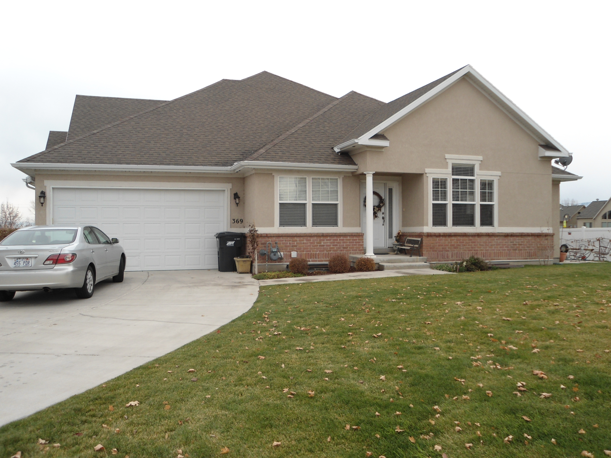
  • Property Address : 369 N 1060 EAST CIR - AMERICAN FORK
  • Tax District : 060 - AMERICAN FORK CITY
  • Acreage : 0.046
  • Property Classification :  RP - RES PRIMARY

  • Legal Description : LOT 35, PLAT A, STONE HOLLOW PUD 2ND AMENDMENT SUBDV. AREA 0.046 AC.

Property Types:
2023 Market Value
   
2024 Market Value
  Primary Residential
$447,600
   
$470,700
               
Total Property Market Value $447,600     $470,700    


Current and Proposed Taxes


Taxing Entity
 
Tax Last Year
 
Tax This Year
with No Change
 
Tax This Year based on proposed budget
STATEWIDE SCHOOL BASIC LEVY  
$346.13
 
$364.51
 
$364.51
ALPINE SCHOOL DISTRICT BOND  
$0.00
 
$318.69
 
$241.02
ALPINE SCHOOL DISTRICT LEVY  
$0.00
 
$778.47
 
$959.69
ALPINE SCHOOL DIST (OTHER)  
$996.54
 
$0.00
 
$0.00
STATE CHARTER SCHOOL-ALPINE  
$15.76
 
$17.86
 
$17.86
AMERICAN FORK CITY  
$437.71
 
$439.33
 
$439.33
ASSESSING & COLLECTING - COUNTY  
$27.08
 
$28.22
 
$28.22
ASSESSING & COLLECTING - STATE  
$3.69
 
$3.88
 
$3.88
UTAH COUNTY  
$161.49
 
$168.79
 
$168.79
CENTRAL UTAH WATER CONS DIST  
$98.47
 
$98.38
 
$103.55
NORTH UTAH COUNTY WATER DIST  
$2.95
 
$3.11
 
$3.11
Total Tax   $2,089.82   $2,221.23
  $2,329.97