UtahCounty.Gov - The Official Website of Utah County Government

Property Information

mobile view

Serial Number: 14:013:0237 Serial Life: 2024...    
Parcel Photo
Total Photos: 1
     
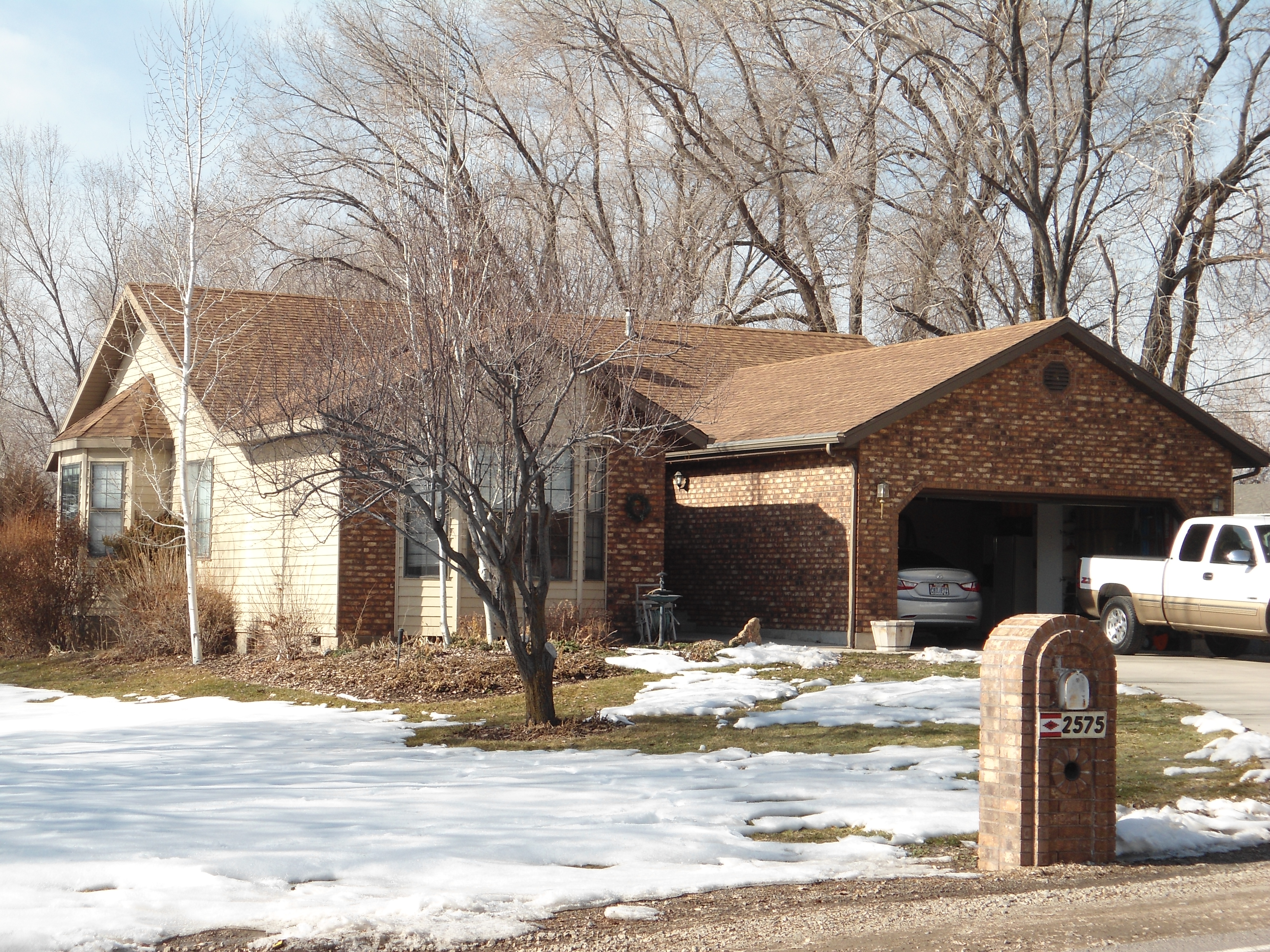
Property Address:  2575 N 600 WEST - PLEASANT GROVE  
Mailing Address: 2575 N 600 W PLEASANT GROVE, UT 84062-9215  
Acreage: 0.459088  
Last Document: 11098-2023  
Subdivision Map Filing   
Taxing Description:  COM S 0 DEG 12' 25" E 50.06 FT & N 89 DEG 47' 35" E 1256.82 FT FR NW COR. SEC. 17, T5S, R2E, SLB&M.; S 0 DEG 1' 0" W 66.03 FT; S 89 DEG 31' 0" W 226.19 FT; N 1 DEG 39' 0" E 90.85 FT; N 89 DEG 27' 0" E 188.72 FT; S 54 DEG 42' 47" E 42.72 FT TO BEG. AREA 0.459 AC.

*Taxing description NOT FOR LEGAL DOCUMENTS


  • Owner Names
  • Value History
  • Tax History
  • Location
  • Photos
  • Documents
  • Aerial Image
  
2024...   BLACKHURST, CAROLE H
2024...   BLACKHURST, MICHAEL D
 
----- Real Estate Values -----
---Improvements---
---Greenbelt---
Total
Year
Com
Res
Agr
Tot
Com
Res
Agr
Tot
Land
Homesite
Tot
    Market Value
2024
$0
$257,700
$0
$257,700
$0
$296,200
$0
$296,200
$0
$0
$0
$553,900
Year
General Taxes
Adjustments
Net Taxes
Fees
Payments
Tax Balance*
Balance Due
Tax District
2025
$0.00
$0.00
$0.00
$0.00
$0.00
$0.00     070 - PLEASANT GROVE CITY
2024
$0.00
$0.00
$0.00
$0.00
($59.25)
($59.25)     070 - PLEASANT GROVE CITY

* Note: Original tax amount (Does not include applicable interest and/or fees).
Parcel Photo
Entry # Date Recorded Type Party1 (Grantor) Party2 (Grantee)
46833-2023 07/18/2023 07/19/2023 AS EAS PLEASANT GROVE CITY ROCKY MOUNTAIN POWER DIV OF (ET AL)
11099-2023 01/26/2023 02/23/2023 EAS BLACKHURST, MICHAEL D & CAROLE H TEE (ET AL) PLEASANT GROVE CITY
11098-2023 01/26/2023 02/23/2023 WD BLACKHURST, MICHAEL D & CAROLE H TEE (ET AL) PLEASANT GROVE CITY


Main Menu

Comments or Concerns on Value/Appraisal - Assessor's Office
Documents/Owner/Parcel information - Recorder's Office
Address Change for Tax Notice

This page was created on 9/10/2024 2:10:17 AM

× Large Image