Property Information
mobile view
| Serial Number: 12:032:0143 |
Serial Life: 2024... |
|
|
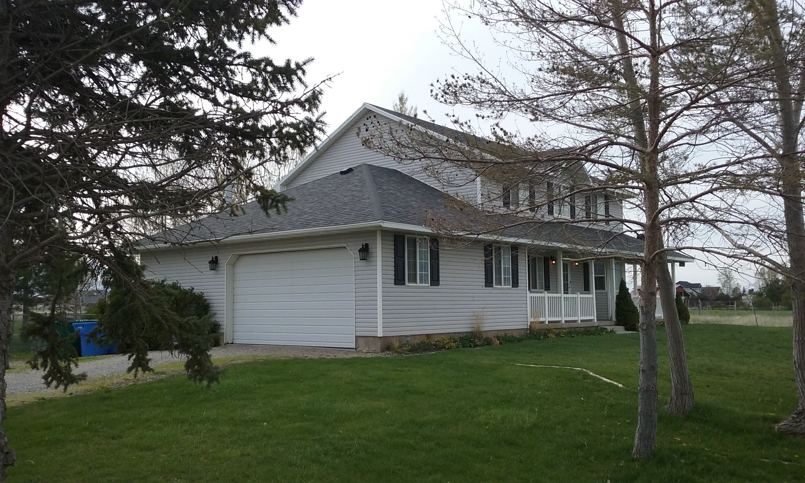 Total Photos: 1
|
| |
|
|
| Property Address: 1386 N 2300 WEST - LEHI |
|
| Mailing Address: 2002 W 1500 N LEHI, UT 84043-3295 |
|
| Acreage: 4.723615 |
|
| Last Document:
42939-2023
|
|
| Subdivision Map Filing |
|
| Taxing Description:
COM S 355.7 FT & E 365.42 FT FR NW COR. SEC. 7, T5S, R1E, SLB&M.; E 678.61 FT; S 1 DEG 15' 0" W 244.54 FT; W 668.41 FT; N 1 DEG 8' 17" W 244.53 FT TO BEG. AREA 3.778 AC. ALSO COM S 355.7 FT & E 365.42 FT FR NW COR. SEC. 7, T5S, R1E, SLB&M.; N 1 DEG 8' 16" W 60.63 FT; E 681.12 FT; S 1 DEG 15' 1" W 60.63 FT; W 678.61 FT; E 678.61 FT TO BEG. AREA 0.946 AC. TOTAL AREA 4.724 AC.
*Taxing description NOT FOR LEGAL DOCUMENTS
|
|
- Owner Names
- Value History
- Tax History
- Location
- Photos
- Documents
- Aerial Image
| |
----- Real Estate Values ----- |
---Improvements--- |
---Greenbelt--- |
Total |
| Year |
Com |
Res |
Agr |
Tot |
Com |
Res |
Agr |
Tot |
Land |
Homesite |
Tot |
Market Value |
| 2024 |
$0 |
$286,500 |
$426,200 |
$712,700 |
$0 |
$291,200 |
$0 |
$291,200 |
$0 |
$0 |
$0 |
$1,003,900 |
| Year |
General Taxes |
Adjustments |
Net Taxes |
Fees |
Payments |
Tax Balance* |
Balance Due |
Tax District |
| 2025 |
$0.00 |
$0.00 |
$0.00 |
$0.00 |
|
$0.00
|
$0.00 |
010 - LEHI CITY |
| 2024 |
$6,356.92 |
$0.00 |
$6,356.92 |
$0.00 |
|
$0.00
|
$0.00 |
010 - LEHI CITY |
* Note: Original tax amount (Does not include applicable interest and/or fees).
| Entry # |
Date |
Recorded |
Type |
Party1 (Grantor) |
Party2 (Grantee) |
| 42945-2023 |
06/28/2023 |
06/30/2023 |
EAS |
PETERSON, LORY GENE & ROBYN V |
LEHI CITY |
| 42939-2023 |
06/28/2023 |
06/30/2023 |
WD |
PETERSON, LORY GENE & ROBYN V |
LEHI CITY |
Main Menu Comments or Concerns on Value/Appraisal - Assessor's Office
Documents/Owner/Parcel information - Recorder's Office
Address Change for Tax Notice
This page was created on 2/27/2025 9:03:30 AM |