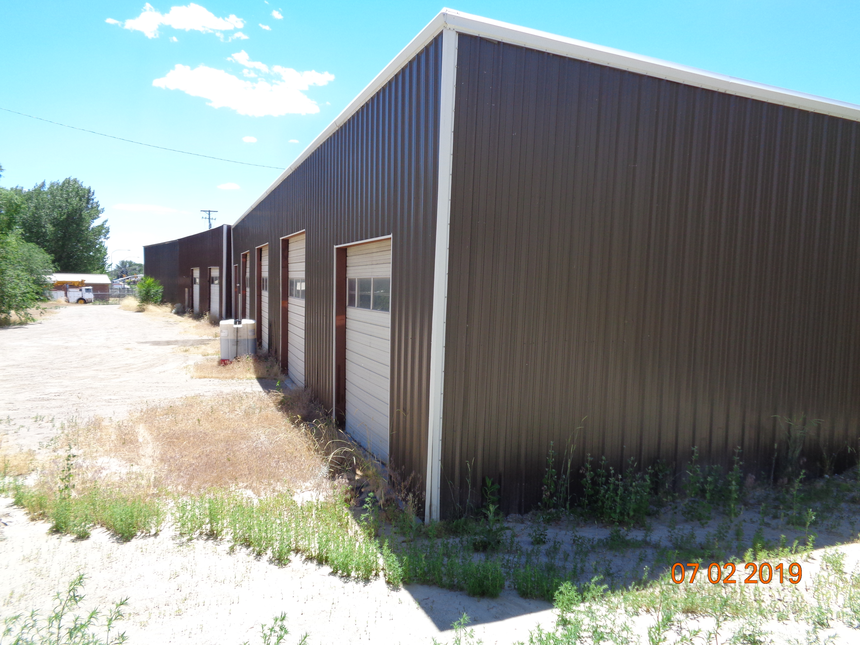
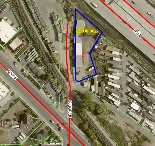
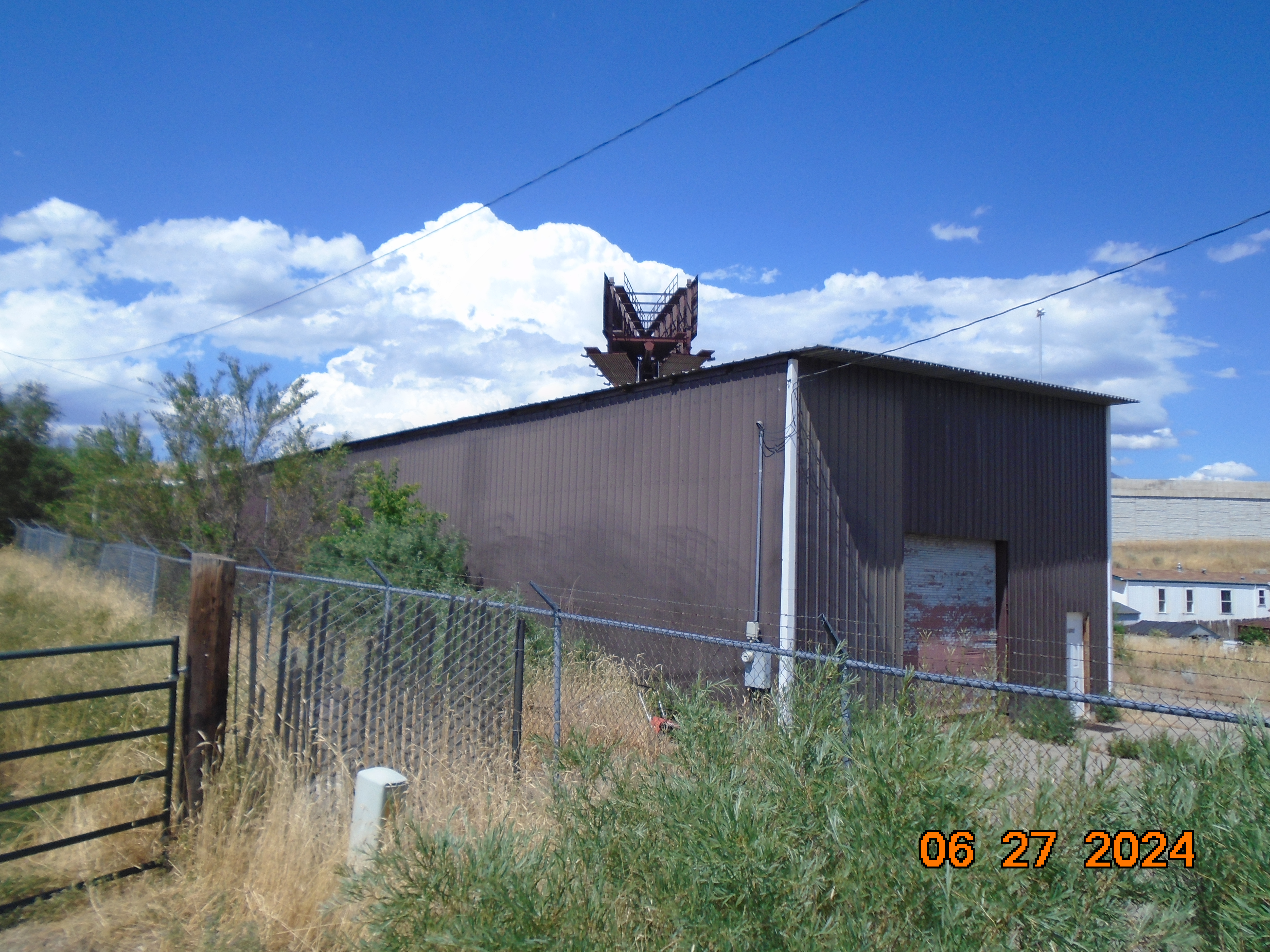
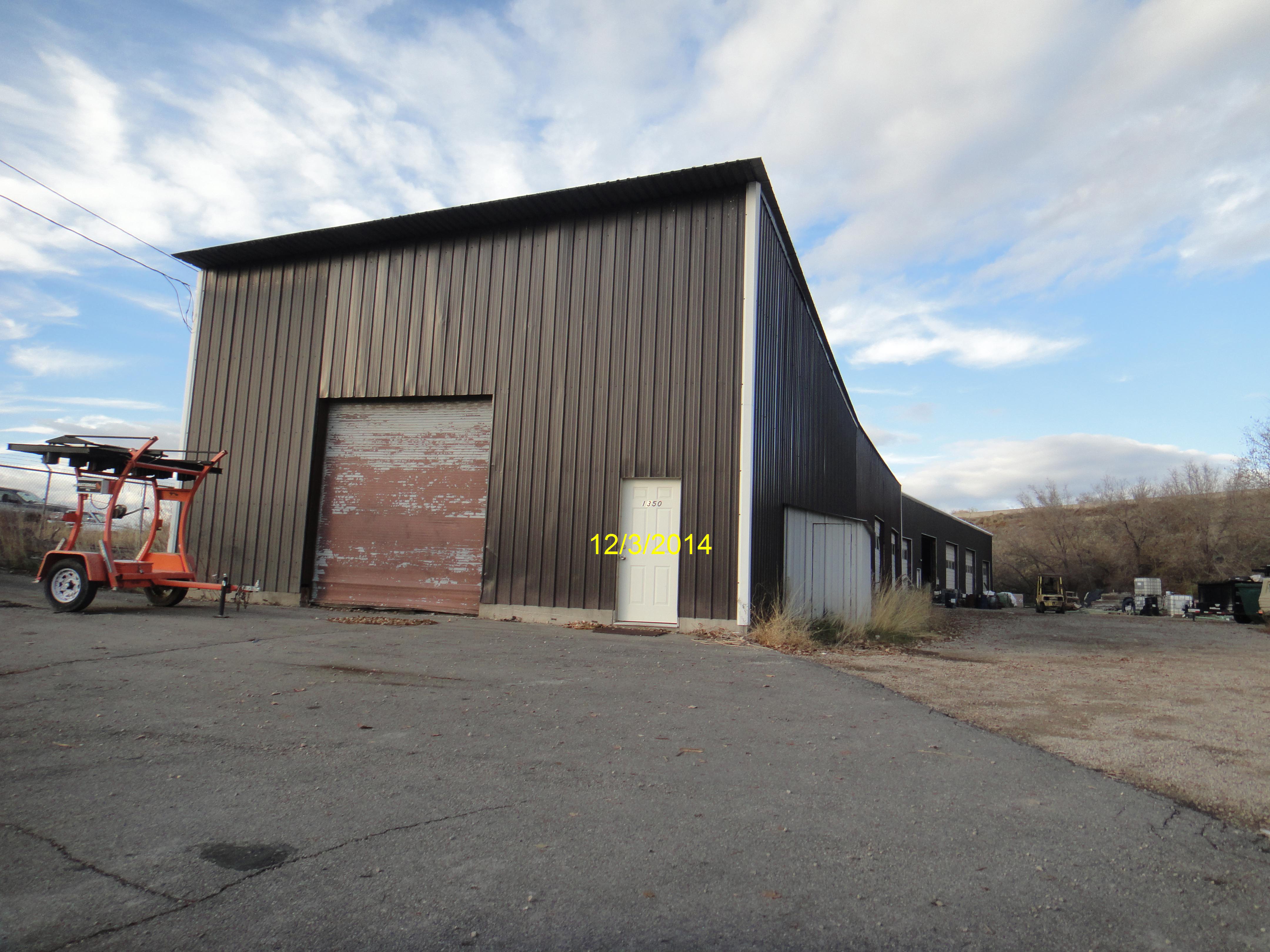
Property Information
mobile view
| Serial Number: 12:038:0022 |
Serial Life: 1980... |
|
|
 Total Photos: 12
|
| |
|
|
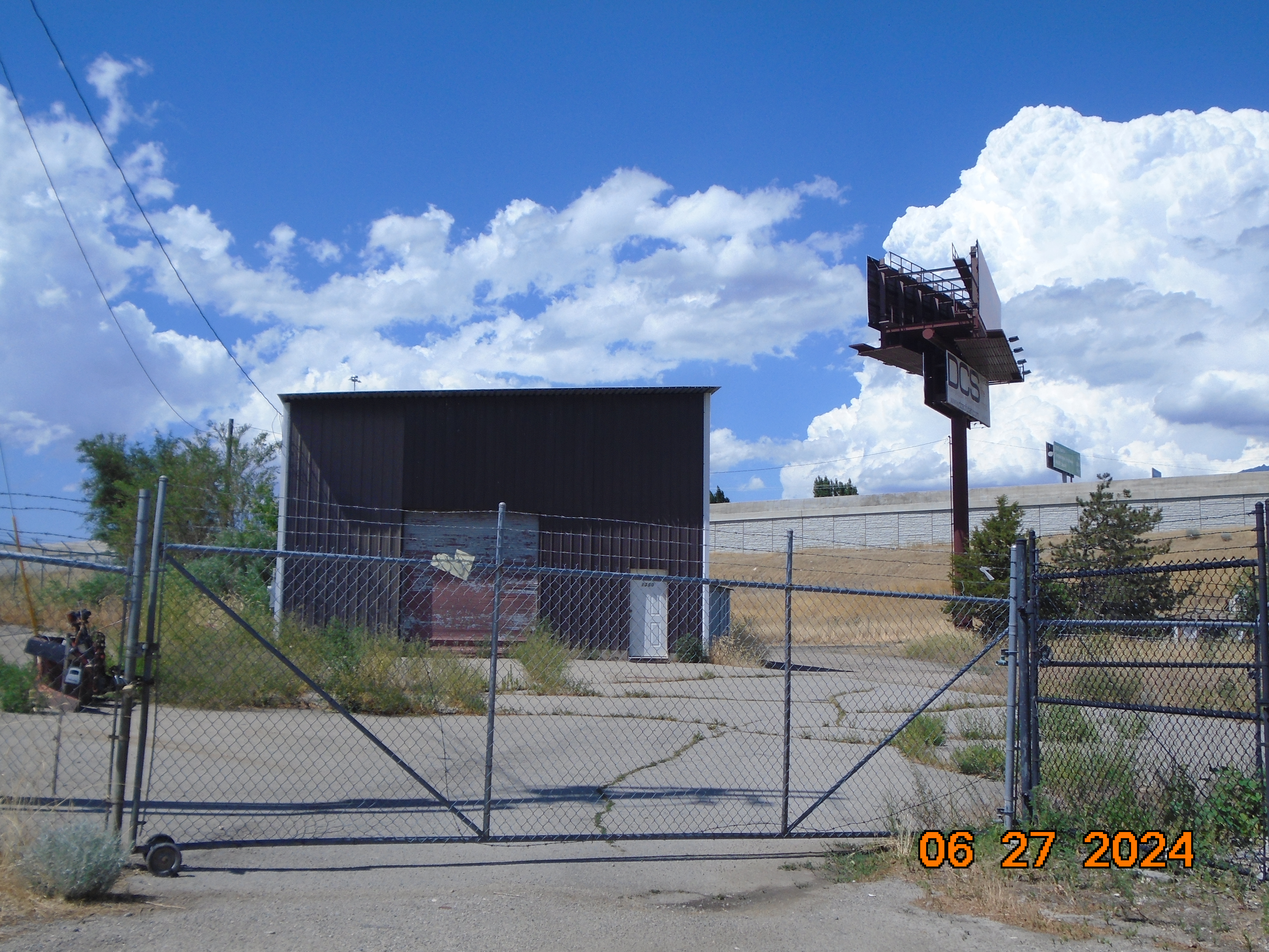
| Property Address: 1350 N 500 WEST - LEHI |
|
| Mailing Address: 1735 S SPRING CREEK RANCH RD LEHI, UT 84043 |
|
| Acreage: 0.75 |
|
| Last Document:
69-1943
|
|
| Subdivision Map Filing |
|
| Taxing Description:
COM E 656.8 FT & S 46.6 FT & S 36'W 254 FT FR N 1/4 COR SEC 8, T5S, R1E, SLM; S 48 DEG 27'50"E 180.06 FT; S 31 DEG 14'33"W 124.51 FT; S 17 DEG 46'52"E 111.69 FT; S 66 DEG 57'W 101.10 FT; N 47 DEG 07'W 20.52 FT; N 36'E 357.85 FT TO BEG. AREA .71 ACRE
*Taxing description NOT FOR LEGAL DOCUMENTS
|
|
- Owner Names
- Value History
- Tax History
- Location
- Photos
- Documents
- Aerial Image
| |
----- Real Estate Values ----- |
---Improvements--- |
---Greenbelt--- |
Total |
| Year |
Com |
Res |
Agr |
Tot |
Com |
Res |
Agr |
Tot |
Land |
Homesite |
Tot |
Market Value |
| 2024 |
$412,000 |
$0 |
$0 |
$412,000 |
$371,400 |
$0 |
$0 |
$371,400 |
$0 |
$0 |
$0 |
$783,400 |
| 2023 |
$406,300 |
$0 |
$0 |
$406,300 |
$331,100 |
$0 |
$0 |
$331,100 |
$0 |
$0 |
$0 |
$737,400 |
| 2022 |
$402,000 |
$0 |
$0 |
$402,000 |
$315,500 |
$0 |
$0 |
$315,500 |
$0 |
$0 |
$0 |
$717,500 |
| 2021 |
$356,500 |
$0 |
$0 |
$356,500 |
$253,400 |
$0 |
$0 |
$253,400 |
$0 |
$0 |
$0 |
$609,900 |
| 2020 |
$313,000 |
$0 |
$0 |
$313,000 |
$276,000 |
$0 |
$0 |
$276,000 |
$0 |
$0 |
$0 |
$589,000 |
| 2019 |
$305,500 |
$0 |
$0 |
$305,500 |
$248,700 |
$0 |
$0 |
$248,700 |
$0 |
$0 |
$0 |
$554,200 |
| 2018 |
$223,200 |
$0 |
$0 |
$223,200 |
$231,500 |
$0 |
$0 |
$231,500 |
$0 |
$0 |
$0 |
$454,700 |
| 2017 |
$211,700 |
$0 |
$0 |
$211,700 |
$285,800 |
$0 |
$0 |
$285,800 |
$0 |
$0 |
$0 |
$497,500 |
| 2016 |
$204,600 |
$0 |
$0 |
$204,600 |
$232,400 |
$0 |
$0 |
$232,400 |
$0 |
$0 |
$0 |
$437,000 |
| 2015 |
$201,200 |
$0 |
$0 |
$201,200 |
$209,500 |
$0 |
$0 |
$209,500 |
$0 |
$0 |
$0 |
$410,700 |
| 2014 |
$200,000 |
$0 |
$0 |
$200,000 |
$182,200 |
$0 |
$0 |
$182,200 |
$0 |
$0 |
$0 |
$382,200 |
| 2013 |
$173,900 |
$0 |
$0 |
$173,900 |
$182,200 |
$0 |
$0 |
$182,200 |
$0 |
$0 |
$0 |
$356,100 |
| 2012 |
$115,900 |
$0 |
$0 |
$115,900 |
$182,200 |
$0 |
$0 |
$182,200 |
$0 |
$0 |
$0 |
$298,100 |
| 2011 |
$115,900 |
$0 |
$0 |
$115,900 |
$182,200 |
$0 |
$0 |
$182,200 |
$0 |
$0 |
$0 |
$298,100 |
| 2010 |
$126,028 |
$0 |
$0 |
$126,028 |
$191,766 |
$0 |
$0 |
$191,766 |
$0 |
$0 |
$0 |
$317,794 |
| 2009 |
$128,600 |
$0 |
$0 |
$128,600 |
$206,200 |
$0 |
$0 |
$206,200 |
$0 |
$0 |
$0 |
$334,800 |
| 2008 |
$27,500 |
$0 |
$0 |
$27,500 |
$123,400 |
$0 |
$0 |
$123,400 |
$0 |
$0 |
$0 |
$150,900 |
| 2007 |
$26,200 |
$0 |
$0 |
$26,200 |
$117,500 |
$0 |
$0 |
$117,500 |
$0 |
$0 |
$0 |
$143,700 |
| 2006 |
$21,872 |
$0 |
$0 |
$21,872 |
$106,821 |
$0 |
$0 |
$106,821 |
$0 |
$0 |
$0 |
$128,693 |
| 2005 |
$21,872 |
$0 |
$0 |
$21,872 |
$106,821 |
$0 |
$0 |
$106,821 |
$0 |
$0 |
$0 |
$128,693 |
| 2004 |
$21,872 |
$0 |
$0 |
$21,872 |
$106,821 |
$0 |
$0 |
$106,821 |
$0 |
$0 |
$0 |
$128,693 |
| 2003 |
$21,872 |
$0 |
$0 |
$21,872 |
$106,821 |
$0 |
$0 |
$106,821 |
$0 |
$0 |
$0 |
$128,693 |
| 2002 |
$21,872 |
$0 |
$0 |
$21,872 |
$106,821 |
$0 |
$0 |
$106,821 |
$0 |
$0 |
$0 |
$128,693 |
| 2001 |
$18,758 |
$0 |
$0 |
$18,758 |
$87,426 |
$0 |
$0 |
$87,426 |
$0 |
$0 |
$0 |
$106,184 |
| 2000 |
$0 |
$0 |
$17,531 |
$17,531 |
$0 |
$0 |
$0 |
$0 |
$0 |
$0 |
$0 |
$17,531 |
| 1999 |
$0 |
$0 |
$17,531 |
$17,531 |
$0 |
$0 |
$0 |
$0 |
$0 |
$0 |
$0 |
$17,531 |
| 1998 |
$0 |
$0 |
$17,531 |
$17,531 |
$0 |
$0 |
$0 |
$0 |
$0 |
$0 |
$0 |
$17,531 |
| 1997 |
$0 |
$0 |
$17,531 |
$17,531 |
$0 |
$0 |
$0 |
$0 |
$0 |
$0 |
$0 |
$17,531 |
| 1996 |
$0 |
$0 |
$17,531 |
$17,531 |
$0 |
$0 |
$0 |
$0 |
$0 |
$0 |
$0 |
$17,531 |
| 1995 |
$0 |
$0 |
$15,937 |
$15,937 |
$0 |
$0 |
$0 |
$0 |
$0 |
$0 |
$0 |
$15,937 |
| 1994 |
$0 |
$0 |
$9,320 |
$9,320 |
$0 |
$0 |
$0 |
$0 |
$0 |
$0 |
$0 |
$9,320 |
| 1993 |
$0 |
$0 |
$9,320 |
$9,320 |
$0 |
$0 |
$0 |
$0 |
$0 |
$0 |
$0 |
$9,320 |
| 1992 |
$0 |
$0 |
$8,550 |
$8,550 |
$0 |
$0 |
$0 |
$0 |
$0 |
$0 |
$0 |
$8,550 |
| 1991 |
$0 |
$0 |
$7,500 |
$7,500 |
$0 |
$0 |
$0 |
$0 |
$0 |
$0 |
$0 |
$7,500 |
| 1990 |
$0 |
$0 |
$7,500 |
$7,500 |
$0 |
$0 |
$0 |
$0 |
$0 |
$0 |
$0 |
$7,500 |
| 1989 |
$0 |
$0 |
$7,500 |
$7,500 |
$0 |
$0 |
$0 |
$0 |
$0 |
$0 |
$0 |
$7,500 |
| 1988 |
$0 |
$0 |
$7,500 |
$7,500 |
$0 |
$0 |
$0 |
$0 |
$0 |
$0 |
$0 |
$7,500 |
| 1987 |
$0 |
$0 |
$17,594 |
$17,594 |
$0 |
$0 |
$0 |
$0 |
$0 |
$0 |
$0 |
$17,594 |
| 1986 |
$0 |
$0 |
$17,594 |
$17,594 |
$0 |
$0 |
$0 |
$0 |
$0 |
$0 |
$0 |
$17,594 |
| 1985 |
$0 |
$0 |
$17,594 |
$17,594 |
$0 |
$0 |
$0 |
$0 |
$0 |
$0 |
$0 |
$17,594 |
| 1984 |
$0 |
$0 |
$17,769 |
$17,769 |
$0 |
$0 |
$0 |
$0 |
$0 |
$0 |
$0 |
$17,769 |
| Year |
General Taxes |
Adjustments |
Net Taxes |
Fees |
Payments |
Tax Balance* |
Balance Due |
Tax District |
| 2025 |
$0.00 |
$0.00 |
$0.00 |
$0.00 |
|
$0.00
|
$0.00 |
010 - LEHI CITY |
| 2024 |
$6,694.15 |
$0.00 |
$6,694.15 |
$0.00 |
|
|
Click for Payoff
|
010 - LEHI CITY |
| 2023 |
$5,803.34 |
$0.00 |
$5,803.34 |
$0.00 |
|
|
Click for Payoff
|
010 - LEHI CITY |
| 2022 |
$5,824.67 |
$0.00 |
$5,824.67 |
$0.00 |
|
|
Click for Payoff
|
010 - LEHI CITY |
| 2021 |
$5,954.45 |
$0.00 |
$5,954.45 |
$0.00 |
|
|
Click for Payoff
|
010 - LEHI CITY |
| 2020 |
$5,817.55 |
$0.00 |
$5,817.55 |
$0.00 |
|
$0.00
|
$0.00 |
010 - LEHI CITY |
| 2019 |
$5,265.45 |
$0.00 |
$5,265.45 |
$0.00 |
|
$0.00
|
$0.00 |
010 - LEHI CITY |
| 2018 |
$4,569.74 |
$0.00 |
$4,569.74 |
$0.00 |
|
$0.00
|
$0.00 |
010 - LEHI CITY |
| 2017 |
$5,172.51 |
$0.00 |
$5,172.51 |
$0.00 |
|
$0.00
|
$0.00 |
010 - LEHI CITY |
| 2016 |
$4,897.02 |
$0.00 |
$4,897.02 |
$0.00 |
|
$0.00
|
$0.00 |
010 - LEHI CITY |
| 2015 |
$4,848.31 |
$0.00 |
$4,848.31 |
$0.00 |
|
$0.00
|
$0.00 |
010 - LEHI CITY |
| 2014 |
$4,538.63 |
$0.00 |
$4,538.63 |
$0.00 |
|
$0.00
|
$0.00 |
010 - LEHI CITY |
| 2013 |
$4,585.14 |
$0.00 |
$4,585.14 |
$0.00 |
|
$0.00
|
$0.00 |
010 - LEHI CITY |
| 2012 |
$3,945.06 |
$0.00 |
$3,945.06 |
$0.00 |
|
$0.00
|
$0.00 |
010 - LEHI CITY |
| 2011 |
$3,920.02 |
$0.00 |
$3,920.02 |
$0.00 |
|
$0.00
|
$0.00 |
010 - LEHI CITY |
| 2010 |
$3,922.53 |
$0.00 |
$3,922.53 |
$0.00 |
|
$0.00
|
$0.00 |
010 - LEHI CITY |
| 2009 |
$3,671.42 |
$0.00 |
$3,671.42 |
$0.00 |
|
$0.00
|
$0.00 |
010 - LEHI CITY |
| 2008 |
$1,566.19 |
$0.00 |
$1,566.19 |
$0.00 |
|
$0.00
|
$0.00 |
010 - LEHI CITY |
| 2007 |
$1,451.80 |
$0.00 |
$1,451.80 |
$0.00 |
|
$0.00
|
$0.00 |
010 - LEHI CITY |
| 2006 |
$1,434.28 |
$0.00 |
$1,434.28 |
$0.00 |
|
$0.00
|
$0.00 |
010 - LEHI CITY |
| 2005 |
$1,618.96 |
$0.00 |
$1,618.96 |
$0.00 |
|
$0.00
|
$0.00 |
010 - LEHI CITY |
| 2004 |
$1,596.31 |
$0.00 |
$1,596.31 |
$0.00 |
|
$0.00
|
$0.00 |
010 - LEHI CITY |
| 2003 |
$1,575.59 |
$0.00 |
$1,575.59 |
$0.00 |
|
$0.00
|
$0.00 |
010 - LEHI CITY |
| 2002 |
$1,440.59 |
$0.00 |
$1,440.59 |
$0.00 |
|
$0.00
|
$0.00 |
010 - LEHI CITY |
| 2001 |
$1,183.31 |
$0.00 |
$1,183.31 |
$0.00 |
|
$0.00
|
$0.00 |
010 - LEHI CITY |
| 2000 |
$198.22 |
$0.00 |
$198.22 |
$0.00 |
|
$0.00
|
$0.00 |
010 - LEHI CITY |
| 1999 |
$190.81 |
$0.00 |
$190.81 |
$0.00 |
|
$0.00
|
$0.00 |
010 - LEHI CITY |
| 1998 |
$183.44 |
$0.00 |
$183.44 |
$0.00 |
|
$0.00
|
$0.00 |
010 - LEHI CITY |
| 1997 |
$181.71 |
$0.00 |
$181.71 |
$0.00 |
|
$0.00
|
$0.00 |
010 - LEHI CITY |
| 1996 |
$170.56 |
$0.00 |
$170.56 |
$0.00 |
|
$0.00
|
$0.00 |
010 - LEHI CITY |
| 1995 |
$173.22 |
$0.00 |
$173.22 |
$0.00 |
|
$0.00
|
$0.00 |
010 - LEHI CITY |
| 1994 |
$130.87 |
$0.00 |
$130.87 |
$0.00 |
|
$0.00
|
$0.00 |
010 - LEHI CITY |
| 1993 |
$112.45 |
$0.00 |
$112.45 |
$0.00 |
|
$0.00
|
$0.00 |
010 - LEHI CITY |
| 1992 |
$103.02 |
$0.00 |
$103.02 |
$0.00 |
|
$0.00
|
$0.00 |
010 - LEHI CITY |
| 1991 |
$95.71 |
$0.00 |
$95.71 |
$0.00 |
|
$0.00
|
$0.00 |
010 - LEHI CITY |
| 1990 |
$87.08 |
$0.00 |
$87.08 |
$0.00 |
|
$0.00
|
$0.00 |
010 - LEHI CITY |
| 1989 |
$89.81 |
$0.00 |
$89.81 |
$0.00 |
|
$0.00
|
$0.00 |
010 - LEHI CITY |
| 1988 |
$89.86 |
$0.00 |
$89.86 |
$0.00 |
|
$0.00
|
$0.00 |
010 - LEHI CITY |
| 1987 |
$209.63 |
$0.00 |
$209.63 |
$0.00 |
|
$0.00
|
$0.00 |
010 - LEHI CITY |
| 1986 |
$207.18 |
$0.00 |
$207.18 |
$0.00 |
|
$0.00
|
$0.00 |
010 - LEHI CITY |
| 1985 |
$209.58 |
$0.00 |
$209.58 |
$0.00 |
|
$0.00
|
$0.00 |
010 - LEHI CITY |
| 1984 |
$206.54 |
$0.00 |
$206.54 |
$0.00 |
|
$0.00
|
$0.00 |
010 - LEHI CITY |
* Note: Original tax amount (Does not include applicable interest and/or fees).
| Entry # |
Date |
Recorded |
Type |
Party1 (Grantor) |
Party2 (Grantee) |
| 46539-2014 |
07/08/2014 |
07/08/2014 |
NI |
R O A GENERAL INC |
WHOM OF INTEREST |
| 6518-2014 |
01/27/2014 |
01/30/2014 |
MEM LS |
FOREVER CONSTRUCTION LLC |
UNDERLAND GROUP THE |
| 114949-2008 |
10/20/2008 |
10/22/2008 |
CT |
STATE OF UTAH |
WHOM OF INTEREST |
| 107508-2008 |
09/30/2008 |
09/30/2008 |
RESOL |
BOARD OF COUNTY COMMISSIONERS UTAH COUNTY |
WHOM OF INTEREST |
| 147363-2005 |
12/09/2005 |
12/21/2005 |
QCD |
UNDERLAND GROUP THE |
FOREVER CONSTRUCTION LLC |
| 76846-1995 |
11/06/1995 |
11/08/1995 |
RESOL |
UTAH COUNTY COMMISSIONERS |
WHOM OF INTEREST |
| 5438-1990 |
09/05/1989 |
02/22/1990 |
TR D |
UNDERLAND GROUP BY (ET AL) |
FIDUCIARY SERVICES TEE |
| 28348-1989 |
08/01/1989 |
09/22/1989 |
WD |
WASATCH BANK |
UNDERLAND GROUP |
| 42144-1987 |
11/16/1987 |
11/16/1987 |
TEE D |
WASATCH BANK BY (ET AL) |
WASATCH BANK |
| 24932-1987 |
06/25/1987 |
06/25/1987 |
ND |
WASATCH BANK TEE |
JUDSON, HERBERT SIDNEY & SID AKA (ET AL) |
| 20987-1985 |
07/23/1985 |
07/26/1985 |
REC |
WASATCH BANK TEE |
JUDSON, SID & HERBERT SIDNEY AKA (ET AL) |
| 14493-1985 |
05/13/1985 |
05/22/1985 |
TR D |
JUDSON, HERBERT SIDNEY & SID AKA (ET AL) |
WASATCH BANK |
| 12298-1985 |
05/02/1985 |
05/02/1985 |
WD |
HANSEN BROTHERS INC |
HANSEN, EARL W & GLENNA B TEE |
| 37066-1984 |
12/07/1984 |
12/17/1984 |
REC |
DESERET BANK TEE |
JUDSON, SID & NANCY |
| 33112-1984 |
10/04/1984 |
11/08/1984 |
TR D |
JUDSON, SID & HERBERT SIDNEY AKA (ET AL) |
WASATCH BANK |
| 10424-1981 |
03/17/1981 |
04/13/1981 |
REC |
WASATCH BANK TEE |
JUDSON, SID & NANCY |
| 7763-1981 |
03/12/1981 |
03/18/1981 |
TR D |
JUDSON, SID & NANCY |
WASATCH BANK |
| 39104-1980 |
11/06/1980 |
11/12/1980 |
TR D |
JUDSON, SID & NANCY |
WASATCH BANK |
Main Menu Comments or Concerns on Value/Appraisal - Assessor's Office
Documents/Owner/Parcel information - Recorder's Office
Address Change for Tax Notice
This page was created on 4/22/2025 4:44:15 PM |