Property Information
mobile view
| Serial Number: 12:046:0202 |
Serial Life: 2024... |
|
|
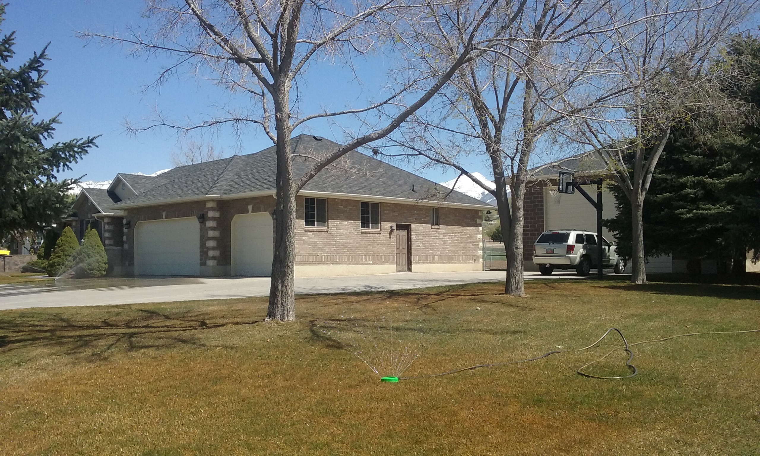 Total Photos: 1
|
| |
|
|
| Property Address: 1470 N 300 EAST - LEHI |
|
| Mailing Address: 1470 N 300 E LEHI, UT 84043-1298 |
|
| Acreage: 0.763922 |
|
| Last Document:
23321-2023
|
|
| Subdivision Map Filing |
|
| Taxing Description:
COM S 0 DEG 10' 8" E 334.56 FT & N 89 DEG 49' 52" E 1378.68 FT FR SW COR. SEC. 4, T5S, R1E, SLB&M.; N 0 DEG 30' 18" W 184.67 FT; N 89 DEG 32' 34" E 179.34 FT; S 0 DEG 32' 35" E 186.51 FT; N 89 DEG 52' 13" W 179.48 FT TO BEG. AREA 0.764 AC.
*Taxing description NOT FOR LEGAL DOCUMENTS
|
|
- Owner Names
- Value History
- Tax History
- Location
- Photos
- Documents
- Aerial Image
| |
----- Real Estate Values ----- |
---Improvements--- |
---Greenbelt--- |
Total |
| Year |
Com |
Res |
Agr |
Tot |
Com |
Res |
Agr |
Tot |
Land |
Homesite |
Tot |
Market Value |
| 2024 |
$0 |
$287,100 |
$0 |
$287,100 |
$0 |
$570,400 |
$0 |
$570,400 |
$0 |
$0 |
$0 |
$857,500 |
| Year |
General Taxes |
Adjustments |
Net Taxes |
Fees |
Payments |
Tax Balance* |
Balance Due |
Tax District |
| 2025 |
$0.00 |
$0.00 |
$0.00 |
$0.00 |
|
$0.00
|
$0.00 |
010 - LEHI CITY |
| 2024 |
$4,030.04 |
$0.00 |
$4,030.04 |
$0.00 |
|
|
Click for Payoff
|
010 - LEHI CITY |
* Note: Original tax amount (Does not include applicable interest and/or fees).
| Entry # |
Date |
Recorded |
Type |
Party1 (Grantor) |
Party2 (Grantee) |
| 23321-2023 |
04/12/2023 |
04/13/2023 |
WD |
HOLLAND, MARCEY L & DAVID E TEE (ET AL) |
ROWLEY, PAUL V & SUZANNE TEE (ET AL) |
| 22061-2023 |
03/29/2023 |
04/10/2023 |
BLA |
HOLLAND, MARCEY L & DAVID E TEE (ET AL) |
BROOKS, LLOYD R & LINDA A TEE (ET AL) |
| 22059-2023 |
03/29/2023 |
04/10/2023 |
WD |
HOLLAND, MARCEY L & DAVID E TEE (ET AL) |
BROOKS, LLOYD R & LINDA A TEE (ET AL) |
Main Menu Comments or Concerns on Value/Appraisal - Assessor's Office
Documents/Owner/Parcel information - Recorder's Office
Address Change for Tax Notice
This page was created on 10/12/2024 1:59:06 AM |