Property Information
mobile view
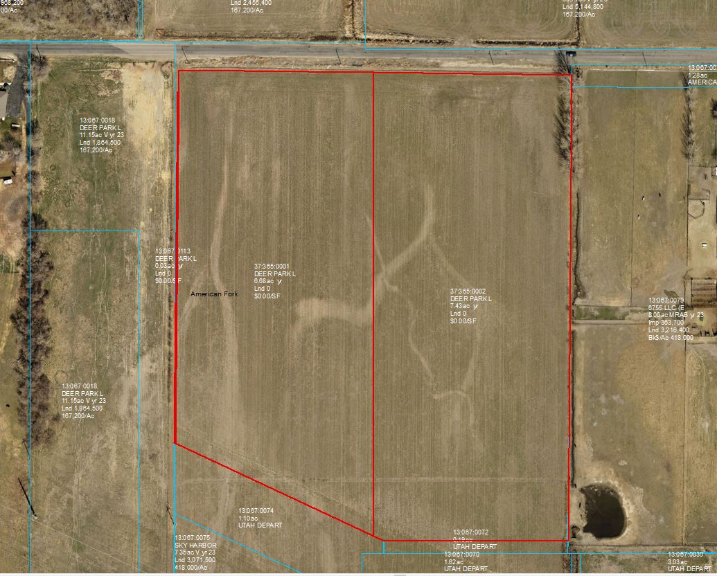
| Serial Number: 13:067:0113 |
Serial Life: 2023 |
|
|
 Total Photos: 1
|
| |
|
|
| Property Address: |
|
| Mailing Address: 520 S 850 E STE A-4 LEHI, UT 84043 |
|
| Acreage: 0.034453 |
|
| Last Document:
42674-2022
|
|
| Subdivision Map Filing |
|
| Taxing Description:
COM N 1898.45 FT & E 545.8 FT FR S 1/4 COR. SEC. 26, T5S, R1E, SLB&M.; N 0 DEG 28' 0" E 660.27 FT; N 89 DEG 53' 55" E 2.29 FT; S 0 DEG 28' 9" W 661.34 FT; N 64 DEG 51' 43" W 2.48 FT TO BEG. AREA 0.034 AC.
*Taxing description NOT FOR LEGAL DOCUMENTS
|
|
- Owner Names
- Value History
- Tax History
- Location
- Photos
- Documents
- Aerial Image
Main Menu Comments or Concerns on Value/Appraisal - Assessor's Office
Documents/Owner/Parcel information - Recorder's Office
Address Change for Tax Notice
This page was created on 10/9/2024 1:20:05 PM |