Property Information
mobile view
| Serial Number: 14:033:0256 |
Serial Life: 2024... |
|
|
 Total Photos: 1
|
| |
|
|
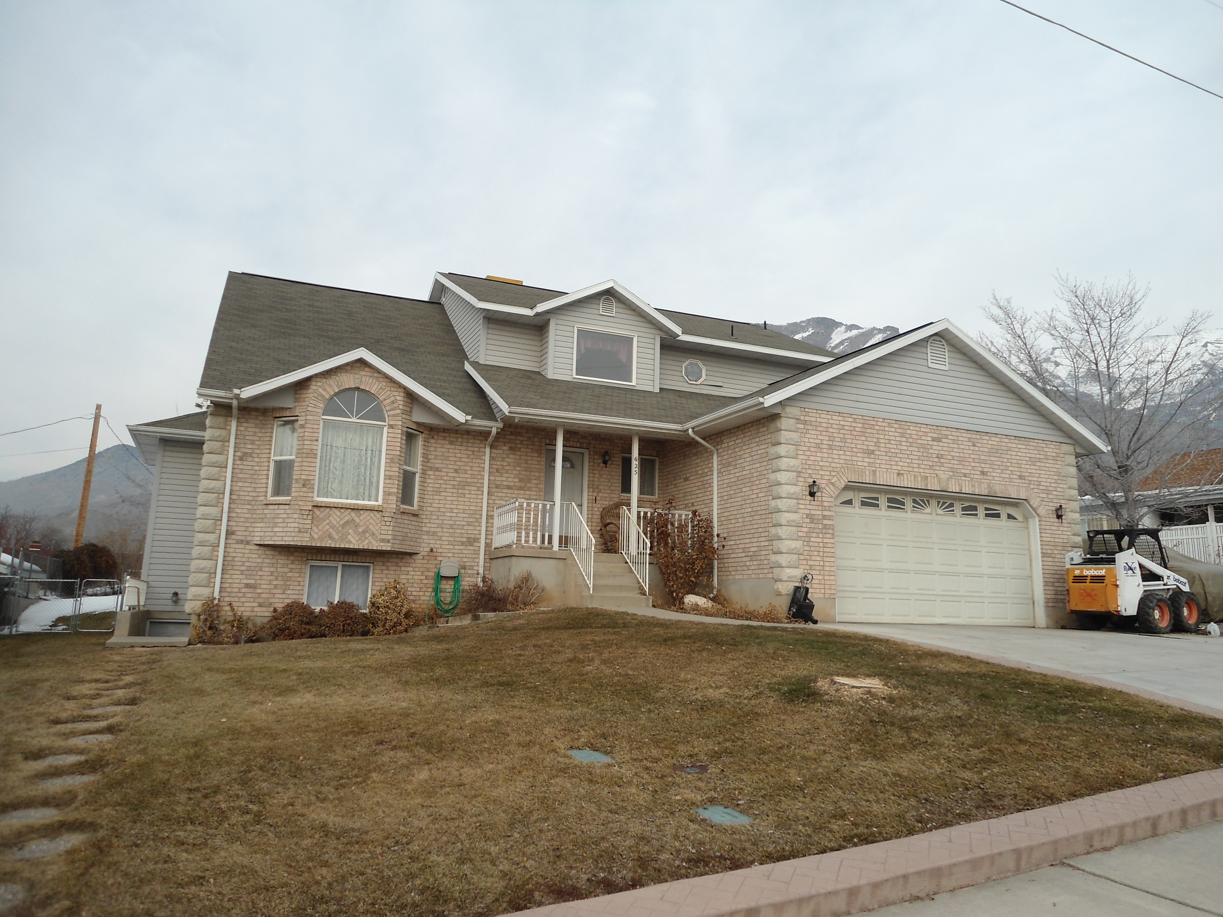
| Property Address: 625 E 700 NORTH - PLEASANT GROVE |
|
| Mailing Address: 625 E 700 N PLEASANT GROVE, UT 84062-1831 |
|
| Acreage: 0.361608 |
|
| Last Document:
27326-2023
|
|
| Subdivision Map Filing |
|
| Taxing Description:
COM S 2135.44 FT & W 585.38 FT FR N 1/4 COR. SEC. 21, T5S, R2E, SLB&M.; E 95.09 FT; S 0 DEG 52' 10" W 148.52 FT; W 92.83 FT; N 9 RD TO BEG. AREA 0.320 AC. ALSO COM S 2295.76 FT & W 477.72 FT FR N 1/4 COR. SEC. 21, T5S, R2E, SLB&M.; N 0 DEG 52' 10" E 120 FT; W 15 FT; S 0 DEG 52' 10" W 120 FT; E 15 FT TO BEG. AREA 0.041 AC. TOTAL AREA .362 AC.
*Taxing description NOT FOR LEGAL DOCUMENTS
|
|
- Owner Names
- Value History
- Tax History
- Location
- Photos
- Documents
- Aerial Image
Main Menu Comments or Concerns on Value/Appraisal - Assessor's Office
Documents/Owner/Parcel information - Recorder's Office
Address Change for Tax Notice
This page was created on 2/25/2025 12:56:26 PM |