Property Information
mobile view
| Serial Number: 14:043:0237 |
Serial Life: 2024... |
|
|
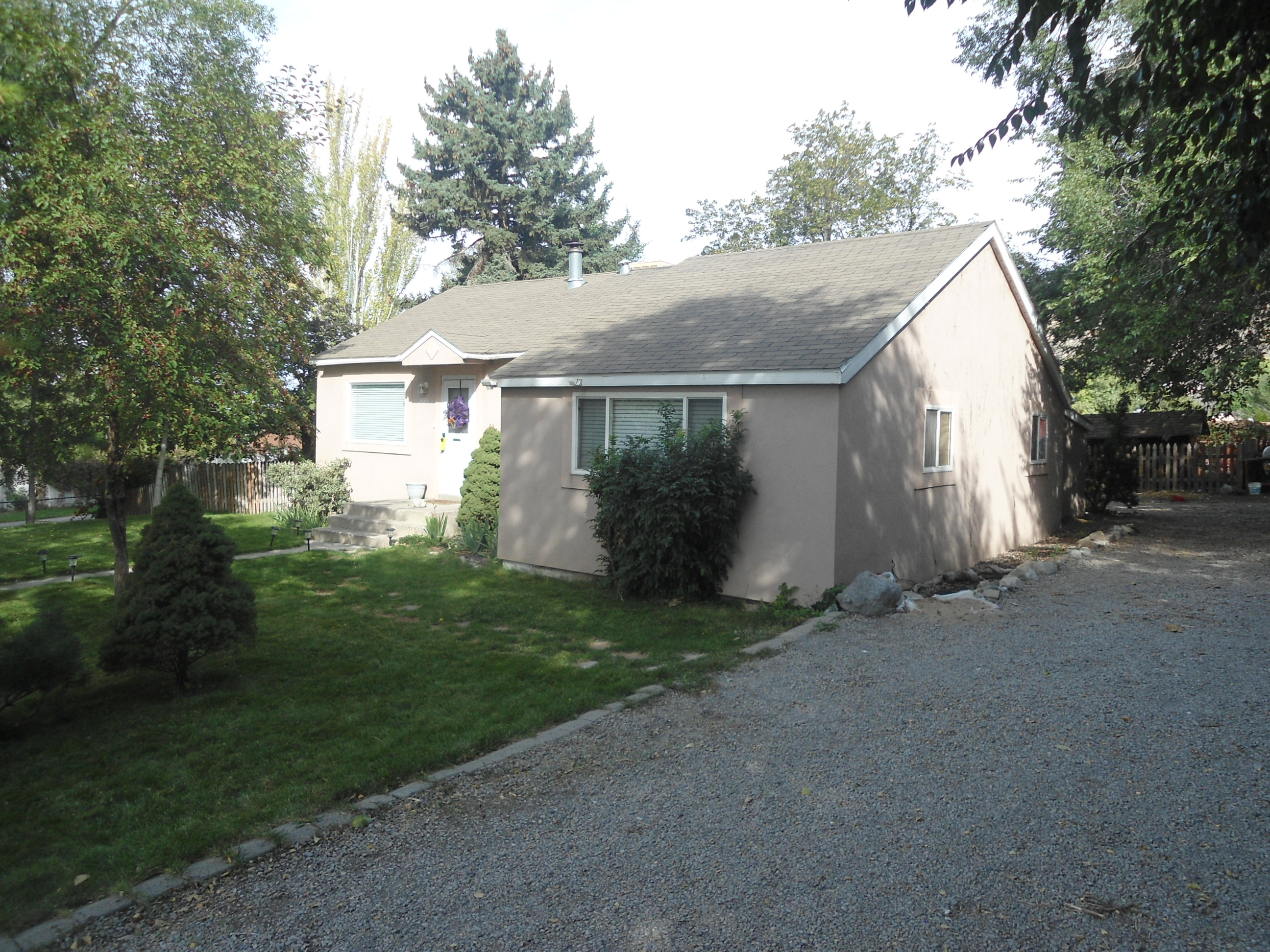 Total Photos: 1
|
| |
|
|
| Property Address: 1485 E BATTLECREEK DR - PLEASANT GROVE |
|
| Mailing Address: 1485 E 200 S PLEASANT GROVE, UT 84062-3013 |
|
| Acreage: 0.334832 |
|
| Last Document:
2292-2023
|
|
| Subdivision Map Filing |
|
| Taxing Description:
COM S 0 DEG 10' 0" W 673.51 FT ALONG 1/4 SEC. LINE & W 6.54 FT FR N 1/4 COR. SEC. 27, T5S, R2E, SLB&M.; N 89 DEG 20' 0" W 115.95 FT; N 0 DEG 32' 0" E 73 FT; E 11.8 FT; N 0 DEG 32' 0" E 52.1 FT; S 89 DEG 29' 55" E 92.64 FT; S 4 DEG 43' 0" E 126.26 FT TO BEG. AREA 0.303 AC. ALSO COM S 0 DEG 10' 0" W 673.51 FT ALONG 1/4 SEC. LINE & W 6.54 FT FR N 1/4 COR. SEC. 27, T5S, R2E, SLB&M.; N 4 DEG 43' 0" W 126.26 FT; S 89 DEG 29' 54" E 16.42 FT; S 0 DEG 15' 29" W 125.7 FT; W 5.47 FT TO BEG. AREA 0.032 AC. TOTAL AREA .335 AC.
*Taxing description NOT FOR LEGAL DOCUMENTS
|
|
- Owner Names
- Value History
- Tax History
- Location
- Photos
- Documents
- Aerial Image
| |
----- Real Estate Values ----- |
---Improvements--- |
---Greenbelt--- |
Total |
| Year |
Com |
Res |
Agr |
Tot |
Com |
Res |
Agr |
Tot |
Land |
Homesite |
Tot |
Market Value |
| 2025 |
$0 |
$227,000 |
$0 |
$227,000 |
$0 |
$138,300 |
$0 |
$138,300 |
$0 |
$0 |
$0 |
$365,300 |
| 2024 |
$0 |
$216,200 |
$0 |
$216,200 |
$0 |
$115,700 |
$0 |
$115,700 |
$0 |
$0 |
$0 |
$331,900 |
| Year |
General Taxes |
Adjustments |
Net Taxes |
Fees |
Payments |
Tax Balance* |
Balance Due |
Tax Area |
| 2026 |
$0.00 |
$0.00 |
$0.00 |
$0.00 |
|
$0.00
|
$0.00 |
070 - PLEASANT GROVE CITY |
| 2025 |
$0.00 |
$0.00 |
$0.00 |
$0.00 |
|
$0.00
|
$0.00 |
070 - PLEASANT GROVE CITY |
| 2024 |
$1,564.23 |
$0.00 |
$1,564.23 |
$0.00 |
|
$0.00
|
$0.00 |
070 - PLEASANT GROVE CITY |
* Note: Original tax amount (Does not include applicable interest and/or fees).
| Entry # |
Date |
Recorded |
Type |
Party1 (Grantor) |
Party2 (Grantee) |
| 35137-2025 |
05/13/2025 |
05/13/2025 |
D TR |
ADAMS, EDWARD JON |
SILVERVIEW VENTURES LLC AN INT (ET AL) |
| 2292-2023 |
01/10/2023 |
01/13/2023 |
BLA |
ADAMS, EDWARD JON |
DAVIS, JOSHUA J |
Main Menu Comments or Concerns on Value/Appraisal - Assessor's Office
Documents/Owner/Parcel information - Recorder's Office
Address Change for Tax Notice
This page was created on 7/23/2025 7:12:35 AM |