Property Information
mobile view
| Serial Number: 14:049:0161 |
Serial Life: 1995-2001 |
|
|
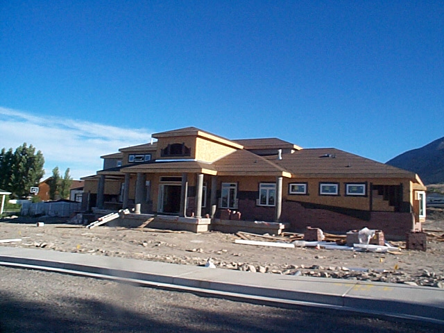 Total Photos: 1
|
| |
|
|
| Property Address: 20 W 600 NORTH - LINDON |
|
| Mailing Address: 967 N 1020 E PLEASANT GROVE, UT 84062-2028 |
|
| Acreage: 1.178216 |
|
| Last Document:
1849-1998
|
|
| Subdivision Map Filing |
|
| Taxing Description:
COM N 0 DEG 19' 56" W 298.87 FT FR SE COR. SEC. 28, T5S, R2E, SLB&M.; N 0 DEG 19' 56" W 265.82 FT; S 89 DEG 40' 4" W 193 FT; S 0 DEG 19' 56" E 266.02 FT; N 89 DEG 36' 36" E 193 FT TO BEG. AREA 1.178 AC.
*Taxing description NOT FOR LEGAL DOCUMENTS
|
|
- Owner Names
- Value History
- Tax History
- Location
- Photos
- Documents
- Aerial Image
| |
----- Real Estate Values ----- |
---Improvements--- |
---Greenbelt--- |
Total |
| Year |
Com |
Res |
Agr |
Tot |
Com |
Res |
Agr |
Tot |
Land |
Homesite |
Tot |
Market Value |
| 2001 |
$0 |
$54,264 |
$0 |
$54,264 |
$0 |
$0 |
$0 |
$0 |
$0 |
$0 |
$0 |
$54,264 |
| 2000 |
$0 |
$50,714 |
$0 |
$50,714 |
$0 |
$0 |
$0 |
$0 |
$0 |
$0 |
$0 |
$50,714 |
| 1999 |
$0 |
$50,714 |
$0 |
$50,714 |
$0 |
$0 |
$0 |
$0 |
$0 |
$0 |
$0 |
$50,714 |
| 1998 |
$0 |
$44,880 |
$0 |
$44,880 |
$0 |
$0 |
$0 |
$0 |
$0 |
$0 |
$0 |
$44,880 |
| 1997 |
$0 |
$68,772 |
$0 |
$68,772 |
$0 |
$0 |
$0 |
$0 |
$0 |
$0 |
$0 |
$68,772 |
| 1996 |
$0 |
$67,716 |
$0 |
$67,716 |
$0 |
$0 |
$0 |
$0 |
$0 |
$0 |
$0 |
$67,716 |
| 1995 |
$0 |
$61,560 |
$0 |
$61,560 |
$0 |
$0 |
$0 |
$0 |
$0 |
$0 |
$0 |
$61,560 |
| Year |
General Taxes |
Adjustments |
Net Taxes |
Fees |
Payments |
Tax Balance* |
Balance Due |
Tax District |
| 2001 |
$573.03 |
$0.00 |
$573.03 |
$0.00 |
|
$0.00
|
$0.00 |
080 - LINDON CITY |
| 2000 |
$553.34 |
$0.00 |
$553.34 |
$0.00 |
|
$0.00
|
$0.00 |
080 - LINDON CITY |
| 1999 |
$565.71 |
$0.00 |
$565.71 |
$0.00 |
|
$0.00
|
$0.00 |
080 - LINDON CITY |
| 1998 |
$492.11 |
$0.00 |
$492.11 |
$0.00 |
|
$0.00
|
$0.00 |
080 - LINDON CITY |
| 1997 |
$751.40 |
$0.00 |
$751.40 |
$0.00 |
|
$0.00
|
$0.00 |
080 - LINDON CITY |
| 1996 |
$699.03 |
$0.00 |
$699.03 |
$0.00 |
|
$0.00
|
$0.00 |
080 - LINDON CITY |
| 1995 |
$704.55 |
$0.00 |
$704.55 |
$0.00 |
|
$0.00
|
$0.00 |
080 - LINDON CITY |
* Note: Original tax amount (Does not include applicable interest and/or fees).
| Entry # |
Date |
Recorded |
Type |
Party1 (Grantor) |
Party2 (Grantee) |
| 112788-2001 |
11/16/2000 |
11/02/2001 |
S PLAT |
ETVXJT (ET AL) |
HAMLING MEADOWS PLAT A |
| 17329-2001 |
02/23/2001 |
02/26/2001 |
D TR |
HAMLING, JERRY A & JULIE K |
WESTERN COMMUNITY BANK |
| 17328-2001 |
02/23/2001 |
02/26/2001 |
QCD |
J & J HAMLING PROPERTIES LC |
HAMLING, JERRY A & JULIE K |
| 68242-1998 |
06/02/1998 |
07/08/1998 |
WD |
HAMLING, JERRY A & JULIE K |
J & J HAMLING PROPERTIES LC |
| 1849-1998 |
11/05/1997 |
01/08/1998 |
WD |
HEWLETT, JOHN BRAZER |
HAMLING, JERRY A & JULIE K |
| 89317-1997 |
11/05/1997 |
11/10/1997 |
NI |
HEWLETT, JOHN BRAZER (ET AL) |
WHOM OF INTEREST |
| 50417-1996 |
06/11/1996 |
06/18/1996 |
REC |
CENTRAL BANK TEE |
IORG, DANE & GAY |
| 42457-1996 |
05/20/1996 |
05/21/1996 |
WD |
IORG, DANE & GAY |
HEWLETT, JOHN BRAZER |
| 76907-1995 |
11/02/1995 |
11/08/1995 |
REC |
CENTRAL BANK TEE |
IORG, DANE & GAY |
| 71419-1995 |
10/17/1995 |
10/20/1995 |
D TR |
IORG, DARE & GAY |
CENTRAL BANK |
| 18863-1995 |
03/28/1995 |
03/28/1995 |
D TR |
IORG, DANE & GAY |
CENTRAL BANK |
| 18660-1995 |
03/28/1995 |
03/28/1995 |
REC |
SECURITY TITLE AND ABSTRACT COMPANY TEE |
IORG, DANE & GAY |
| 22716-1994 |
03/15/1994 |
03/18/1994 |
WD |
JOYNER, JAMES R |
JOYNER DEVELOPMENT INC |
| 22715-1994 |
03/16/1994 |
03/18/1994 |
TR D |
IORG, DANE & GAY |
JOYNER DEVELOPMENT INC |
| 22714-1994 |
03/16/1994 |
03/18/1994 |
WD |
JOYNER DEVELOPMENT INC |
IORG, DANE & GAY |
Main Menu Comments or Concerns on Value/Appraisal - Assessor's Office
Documents/Owner/Parcel information - Recorder's Office
Address Change for Tax Notice
This page was created on 4/13/2025 4:26:42 AM |