Property Information
mobile view
| Serial Number: 17:016:0076 |
Serial Life: 1995... |
|
|
 Total Photos: 2
|
| |
|
|
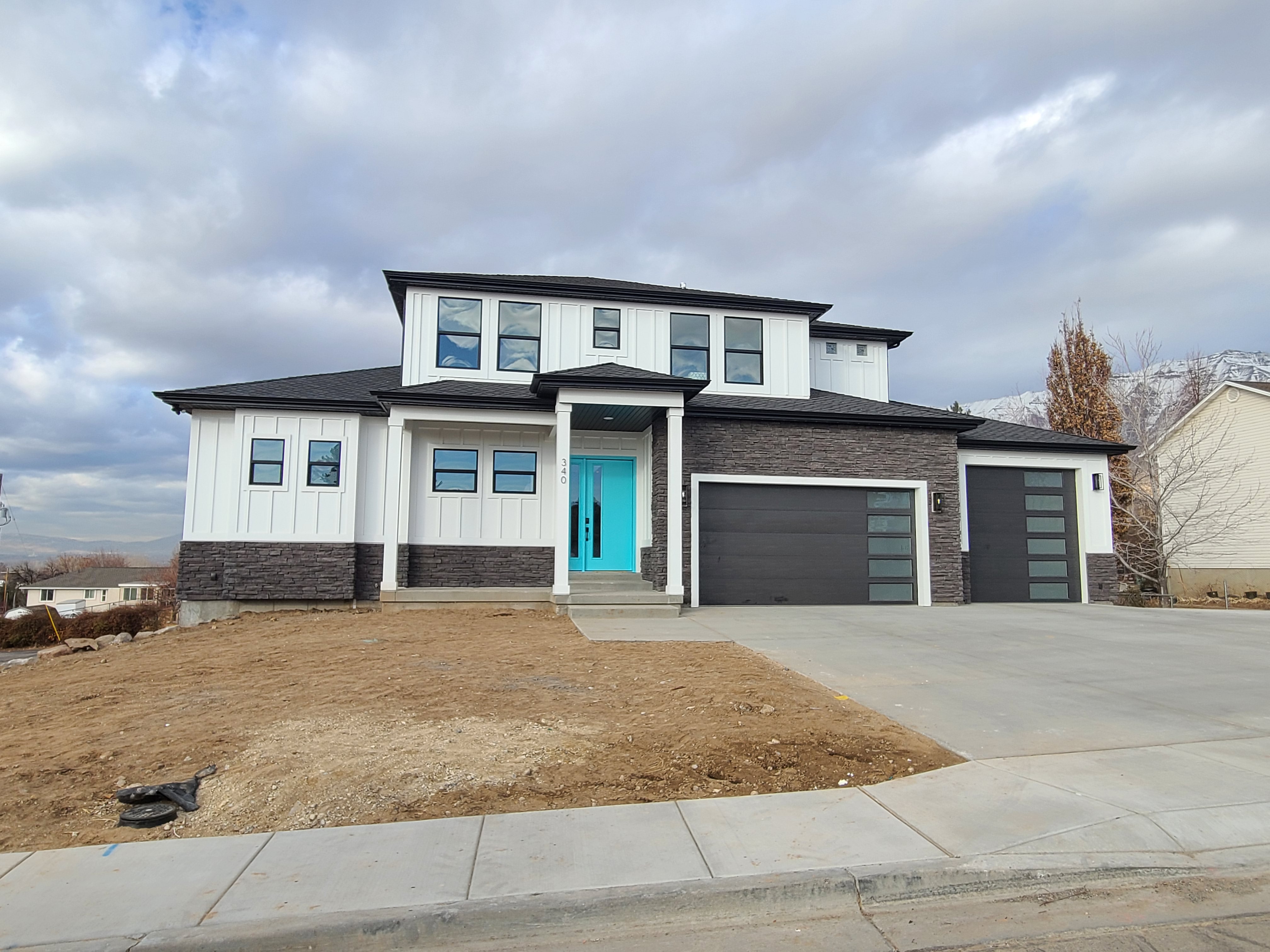
| Property Address: 340 W 470 SOUTH - LINDON |
|
| Mailing Address: 101 W 220 S OREM, UT 84058-5479 |
|
| Acreage: 0.537915 |
|
| Last Document:
67144-1994
|
|
| Subdivision Map Filing |
|
| Taxing Description:
COM S 0 DEG 51' 57" E 1577.55 FT & E 260 FT FR N 1/4 COR. SEC. 4, T6S, R2E, SLB&M.; S 89 DEG 4' 13" E 142.01 FT; S 2 DEG 22' 1" E 166.32 FT; N 88 DEG 41' 53" W 88.33 FT; S 88 DEG 19' 58" W 51.75 FT; N 3 DEG 0' 34" W 168.22 FT TO BEG. AREA 0.538 AC.
*Taxing description NOT FOR LEGAL DOCUMENTS
|
|
- Owner Names
- Value History
- Tax History
- Location
- Photos
- Documents
- Aerial Image
| 2015... |
|
SCHAEFER, ALEXXIS |
|
| 2015... |
|
SCHAEFER, RHETT |
|
| 2015NV |
|
HOOLEY, BOYD F |
|
| 2015NV |
|
HOOLEY, CONNIE K |
|
| 2013-2014 |
|
HOOLEY, BOYD F |
|
| 2013-2014 |
|
HOOLEY, CONNIE K |
|
| 2007-2012 |
|
HOOLEY, BOYD F |
|
| 2007-2012 |
|
HOOLEY, CONNIE K |
|
| 1996-2006 |
|
HOOLEY, BOYD F |
|
| 1996-2006 |
|
HOOLEY, CONNIE K |
|
| 1995 |
|
HOOLEY, BOYD F |
|
| 1995 |
|
HOOLEY, CONNIE K |
|
| 1995NV |
|
HOOLEY, BOYD F |
|
| 1995NV |
|
HOOLEY, CONNIE K |
|
| |
----- Real Estate Values ----- |
---Improvements--- |
---Greenbelt--- |
Total |
| Year |
Com |
Res |
Agr |
Tot |
Com |
Res |
Agr |
Tot |
Land |
Homesite |
Tot |
Market Value |
| 2024 |
$0 |
$227,700 |
$0 |
$227,700 |
$0 |
$693,000 |
$0 |
$693,000 |
$0 |
$0 |
$0 |
$920,700 |
| 2023 |
$0 |
$207,000 |
$0 |
$207,000 |
$0 |
$720,400 |
$0 |
$720,400 |
$0 |
$0 |
$0 |
$927,400 |
| 2022 |
$0 |
$217,700 |
$0 |
$217,700 |
$0 |
$623,000 |
$0 |
$623,000 |
$0 |
$0 |
$0 |
$840,700 |
| 2021 |
$0 |
$155,500 |
$0 |
$155,500 |
$0 |
$542,100 |
$0 |
$542,100 |
$0 |
$0 |
$0 |
$697,600 |
| 2020 |
$0 |
$144,000 |
$0 |
$144,000 |
$0 |
$61,400 |
$0 |
$61,400 |
$0 |
$0 |
$0 |
$205,400 |
| 2019 |
$0 |
$135,200 |
$0 |
$135,200 |
$0 |
$61,400 |
$0 |
$61,400 |
$0 |
$0 |
$0 |
$196,600 |
| 2018 |
$0 |
$126,500 |
$0 |
$126,500 |
$0 |
$57,000 |
$0 |
$57,000 |
$0 |
$0 |
$0 |
$183,500 |
| 2017 |
$0 |
$117,800 |
$0 |
$117,800 |
$0 |
$52,900 |
$0 |
$52,900 |
$0 |
$0 |
$0 |
$170,700 |
| 2016 |
$0 |
$100,300 |
$0 |
$100,300 |
$0 |
$52,300 |
$0 |
$52,300 |
$0 |
$0 |
$0 |
$152,600 |
| 2015 |
$0 |
$100,300 |
$0 |
$100,300 |
$0 |
$52,300 |
$0 |
$52,300 |
$0 |
$0 |
$0 |
$152,600 |
| 2014 |
$0 |
$78,500 |
$0 |
$78,500 |
$0 |
$41,600 |
$0 |
$41,600 |
$0 |
$0 |
$0 |
$120,100 |
| 2013 |
$0 |
$66,400 |
$0 |
$66,400 |
$0 |
$41,600 |
$0 |
$41,600 |
$0 |
$0 |
$0 |
$108,000 |
| 2012 |
$0 |
$53,000 |
$0 |
$53,000 |
$0 |
$55,000 |
$0 |
$55,000 |
$0 |
$0 |
$0 |
$108,000 |
| 2011 |
$0 |
$134,400 |
$0 |
$134,400 |
$0 |
$42,500 |
$0 |
$42,500 |
$0 |
$0 |
$0 |
$176,900 |
| 2010 |
$0 |
$134,400 |
$0 |
$134,400 |
$0 |
$42,500 |
$0 |
$42,500 |
$0 |
$0 |
$0 |
$176,900 |
| 2009 |
$0 |
$134,400 |
$0 |
$134,400 |
$0 |
$42,500 |
$0 |
$42,500 |
$0 |
$0 |
$0 |
$176,900 |
| 2008 |
$0 |
$134,400 |
$0 |
$134,400 |
$0 |
$42,500 |
$0 |
$42,500 |
$0 |
$0 |
$0 |
$176,900 |
| 2007 |
$0 |
$57,746 |
$0 |
$57,746 |
$0 |
$42,475 |
$0 |
$42,475 |
$0 |
$0 |
$0 |
$100,221 |
| 2006 |
$0 |
$57,746 |
$0 |
$57,746 |
$0 |
$0 |
$0 |
$0 |
$0 |
$0 |
$0 |
$57,746 |
| 2005 |
$0 |
$57,746 |
$0 |
$57,746 |
$0 |
$0 |
$0 |
$0 |
$0 |
$0 |
$0 |
$57,746 |
| 2004 |
$0 |
$57,746 |
$0 |
$57,746 |
$0 |
$0 |
$0 |
$0 |
$0 |
$0 |
$0 |
$57,746 |
| 2003 |
$0 |
$57,746 |
$0 |
$57,746 |
$0 |
$0 |
$0 |
$0 |
$0 |
$0 |
$0 |
$57,746 |
| 2002 |
$0 |
$57,746 |
$0 |
$57,746 |
$0 |
$0 |
$0 |
$0 |
$0 |
$0 |
$0 |
$57,746 |
| 2001 |
$0 |
$57,746 |
$0 |
$57,746 |
$0 |
$0 |
$0 |
$0 |
$0 |
$0 |
$0 |
$57,746 |
| 2000 |
$0 |
$53,968 |
$0 |
$53,968 |
$0 |
$0 |
$0 |
$0 |
$0 |
$0 |
$0 |
$53,968 |
| 1999 |
$0 |
$53,968 |
$0 |
$53,968 |
$0 |
$0 |
$0 |
$0 |
$0 |
$0 |
$0 |
$53,968 |
| 1998 |
$0 |
$47,759 |
$0 |
$47,759 |
$0 |
$0 |
$0 |
$0 |
$0 |
$0 |
$0 |
$47,759 |
| 1997 |
$0 |
$47,759 |
$0 |
$47,759 |
$0 |
$0 |
$0 |
$0 |
$0 |
$0 |
$0 |
$47,759 |
| 1996 |
$0 |
$47,025 |
$0 |
$47,025 |
$0 |
$0 |
$0 |
$0 |
$0 |
$0 |
$0 |
$47,025 |
| 1995 |
$0 |
$42,750 |
$0 |
$42,750 |
$0 |
$0 |
$0 |
$0 |
$0 |
$0 |
$0 |
$42,750 |
| Year |
General Taxes |
Adjustments |
Net Taxes |
Fees |
Payments |
Tax Balance* |
Balance Due |
Tax District |
| 2025 |
$0.00 |
$0.00 |
$0.00 |
$0.00 |
|
$0.00
|
$0.00 |
080 - LINDON CITY |
| 2024 |
$4,107.80 |
$0.00 |
$4,107.80 |
$0.00 |
|
$0.00
|
$0.00 |
080 - LINDON CITY |
| 2023 |
$3,852.05 |
$0.00 |
$3,852.05 |
$0.00 |
|
$0.00
|
$0.00 |
080 - LINDON CITY |
| 2022 |
$3,614.93 |
$0.00 |
$3,614.93 |
$0.00 |
|
$0.00
|
$0.00 |
080 - LINDON CITY |
| 2021 |
$3,616.95 |
$0.00 |
$3,616.95 |
$0.00 |
|
$0.00
|
$0.00 |
080 - LINDON CITY |
| 2020 |
$1,966.91 |
$0.00 |
$1,966.91 |
$0.00 |
|
$0.00
|
$0.00 |
080 - LINDON CITY |
| 2019 |
$1,804.59 |
$0.00 |
$1,804.59 |
$0.00 |
|
$0.00
|
$0.00 |
080 - LINDON CITY |
| 2018 |
$1,786.56 |
$0.00 |
$1,786.56 |
$0.00 |
|
$0.00
|
$0.00 |
080 - LINDON CITY |
| 2017 |
$1,704.78 |
$0.00 |
$1,704.78 |
$0.00 |
|
$0.00
|
$0.00 |
080 - LINDON CITY |
| 2016 |
$1,647.62 |
$0.00 |
$1,647.62 |
$0.00 |
|
$0.00
|
$0.00 |
080 - LINDON CITY |
| 2015 |
$1,742.84 |
$0.00 |
$1,742.84 |
$0.00 |
|
$0.00
|
$0.00 |
080 - LINDON CITY |
| 2014 |
$1,384.63 |
$0.00 |
$1,384.63 |
$0.00 |
|
$0.00
|
$0.00 |
080 - LINDON CITY |
| 2013 |
$1,344.28 |
$0.00 |
$1,344.28 |
$0.00 |
|
$0.00
|
$0.00 |
080 - LINDON CITY |
| 2012 |
$2,249.11 |
($876.00) |
$1,373.11 |
$0.00 |
|
$0.00
|
$0.00 |
080 - LINDON CITY |
| 2011 |
$2,241.32 |
$0.00 |
$2,241.32 |
$0.00 |
|
$0.00
|
$0.00 |
080 - LINDON CITY |
| 2010 |
$2,088.84 |
$0.00 |
$2,088.84 |
$0.00 |
|
$0.00
|
$0.00 |
080 - LINDON CITY |
| 2009 |
$1,915.83 |
$0.00 |
$1,915.83 |
$0.00 |
|
$0.00
|
$0.00 |
080 - LINDON CITY |
| 2008 |
$1,723.71 |
$0.00 |
$1,723.71 |
$0.00 |
|
$0.00
|
$0.00 |
080 - LINDON CITY |
| 2007 |
$965.03 |
$0.00 |
$965.03 |
$0.00 |
|
$0.00
|
$0.00 |
080 - LINDON CITY |
| 2006 |
$589.24 |
$0.00 |
$589.24 |
$0.00 |
|
$0.00
|
$0.00 |
080 - LINDON CITY |
| 2005 |
$677.65 |
$0.00 |
$677.65 |
$0.00 |
|
$0.00
|
$0.00 |
080 - LINDON CITY |
| 2004 |
$677.59 |
$0.00 |
$677.59 |
$0.00 |
|
$0.00
|
$0.00 |
080 - LINDON CITY |
| 2003 |
$665.64 |
$0.00 |
$665.64 |
$0.00 |
|
$0.00
|
$0.00 |
080 - LINDON CITY |
| 2002 |
$610.55 |
$0.00 |
$610.55 |
$0.00 |
|
$0.00
|
$0.00 |
080 - LINDON CITY |
| 2001 |
$609.80 |
$0.00 |
$609.80 |
$0.00 |
|
$0.00
|
$0.00 |
080 - LINDON CITY |
| 2000 |
$588.84 |
$0.00 |
$588.84 |
$0.00 |
|
$0.00
|
$0.00 |
080 - LINDON CITY |
| 1999 |
$602.01 |
$0.00 |
$602.01 |
$0.00 |
|
$0.00
|
$0.00 |
080 - LINDON CITY |
| 1998 |
$523.68 |
$0.00 |
$523.68 |
$0.00 |
|
$0.00
|
$0.00 |
080 - LINDON CITY |
| 1997 |
$521.81 |
$0.00 |
$521.81 |
$0.00 |
|
$0.00
|
$0.00 |
080 - LINDON CITY |
| 1996 |
$485.44 |
$0.00 |
$485.44 |
$0.00 |
|
$0.00
|
$0.00 |
080 - LINDON CITY |
| 1995 |
$489.27 |
$0.00 |
$489.27 |
$0.00 |
|
$0.00
|
$0.00 |
080 - LINDON CITY |
* Note: Original tax amount (Does not include applicable interest and/or fees).
| Entry # |
Date |
Recorded |
Type |
Party1 (Grantor) |
Party2 (Grantee) |
| 81782-2021 |
04/20/2021 |
04/30/2021 |
REC |
CENTRAL BANK TEE |
SCHAEFER, RHETT & ALEXXIS |
| 62714-2021 |
03/29/2021 |
04/02/2021 |
D TR |
SCHAEFER, RHETT & ALEXXIS |
CENTRAL BANK |
| 161620-2020 |
10/05/2020 |
10/16/2020 |
N |
PACIFICORP |
WHOM OF INTEREST |
| 133782-2020 |
08/31/2020 |
09/02/2020 |
R/W EAS |
SCHAEFER, RHETT & ALEXXIS |
ROCKY MOUNTAIN POWER DIV OF (ET AL) |
| 104717-2020 |
07/17/2020 |
07/21/2020 |
D TR |
SCHAEFER, RHETT & ALEXXIS |
CENTRAL BANK |
| 97521-2020 |
07/09/2020 |
07/10/2020 |
REC |
ROCK CANYON BANK TEE |
SCHAEFER, RHETT & ALEXXIS L |
| 52299-2014 |
07/25/2014 |
07/29/2014 |
D TR |
SCHAEFER, RHETT & ALEXXIS L |
ROCK CANYON BANK |
| 52279-2014 |
07/26/2014 |
07/29/2014 |
WD |
HOOLEY, BOYD F & CONNIE K TEE (ET AL) |
SCHAEFER, RHETT & ALEXXIS |
| 50831-2014 |
07/22/2014 |
07/23/2014 |
P REC |
BACKMAN TITLE SERVICES LTD BY (ET AL) |
HOOLEY, BONNIE TEE |
| 50830-2014 |
07/22/2014 |
07/23/2014 |
SUB TEE |
HOOLEY, BONNIE & BONNIE TEE |
BACKMAN TITLE SERVICES LTD SUCTEE |
| 50829-2014 |
07/22/2014 |
07/23/2014 |
QCD |
HOOLEY, BONNIE TEE (ET AL) |
HOOLEY, BOYD F & CONNIE K TEE |
| 16305-2012 |
02/28/2012 |
02/29/2012 |
EAS |
THOMAS, KEVIN A |
HOOLEY, BOYD F & CONNIE K TEE (ET AL) |
| 8778-2012 |
02/02/2012 |
02/03/2012 |
WD |
HOOLEY, BOYD F & CONNIE K TEE (ET AL) |
HOOLEY, BOYD F & CONNIE K TEE |
| 24623-1997 |
04/02/1997 |
04/02/1997 |
ND |
MADDOX, JOHN WM SUBTEE |
FOSTER, JOHN |
| 24622-1997 |
04/02/1997 |
04/02/1997 |
SUB TEE |
HOOLEY, BONNIE TEE |
MADDOX, JOHN WM SUCTEE |
| 9111-1996 |
02/02/1996 |
02/02/1996 |
AS |
HOOLEY, BONNIE TEE |
HOOLEY, BONNIE TEE |
| 9109-1996 |
12/20/1995 |
02/02/1996 |
QCD |
HOOLEY ANNUITY TRUST (ET AL) |
HOOLEY, BONNIE TEE |
| 47456-1995 |
07/26/1995 |
07/26/1995 |
WD |
HOOLEY, BOYD F & CONNIE K |
HOOLEY, BOYD F & CONNIE K TEE |
| 29740-1995 |
04/28/1995 |
05/11/1995 |
W FARM |
UTAH COUNTY ASSESSOR |
WHOM OF INTEREST |
| 26211-1995 |
04/24/1995 |
04/28/1995 |
QCD |
FOSTER, JOHN |
FOSTER, JOHN & DEBRA |
| 26210-1995 |
04/20/1995 |
04/28/1995 |
TR D |
FOSTER, JOHN |
HOOLEY, BONNIE TEE |
| 26209-1995 |
04/12/1995 |
04/28/1995 |
WD |
HOOLEY ANNUITY TRUST (ET AL) |
FOSTER, JOHN |
| 91927-1994 |
10/27/1994 |
12/05/1994 |
FLA |
HOOLEY BONNIE MARITAL TRUST THE (ET AL) |
RUST, DAVID WAYNE (ET AL) |
| 67144-1994 |
08/22/1994 |
08/22/1994 |
QCD |
HOOLEY BONNIE MARITAL TRUST THE (ET AL) |
HOOLEY, BOYD F & CONNIE K |
Main Menu Comments or Concerns on Value/Appraisal - Assessor's Office
Documents/Owner/Parcel information - Recorder's Office
Address Change for Tax Notice
This page was created on 3/26/2025 6:52:18 AM |
