Property Information
mobile view
| Serial Number: 25:035:0062 |
Serial Life: 2021... |
|
|
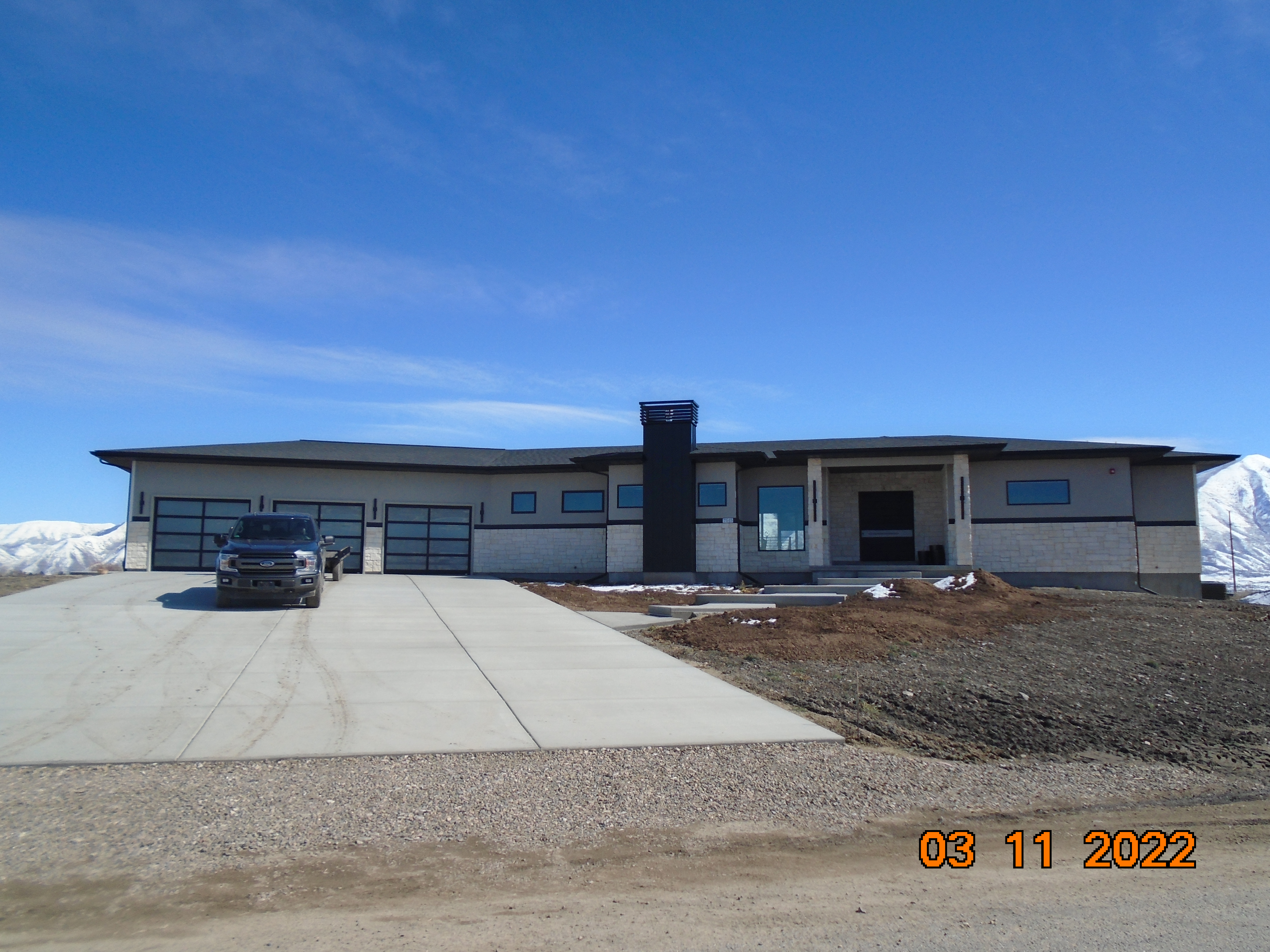 Total Photos: 1
|
| |
|
|
| Property Address: 7515 S 1800 WEST - SPANISH FORK DISTR |
|
| Mailing Address: 113 RICHMOND AVE VIRDEN, NM 88045 |
|
| Acreage: 8.689981 |
|
| Last Document:
109064-2020
|
|
| Subdivision Map Filing |
|
| Taxing Description:
COM N 1329.652 FT & W 732.82 FT & S 0 DEG 12' 0" E 807.37 FT FR E 1/4 COR. SEC. 27, T8S, R2E, SLB&M.; S 0 DEG 12' 0" E 358.16 FT; S 37 DEG 44' 1" W 198.568 FT; N 89 DEG 58' 38" W 492.126 FT; N 87 DEG 48' 29" W 14.954 FT; N 78 DEG 4' 25" W 9.132 FT; N 68 DEG 14' 49" W 12.521 FT; N 40 DEG 43' 31" W 15.618 FT; N 2 DEG 40' 54" W 6.32 FT; N 0 DEG 26' 44" W 633.18 FT; S 89 DEG 58' 36" E 335.56 FT; S 143.27 FT; E 327.76 FT TO BEG. AREA 8.690 AC.
*Taxing description NOT FOR LEGAL DOCUMENTS
|
|
- Owner Names
- Value History
- Tax History
- Location
- Photos
- Documents
- Aerial Image
| |
----- Real Estate Values ----- |
---Improvements--- |
---Greenbelt--- |
Total |
| Year |
Com |
Res |
Agr |
Tot |
Com |
Res |
Agr |
Tot |
Land |
Homesite |
Tot |
Market Value |
| 2024 |
$0 |
$246,200 |
$343,400 |
$589,600 |
$0 |
$950,200 |
$0 |
$950,200 |
$5,148 |
$112,000 |
$117,148 |
$1,539,800 |
| 2023 |
$0 |
$246,200 |
$343,400 |
$589,600 |
$0 |
$995,400 |
$0 |
$995,400 |
$4,726 |
$112,000 |
$116,726 |
$1,585,000 |
| 2022 |
$0 |
$262,500 |
$366,100 |
$628,600 |
$0 |
$568,500 |
$0 |
$568,500 |
$4,777 |
$112,000 |
$116,777 |
$1,197,100 |
| 2021 |
$0 |
$0 |
$243,400 |
$243,400 |
$0 |
$0 |
$0 |
$0 |
$4,823 |
$0 |
$4,823 |
$243,400 |
| Year |
General Taxes |
Adjustments |
Net Taxes |
Fees |
Payments |
Tax Balance* |
Balance Due |
Tax District |
| 2025 |
$0.00 |
$0.00 |
$0.00 |
$0.00 |
|
$0.00
|
$0.00 |
120 - NEBO SCHOOL DIST S/A 6-7-8 |
| 2024 |
$0.00 |
$0.00 |
$0.00 |
$0.00 |
|
$0.00
|
$0.00 |
120 - NEBO SCHOOL DIST S/A 6-7-8 |
| 2023 |
$6,135.50 |
$0.00 |
$6,135.50 |
$0.00 |
|
$0.00
|
$0.00 |
120 - NEBO SCHOOL DIST S/A 6-7-8 |
| 2022 |
$3,858.37 |
$0.00 |
$3,858.37 |
$0.00 |
|
$0.00
|
$0.00 |
120 - NEBO SCHOOL DIST S/A 6-7-8 |
| 2021 |
$57.16 |
$0.00 |
$57.16 |
$0.00 |
|
$0.00
|
$0.00 |
120 - NEBO SCHOOL DIST S/A 6-7-8 |
* Note: Original tax amount (Does not include applicable interest and/or fees).
| Entry # |
Date |
Recorded |
Type |
Party1 (Grantor) |
Party2 (Grantee) |
| 29570-2023 |
05/04/2023 |
05/10/2023 |
N |
UTAH COUNTY COMMISSIONERS |
WHOM OF INTEREST |
| 139878-2021 |
07/22/2021 |
08/10/2021 |
FARM |
PAYNE, DONALD L |
WHOM OF INTEREST |
| 109064-2020 |
07/20/2020 |
07/29/2020 |
QCD |
PAYNE, DONALD L |
PAYNE, DONALD L |
Main Menu Comments or Concerns on Value/Appraisal - Assessor's Office
Documents/Owner/Parcel information - Recorder's Office
Address Change for Tax Notice
This page was created on 9/8/2024 3:52:07 PM |