Property Information
mobile view
| Serial Number: 27:048:0014 |
Serial Life: 1979... |
|
|
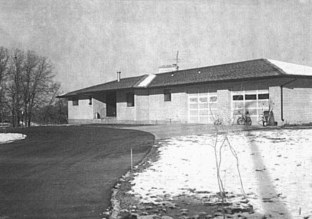 Total Photos: 1
|
| |
|
|
| Property Address: 1015 E 8800 SOUTH - SPANISH FORK DISTR |
|
| Mailing Address: 1015 E 8800 S SPANISH FORK, UT 84660-9202 |
|
| Acreage: 3.08 |
|
| Last Document:
31829-1976
|
|
| Subdivision Map Filing |
|
| Taxing Description:
COM. AT PT IN FENCE LINE N 41.60 FT & E 1121.98 FT (BASED ON UT ST COORDINATE SYSTEM, CE ZONE) FR SW COR SEC 32, T8S, R3E, SLM; N 89 01' 11" E ALONG SD FENCE LINE 155.20 FT; N 2 17' 07" W 431.09 FT; E 181.70 FT; N 265 FT; S 80 46' 19" W 160 FT; N 68 17' 23" W 138.911 FT; S 2 36' 29" W 724.78 FT TO BEG. AREA 3.08 ACRES.
*Taxing description NOT FOR LEGAL DOCUMENTS
|
|
- Owner Names
- Value History
- Tax History
- Location
- Photos
- Documents
- Aerial Image
| |
----- Real Estate Values ----- |
---Improvements--- |
---Greenbelt--- |
Total |
| Year |
Com |
Res |
Agr |
Tot |
Com |
Res |
Agr |
Tot |
Land |
Homesite |
Tot |
Market Value |
| 2024 |
$0 |
$264,700 |
$68,100 |
$332,800 |
$0 |
$571,700 |
$0 |
$571,700 |
$439 |
$224,000 |
$224,439 |
$904,500 |
| 2023 |
$0 |
$220,600 |
$68,100 |
$288,700 |
$0 |
$573,100 |
$0 |
$573,100 |
$403 |
$224,000 |
$224,403 |
$861,800 |
| 2022 |
$0 |
$235,200 |
$72,600 |
$307,800 |
$0 |
$573,100 |
$0 |
$573,100 |
$407 |
$224,000 |
$224,407 |
$880,900 |
| 2021 |
$0 |
$168,000 |
$36,300 |
$204,300 |
$0 |
$430,900 |
$0 |
$430,900 |
$399 |
$160,000 |
$160,399 |
$635,200 |
| 2020 |
$0 |
$140,000 |
$32,400 |
$172,400 |
$0 |
$430,900 |
$0 |
$430,900 |
$397 |
$56,000 |
$56,397 |
$603,300 |
| 2019 |
$0 |
$140,000 |
$32,400 |
$172,400 |
$0 |
$264,700 |
$0 |
$264,700 |
$398 |
$56,000 |
$56,398 |
$437,100 |
| 2018 |
$0 |
$140,000 |
$32,400 |
$172,400 |
$0 |
$264,700 |
$0 |
$264,700 |
$444 |
$56,000 |
$56,444 |
$437,100 |
| 2017 |
$0 |
$200,000 |
$32,400 |
$232,400 |
$0 |
$264,700 |
$0 |
$264,700 |
$466 |
$56,000 |
$56,466 |
$497,100 |
| 2016 |
$0 |
$80,000 |
$62,400 |
$142,400 |
$0 |
$252,100 |
$0 |
$252,100 |
$457 |
$56,000 |
$56,457 |
$394,500 |
| 2015 |
$0 |
$80,000 |
$62,400 |
$142,400 |
$0 |
$252,100 |
$0 |
$252,100 |
$455 |
$56,000 |
$56,455 |
$394,500 |
| 2014 |
$0 |
$80,000 |
$62,400 |
$142,400 |
$0 |
$240,100 |
$0 |
$240,100 |
$471 |
$56,000 |
$56,471 |
$382,500 |
| 2013 |
$0 |
$80,000 |
$62,400 |
$142,400 |
$0 |
$240,100 |
$0 |
$240,100 |
$497 |
$56,000 |
$56,497 |
$382,500 |
| 2012 |
$0 |
$80,000 |
$62,400 |
$142,400 |
$0 |
$233,800 |
$6,300 |
$240,100 |
$486 |
$56,000 |
$56,486 |
$382,500 |
| 2011 |
$0 |
$80,000 |
$62,400 |
$142,400 |
$0 |
$233,800 |
$6,300 |
$240,100 |
$478 |
$56,000 |
$56,478 |
$382,500 |
| 2010 |
$0 |
$80,000 |
$62,400 |
$142,400 |
$0 |
$233,800 |
$6,300 |
$240,100 |
$478 |
$56,000 |
$56,478 |
$382,500 |
| 2009 |
$0 |
$80,000 |
$62,400 |
$142,400 |
$0 |
$233,800 |
$6,300 |
$240,100 |
$467 |
$56,000 |
$56,467 |
$382,500 |
| 2008 |
$0 |
$80,000 |
$62,400 |
$142,400 |
$0 |
$233,800 |
$6,300 |
$240,100 |
$456 |
$56,000 |
$56,456 |
$382,500 |
| 2007 |
$0 |
$80,000 |
$62,400 |
$142,400 |
$0 |
$233,800 |
$6,300 |
$240,100 |
$456 |
$56,000 |
$56,456 |
$382,500 |
| 2006 |
$0 |
$56,000 |
$55,566 |
$111,566 |
$0 |
$233,758 |
$6,253 |
$240,011 |
$437 |
$56,000 |
$56,437 |
$351,577 |
| 2005 |
$0 |
$56,000 |
$55,566 |
$111,566 |
$0 |
$233,758 |
$6,253 |
$240,011 |
$437 |
$56,000 |
$56,437 |
$351,577 |
| 2004 |
$0 |
$52,978 |
$55,566 |
$108,544 |
$0 |
$233,758 |
$6,253 |
$240,011 |
$540 |
$52,978 |
$53,518 |
$348,555 |
| 2003 |
$0 |
$52,978 |
$55,566 |
$108,544 |
$0 |
$233,758 |
$6,253 |
$240,011 |
$455 |
$52,978 |
$53,433 |
$348,555 |
| 2002 |
$0 |
$52,978 |
$55,566 |
$108,544 |
$0 |
$233,758 |
$6,253 |
$240,011 |
$455 |
$52,978 |
$53,433 |
$348,555 |
| 2001 |
$0 |
$46,068 |
$48,318 |
$94,386 |
$0 |
$233,758 |
$6,253 |
$240,011 |
$422 |
$46,068 |
$46,490 |
$334,397 |
| 2000 |
$0 |
$43,054 |
$45,157 |
$88,211 |
$0 |
$218,568 |
$6,253 |
$224,821 |
$487 |
$43,054 |
$43,541 |
$313,032 |
| 1999 |
$0 |
$12,878 |
$45,157 |
$58,035 |
$0 |
$218,568 |
$6,253 |
$224,821 |
$417 |
$43,054 |
$43,471 |
$282,856 |
| 1998 |
$0 |
$12,878 |
$45,157 |
$58,035 |
$0 |
$218,568 |
$6,253 |
$224,821 |
$317 |
$43,054 |
$43,371 |
$282,856 |
| 1997 |
$0 |
$12,878 |
$45,157 |
$58,035 |
$0 |
$218,568 |
$6,253 |
$224,821 |
$322 |
$43,055 |
$43,377 |
$282,856 |
| 1996 |
$0 |
$11,651 |
$45,157 |
$56,808 |
$0 |
$197,745 |
$6,253 |
$203,998 |
$422 |
$43,055 |
$43,477 |
$260,806 |
| 1995 |
$0 |
$10,592 |
$41,052 |
$51,644 |
$0 |
$197,745 |
$6,253 |
$203,998 |
$322 |
$39,141 |
$39,463 |
$255,642 |
| 1994 |
$0 |
$6,194 |
$24,007 |
$30,201 |
$0 |
$159,472 |
$6,253 |
$165,725 |
$379 |
$22,890 |
$23,269 |
$195,926 |
| 1993 |
$0 |
$6,194 |
$24,007 |
$30,201 |
$0 |
$159,472 |
$6,253 |
$165,725 |
$379 |
$22,890 |
$23,269 |
$195,926 |
| 1992 |
$0 |
$5,683 |
$22,025 |
$27,708 |
$0 |
$146,305 |
$5,737 |
$152,042 |
$379 |
$21,000 |
$21,379 |
$179,750 |
| 1991 |
$0 |
$5,683 |
$22,025 |
$27,708 |
$0 |
$128,338 |
$5,737 |
$134,075 |
$379 |
$21,000 |
$21,379 |
$161,783 |
| 1990 |
$0 |
$5,683 |
$22,025 |
$27,708 |
$0 |
$128,338 |
$5,737 |
$134,075 |
$379 |
$21,000 |
$21,379 |
$161,783 |
| 1989 |
$0 |
$5,683 |
$22,025 |
$27,708 |
$0 |
$128,338 |
$5,737 |
$134,075 |
$375 |
$15,810 |
$16,185 |
$161,783 |
| 1988 |
$0 |
$5,683 |
$22,025 |
$27,708 |
$0 |
$128,338 |
$5,738 |
$134,076 |
$375 |
$15,810 |
$16,185 |
$161,784 |
| 1987 |
$0 |
$5,858 |
$22,706 |
$28,564 |
$0 |
$132,308 |
$5,738 |
$138,046 |
$375 |
$16,300 |
$16,675 |
$166,610 |
| 1986 |
$0 |
$5,858 |
$22,706 |
$28,564 |
$0 |
$132,311 |
$5,738 |
$138,049 |
$375 |
$16,300 |
$16,675 |
$166,613 |
| 1985 |
$0 |
$5,858 |
$22,706 |
$28,564 |
$0 |
$132,308 |
$5,738 |
$138,046 |
$75 |
$16,300 |
$16,375 |
$166,610 |
| 1984 |
$0 |
$5,917 |
$22,938 |
$28,855 |
$0 |
$133,642 |
$5,738 |
$139,380 |
$75 |
$16,467 |
$16,542 |
$168,235 |
| Year |
General Taxes |
Adjustments |
Net Taxes |
Fees |
Payments |
Tax Balance* |
Balance Due |
Tax District |
| 2025 |
$0.00 |
$0.00 |
$0.00 |
$0.00 |
|
$0.00
|
$0.00 |
120 - NEBO SCHOOL DIST S/A 6-7-8 |
| 2024 |
$4,382.49 |
($115.05) |
$4,267.44 |
$0.00 |
|
$0.00
|
$0.00 |
120 - NEBO SCHOOL DIST S/A 6-7-8 |
| 2023 |
$4,386.32 |
($114.95) |
$4,271.37 |
$0.00 |
|
$0.00
|
$0.00 |
120 - NEBO SCHOOL DIST S/A 6-7-8 |
| 2022 |
$4,466.67 |
($117.06) |
$4,349.61 |
$0.00 |
|
$0.00
|
$0.00 |
120 - NEBO SCHOOL DIST S/A 6-7-8 |
| 2021 |
$3,856.57 |
$0.00 |
$3,856.57 |
$0.00 |
|
$0.00
|
$0.00 |
120 - NEBO SCHOOL DIST S/A 6-7-8 |
| 2020 |
$3,273.82 |
($140.38) |
$3,133.44 |
$0.00 |
|
$0.00
|
$0.00 |
120 - NEBO SCHOOL DIST S/A 6-7-8 |
| 2019 |
$2,114.86 |
$0.00 |
$2,114.86 |
$0.00 |
|
$0.00
|
$0.00 |
120 - NEBO SCHOOL DIST S/A 6-7-8 |
| 2018 |
$2,211.07 |
$0.00 |
$2,211.07 |
$0.00 |
|
$0.00
|
$0.00 |
120 - NEBO SCHOOL DIST S/A 6-7-8 |
| 2017 |
$2,274.66 |
$0.00 |
$2,274.66 |
$0.00 |
|
$0.00
|
$0.00 |
120 - NEBO SCHOOL DIST S/A 6-7-8 |
| 2016 |
$2,254.05 |
$0.00 |
$2,254.05 |
$0.00 |
|
$0.00
|
$0.00 |
120 - NEBO SCHOOL DIST S/A 6-7-8 |
| 2015 |
$2,273.06 |
$0.00 |
$2,273.06 |
$0.00 |
|
$0.00
|
$0.00 |
120 - NEBO SCHOOL DIST S/A 6-7-8 |
| 2014 |
$2,183.83 |
$0.00 |
$2,183.83 |
$0.00 |
|
$0.00
|
$0.00 |
120 - NEBO SCHOOL DIST S/A 6-7-8 |
| 2013 |
$2,272.06 |
$0.00 |
$2,272.06 |
$0.00 |
|
$0.00
|
$0.00 |
120 - NEBO SCHOOL DIST S/A 6-7-8 |
| 2012 |
$2,340.59 |
$0.00 |
$2,340.59 |
$0.00 |
|
$0.00
|
$0.00 |
120 - NEBO SCHOOL DIST S/A 6-7-8 |
| 2011 |
$2,297.94 |
$0.00 |
$2,297.94 |
$0.00 |
|
$0.00
|
$0.00 |
120 - NEBO SCHOOL DIST S/A 6-7-8 |
| 2010 |
$2,244.76 |
$0.00 |
$2,244.76 |
$0.00 |
|
$0.00
|
$0.00 |
120 - NEBO SCHOOL DIST S/A 6-7-8 |
| 2009 |
$2,147.41 |
$0.00 |
$2,147.41 |
$0.00 |
|
$0.00
|
$0.00 |
120 - NEBO SCHOOL DIST S/A 6-7-8 |
| 2008 |
$1,920.65 |
$0.00 |
$1,920.65 |
$0.00 |
|
$0.00
|
$0.00 |
120 - NEBO SCHOOL DIST S/A 6-7-8 |
| 2007 |
$1,901.04 |
$0.00 |
$1,901.04 |
$0.00 |
|
$0.00
|
$0.00 |
120 - NEBO SCHOOL DIST S/A 6-7-8 |
| 2006 |
$2,086.34 |
$0.00 |
$2,086.34 |
$0.00 |
|
$0.00
|
$0.00 |
120 - NEBO SCHOOL DIST S/A 6-7-8 |
| 2005 |
$2,206.90 |
$0.00 |
$2,206.90 |
$0.00 |
|
$0.00
|
$0.00 |
120 - NEBO SCHOOL DIST S/A 6-7-8 |
| 2004 |
$2,185.85 |
$0.00 |
$2,185.85 |
$0.00 |
|
$0.00
|
$0.00 |
120 - NEBO SCHOOL DIST S/A 6-7-8 |
| 2003 |
$2,006.83 |
$0.00 |
$2,006.83 |
$0.00 |
|
$0.00
|
$0.00 |
120 - NEBO SCHOOL DIST S/A 6-7-8 |
| 2002 |
$1,957.01 |
$0.00 |
$1,957.01 |
$0.00 |
|
$0.00
|
$0.00 |
120 - NEBO SCHOOL DIST S/A 6-7-8 |
| 2001 |
$1,941.72 |
$0.00 |
$1,941.72 |
$0.00 |
|
$0.00
|
$0.00 |
120 - NEBO SCHOOL DIST S/A 6-7-8 |
| 2000 |
$1,796.29 |
$0.00 |
$1,796.29 |
$0.00 |
|
$0.00
|
$0.00 |
120 - NEBO SCHOOL DIST S/A 6-7-8 |
| 1999 |
$1,707.52 |
$0.00 |
$1,707.52 |
$0.00 |
|
$0.00
|
$0.00 |
120 - NEBO SCHOOL DIST S/A 6-7-8 |
| 1998 |
$1,682.92 |
$0.00 |
$1,682.92 |
$0.00 |
|
$0.00
|
$0.00 |
120 - NEBO SCHOOL DIST S/A 6-7-8 |
| 1997 |
$1,834.64 |
$0.00 |
$1,834.64 |
$0.00 |
|
$0.00
|
$0.00 |
120 - NEBO SCHOOL DIST S/A 6-7-8 |
| 1996 |
$1,654.77 |
$0.00 |
$1,654.77 |
$0.00 |
|
$0.00
|
$0.00 |
120 - NEBO SCHOOL DIST S/A 6-7-8 |
| 1995 |
$1,631.41 |
$0.00 |
$1,631.41 |
$0.00 |
|
$0.00
|
$0.00 |
120 - NEBO SCHOOL DIST S/A 6-7-8 |
| 1994 |
$1,939.71 |
$0.00 |
$1,939.71 |
$0.00 |
|
$0.00
|
$0.00 |
120 - NEBO SCHOOL DIST S/A 6-7-8 |
| 1993 |
$1,768.58 |
$0.00 |
$1,768.58 |
$0.00 |
|
$0.00
|
$0.00 |
120 - NEBO SCHOOL DIST S/A 6-7-8 |
| 1992 |
$1,580.51 |
$0.00 |
$1,580.51 |
$0.00 |
|
$0.00
|
$0.00 |
120 - NEBO SCHOOL DIST S/A 6-7-8 |
| 1991 |
$1,490.00 |
$0.00 |
$1,490.00 |
$0.00 |
|
$0.00
|
$0.00 |
120 - NEBO SCHOOL DIST S/A 6-7-8 |
| 1990 |
$1,445.25 |
$0.00 |
$1,445.25 |
$0.00 |
|
$0.00
|
$0.00 |
120 - NEBO SCHOOL DIST S/A 6-7-8 |
| 1989 |
$1,440.49 |
$0.00 |
$1,440.49 |
$0.00 |
|
$0.00
|
$0.00 |
120 - NEBO SCHOOL DIST S/A 6-7-8 |
| 1988 |
$1,408.03 |
$0.00 |
$1,408.03 |
$0.00 |
|
$0.00
|
$0.00 |
120 - NEBO SCHOOL DIST S/A 6-7-8 |
| 1987 |
$1,414.30 |
$0.00 |
$1,414.30 |
$0.00 |
|
$0.00
|
$0.00 |
120 - NEBO SCHOOL DIST S/A 6-7-8 |
| 1986 |
$1,345.49 |
$0.00 |
$1,345.49 |
$0.00 |
|
$0.00
|
$0.00 |
120 - NEBO SCHOOL DIST S/A 6-7-8 |
| 1985 |
$1,248.73 |
$0.00 |
$1,248.73 |
$0.00 |
|
$0.00
|
$0.00 |
120 - NEBO SCHOOL DIST S/A 6-7-8 |
| 1984 |
$1,199.66 |
$0.00 |
$1,199.66 |
$0.00 |
|
$0.00
|
$0.00 |
120 - NEBO SCHOOL DIST S/A 6-7-8 |
* Note: Original tax amount (Does not include applicable interest and/or fees).
| Entry # |
Date |
Recorded |
Type |
Party1 (Grantor) |
Party2 (Grantee) |
| 3187-2015 |
12/04/2014 |
01/14/2015 |
QCD |
UNITED STATES OF AMERICA |
SOUTH UTAH VALLEY ELECTRIC SERVICE DISTRICT |
| 74606-2011 |
10/12/2011 |
10/19/2011 |
EAS |
SPANISH FORK IRRIGATION COMPANY |
WHOM OF INTEREST |
| 50963-2009 |
05/04/2009 |
05/08/2009 |
CT |
STATE OF UTAH |
WHOM OF INTEREST |
| 42373-2009 |
04/21/2009 |
04/21/2009 |
RESOL |
BOARD OF COUNTY COMMISSIONERS UTAH COUNTY |
WHOM OF INTEREST |
| 114949-2008 |
10/20/2008 |
10/22/2008 |
CT |
STATE OF UTAH |
WHOM OF INTEREST |
| 107508-2008 |
09/30/2008 |
09/30/2008 |
RESOL |
BOARD OF COUNTY COMMISSIONERS UTAH COUNTY |
WHOM OF INTEREST |
| 47096-2001 |
04/17/2001 |
05/15/2001 |
Z ORDIN |
UTAH COUNTY COMMISSIONERS |
WHOM OF INTEREST |
| 3081-1998 |
01/09/1998 |
01/13/1998 |
REC |
FAR WEST BANK TEE |
WALLEHTINE, MAX & GAY TEE |
| 68960-1994 |
08/26/1994 |
08/29/1994 |
REC |
FAR WEST BANK TEE |
WALLENTINE, MAX & GAY W |
| 68959-1994 |
08/26/1994 |
08/29/1994 |
REC |
FAR WEST BANK TEE |
WALLENTINE, MAX & GAY W |
| 68958-1994 |
08/26/1994 |
08/29/1994 |
D TR |
WALLENTINE, MAX & ALMA GAY TEE |
FAR WEST BANK |
| 8258-1994 |
12/14/1993 |
01/31/1994 |
REC |
ASSOCIATED TITLE COMPANY TEE |
WALLENTINE, MAX V & GAY W |
| 8257-1994 |
12/14/1993 |
01/31/1994 |
SUB TEE |
FIRST SECURITY BANK OF UTAH |
ASSOCIATED TITLE COMPANY SUCTEE |
| 70546-1993 |
10/01/1993 |
10/06/1993 |
TR D |
WALLENTINE, ALMA GAY TEE |
WALLENTINE, MAX V |
| 42-1992 |
12/31/1991 |
01/02/1992 |
FARM |
WALLENTINE, MAX & ALMA G |
WHOM OF INTEREST |
| 3578-1991 |
01/25/1991 |
01/31/1991 |
WD |
WALLENTINE, MAX V & GAY W |
WALLENTINE, MAX & ALMA GAY TEE |
| 16148-1990 |
|
05/23/1990 |
S ORDIN |
UTAH COUNTY COMMISSIONERS |
WHOM OF INTEREST |
| 16147-1990 |
05/14/1990 |
05/23/1990 |
S ORDIN |
UTAH COUNTY COMMISSIONERS |
WHOM OF INTEREST |
| 16146-1990 |
|
05/23/1990 |
S ORDIN |
UTAH COUNTY COMMISSIONERS |
WHOM OF INTEREST |
| 16145-1990 |
05/14/1990 |
05/23/1990 |
S ORDIN |
UTAH COUNTY COMMISSIONERS |
WHOM OF INTEREST |
| 16144-1990 |
|
05/23/1990 |
Z MAP |
UTAH COUNTY COMMISSIONERS |
WHOM OF INTEREST |
| 16143-1990 |
|
05/23/1990 |
Z ORDIN |
UTAH COUNTY COMMISSIONERS |
WHOM OF INTEREST |
| 16142-1990 |
05/14/1990 |
05/23/1990 |
Z ORDIN |
UTAH COUNTY COMMISSIONERS |
WHOM OF INTEREST |
| 2950-1990 |
01/26/1990 |
01/30/1990 |
TR D |
WALLENTINE, MAX V & GAY W |
FAR WEST BANK |
| 22961-1989 |
08/04/1989 |
08/10/1989 |
TR D |
WALLENTINE, MAX & GAY W |
FAR WEST BANK |
| 18436-1988 |
05/04/1988 |
06/27/1988 |
DEDPLAT |
8800 S STREET FROM STATE HIGHWAY 6 TO ZERO STREET |
UTAH COUNTY |
Main Menu Comments or Concerns on Value/Appraisal - Assessor's Office
Documents/Owner/Parcel information - Recorder's Office
Address Change for Tax Notice
This page was created on 4/22/2025 11:23:49 PM |