Property Information
mobile view
| Serial Number: 29:018:0064 |
Serial Life: 2001-2007 |
|
|
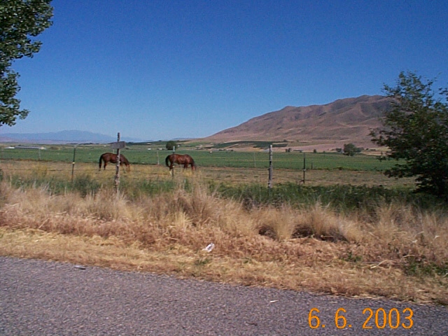
Total Photos: 1
|
| |
|
|
| Property Address: |
|
| Mailing Address: 74 W 800 S SANTAQUIN, UT 84655 |
|
| Acreage: 8.00032954 |
|
| Last Document:
58504-2000
|
|
| Subdivision Map Filing |
|
| Taxing Description:
COM S 3.07 FT & W 171.13 FT FR S 1/4 COR. SEC. 21, T9S, R1E, SLB&M.; S 88 DEG 58' 16" W 440 FT; N 0 DEG 5' 16" W 792.15 FT; N 88 DEG 58' 16" E 439.99 FT; S 0 DEG 5' 19" E 792.15 FT TO BEG. AREA 8.000 AC.
*Taxing description NOT FOR LEGAL DOCUMENTS
|
|
- Owner Names
- Value History
- Tax History
- Location
- Photos
- Documents
- Aerial Image
| |
----- Real Estate Values ----- |
---Improvements--- |
---Greenbelt--- |
Total |
| Year |
Com |
Res |
Agr |
Tot |
Com |
Res |
Agr |
Tot |
Land |
Homesite |
Tot |
Market Value |
| 2007 |
$0 |
$0 |
$38,500 |
$38,500 |
$0 |
$0 |
$0 |
$0 |
$3,160 |
$0 |
$3,160 |
$38,500 |
| 2006 |
$0 |
$0 |
$38,520 |
$38,520 |
$0 |
$0 |
$0 |
$0 |
$3,080 |
$0 |
$3,080 |
$38,520 |
| 2005 |
$0 |
$0 |
$38,520 |
$38,520 |
$0 |
$0 |
$0 |
$0 |
$3,080 |
$0 |
$3,080 |
$38,520 |
| 2004 |
$0 |
$0 |
$38,520 |
$38,520 |
$0 |
$0 |
$0 |
$0 |
$3,120 |
$0 |
$3,120 |
$38,520 |
| 2003 |
$0 |
$0 |
$38,520 |
$38,520 |
$0 |
$0 |
$0 |
$0 |
$2,600 |
$0 |
$2,600 |
$38,520 |
| 2002 |
$0 |
$0 |
$38,520 |
$38,520 |
$0 |
$0 |
$0 |
$0 |
$2,600 |
$0 |
$2,600 |
$38,520 |
| 2001 |
$0 |
$0 |
$38,520 |
$38,520 |
$0 |
$0 |
$0 |
$0 |
$2,400 |
$0 |
$2,400 |
$38,520 |
| Year |
General Taxes |
Adjustments |
Net Taxes |
Fees |
Payments |
Tax Balance* |
Balance Due |
Tax District |
| 2007 |
$32.98 |
$0.00 |
$32.98 |
$0.00 |
|
$0.00
|
$0.00 |
200 - GENOLA CITY |
| 2006 |
$34.98 |
$0.00 |
$34.98 |
$0.00 |
|
$0.00
|
$0.00 |
200 - GENOLA CITY |
| 2005 |
$37.13 |
$0.00 |
$37.13 |
$0.00 |
|
$0.00
|
$0.00 |
200 - GENOLA CITY |
| 2004 |
$37.74 |
$0.00 |
$37.74 |
$0.00 |
|
$0.00
|
$0.00 |
200 - GENOLA CITY |
| 2003 |
$28.40 |
$0.00 |
$28.40 |
$0.00 |
|
$0.00
|
$0.00 |
200 - GENOLA CITY |
| 2002 |
$27.64 |
$0.00 |
$27.64 |
$0.00 |
|
$0.00
|
$0.00 |
200 - GENOLA CITY |
| 2001 |
$25.73 |
$0.00 |
$25.73 |
$0.00 |
|
$0.00
|
$0.00 |
200 - GENOLA CITY |
* Note: Original tax amount (Does not include applicable interest and/or fees).
| Entry # |
Date |
Recorded |
Type |
Party1 (Grantor) |
Party2 (Grantee) |
| 110403-2007 |
06/14/2007 |
07/31/2007 |
S PLAT |
LARSON, MARTIN B & BELINDA I (ET AL) |
GENOLA MEADOWS PLAT A |
| 113-2007 |
12/29/2006 |
01/02/2007 |
WD |
EWELL, CAROLEE K |
TOWN OF GENOLA |
| 63959-2006 |
05/05/2006 |
05/23/2006 |
QCD |
EWELL, BRIAN E |
EWELL, CAROLEE K |
| 54135-2006 |
04/28/2006 |
05/03/2006 |
CAN ND |
LUNDBERG, SCOTT TEE |
DAVIS, ANNETTE PIERCE |
| 111577-2005 |
08/25/2005 |
10/03/2005 |
RSUBTEE |
WASHINGTON MUTUAL BANK (ET AL) |
EWELL, BRIAN E & CAROLEE K |
| 15726-2005 |
02/15/2005 |
02/15/2005 |
RESOL |
UTAH COUNTY |
WHOM OF INTEREST |
| 142169-2003 |
08/28/2003 |
08/28/2003 |
FARM |
EWELL, BRIAN E & CAROLEE K |
WHOM OF INTEREST |
| 58505-2000 |
07/19/2000 |
07/27/2000 |
D TR |
EWELL, BRIAN E & CAROLEE K |
WASHINGTON MUTUAL BANK |
| 58504-2000 |
07/19/2000 |
07/27/2000 |
WD |
WALLIN, RALPH JR & DIANE TEE (ET AL) |
EWELL, BRIAN E & CAROLEE K |
Main Menu Comments or Concerns on Value/Appraisal - Assessor's Office
Documents/Owner/Parcel information - Recorder's Office
Address Change for Tax Notice
This page was created on 8/5/2024 9:20:19 AM |