Property Information
mobile view
| Serial Number: 34:101:0001 |
Serial Life: 1987... |
|
|
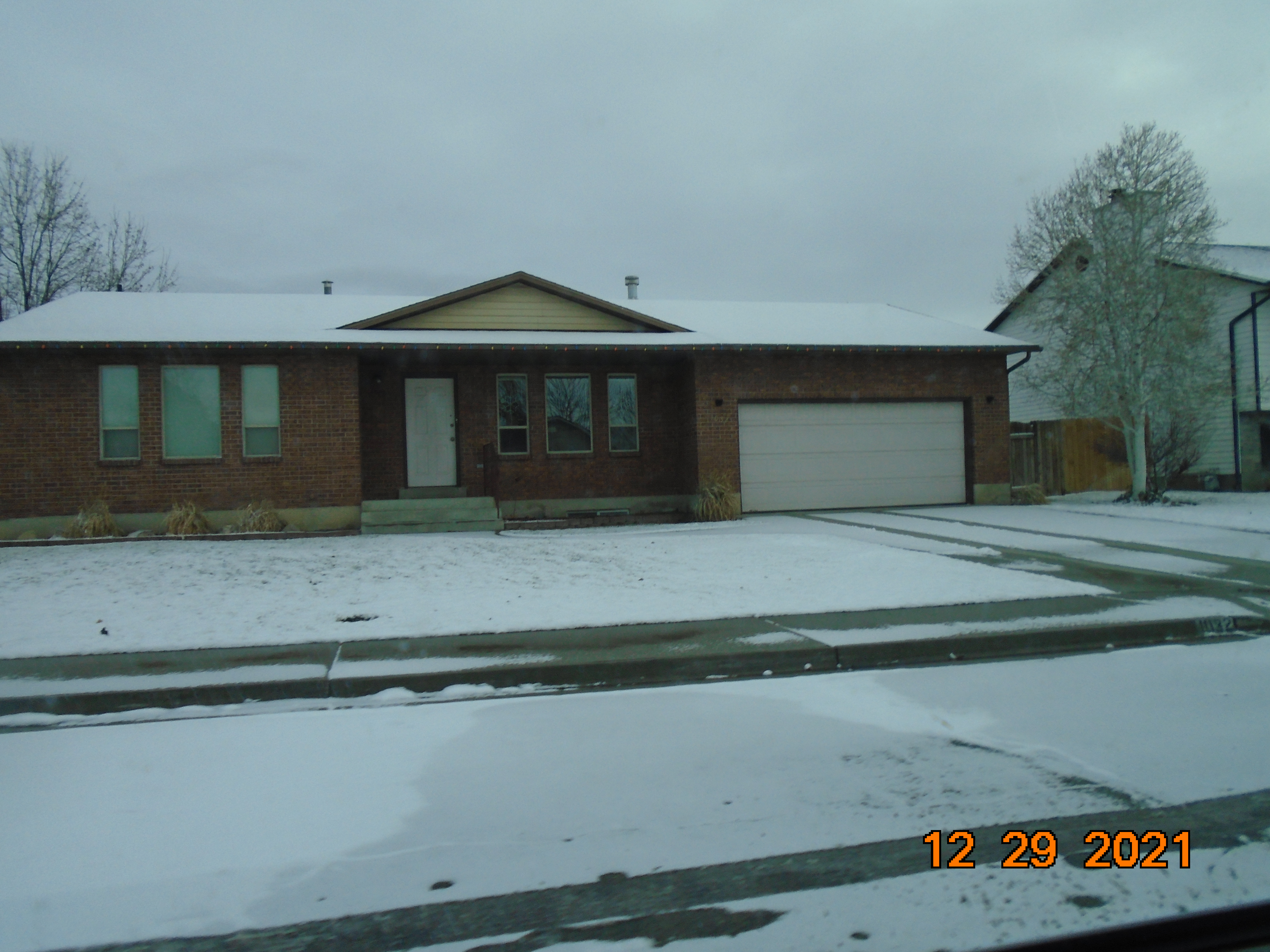 Total Photos: 2
|
| |
|
|
| Property Address: 1032 N 500 WEST - OREM |
|
| Mailing Address: 1032 N 500 W OREM, UT 84057-3087 |
|
| Acreage: 0.2 |
|
| Last Document:
6215-1999
|
|
| Subdivision Map Filing |
|
| Taxing Description:
LOT 1, PLAT A, ARLINGTON PARK SUB AREA 0.199 AC.
*Taxing description NOT FOR LEGAL DOCUMENTS
|
|
- Owner Names
- Value History
- Tax History
- Location
- Photos
- Documents
- Aerial Image
| 2011... |
|
BROWN, GARY REED |
|
| 2011... |
|
BROWN, VONDA GAY |
|
| 2000-2010 |
|
BROWN, GARY REED |
|
| 2000-2010 |
|
BROWN, VONDA GAY |
|
| 2000NV |
|
BROWN, GARY REED |
|
| 2000NV |
|
BROWN, VONDA GAY |
|
| 1999 |
|
BROWN, GARY REED |
|
| 1999 |
|
BROWN, VONDA GAY |
|
| 1987-1998 |
|
BROWN, GARY R |
|
| 1987-1998 |
|
BROWN, VONDA B |
|
| 1987NV |
|
BROWN, GARY R |
|
| 1987NV |
|
SHEA DEVELOPMENT |
|
| 1987NV |
|
SHEA, MARK |
|
| 1987NV |
|
WELLS FARGO MORTGAGE COMPANY |
|
| |
----- Real Estate Values ----- |
---Improvements--- |
---Greenbelt--- |
Total |
| Year |
Com |
Res |
Agr |
Tot |
Com |
Res |
Agr |
Tot |
Land |
Homesite |
Tot |
Market Value |
| 2024 |
$0 |
$187,000 |
$0 |
$187,000 |
$0 |
$233,800 |
$0 |
$233,800 |
$0 |
$0 |
$0 |
$420,800 |
| 2023 |
$0 |
$187,000 |
$0 |
$187,000 |
$0 |
$231,600 |
$0 |
$231,600 |
$0 |
$0 |
$0 |
$418,600 |
| 2022 |
$0 |
$199,400 |
$0 |
$199,400 |
$0 |
$251,000 |
$0 |
$251,000 |
$0 |
$0 |
$0 |
$450,400 |
| 2021 |
$0 |
$153,400 |
$0 |
$153,400 |
$0 |
$196,100 |
$0 |
$196,100 |
$0 |
$0 |
$0 |
$349,500 |
| 2020 |
$0 |
$122,700 |
$0 |
$122,700 |
$0 |
$192,300 |
$0 |
$192,300 |
$0 |
$0 |
$0 |
$315,000 |
| 2019 |
$0 |
$122,700 |
$0 |
$122,700 |
$0 |
$167,800 |
$0 |
$167,800 |
$0 |
$0 |
$0 |
$290,500 |
| 2018 |
$0 |
$112,100 |
$0 |
$112,100 |
$0 |
$150,400 |
$0 |
$150,400 |
$0 |
$0 |
$0 |
$262,500 |
| 2017 |
$0 |
$105,100 |
$0 |
$105,100 |
$0 |
$130,800 |
$0 |
$130,800 |
$0 |
$0 |
$0 |
$235,900 |
| 2016 |
$0 |
$84,100 |
$0 |
$84,100 |
$0 |
$145,300 |
$0 |
$145,300 |
$0 |
$0 |
$0 |
$229,400 |
| 2015 |
$0 |
$73,600 |
$0 |
$73,600 |
$0 |
$128,400 |
$0 |
$128,400 |
$0 |
$0 |
$0 |
$202,000 |
| 2014 |
$0 |
$68,000 |
$0 |
$68,000 |
$0 |
$125,900 |
$0 |
$125,900 |
$0 |
$0 |
$0 |
$193,900 |
| 2013 |
$0 |
$44,300 |
$0 |
$44,300 |
$0 |
$125,900 |
$0 |
$125,900 |
$0 |
$0 |
$0 |
$170,200 |
| 2012 |
$0 |
$43,700 |
$0 |
$43,700 |
$0 |
$111,400 |
$0 |
$111,400 |
$0 |
$0 |
$0 |
$155,100 |
| 2011 |
$0 |
$46,500 |
$0 |
$46,500 |
$0 |
$113,400 |
$0 |
$113,400 |
$0 |
$0 |
$0 |
$159,900 |
| 2010 |
$0 |
$57,035 |
$0 |
$57,035 |
$0 |
$112,847 |
$0 |
$112,847 |
$0 |
$0 |
$0 |
$169,882 |
| 2009 |
$0 |
$65,700 |
$0 |
$65,700 |
$0 |
$109,400 |
$0 |
$109,400 |
$0 |
$0 |
$0 |
$175,100 |
| 2008 |
$0 |
$86,400 |
$0 |
$86,400 |
$0 |
$105,800 |
$0 |
$105,800 |
$0 |
$0 |
$0 |
$192,200 |
| 2007 |
$0 |
$90,000 |
$0 |
$90,000 |
$0 |
$110,200 |
$0 |
$110,200 |
$0 |
$0 |
$0 |
$200,200 |
| 2006 |
$0 |
$44,600 |
$0 |
$44,600 |
$0 |
$112,500 |
$0 |
$112,500 |
$0 |
$0 |
$0 |
$157,100 |
| 2005 |
$0 |
$42,489 |
$0 |
$42,489 |
$0 |
$107,180 |
$0 |
$107,180 |
$0 |
$0 |
$0 |
$149,669 |
| 2004 |
$0 |
$42,489 |
$0 |
$42,489 |
$0 |
$107,180 |
$0 |
$107,180 |
$0 |
$0 |
$0 |
$149,669 |
| 2003 |
$0 |
$42,489 |
$0 |
$42,489 |
$0 |
$107,180 |
$0 |
$107,180 |
$0 |
$0 |
$0 |
$149,669 |
| 2002 |
$0 |
$42,489 |
$0 |
$42,489 |
$0 |
$107,180 |
$0 |
$107,180 |
$0 |
$0 |
$0 |
$149,669 |
| 2001 |
$0 |
$42,489 |
$0 |
$42,489 |
$0 |
$107,180 |
$0 |
$107,180 |
$0 |
$0 |
$0 |
$149,669 |
| 2000 |
$0 |
$39,709 |
$0 |
$39,709 |
$0 |
$98,285 |
$0 |
$98,285 |
$0 |
$0 |
$0 |
$137,994 |
| 1999 |
$0 |
$37,111 |
$0 |
$37,111 |
$0 |
$91,855 |
$0 |
$91,855 |
$0 |
$0 |
$0 |
$128,966 |
| 1998 |
$0 |
$37,111 |
$0 |
$37,111 |
$0 |
$91,855 |
$0 |
$91,855 |
$0 |
$0 |
$0 |
$128,966 |
| 1997 |
$0 |
$37,111 |
$0 |
$37,111 |
$0 |
$91,855 |
$0 |
$91,855 |
$0 |
$0 |
$0 |
$128,966 |
| 1996 |
$0 |
$35,060 |
$0 |
$35,060 |
$0 |
$86,778 |
$0 |
$86,778 |
$0 |
$0 |
$0 |
$121,838 |
| 1995 |
$0 |
$31,873 |
$0 |
$31,873 |
$0 |
$86,778 |
$0 |
$86,778 |
$0 |
$0 |
$0 |
$118,651 |
| 1994 |
$0 |
$18,639 |
$0 |
$18,639 |
$0 |
$69,982 |
$0 |
$69,982 |
$0 |
$0 |
$0 |
$88,621 |
| 1993 |
$0 |
$18,639 |
$0 |
$18,639 |
$0 |
$69,982 |
$0 |
$69,982 |
$0 |
$0 |
$0 |
$88,621 |
| 1992 |
$0 |
$17,100 |
$0 |
$17,100 |
$0 |
$64,204 |
$0 |
$64,204 |
$0 |
$0 |
$0 |
$81,304 |
| 1991 |
$0 |
$15,000 |
$0 |
$15,000 |
$0 |
$51,015 |
$0 |
$51,015 |
$0 |
$0 |
$0 |
$66,015 |
| 1990 |
$0 |
$15,000 |
$0 |
$15,000 |
$0 |
$51,015 |
$0 |
$51,015 |
$0 |
$0 |
$0 |
$66,015 |
| 1989 |
$0 |
$15,000 |
$0 |
$15,000 |
$0 |
$51,015 |
$0 |
$51,015 |
$0 |
$0 |
$0 |
$66,015 |
| 1988 |
$0 |
$15,000 |
$0 |
$15,000 |
$0 |
$49,648 |
$0 |
$49,648 |
$0 |
$0 |
$0 |
$64,648 |
| 1987 |
$0 |
$15,000 |
$0 |
$15,000 |
$0 |
$51,092 |
$0 |
$51,092 |
$0 |
$0 |
$0 |
$66,092 |
| Year |
General Taxes |
Adjustments |
Net Taxes |
Fees |
Payments |
Tax Balance* |
Balance Due |
Tax District |
| 2025 |
$0.00 |
$0.00 |
$0.00 |
$0.00 |
|
$0.00
|
$0.00 |
090 - OREM CITY |
| 2024 |
$1,892.72 |
$0.00 |
$1,892.72 |
$0.00 |
|
$0.00
|
$0.00 |
090 - OREM CITY |
| 2023 |
$1,751.82 |
$0.00 |
$1,751.82 |
$0.00 |
|
$0.00
|
$0.00 |
090 - OREM CITY |
| 2022 |
$1,945.59 |
$0.00 |
$1,945.59 |
$0.00 |
|
$0.00
|
$0.00 |
090 - OREM CITY |
| 2021 |
$1,812.30 |
$0.00 |
$1,812.30 |
$0.00 |
|
$0.00
|
$0.00 |
090 - OREM CITY |
| 2020 |
$1,661.99 |
$0.00 |
$1,661.99 |
$0.00 |
|
$0.00
|
$0.00 |
090 - OREM CITY |
| 2019 |
$1,473.92 |
$0.00 |
$1,473.92 |
$0.00 |
|
$0.00
|
$0.00 |
090 - OREM CITY |
| 2018 |
$1,393.94 |
$0.00 |
$1,393.94 |
$0.00 |
|
$0.00
|
$0.00 |
090 - OREM CITY |
| 2017 |
$1,286.16 |
$0.00 |
$1,286.16 |
$0.00 |
|
$0.00
|
$0.00 |
090 - OREM CITY |
| 2016 |
$1,356.33 |
$0.00 |
$1,356.33 |
$0.00 |
|
$0.00
|
$0.00 |
090 - OREM CITY |
| 2015 |
$1,262.87 |
$0.00 |
$1,262.87 |
$0.00 |
|
$0.00
|
$0.00 |
090 - OREM CITY |
| 2014 |
$1,217.78 |
$0.00 |
$1,217.78 |
$0.00 |
|
$0.00
|
$0.00 |
090 - OREM CITY |
| 2013 |
$1,152.71 |
$0.00 |
$1,152.71 |
$0.00 |
|
$0.00
|
$0.00 |
090 - OREM CITY |
| 2012 |
$1,072.11 |
$0.00 |
$1,072.11 |
$0.00 |
|
$0.00
|
$0.00 |
090 - OREM CITY |
| 2011 |
$1,100.02 |
$0.00 |
$1,100.02 |
$0.00 |
|
$0.00
|
$0.00 |
090 - OREM CITY |
| 2010 |
$1,094.12 |
$0.00 |
$1,094.12 |
$0.00 |
|
$0.00
|
$0.00 |
090 - OREM CITY |
| 2009 |
$1,045.39 |
$0.00 |
$1,045.39 |
$0.00 |
|
$0.00
|
$0.00 |
090 - OREM CITY |
| 2008 |
$1,063.34 |
$0.00 |
$1,063.34 |
$0.00 |
|
$0.00
|
$0.00 |
090 - OREM CITY |
| 2007 |
$1,094.93 |
$0.00 |
$1,094.93 |
$0.00 |
|
$0.00
|
$0.00 |
090 - OREM CITY |
| 2006 |
$914.94 |
$0.00 |
$914.94 |
$0.00 |
|
$0.00
|
$0.00 |
090 - OREM CITY |
| 2005 |
$983.86 |
$0.00 |
$983.86 |
$0.00 |
|
$0.00
|
$0.00 |
090 - OREM CITY |
| 2004 |
$966.41 |
$0.00 |
$966.41 |
$0.00 |
|
$0.00
|
$0.00 |
090 - OREM CITY |
| 2003 |
$937.77 |
$0.00 |
$937.77 |
$0.00 |
|
$0.00
|
$0.00 |
090 - OREM CITY |
| 2002 |
$857.01 |
$0.00 |
$857.01 |
$0.00 |
|
$0.00
|
$0.00 |
090 - OREM CITY |
| 2001 |
$848.78 |
$0.00 |
$848.78 |
$0.00 |
|
$0.00
|
$0.00 |
090 - OREM CITY |
| 2000 |
$809.14 |
$0.00 |
$809.14 |
$0.00 |
|
$0.00
|
$0.00 |
090 - OREM CITY |
| 1999 |
$778.54 |
$0.00 |
$778.54 |
$0.00 |
|
$0.00
|
$0.00 |
090 - OREM CITY |
| 1998 |
$735.13 |
$0.00 |
$735.13 |
$0.00 |
|
$0.00
|
$0.00 |
090 - OREM CITY |
| 1997 |
$732.08 |
$0.00 |
$732.08 |
$0.00 |
|
$0.00
|
$0.00 |
090 - OREM CITY |
| 1996 |
$631.85 |
$0.00 |
$631.85 |
$0.00 |
|
$0.00
|
$0.00 |
090 - OREM CITY |
| 1995 |
$696.30 |
$0.00 |
$696.30 |
$0.00 |
|
$0.00
|
$0.00 |
090 - OREM CITY |
| 1994 |
$828.62 |
$0.00 |
$828.62 |
$0.00 |
|
$0.00
|
$0.00 |
090 - OREM CITY |
| 1993 |
$733.31 |
$0.00 |
$733.31 |
$0.00 |
|
$0.00
|
$0.00 |
090 - OREM CITY |
| 1992 |
$678.30 |
$0.00 |
$678.30 |
$0.00 |
|
$0.00
|
$0.00 |
090 - OREM CITY |
| 1991 |
$575.82 |
$0.00 |
$575.82 |
$0.00 |
|
$0.00
|
$0.00 |
090 - OREM CITY |
| 1990 |
$553.54 |
$0.00 |
$553.54 |
$0.00 |
|
$0.00
|
$0.00 |
090 - OREM CITY |
| 1989 |
$564.15 |
$0.00 |
$564.15 |
$0.00 |
|
$0.00
|
$0.00 |
090 - OREM CITY |
| 1988 |
$551.15 |
$0.00 |
$551.15 |
$0.00 |
|
$0.00
|
$0.00 |
090 - OREM CITY |
| 1987 |
$554.14 |
$0.00 |
$554.14 |
$0.00 |
|
$0.00
|
$0.00 |
090 - OREM CITY |
* Note: Original tax amount (Does not include applicable interest and/or fees).
| Entry # |
Date |
Recorded |
Type |
Party1 (Grantor) |
Party2 (Grantee) |
| 80396-2009 |
07/22/2009 |
07/22/2009 |
REC |
UTAH COMMUNITY CREDIT UNION TEE |
BROWN, GARY R & VONDA G |
| 197989-2003 |
12/02/2003 |
12/18/2003 |
RSUBTEE |
CHASE MANHATTAN MORTGAGE CORPORATION (ET AL) |
BROWN, GARY REED & VONDA GAY |
| 174307-2003 |
10/27/2003 |
10/29/2003 |
D TR |
BROWN, GARY R & VONDA G |
UTAH COMMUNITY CREDIT UNION |
| 174306-2003 |
10/27/2003 |
10/29/2003 |
WD |
BROWN, GARY REED & VONDA GAY TEE (ET AL) |
BROWN, GARY R |
| 121062-1999 |
06/02/1999 |
11/17/1999 |
AS |
FIRSTAR BANK FKA (ET AL) |
CHASE MANHATTAN MORTGAGE CORPORATION |
| 40862-1999 |
04/01/1999 |
04/08/1999 |
REC |
LUNDBERG, J SCOTT TEE |
BROWN, GARY R & VONDA B |
| 40861-1999 |
03/22/1999 |
04/08/1999 |
SUB TEE |
STAR BANK SUC TO (ET AL) |
LUNDBERG, SCOTT SUCTEE |
| 6215-1999 |
01/13/1999 |
01/20/1999 |
QCD |
BROWN, GARY REED & VONDA GAY |
BROWN, GARY REED & VONDA GAY TEE |
| 6214-1999 |
01/14/1999 |
01/20/1999 |
D TR |
BROWN, GARY REED & VONDA GAY |
STAR BANK |
| 6213-1999 |
01/13/1999 |
01/20/1999 |
QCD |
BROWN, GARY REED & VONDA GAY TEE (ET AL) |
BROWN, GARY REED & VONDA GAY |
| 43159-1998 |
04/29/1998 |
05/01/1998 |
SP WD |
BROWN, GARY R & VONDA B |
BROWN, GARY REED & VONDA GAY TEE |
| 33119-1998 |
11/05/1997 |
04/06/1998 |
AS |
WESTERN MORTGAGE LOAN CORPORATION |
GREAT FINANCIAL BANK |
| 23872-1998 |
03/05/1998 |
03/13/1998 |
SP WD |
BROWN, GARY R & VONDA B |
BROWN, GARY REED & VONDA GAY |
| 70164-1992 |
11/14/1992 |
12/22/1992 |
RSUBTEE |
CENLAR FEDERAL SAVINGS BANK (ET AL) |
BROWN, GARY R & VONDA B |
| 51326-1992 |
09/04/1992 |
09/29/1992 |
AS |
AIM MORTGAGE INC |
WESTERN MORTGAGE LOAN CORPORATION |
| 51325-1992 |
09/04/1992 |
09/29/1992 |
D TR |
BROWN, GARY R & VONDA B |
AIM MORTGAGE INC |
| 48246-1992 |
09/14/1992 |
09/15/1992 |
R LP |
A & Y BUILDING SUPPLY INC |
BROWN, GARY R & VONDA B (ET AL) |
| 46329-1992 |
09/03/1992 |
09/03/1992 |
R LN |
YORK, JOHN |
WHOM OF INTEREST |
| 46244-1987 |
11/13/1987 |
12/28/1987 |
AS |
ICA MORTGAGE CORPORATION |
CENLAR FEDERAL SAVINGS BANK |
| 13201-1987 |
12/23/1986 |
04/07/1987 |
REC |
FAR WEST BANK TEE |
SHEA, MARK DBA (ET AL) |
| 2895-1987 |
01/10/1987 |
01/26/1987 |
LP |
BROWN, GARY R & VONDA B (ET AL) |
A & Y BUILDING SUPPLY INC |
| 2488-1987 |
11/17/1986 |
01/21/1987 |
O |
KARDER (SIC), OMAR (ET AL) |
KADER, KAMEL |
| 39325-1986 |
11/13/1986 |
11/17/1986 |
REC |
ASSOCIATED TITLE COMPANY TEE |
SHEA, MARK DBA (ET AL) |
| 35159-1986 |
04/28/1986 |
10/15/1986 |
W FARM |
UTAH COUNTY ASSESSOR |
WHOM OF INTEREST |
| 33814-1986 |
08/05/1986 |
10/06/1986 |
REC |
FAR WEST BANK TEE |
SHEA, MARK DBA (ET AL) |
| 32444-1986 |
09/25/1986 |
09/25/1986 |
N LN |
BROWN, GARY R & VONDA B |
A & Y BUILDING SUPPLY INC |
| 31297-1986 |
09/19/1986 |
09/18/1986 |
QCD |
OSCO DEVELOPMENT (ET AL) |
KADER TRUST |
| 29804-1986 |
08/05/1986 |
09/08/1986 |
REC |
FAR WEST BANK TEE |
BROWN, GARY R (ET AL) |
| 29062-1986 |
09/03/1986 |
09/03/1986 |
NI |
SHEA, MARK |
OSCO DEVELOPMENT |
| 24335-1986 |
07/22/1986 |
07/30/1986 |
AS |
FAR WEST BANK |
ICA MORTGAGE |
| 23417-1986 |
07/15/1986 |
07/22/1986 |
TR D |
BROWN, GARY R & VONDA B |
FAR WEST BANK |
| 23416-1986 |
07/15/1986 |
07/22/1986 |
WD |
BROWN, GARY R (ET AL) |
BROWN, GARY R & VONDA B |
| 14513-1986 |
05/08/1986 |
05/13/1986 |
P REC |
FAR WEST BANK TEE |
SHEA, MARK DBA (ET AL) |
| 14161-1986 |
05/08/1986 |
05/09/1986 |
P REC |
ASSOCIATED TITLE COMPANY TEE |
SHEA, MARK DBA (ET AL) |
| 13879-1986 |
05/05/1986 |
05/07/1986 |
TR D |
BROWN, GARY R (ET AL) |
FAR WEST BANK |
| 13878-1986 |
05/05/1986 |
05/07/1986 |
WD |
SHEA, MARK DBA (ET AL) |
BROWN, GARY R (ET AL) |
| 12140-1986 |
04/16/1986 |
04/23/1986 |
TR D |
SHEA, MARK DBA (ET AL) |
KADER, GHAZY M & AISHE TEE (ET AL) |
| 12139-1986 |
12/26/1985 |
04/23/1986 |
S PLAT |
SHEA, MARK |
ARLINGTON PARK PLAT A |
Main Menu Comments or Concerns on Value/Appraisal - Assessor's Office
Documents/Owner/Parcel information - Recorder's Office
Address Change for Tax Notice
This page was created on 12/19/2024 1:52:29 PM |
