Property Information
mobile view
| Serial Number: 34:607:0009 |
Serial Life: 2018... |
|
|
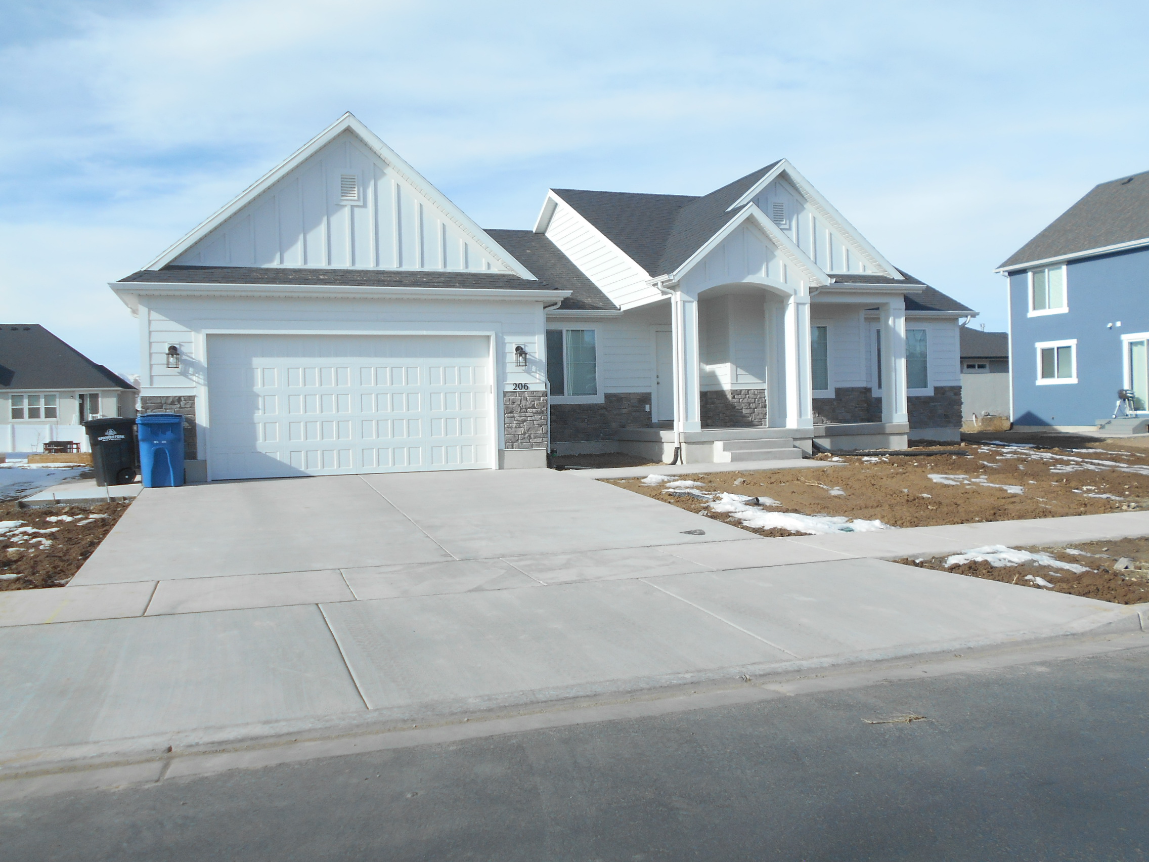 Total Photos: 3
|
| |
|
|
| Property Address: 206 S 1230 WEST - SPANISH FORK |
|
| Mailing Address: 206 S 1230 W SPANISH FORK, UT 84660 |
|
| Acreage: 0.266773 |
|
| Last Document:
84911-2017
|
|
| Subdivision Map Filing |
|
| Taxing Description:
LOT 9, PLAT A, ANTHEM PARK SUB AREA 0.267 AC.
*Taxing description NOT FOR LEGAL DOCUMENTS
|
|
- Owner Names
- Value History
- Tax History
- Location
- Photos
- Documents
- Aerial Image
| |
----- Real Estate Values ----- |
---Improvements--- |
---Greenbelt--- |
Total |
| Year |
Com |
Res |
Agr |
Tot |
Com |
Res |
Agr |
Tot |
Land |
Homesite |
Tot |
Market Value |
| 2024 |
$0 |
$216,400 |
$0 |
$216,400 |
$0 |
$409,500 |
$0 |
$409,500 |
$0 |
$0 |
$0 |
$625,900 |
| 2023 |
$0 |
$216,400 |
$0 |
$216,400 |
$0 |
$424,600 |
$0 |
$424,600 |
$0 |
$0 |
$0 |
$641,000 |
| 2022 |
$0 |
$230,700 |
$0 |
$230,700 |
$0 |
$371,300 |
$0 |
$371,300 |
$0 |
$0 |
$0 |
$602,000 |
| 2021 |
$0 |
$135,700 |
$0 |
$135,700 |
$0 |
$259,600 |
$0 |
$259,600 |
$0 |
$0 |
$0 |
$395,300 |
| 2020 |
$0 |
$123,400 |
$0 |
$123,400 |
$0 |
$259,500 |
$0 |
$259,500 |
$0 |
$0 |
$0 |
$382,900 |
| 2019 |
$0 |
$115,900 |
$0 |
$115,900 |
$0 |
$0 |
$0 |
$0 |
$0 |
$0 |
$0 |
$115,900 |
| 2018 |
$0 |
$86,000 |
$0 |
$86,000 |
$0 |
$0 |
$0 |
$0 |
$0 |
$0 |
$0 |
$86,000 |
| Year |
General Taxes |
Adjustments |
Net Taxes |
Fees |
Payments |
Tax Balance* |
Balance Due |
Tax District |
| 2025 |
$0.00 |
$0.00 |
$0.00 |
$0.00 |
|
$0.00
|
$0.00 |
150 - SPANISH FORK CITY |
| 2024 |
$3,339.86 |
$0.00 |
$3,339.86 |
$0.00 |
|
|
Click for Payoff
|
150 - SPANISH FORK CITY |
| 2023 |
$3,416.56 |
$0.00 |
$3,416.56 |
$0.00 |
|
$0.00
|
$0.00 |
150 - SPANISH FORK CITY |
| 2022 |
$3,271.60 |
$0.00 |
$3,271.60 |
$0.00 |
|
$0.00
|
$0.00 |
150 - SPANISH FORK CITY |
| 2021 |
$2,441.57 |
$0.00 |
$2,441.57 |
$0.00 |
|
$0.00
|
$0.00 |
150 - SPANISH FORK CITY |
| 2020 |
$2,432.58 |
$0.00 |
$2,432.58 |
$0.00 |
|
$0.00
|
$0.00 |
150 - SPANISH FORK CITY |
| 2019 |
$1,272.47 |
$0.00 |
$1,272.47 |
$0.00 |
|
$0.00
|
$0.00 |
150 - SPANISH FORK CITY |
| 2018 |
$976.79 |
$0.00 |
$976.79 |
$0.00 |
|
$0.00
|
$0.00 |
150 - SPANISH FORK CITY |
* Note: Original tax amount (Does not include applicable interest and/or fees).
| Entry # |
Date |
Recorded |
Type |
Party1 (Grantor) |
Party2 (Grantee) |
| 25541-2024 |
04/16/2024 |
04/22/2024 |
D TR |
BLUTH, LOGAN & AUDREY |
UTAH COMMUNITY FEDERAL CREDIT UNION |
| 17049-2021 |
01/19/2021 |
01/28/2021 |
RSUBTEE |
MORTGAGE ELECTRONIC REGISTRATION SYSTEMS INC (ET AL) |
BLUTH, LOGAN & AUDREY |
| 205543-2020 |
12/17/2020 |
12/22/2020 |
D TR |
BLUTH, LOGAN & AUDREY |
QUICKEN LOANS LLC |
| 77065-2020 |
06/04/2020 |
06/05/2020 |
D TR |
BLUTH, LOGAN & AUDREY |
QUICKEN LOANS INC |
| 77064-2020 |
06/04/2020 |
06/05/2020 |
WD |
ARIVE HOMES LLC |
BLUTH, LOGAN & AUDREY |
| 15187-2020 |
01/27/2020 |
02/05/2020 |
REC |
UTAH COMMUNITY FEDERAL CREDIT UNION TEE |
ARIVE HOMES LLC |
| 59176-2019 |
06/26/2019 |
06/27/2019 |
D TR |
ARIVE HOMES LLC BY (ET AL) |
UTAH COMMUNITY FEDERAL CREDIT UNION |
| 59175-2019 |
06/25/2019 |
06/27/2019 |
WD |
DIAMOND CREEK DEVELOPMENT LLC |
ARIVE HOMES LLC |
| 101414-2018 |
10/05/2018 |
10/23/2018 |
REC |
CENTRAL BANK TEE |
DIAMOND CREEK DEVELOPMENT LLC |
| 84911-2017 |
03/15/2017 |
08/30/2017 |
S PLAT |
DIAMOND CREEK DEVELOPMENT LLC |
ANTHEM PARK PLAT A |
Main Menu Comments or Concerns on Value/Appraisal - Assessor's Office
Documents/Owner/Parcel information - Recorder's Office
Address Change for Tax Notice
This page was created on 10/9/2024 11:36:46 PM |

