Property Information
mobile view
| Serial Number: 35:134:0006 |
Serial Life: 1990... |
|
|
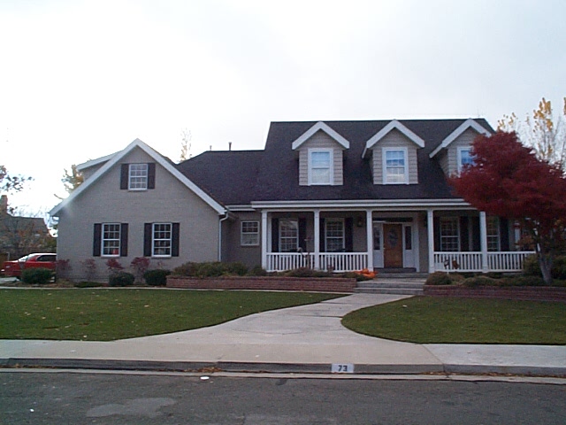 Total Photos: 2
|
| |
|
|
| Property Address: 73 W 620 SOUTH - OREM |
|
| Mailing Address: 73 W 620 S OREM, UT 84058-3124 |
|
| Acreage: 0.4 |
|
| Last Document:
7070-1990
|
|
| Subdivision Map Filing |
|
| Taxing Description:
LOT 6, PLAT B, BRECKENRIDGE SUBDIVISION. AREA .40 AC.
*Taxing description NOT FOR LEGAL DOCUMENTS
|
|
- Owner Names
- Value History
- Tax History
- Location
- Photos
- Documents
- Aerial Image
| 2021... |
|
DEAN, JENNIFER |
|
| 2017-2020 |
|
JOHN AND FRANCINE MILLER FAMILY TRUST JAN 10 2013 |
|
| 2017-2020 |
|
MILLER, FRANCINE C |
|
| 2017-2020 |
|
MILLER, JOHN S |
|
| 2017NV |
|
MILLER, JOHN L |
|
| 2017NV |
|
MILLER, JOHN S |
|
| 2014-2016 |
|
MILELR (SIC), FRANCINE C |
|
| 2014-2016 |
|
MILLER, JOHN S |
|
| 2004-2013 |
|
MILLER, FRACINE C |
|
| 2004-2013 |
|
MILLER, JOHN S |
|
| 2004NV |
|
MILLER, JOHN S |
|
| 2003 |
|
BURR, BRYAN JAMES |
|
| 2003 |
|
BURR, NATALIE D |
|
| 1997-2002 |
|
BURR, NATALIE D |
|
| 1997NV |
|
BURR, BRYAN J |
|
| 1997NV |
|
BURR, NATALIE D |
|
| 1995-1996 |
|
BURR, NATALIE D |
|
| 1994 |
|
BURR, BRYAN J |
|
| 1994 |
|
BURR, NATALIE D |
|
| 1991-1993 |
|
BANKHEAD, JANN M |
|
| 1990 |
|
BANKHEAD, JANN M |
|
| 1990 |
|
BANKHEAD, MICHELLE O |
|
| 1990 |
|
BRINKERHOFF, ALYCE A |
|
| |
----- Real Estate Values ----- |
---Improvements--- |
---Greenbelt--- |
Total |
| Year |
Com |
Res |
Agr |
Tot |
Com |
Res |
Agr |
Tot |
Land |
Homesite |
Tot |
Market Value |
| 2024 |
$0 |
$269,400 |
$0 |
$269,400 |
$0 |
$771,800 |
$0 |
$771,800 |
$0 |
$0 |
$0 |
$1,041,200 |
| 2023 |
$0 |
$269,400 |
$0 |
$269,400 |
$0 |
$815,300 |
$0 |
$815,300 |
$0 |
$0 |
$0 |
$1,084,700 |
| 2022 |
$0 |
$287,200 |
$0 |
$287,200 |
$0 |
$734,900 |
$0 |
$734,900 |
$0 |
$0 |
$0 |
$1,022,100 |
| 2021 |
$0 |
$220,900 |
$0 |
$220,900 |
$0 |
$602,400 |
$0 |
$602,400 |
$0 |
$0 |
$0 |
$823,300 |
| 2020 |
$0 |
$192,100 |
$0 |
$192,100 |
$0 |
$573,700 |
$0 |
$573,700 |
$0 |
$0 |
$0 |
$765,800 |
| 2019 |
$0 |
$192,100 |
$0 |
$192,100 |
$0 |
$532,600 |
$0 |
$532,600 |
$0 |
$0 |
$0 |
$724,700 |
| 2018 |
$0 |
$151,200 |
$0 |
$151,200 |
$0 |
$509,900 |
$0 |
$509,900 |
$0 |
$0 |
$0 |
$661,100 |
| 2017 |
$0 |
$130,800 |
$0 |
$130,800 |
$0 |
$503,300 |
$0 |
$503,300 |
$0 |
$0 |
$0 |
$634,100 |
| 2016 |
$0 |
$122,600 |
$0 |
$122,600 |
$0 |
$503,300 |
$0 |
$503,300 |
$0 |
$0 |
$0 |
$625,900 |
| 2015 |
$0 |
$122,600 |
$0 |
$122,600 |
$0 |
$503,300 |
$0 |
$503,300 |
$0 |
$0 |
$0 |
$625,900 |
| 2014 |
$0 |
$110,400 |
$0 |
$110,400 |
$0 |
$440,600 |
$0 |
$440,600 |
$0 |
$0 |
$0 |
$551,000 |
| 2013 |
$0 |
$102,600 |
$0 |
$102,600 |
$0 |
$440,600 |
$0 |
$440,600 |
$0 |
$0 |
$0 |
$543,200 |
| 2012 |
$0 |
$95,800 |
$0 |
$95,800 |
$0 |
$396,900 |
$0 |
$396,900 |
$0 |
$0 |
$0 |
$492,700 |
| 2011 |
$0 |
$110,000 |
$0 |
$110,000 |
$0 |
$387,700 |
$0 |
$387,700 |
$0 |
$0 |
$0 |
$497,700 |
| 2010 |
$0 |
$107,600 |
$0 |
$107,600 |
$0 |
$424,880 |
$0 |
$424,880 |
$0 |
$0 |
$0 |
$532,480 |
| 2009 |
$0 |
$107,600 |
$0 |
$107,600 |
$0 |
$452,900 |
$0 |
$452,900 |
$0 |
$0 |
$0 |
$560,500 |
| 2008 |
$0 |
$107,600 |
$0 |
$107,600 |
$0 |
$611,000 |
$0 |
$611,000 |
$0 |
$0 |
$0 |
$718,600 |
| 2007 |
$0 |
$112,100 |
$0 |
$112,100 |
$0 |
$636,500 |
$0 |
$636,500 |
$0 |
$0 |
$0 |
$748,600 |
| 2006 |
$0 |
$76,500 |
$0 |
$76,500 |
$0 |
$440,200 |
$0 |
$440,200 |
$0 |
$0 |
$0 |
$516,700 |
| 2005 |
$0 |
$72,894 |
$0 |
$72,894 |
$0 |
$419,257 |
$0 |
$419,257 |
$0 |
$0 |
$0 |
$492,151 |
| 2004 |
$0 |
$72,894 |
$0 |
$72,894 |
$0 |
$419,257 |
$0 |
$419,257 |
$0 |
$0 |
$0 |
$492,151 |
| 2003 |
$0 |
$72,894 |
$0 |
$72,894 |
$0 |
$419,257 |
$0 |
$419,257 |
$0 |
$0 |
$0 |
$492,151 |
| 2002 |
$0 |
$72,894 |
$0 |
$72,894 |
$0 |
$419,257 |
$0 |
$419,257 |
$0 |
$0 |
$0 |
$492,151 |
| 2001 |
$0 |
$72,894 |
$0 |
$72,894 |
$0 |
$419,257 |
$0 |
$419,257 |
$0 |
$0 |
$0 |
$492,151 |
| 2000 |
$0 |
$68,125 |
$0 |
$68,125 |
$0 |
$381,455 |
$0 |
$381,455 |
$0 |
$0 |
$0 |
$449,580 |
| 1999 |
$0 |
$63,668 |
$0 |
$63,668 |
$0 |
$356,500 |
$0 |
$356,500 |
$0 |
$0 |
$0 |
$420,168 |
| 1998 |
$0 |
$63,668 |
$0 |
$63,668 |
$0 |
$356,500 |
$0 |
$356,500 |
$0 |
$0 |
$0 |
$420,168 |
| 1997 |
$0 |
$63,668 |
$0 |
$63,668 |
$0 |
$356,500 |
$0 |
$356,500 |
$0 |
$0 |
$0 |
$420,168 |
| 1996 |
$0 |
$61,509 |
$0 |
$61,509 |
$0 |
$344,411 |
$0 |
$344,411 |
$0 |
$0 |
$0 |
$405,920 |
| 1995 |
$0 |
$55,917 |
$0 |
$55,917 |
$0 |
$344,411 |
$0 |
$344,411 |
$0 |
$0 |
$0 |
$400,328 |
| 1994 |
$0 |
$32,700 |
$0 |
$32,700 |
$0 |
$277,751 |
$0 |
$277,751 |
$0 |
$0 |
$0 |
$310,451 |
| 1993 |
$0 |
$32,700 |
$0 |
$32,700 |
$0 |
$277,751 |
$0 |
$277,751 |
$0 |
$0 |
$0 |
$310,451 |
| 1992 |
$0 |
$18,810 |
$0 |
$18,810 |
$0 |
$0 |
$0 |
$0 |
$0 |
$0 |
$0 |
$18,810 |
| 1991 |
$0 |
$16,500 |
$0 |
$16,500 |
$0 |
$0 |
$0 |
$0 |
$0 |
$0 |
$0 |
$16,500 |
| 1990 |
$0 |
$16,500 |
$0 |
$16,500 |
$0 |
$0 |
$0 |
$0 |
$0 |
$0 |
$0 |
$16,500 |
| Year |
General Taxes |
Adjustments |
Net Taxes |
Fees |
Payments |
Tax Balance* |
Balance Due |
Tax District |
| 2025 |
$0.00 |
$0.00 |
$0.00 |
$0.00 |
|
$0.00
|
$0.00 |
090 - OREM CITY |
| 2024 |
$4,683.21 |
$0.00 |
$4,683.21 |
$0.00 |
|
$0.00
|
$0.00 |
090 - OREM CITY |
| 2023 |
$4,539.42 |
$0.00 |
$4,539.42 |
$0.00 |
|
$0.00
|
$0.00 |
090 - OREM CITY |
| 2022 |
$4,415.17 |
$0.00 |
$4,415.17 |
$0.00 |
|
$0.00
|
$0.00 |
090 - OREM CITY |
| 2021 |
$4,269.14 |
$0.00 |
$4,269.14 |
$0.00 |
|
$0.00
|
$0.00 |
090 - OREM CITY |
| 2020 |
$4,040.48 |
$0.00 |
$4,040.48 |
$0.00 |
|
$0.00
|
$0.00 |
090 - OREM CITY |
| 2019 |
$3,676.95 |
$0.00 |
$3,676.95 |
$0.00 |
|
$0.00
|
$0.00 |
090 - OREM CITY |
| 2018 |
$3,510.61 |
$0.00 |
$3,510.61 |
$0.00 |
|
$0.00
|
$0.00 |
090 - OREM CITY |
| 2017 |
$3,457.21 |
$0.00 |
$3,457.21 |
$0.00 |
|
$0.00
|
$0.00 |
090 - OREM CITY |
| 2016 |
$3,700.63 |
$0.00 |
$3,700.63 |
$0.00 |
|
$0.00
|
$0.00 |
090 - OREM CITY |
| 2015 |
$3,913.03 |
$0.00 |
$3,913.03 |
$0.00 |
|
$0.00
|
$0.00 |
090 - OREM CITY |
| 2014 |
$3,460.53 |
$0.00 |
$3,460.53 |
$0.00 |
|
$0.00
|
$0.00 |
090 - OREM CITY |
| 2013 |
$3,678.93 |
$0.00 |
$3,678.93 |
$0.00 |
|
$0.00
|
$0.00 |
090 - OREM CITY |
| 2012 |
$3,405.74 |
$0.00 |
$3,405.74 |
$0.00 |
|
$0.00
|
$0.00 |
090 - OREM CITY |
| 2011 |
$3,423.88 |
$0.00 |
$3,423.88 |
$0.00 |
|
$0.00
|
$0.00 |
090 - OREM CITY |
| 2010 |
$3,429.44 |
$0.00 |
$3,429.44 |
$0.00 |
|
$0.00
|
$0.00 |
090 - OREM CITY |
| 2009 |
$3,346.33 |
$0.00 |
$3,346.33 |
$0.00 |
|
$0.00
|
$0.00 |
090 - OREM CITY |
| 2008 |
$3,975.62 |
$0.00 |
$3,975.62 |
$0.00 |
|
$0.00
|
$0.00 |
090 - OREM CITY |
| 2007 |
$4,094.24 |
$0.00 |
$4,094.24 |
$0.00 |
|
$0.00
|
$0.00 |
090 - OREM CITY |
| 2006 |
$3,009.23 |
$0.00 |
$3,009.23 |
$0.00 |
|
$0.00
|
$0.00 |
090 - OREM CITY |
| 2005 |
$3,235.20 |
$0.00 |
$3,235.20 |
$0.00 |
|
$0.00
|
$0.00 |
090 - OREM CITY |
| 2004 |
$3,177.82 |
$0.00 |
$3,177.82 |
$0.00 |
|
$0.00
|
$0.00 |
090 - OREM CITY |
| 2003 |
$3,083.62 |
$0.00 |
$3,083.62 |
$0.00 |
|
$0.00
|
$0.00 |
090 - OREM CITY |
| 2002 |
$2,818.08 |
$0.00 |
$2,818.08 |
$0.00 |
|
$0.00
|
$0.00 |
090 - OREM CITY |
| 2001 |
$2,791.01 |
$0.00 |
$2,791.01 |
$0.00 |
|
$0.00
|
$0.00 |
090 - OREM CITY |
| 2000 |
$2,636.13 |
$0.00 |
$2,636.13 |
$0.00 |
|
$0.00
|
$0.00 |
090 - OREM CITY |
| 1999 |
$2,536.47 |
$0.00 |
$2,536.47 |
$0.00 |
|
$0.00
|
$0.00 |
090 - OREM CITY |
| 1998 |
$2,395.04 |
$0.00 |
$2,395.04 |
$0.00 |
|
$0.00
|
$0.00 |
090 - OREM CITY |
| 1997 |
$2,385.10 |
$0.00 |
$2,385.10 |
$0.00 |
|
$0.00
|
$0.00 |
090 - OREM CITY |
| 1996 |
$2,105.08 |
$0.00 |
$2,105.08 |
$0.00 |
|
$0.00
|
$0.00 |
090 - OREM CITY |
| 1995 |
$2,349.32 |
$0.00 |
$2,349.32 |
$0.00 |
|
$0.00
|
$0.00 |
090 - OREM CITY |
| 1994 |
$2,902.72 |
$0.00 |
$2,902.72 |
$0.00 |
|
$0.00
|
$0.00 |
090 - OREM CITY |
| 1993 |
$2,568.91 |
$0.00 |
$2,568.91 |
$0.00 |
|
$0.00
|
$0.00 |
090 - OREM CITY |
| 1992 |
$223.39 |
$0.00 |
$223.39 |
$0.00 |
|
$0.00
|
$0.00 |
090 - OREM CITY |
| 1991 |
$204.87 |
$0.00 |
$204.87 |
$0.00 |
|
$0.00
|
$0.00 |
090 - OREM CITY |
| 1990 |
$184.47 |
$0.00 |
$184.47 |
$0.00 |
|
$0.00
|
$0.00 |
090 - OREM CITY |
* Note: Original tax amount (Does not include applicable interest and/or fees).
| Entry # |
Date |
Recorded |
Type |
Party1 (Grantor) |
Party2 (Grantee) |
| 41001-2024 |
06/05/2024 |
06/21/2024 |
RC |
AMERICA FIRST FEDERAL CREDIT UNION |
WHOM OF INTEREST |
| 36412-2024 |
05/31/2024 |
06/03/2024 |
TR D |
DEAN, JENNIFER |
AMERICA FIRST FEDERAL CREDIT UNION |
| 199363-2021 |
11/22/2021 |
11/30/2021 |
REC |
MORAN, KEVIN P TEE |
DEAN, JENNIFER |
| 199362-2021 |
11/08/2021 |
11/30/2021 |
SUB TEE |
MORTGAGE ELECTRONIC REGISTRATION SYSTEMS INC |
MORAN, KEVIN P SUBTEE |
| 184627-2021 |
10/25/2021 |
10/29/2021 |
D TR |
DEAN, JENNIFER |
UNITED WHOLESALE MORTGAGE LLC |
| 186168-2020 |
11/12/2020 |
11/23/2020 |
RSUBTEE |
MORTGAGE ELECTRONIC REGISTRATION SYSTEMS INC (ET AL) |
MILLER, JOHN S & JOHN L |
| 160201-2020 |
10/13/2020 |
10/14/2020 |
D TR |
DEAN, JENNIFER |
MOUNTAIN AMERICA FEDERAL CREDIT UNION |
| 160134-2020 |
10/08/2020 |
10/14/2020 |
WD |
MILLER, JOHN S & FRANCINE C TEE (ET AL) |
DEAN, JENNIFER |
| 143285-2020 |
09/14/2020 |
09/18/2020 |
REL |
MILLER, JOHN L |
MILLER, JOHN S & FRANCINE C TEE (ET AL) |
| 119258-2018 |
12/17/2018 |
12/18/2018 |
MTGE |
MILLER, JOHN S & FRANCINE C TEE (ET AL) |
MILLER, JOHN L |
| 25466-2016 |
03/23/2016 |
03/25/2016 |
RSUBTEE |
JPMORGAN CHASE BANK (ET AL) |
MILLER, JOHN S |
| 25456-2016 |
03/23/2016 |
03/25/2016 |
RSUBTEE |
JPMORGAN CHASE BANK (ET AL) |
MILLER, JOHN S |
| 10438-2016 |
02/03/2016 |
02/08/2016 |
RSUBTEE |
SOUTHAM & ASSOCIATES INC (ET AL) |
MILLER, JOHN & FRANCINE |
| 9235-2016 |
01/29/2016 |
02/03/2016 |
WD |
MILLER, JOHN S & JOHN L |
MILLER, JOHN S & FRANCINE C TEE (ET AL) |
| 9234-2016 |
01/29/2016 |
02/03/2016 |
D TR |
MILLER, JOHN S & JOHN L |
ZB N A DBA (ET AL) |
| 9233-2016 |
03/03/2016 |
02/03/2016 |
WD |
MILLER, JOHN S & FRANCINE C TEE (ET AL) |
MILLER, JOHN S & JOHN L |
| 88464-2014 |
12/02/2014 |
12/08/2014 |
REC |
CENTERPOINT CONSULTING LLC TEE |
MILLER, JOHN & FRANCINE |
| 12272-2013 |
01/10/2013 |
02/07/2013 |
SP WD |
MILLER, JOHN S & FRANCINE C |
MILLER, JOHN S TEE (ET AL) |
| 87231-2012 |
10/02/2012 |
10/09/2012 |
TR D |
MILLER, JOHN & FRANCINE |
SOUTHAM & ASSOCIATES INC |
| 11112-2012 |
02/10/2012 |
02/10/2012 |
D TR |
MILLER, JOHN & FRANCINE |
CENTERPOINT CONSULTING LLC |
| 176434-2003 |
11/27/2003 |
11/04/2003 |
D TR |
MORTGAGE ELECTRONIC REGISTRATION SYSTEMS INC |
BURR, BRYAN JAMES & NATALIE D |
| 165716-2003 |
10/02/2003 |
10/14/2003 |
WD |
MILLER, JOHN S |
MILLER, JOHN S & FRACINE C |
| 162145-2003 |
10/02/2003 |
10/07/2003 |
D TR |
MILLER, JOHN S |
WASHINGTON MUTUAL BANK |
| 162144-2003 |
10/01/2003 |
10/07/2003 |
D TR |
MILLER, JOHN S |
WASHINGTON MUTUAL BANK |
| 162143-2003 |
10/02/2003 |
10/07/2003 |
WD |
BURR, NATALIE D TEE (ET AL) |
MILLER, JOHN S |
| 37564-2003 |
01/18/2003 |
03/13/2003 |
RSUBTEE |
MORTGAGE ELECTRONIC REGISTRATION SYSTEMS INC (ET AL) |
RIVERS, ROD TEE (ET AL) |
| 146901-2002 |
11/27/2002 |
12/03/2002 |
WD |
BURR, BRYAN JAMES & NATALIE D |
BURR, NATALIE D TEE |
| 146900-2002 |
11/27/2002 |
12/03/2002 |
D TR |
BURR, BRYAN J & NATALIE D |
TAYLOR BEAN & WHITAKER MORTGAGE CORP |
| 146899-2002 |
11/27/2002 |
12/03/2002 |
WD |
BURR, NATALIE D TEE (ET AL) |
BURR, BRYAN JAMES & NATALIE D |
| 56243-2002 |
04/15/2001 |
05/16/2002 |
AS |
CHASE MANHATTAN MORTGAGE CORPORATION |
MORTGAGE ELECTRONIC REGISTRATION SYSTEMS INC |
| 36724-1999 |
02/25/1999 |
03/30/1999 |
REC |
FAR WEST BANK TEE |
BANKHEAD, JANN M |
| 16091-1997 |
02/24/1997 |
03/04/1997 |
REC |
BILLINGS, PETER W BILLINGS TEE |
BURR, BRYAN & NATLAIE |
| 91509-1996 |
11/06/1996 |
11/12/1996 |
TR D |
BURR, BRYAN & NATALIE D |
MOSIER, R KIMBALL TEE |
| 19061-1996 |
03/07/1996 |
03/07/1996 |
REC |
PROVO LAND TITLE COMPANY TEE |
BURR, BRYAN J & NATALIE D |
| 19060-1996 |
02/23/1996 |
03/07/1996 |
SUB TEE |
COUNTRYWIDE FUNDING CORPORATION |
PROVO LAND TITLE COMPANY SUBTEE |
| 11418-1996 |
02/05/1996 |
02/09/1996 |
WD |
BURR, BRYAN J & NATALIE D |
BURR, NATALIE D TEE |
| 11415-1996 |
02/05/1996 |
02/09/1996 |
AS |
FIRST COLONY MORTGAGE CORP |
CHASE MANHATTAN MORTGAGE CORPORATION |
| 11414-1996 |
02/05/1996 |
02/09/1996 |
D TR |
BURR, BRYAN J & NATALIE D |
FIRST COLONY MORTGAGE CORP |
| 11413-1996 |
02/05/1996 |
02/09/1996 |
WD |
BURR, NATALIE D TEE (ET AL) |
BURR, BRYAN J & NATALIE D |
| 68490-1994 |
08/26/1994 |
08/26/1994 |
QCD |
BURR, BRYAN J & NATALIE D |
BURR, NATALIE D TEE |
| 9504-1993 |
02/18/1993 |
02/19/1993 |
REC |
FAR WEST BANK TEE |
BANKHEAD, JANN M |
| 1169-1993 |
01/06/1993 |
01/07/1993 |
AS |
FIRST COLONY MORTGAGE CORPORATION |
COUNTRYWIDE FUNDING CORPORATION |
| 980-1993 |
12/31/1992 |
01/06/1993 |
D TR |
BURR, BRYAN J & NATALIE D |
FIRST COLONY MORTGAGE CORP |
| 979-1993 |
01/04/1993 |
01/06/1993 |
WD |
BANKHEAD, JANN M |
BURR, BRYAN J & NATALIE D |
| 13713-1992 |
02/05/1992 |
03/25/1992 |
D TR |
BANKHEAD, JANN M |
FAR WEST BANK |
| 31770-1990 |
09/25/1990 |
09/25/1990 |
REC |
PROVO LAND TITLE COMPANY TEE |
BRINKERHOFF, ALYCE A (ET AL) |
| 21581-1990 |
07/06/1990 |
07/06/1990 |
ERR REC |
PROVO LAND TITLE COMPANY |
BANKHEAD, JANN M & MICHELLE O |
| 17745-1990 |
06/05/1990 |
06/06/1990 |
P REC |
PROVO LAND TITLE COMPANY TEE |
BRINKERHOFF, ALYCE A (ET AL) |
| 11948-1990 |
04/18/1990 |
04/18/1990 |
W FARM |
UTAH COUNTY ASSESSOR |
WHOM OF INTEREST |
| 7070-1990 |
03/07/1990 |
03/08/1990 |
WD |
BRINKERHOFF, ALYCE A (ET AL) |
BANKHEAD, JANN M |
| 13370-1989 |
05/09/1989 |
05/15/1989 |
W FARM |
UTAH COUNTY ASSESSOR |
WHOM OF INTEREST |
| 13209-1989 |
05/11/1989 |
05/12/1989 |
DECLCOV |
BANKHEAD, JANN M & MICHELLE O (ET AL) |
WHOM OF INTEREST |
| 12344-1989 |
03/28/1989 |
05/03/1989 |
S PLAT |
BRINKERHOFF, ROGER A & ALYCE A (ET AL) |
BRECKENRIDGE PLAT B |
Main Menu Comments or Concerns on Value/Appraisal - Assessor's Office
Documents/Owner/Parcel information - Recorder's Office
Address Change for Tax Notice
This page was created on 4/23/2025 2:29:52 PM |
