Property Information
mobile view
| Serial Number: 36:578:0028 |
Serial Life: 1996NV |
|
|
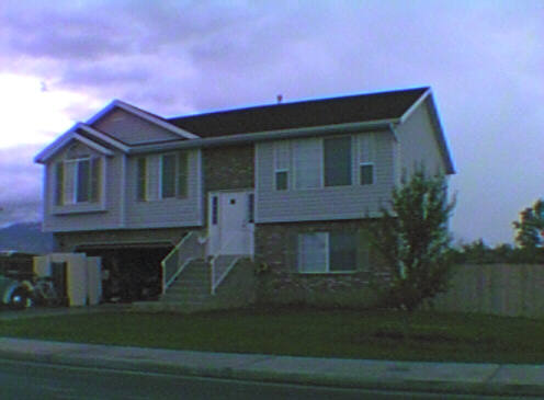
Total Photos: 1
|
| |
|
|
| Property Address: 769 S 1370 WEST - OREM |
|
| Mailing Address: 1161 E 350 N OREM, UT 84097-5031 |
|
| Acreage: 0.211 |
|
| Last Document:
13549-1995
|
|
| Subdivision Map Filing |
|
| Taxing Description:
PT LOT 28, PLAT C, COUNTRY EATATES SUB ALSO DESCRIBED AS FOLLOWS; COM N 260.67 FT & E 1493.83 FT FR W 1/4 COR. SEC. 21, T6S, R2E, SLB&M.; N 60 DEG 1' 46" E 120 FT; S 29 DEG 58' 14" E 89.37 FT; S 64 DEG 28' 22" W 57.73 FT; W 72.08 FT; N 29 DEG 58' 14" W 48.89 FT TO BEG. AREA 0.211 AC.
*Taxing description NOT FOR LEGAL DOCUMENTS
|
|
- Owner Names
- Value History
- Tax History
- Location
- Photos
- Documents
- Aerial Image
Main Menu Comments or Concerns on Value/Appraisal - Assessor's Office
Documents/Owner/Parcel information - Recorder's Office
Address Change for Tax Notice
This page was created on 7/31/2024 11:50:14 AM |