Property Information
mobile view
| Serial Number: 37:228:0006 |
Serial Life: 2006... |
|
|
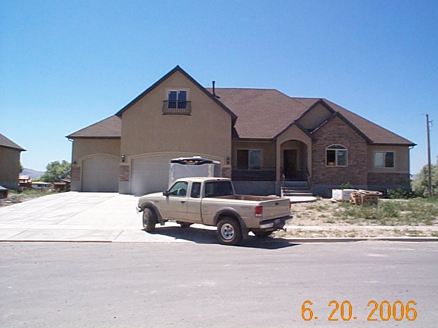 Total Photos: 1
|
| |
|
|
| Property Address: 226 S 650 WEST CIR - AMERICAN FORK |
|
| Mailing Address: 226 S 650 W CIR AMERICAN FORK, UT 84003-5609 |
|
| Acreage: 0.345 |
|
| Last Document:
55235-2005
|
|
| Subdivision Map Filing |
|
| Taxing Description:
LOT 6, DURRANT MEADOWS SUBDV. AREA 0.345 AC.
*Taxing description NOT FOR LEGAL DOCUMENTS
|
|
- Owner Names
- Value History
- Tax History
- Location
- Photos
- Documents
- Aerial Image
| |
----- Real Estate Values ----- |
---Improvements--- |
---Greenbelt--- |
Total |
| Year |
Com |
Res |
Agr |
Tot |
Com |
Res |
Agr |
Tot |
Land |
Homesite |
Tot |
Market Value |
| 2024 |
$0 |
$220,800 |
$0 |
$220,800 |
$0 |
$502,200 |
$0 |
$502,200 |
$0 |
$0 |
$0 |
$723,000 |
| 2023 |
$0 |
$200,700 |
$0 |
$200,700 |
$0 |
$510,700 |
$0 |
$510,700 |
$0 |
$0 |
$0 |
$711,400 |
| 2022 |
$0 |
$211,000 |
$0 |
$211,000 |
$0 |
$557,700 |
$0 |
$557,700 |
$0 |
$0 |
$0 |
$768,700 |
| 2021 |
$0 |
$162,300 |
$0 |
$162,300 |
$0 |
$416,200 |
$0 |
$416,200 |
$0 |
$0 |
$0 |
$578,500 |
| 2020 |
$0 |
$150,300 |
$0 |
$150,300 |
$0 |
$396,400 |
$0 |
$396,400 |
$0 |
$0 |
$0 |
$546,700 |
| 2019 |
$0 |
$150,300 |
$0 |
$150,300 |
$0 |
$393,200 |
$0 |
$393,200 |
$0 |
$0 |
$0 |
$543,500 |
| 2018 |
$0 |
$142,400 |
$0 |
$142,400 |
$0 |
$390,400 |
$0 |
$390,400 |
$0 |
$0 |
$0 |
$532,800 |
| 2017 |
$0 |
$142,400 |
$0 |
$142,400 |
$0 |
$390,400 |
$0 |
$390,400 |
$0 |
$0 |
$0 |
$532,800 |
| 2016 |
$0 |
$87,000 |
$0 |
$87,000 |
$0 |
$350,900 |
$0 |
$350,900 |
$0 |
$0 |
$0 |
$437,900 |
| 2015 |
$0 |
$79,100 |
$0 |
$79,100 |
$0 |
$350,900 |
$0 |
$350,900 |
$0 |
$0 |
$0 |
$430,000 |
| 2014 |
$0 |
$75,200 |
$0 |
$75,200 |
$0 |
$339,500 |
$0 |
$339,500 |
$0 |
$0 |
$0 |
$414,700 |
| 2013 |
$0 |
$69,000 |
$0 |
$69,000 |
$0 |
$295,200 |
$0 |
$295,200 |
$0 |
$0 |
$0 |
$364,200 |
| 2012 |
$0 |
$59,800 |
$0 |
$59,800 |
$0 |
$268,400 |
$0 |
$268,400 |
$0 |
$0 |
$0 |
$328,200 |
| 2011 |
$0 |
$59,800 |
$0 |
$59,800 |
$0 |
$278,100 |
$0 |
$278,100 |
$0 |
$0 |
$0 |
$337,900 |
| 2010 |
$0 |
$62,414 |
$0 |
$62,414 |
$0 |
$282,432 |
$0 |
$282,432 |
$0 |
$0 |
$0 |
$344,846 |
| 2009 |
$0 |
$90,400 |
$0 |
$90,400 |
$0 |
$275,100 |
$0 |
$275,100 |
$0 |
$0 |
$0 |
$365,500 |
| 2008 |
$0 |
$123,900 |
$0 |
$123,900 |
$0 |
$269,400 |
$0 |
$269,400 |
$0 |
$0 |
$0 |
$393,300 |
| 2007 |
$0 |
$130,400 |
$0 |
$130,400 |
$0 |
$283,600 |
$0 |
$283,600 |
$0 |
$0 |
$0 |
$414,000 |
| 2006 |
$0 |
$100,000 |
$0 |
$100,000 |
$0 |
$0 |
$0 |
$0 |
$0 |
$0 |
$0 |
$100,000 |
| Year |
General Taxes |
Adjustments |
Net Taxes |
Fees |
Payments |
Tax Balance* |
Balance Due |
Tax District |
| 2025 |
$0.00 |
$0.00 |
$0.00 |
$0.00 |
|
$0.00
|
$0.00 |
060 - AMERICAN FORK CITY |
| 2024 |
$3,578.85 |
$0.00 |
$3,578.85 |
$0.00 |
|
$0.00
|
$0.00 |
060 - AMERICAN FORK CITY |
| 2023 |
$3,321.49 |
$0.00 |
$3,321.49 |
$0.00 |
|
$0.00
|
$0.00 |
060 - AMERICAN FORK CITY |
| 2022 |
$3,636.80 |
$0.00 |
$3,636.80 |
$0.00 |
|
$0.00
|
$0.00 |
060 - AMERICAN FORK CITY |
| 2021 |
$3,185.89 |
$0.00 |
$3,185.89 |
$0.00 |
|
$0.00
|
$0.00 |
060 - AMERICAN FORK CITY |
| 2020 |
$3,104.27 |
$0.00 |
$3,104.27 |
$0.00 |
|
$0.00
|
$0.00 |
060 - AMERICAN FORK CITY |
| 2019 |
$2,983.87 |
$0.00 |
$2,983.87 |
$0.00 |
|
$0.00
|
$0.00 |
060 - AMERICAN FORK CITY |
| 2018 |
$3,059.34 |
$0.00 |
$3,059.34 |
$0.00 |
|
$0.00
|
$0.00 |
060 - AMERICAN FORK CITY |
| 2017 |
$3,117.65 |
$0.00 |
$3,117.65 |
$0.00 |
|
$0.00
|
$0.00 |
060 - AMERICAN FORK CITY |
| 2016 |
$2,757.92 |
$0.00 |
$2,757.92 |
$0.00 |
|
$0.00
|
$0.00 |
060 - AMERICAN FORK CITY |
| 2015 |
$2,853.61 |
$0.00 |
$2,853.61 |
$0.00 |
|
$0.00
|
$0.00 |
060 - AMERICAN FORK CITY |
| 2014 |
$2,789.94 |
$0.00 |
$2,789.94 |
$0.00 |
|
$0.00
|
$0.00 |
060 - AMERICAN FORK CITY |
| 2013 |
$2,640.49 |
$0.00 |
$2,640.49 |
$0.00 |
|
$0.00
|
$0.00 |
060 - AMERICAN FORK CITY |
| 2012 |
$2,427.50 |
$0.00 |
$2,427.50 |
$0.00 |
|
$0.00
|
$0.00 |
060 - AMERICAN FORK CITY |
| 2011 |
$2,492.55 |
$0.00 |
$2,492.55 |
$0.00 |
|
$0.00
|
$0.00 |
060 - AMERICAN FORK CITY |
| 2010 |
$2,388.08 |
$0.00 |
$2,388.08 |
$0.00 |
|
$0.00
|
$0.00 |
060 - AMERICAN FORK CITY |
| 2009 |
$2,330.08 |
$0.00 |
$2,330.08 |
$0.00 |
|
$0.00
|
$0.00 |
060 - AMERICAN FORK CITY |
| 2008 |
$2,356.97 |
$0.00 |
$2,356.97 |
$0.00 |
|
$0.00
|
$0.00 |
060 - AMERICAN FORK CITY |
| 2007 |
$2,384.93 |
$0.00 |
$2,384.93 |
$0.00 |
|
$0.00
|
$0.00 |
060 - AMERICAN FORK CITY |
| 2006 |
$1,126.10 |
$0.00 |
$1,126.10 |
$0.00 |
|
$0.00
|
$0.00 |
060 - AMERICAN FORK CITY |
* Note: Original tax amount (Does not include applicable interest and/or fees).
| Entry # |
Date |
Recorded |
Type |
Party1 (Grantor) |
Party2 (Grantee) |
| 128094-2020 |
07/23/2020 |
08/26/2020 |
REC |
FIRST AMERICAN TITLE INSURANCE COMPANY TEE |
LOVELL, AUSTIN |
| 98460-2020 |
07/06/2020 |
07/13/2020 |
D TR |
LOVELL, AUSTIN |
QUICKEN LOANS LLC |
| 70982-2019 |
07/19/2019 |
07/29/2019 |
RSUBTEE |
MORTGAGE ELECTRONIC REGISTRATION SYSTEMS INC (ET AL) |
MCKENZIE, JAMIE |
| 58420-2019 |
06/25/2019 |
06/26/2019 |
D TR |
LOVELL, AUSTIN |
UNITED WHOLESALE MORTGAGE LLC |
| 58419-2019 |
06/26/2019 |
06/26/2019 |
WD |
MCKENZIE, JAMIE |
LOVELL, AUSTIN |
| 58418-2019 |
06/21/2019 |
06/26/2019 |
QCD |
MCKENZIE, SUZANNE |
MCKENZIE, JAMIE |
| 74675-2016 |
08/02/2016 |
08/09/2016 |
RSUBTEE |
JPMORGAN CHASE BANK (ET AL) |
MCKENZIE, JAMES P & SUZANNE L |
| 73998-2016 |
08/01/2016 |
08/05/2016 |
RSUBTEE |
JPMORGAN CHASE BANK (ET AL) |
MCKENZIE, JAMES P & SUZANNE L |
| 65116-2016 |
07/11/2016 |
07/15/2016 |
D TR |
MCKENZIE, JAMIE |
SECURITY HOME MORTGAGE LLC |
| 114949-2008 |
10/20/2008 |
10/22/2008 |
CT |
STATE OF UTAH |
WHOM OF INTEREST |
| 107508-2008 |
09/30/2008 |
09/30/2008 |
RESOL |
BOARD OF COUNTY COMMISSIONERS UTAH COUNTY |
WHOM OF INTEREST |
| 36136-2008 |
03/26/2008 |
03/27/2008 |
REC |
FIRST AMERICAN TITLE INSURANCE AGENCY LLC TEE |
HEYMAN, WALTER A |
| 51601-2007 |
04/06/2007 |
04/09/2007 |
REC |
HALLIDAY & HALLIDAY PC TEE |
MCKENZIE, JAMIE |
| 51600-2007 |
03/28/2007 |
04/09/2007 |
SUB TEE |
MORTGAGE ELECTRONIC REGISTRATION SYSTEMS INC |
HALLIDAY & HALLIDAY PC SUCTEE |
| 47025-2007 |
03/29/2007 |
04/02/2007 |
REC |
HALLIDAY & HALLIDAY PC TEE |
MCKENZIE, JAMIE |
| 47024-2007 |
03/14/2007 |
04/02/2007 |
SUB TEE |
MORTGAGE ELECTRONIC REGISTRATION SYSTEMS INC |
HALLIDAY & HALLIDAY PC SUCTEE |
| 7620-2007 |
01/09/2007 |
01/16/2007 |
D TR |
MCKENZIE, JAMES P & SUZANNE L |
WASHINGTON MUTUAL BANK |
| 7619-2007 |
01/09/2007 |
01/16/2007 |
D TR |
MCKENZIE, JAMES P & SUZANNE L |
WASHINGTON MUTUAL BANK |
| 118643-2006 |
08/21/2006 |
09/11/2006 |
REC |
BANK OF AMERICAN FORK TEE |
LOVERIDGE, MICHAEL S & LINDA |
| 102738-2006 |
08/07/2006 |
08/09/2006 |
D TR |
MC KENZIE, JAMIE |
CREDIT SUISSE FINANCIAL CORPORATION |
| 102737-2006 |
08/07/2006 |
08/09/2006 |
D TR |
MCKENZIE, JAMIE |
CREDIT SUISSE FINANCIAL CORPORATION |
| 102369-2006 |
07/25/2006 |
08/09/2006 |
WD |
LOVERIDGE, MICHAEL S |
MCKENZIE, JAMIE |
| 36912-2006 |
03/15/2006 |
03/28/2006 |
REC |
WESTERN COMMUNITY BANK TEE |
HEYMAN, WALTER A |
| 11173-2006 |
01/30/2006 |
01/30/2006 |
W FARM |
CARTER, CHAD & STACIE (ET AL) |
WHOM OF INTEREST |
| 146886-2005 |
10/12/2005 |
12/20/2005 |
REC |
WESTERN COMMUNITY BANK TEE |
HEYMAN, WALTER A |
| 93924-2005 |
08/23/2005 |
08/24/2005 |
P REC |
WESTERN COMMUNITY BANK TEE |
HEYMAN, WALTER A |
| 89125-2005 |
08/11/2005 |
08/12/2005 |
D TR |
LOVERIDGE, MICHAEL S & LINDA |
BANK OF AMERICAN FORK |
| 89011-2005 |
08/12/2005 |
08/12/2005 |
WD |
HEYMAN, WALTER A |
LOVERIDGE, MICHAEL S |
| 79488-2005 |
07/21/2005 |
07/22/2005 |
R FARM |
UTAH COUNTY TREASURER |
FENN, DONALD (ET AL) |
| 68477-2005 |
06/27/2005 |
06/27/2005 |
W FARM |
UTAH COUNTY |
WHOM OF INTEREST |
| 55235-2005 |
02/08/2005 |
05/24/2005 |
S PLAT |
HEYMAN, WALTER A |
DURRANT MEADOWS |
Main Menu Comments or Concerns on Value/Appraisal - Assessor's Office
Documents/Owner/Parcel information - Recorder's Office
Address Change for Tax Notice
This page was created on 4/23/2025 3:51:44 AM |