Property Information
mobile view
| Serial Number: 38:007:0019 |
Serial Life: 2009... |
|
|
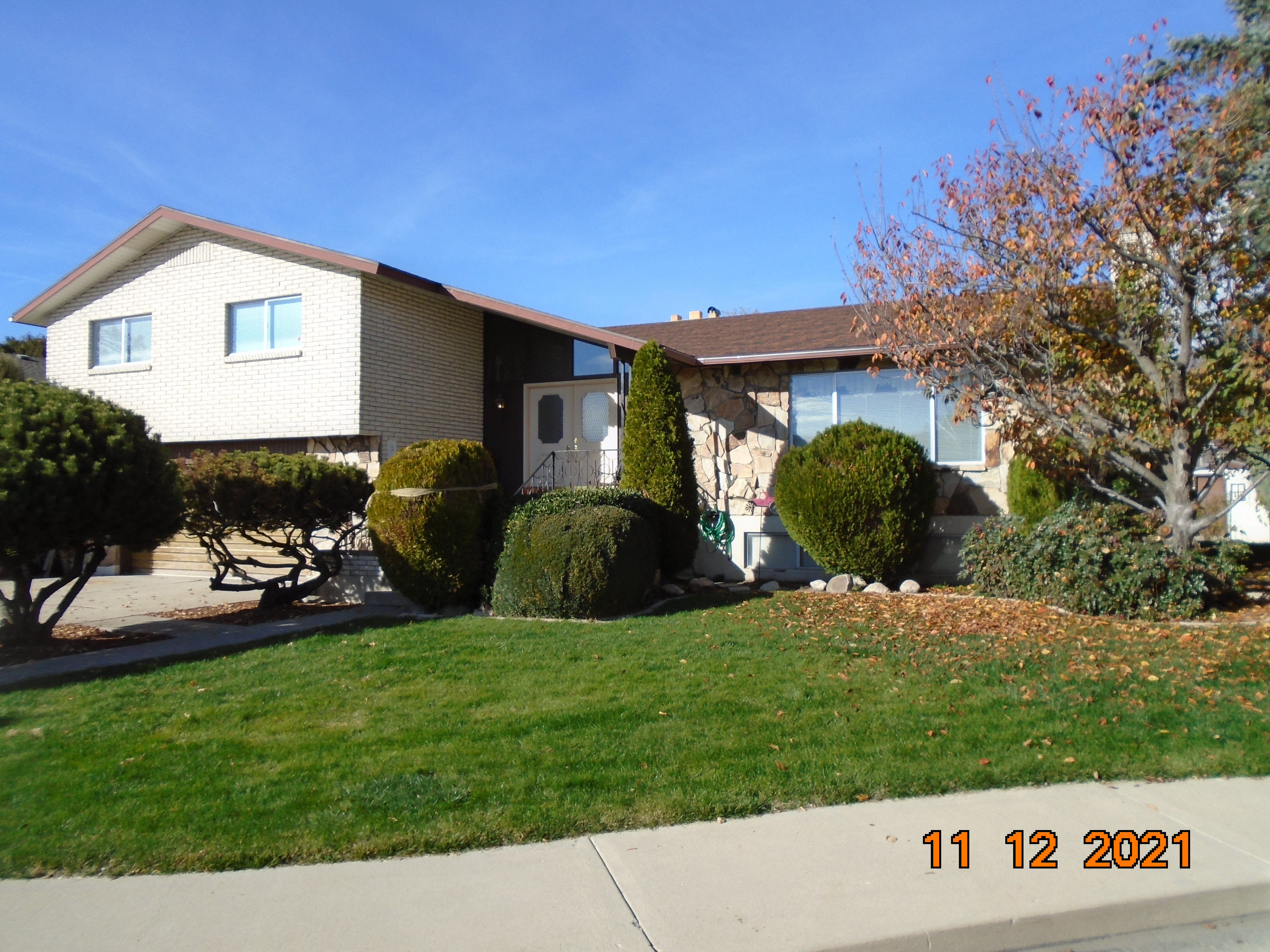 Total Photos: 2
|
| |
|
|
| Property Address: 1135 E 120 SOUTH - OREM |
|
| Mailing Address: PO BOX 735 KAYSVILLE, UT 84037 |
|
| Acreage: 0.256008 |
|
| Last Document:
20664-2022
|
|
| Subdivision Map Filing |
|
| Taxing Description:
LOT 9, PLAT C, EAST RIDGE SUBDV. AREA 0.194 AC. ALSO COM N 0 DEG 2' 14" W 2273.27 FT & N 89 DEG 57' 46" E 2082.74 FT FR SW COR. SEC. 13, T6S, R2E, SLB&M.; N 87 DEG 47' 0" E 89.55 FT; S 2 DEG 13' 0" E 30 FT; S 87 DEG 47' 0" W 89.55 FT; N 2 DEG 13' 0" W 30 FT TO BEG. AREA 0.062 AC. TOTAL AREA .256 AC.
*Taxing description NOT FOR LEGAL DOCUMENTS
|
|
- Owner Names
- Value History
- Tax History
- Location
- Photos
- Documents
- Aerial Image
| |
----- Real Estate Values ----- |
---Improvements--- |
---Greenbelt--- |
Total |
| Year |
Com |
Res |
Agr |
Tot |
Com |
Res |
Agr |
Tot |
Land |
Homesite |
Tot |
Market Value |
| 2024 |
$0 |
$280,600 |
$0 |
$280,600 |
$0 |
$319,000 |
$0 |
$319,000 |
$0 |
$0 |
$0 |
$599,600 |
| 2023 |
$0 |
$280,600 |
$0 |
$280,600 |
$0 |
$338,700 |
$0 |
$338,700 |
$0 |
$0 |
$0 |
$619,300 |
| 2022 |
$0 |
$299,200 |
$0 |
$299,200 |
$0 |
$288,600 |
$0 |
$288,600 |
$0 |
$0 |
$0 |
$587,800 |
| 2021 |
$0 |
$176,000 |
$0 |
$176,000 |
$0 |
$255,400 |
$0 |
$255,400 |
$0 |
$0 |
$0 |
$431,400 |
| 2020 |
$0 |
$140,800 |
$0 |
$140,800 |
$0 |
$245,600 |
$0 |
$245,600 |
$0 |
$0 |
$0 |
$386,400 |
| 2019 |
$0 |
$129,700 |
$0 |
$129,700 |
$0 |
$235,600 |
$0 |
$235,600 |
$0 |
$0 |
$0 |
$365,300 |
| 2018 |
$0 |
$118,600 |
$0 |
$118,600 |
$0 |
$235,600 |
$0 |
$235,600 |
$0 |
$0 |
$0 |
$354,200 |
| 2017 |
$0 |
$107,400 |
$0 |
$107,400 |
$0 |
$235,600 |
$0 |
$235,600 |
$0 |
$0 |
$0 |
$343,000 |
| 2016 |
$0 |
$75,600 |
$0 |
$75,600 |
$0 |
$222,000 |
$0 |
$222,000 |
$0 |
$0 |
$0 |
$297,600 |
| 2015 |
$0 |
$75,600 |
$0 |
$75,600 |
$0 |
$193,000 |
$0 |
$193,000 |
$0 |
$0 |
$0 |
$268,600 |
| 2014 |
$0 |
$74,100 |
$0 |
$74,100 |
$0 |
$160,800 |
$0 |
$160,800 |
$0 |
$0 |
$0 |
$234,900 |
| 2013 |
$0 |
$70,400 |
$0 |
$70,400 |
$0 |
$139,800 |
$0 |
$139,800 |
$0 |
$0 |
$0 |
$210,200 |
| 2012 |
$0 |
$60,100 |
$0 |
$60,100 |
$0 |
$155,900 |
$0 |
$155,900 |
$0 |
$0 |
$0 |
$216,000 |
| 2011 |
$0 |
$72,100 |
$0 |
$72,100 |
$0 |
$150,500 |
$0 |
$150,500 |
$0 |
$0 |
$0 |
$222,600 |
| 2010 |
$0 |
$93,677 |
$0 |
$93,677 |
$0 |
$142,960 |
$0 |
$142,960 |
$0 |
$0 |
$0 |
$236,637 |
| 2009 |
$0 |
$112,300 |
$0 |
$112,300 |
$0 |
$143,500 |
$0 |
$143,500 |
$0 |
$0 |
$0 |
$255,800 |
| Year |
General Taxes |
Adjustments |
Net Taxes |
Fees |
Payments |
Tax Balance* |
Balance Due |
Tax District |
| 2025 |
$0.00 |
$0.00 |
$0.00 |
$0.00 |
|
$0.00
|
$0.00 |
090 - OREM CITY |
| 2024 |
$2,696.94 |
$0.00 |
$2,696.94 |
$0.00 |
|
$0.00
|
$0.00 |
090 - OREM CITY |
| 2023 |
$2,591.74 |
$0.00 |
$2,591.74 |
$0.00 |
|
$0.00
|
$0.00 |
090 - OREM CITY |
| 2022 |
$2,539.12 |
$0.00 |
$2,539.12 |
$0.00 |
|
$0.00
|
$0.00 |
090 - OREM CITY |
| 2021 |
$2,236.98 |
$0.00 |
$2,236.98 |
$0.00 |
|
$0.00
|
$0.00 |
090 - OREM CITY |
| 2020 |
$2,038.70 |
$0.00 |
$2,038.70 |
$0.00 |
|
$0.00
|
$0.00 |
090 - OREM CITY |
| 2019 |
$1,853.44 |
($1,128.98) |
$724.46 |
$0.00 |
|
$0.00
|
$0.00 |
090 - OREM CITY |
| 2018 |
$1,880.89 |
($1,120.96) |
$759.93 |
$0.00 |
|
$0.00
|
$0.00 |
090 - OREM CITY |
| 2017 |
$1,870.09 |
($917.03) |
$953.06 |
$0.00 |
|
$0.00
|
$0.00 |
090 - OREM CITY |
| 2016 |
$1,759.56 |
($874.84) |
$884.72 |
$0.00 |
|
$0.00
|
$0.00 |
090 - OREM CITY |
| 2015 |
$1,679.25 |
($844.64) |
$834.61 |
$0.00 |
|
$0.00
|
$0.00 |
090 - OREM CITY |
| 2014 |
$1,475.28 |
($767.46) |
$707.82 |
$0.00 |
|
$0.00
|
$0.00 |
090 - OREM CITY |
| 2013 |
$1,423.62 |
$0.00 |
$1,423.62 |
$0.00 |
|
$0.00
|
$0.00 |
090 - OREM CITY |
| 2012 |
$1,493.08 |
($763.94) |
$729.14 |
$0.00 |
|
$0.00
|
$0.00 |
090 - OREM CITY |
| 2011 |
$1,531.35 |
($772.86) |
$758.49 |
$0.00 |
|
$0.00
|
$0.00 |
090 - OREM CITY |
| 2010 |
$1,524.06 |
($659.20) |
$864.86 |
$0.00 |
|
$0.00
|
$0.00 |
090 - OREM CITY |
| 2009 |
$1,527.19 |
($1,527.19) |
$0.00 |
$0.00 |
|
$0.00
|
$0.00 |
090 - OREM CITY |
* Note: Original tax amount (Does not include applicable interest and/or fees).
| Entry # |
Date |
Recorded |
Type |
Party1 (Grantor) |
Party2 (Grantee) |
| 38844-2023 |
06/12/2023 |
06/15/2023 |
WD |
LIBBY, STEVEN J & KARIN J |
K & S VENTURES LLC |
| 20665-2022 |
02/15/2022 |
02/16/2022 |
WD |
ANDERSON, KIRK R SUCTEE (ET AL) |
LIBBY, STEVEN J & KARIN J |
| 20664-2022 |
02/15/2022 |
02/16/2022 |
AF DC |
ANDERSON, ROBERT H & ROBERT HUGH AKA (ET AL) |
KONGAIKA, RUTH E SUCTEE (ET AL) |
| 20663-2022 |
02/15/2022 |
02/16/2022 |
AF DC |
ANDERSON, CAROL C & CAROL CHRISTENSEN AKA (ET AL) |
ANDERSON, KIRK R SUCTEE (ET AL) |
| 103433-2008 |
09/19/2008 |
09/19/2008 |
QCD |
ANDERSON, ROBERT HUGH & ROBERT HUGH TEE (ET AL) |
ANDERSON, ROBERT H TEE |
Main Menu Comments or Concerns on Value/Appraisal - Assessor's Office
Documents/Owner/Parcel information - Recorder's Office
Address Change for Tax Notice
This page was created on 2/26/2025 1:17:28 AM |
