Property Information
mobile view
| Serial Number: 38:520:0073 |
Serial Life: 2018... |
|
|
 Total Photos: 4
|
| |
|
|
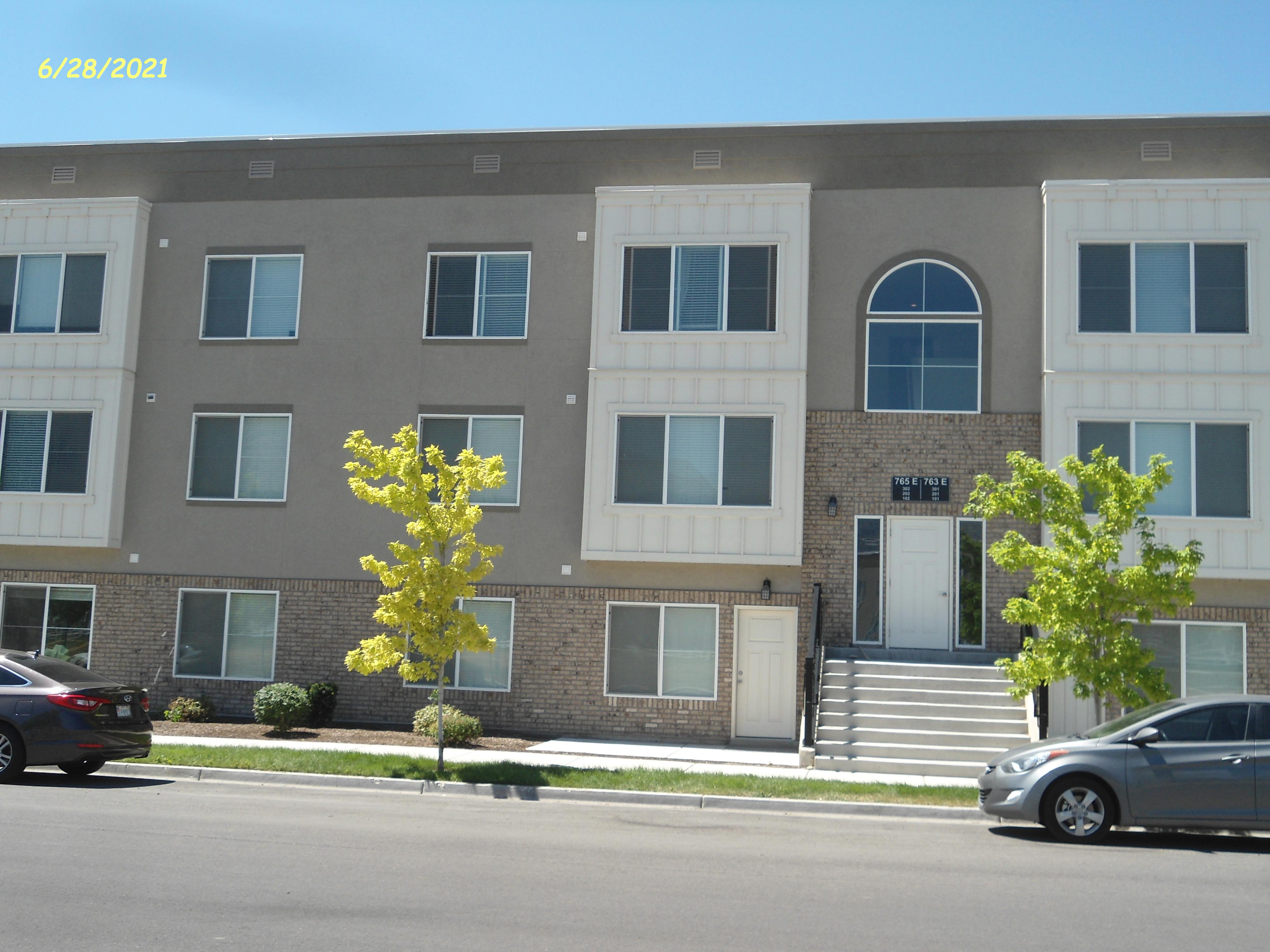
| Property Address: 765 E 550 SOUTH - AMERICAN FORK |
|
| Mailing Address: 2492 E ARBOR DR SAINT GEORGE, UT 84790 |
|
| Acreage: 0.031009 |
|
| Last Document:
31887-2017
|
|
| Subdivision Map Filing |
|
| Taxing Description:
LOT 73, EASTON PARK, PHASE 3 SUB AREA 0.031 AC.
*Taxing description NOT FOR LEGAL DOCUMENTS
|
|
- Owner Names
- Value History
- Tax History
- Location
- Photos
- Documents
- Aerial Image
| |
----- Real Estate Values ----- |
---Improvements--- |
---Greenbelt--- |
Total |
| Year |
Com |
Res |
Agr |
Tot |
Com |
Res |
Agr |
Tot |
Land |
Homesite |
Tot |
Market Value |
| 2024 |
$0 |
$224,800 |
$0 |
$224,800 |
$0 |
$674,300 |
$0 |
$674,300 |
$0 |
$0 |
$0 |
$899,100 |
| 2023 |
$0 |
$222,500 |
$0 |
$222,500 |
$0 |
$667,700 |
$0 |
$667,700 |
$0 |
$0 |
$0 |
$890,200 |
| 2022 |
$0 |
$205,100 |
$0 |
$205,100 |
$0 |
$615,400 |
$0 |
$615,400 |
$0 |
$0 |
$0 |
$820,500 |
| 2021 |
$0 |
$157,800 |
$0 |
$157,800 |
$0 |
$473,400 |
$0 |
$473,400 |
$0 |
$0 |
$0 |
$631,200 |
| 2020 |
$0 |
$146,800 |
$0 |
$146,800 |
$0 |
$440,400 |
$0 |
$440,400 |
$0 |
$0 |
$0 |
$587,200 |
| 2019 |
$0 |
$108,700 |
$0 |
$108,700 |
$0 |
$326,300 |
$0 |
$326,300 |
$0 |
$0 |
$0 |
$435,000 |
| 2018 |
$0 |
$76,500 |
$0 |
$76,500 |
$0 |
$91,800 |
$0 |
$91,800 |
$0 |
$0 |
$0 |
$168,300 |
| Year |
General Taxes |
Adjustments |
Net Taxes |
Fees |
Payments |
Tax Balance* |
Balance Due |
Tax District |
| 2025 |
$0.00 |
$0.00 |
$0.00 |
$0.00 |
|
$0.00
|
$0.00 |
060 - AMERICAN FORK CITY |
| 2024 |
$4,450.55 |
$0.00 |
$4,450.55 |
$0.00 |
|
|
Click for Payoff
|
060 - AMERICAN FORK CITY |
| 2023 |
$4,156.30 |
$0.00 |
$4,156.30 |
$0.00 |
|
$0.00
|
$0.00 |
060 - AMERICAN FORK CITY |
| 2022 |
$3,881.87 |
$0.00 |
$3,881.87 |
$0.00 |
|
$0.00
|
$0.00 |
060 - AMERICAN FORK CITY |
| 2021 |
$3,476.11 |
$0.00 |
$3,476.11 |
$0.00 |
|
$0.00
|
$0.00 |
060 - AMERICAN FORK CITY |
| 2020 |
$3,334.24 |
$0.00 |
$3,334.24 |
$0.00 |
|
$0.00
|
$0.00 |
060 - AMERICAN FORK CITY |
| 2019 |
$2,388.19 |
$0.00 |
$2,388.19 |
$0.00 |
|
$0.00
|
$0.00 |
060 - AMERICAN FORK CITY |
| 2018 |
$966.38 |
$0.00 |
$966.38 |
$0.00 |
|
$0.00
|
$0.00 |
060 - AMERICAN FORK CITY |
* Note: Original tax amount (Does not include applicable interest and/or fees).
| Entry # |
Date |
Recorded |
Type |
Party1 (Grantor) |
Party2 (Grantee) |
| 151560-2020 |
09/24/2020 |
09/30/2020 |
RSUBTEE |
MORTGAGE ELECTRONIC REGISTRATION SYSTEMS INC (ET AL) |
WELCH, KEEAN |
| 121628-2020 |
08/11/2020 |
08/17/2020 |
D TR |
WELCH, KEEAN |
FIRST COLONY MORTGAGE CORPORATION |
| 95944-2018 |
10/05/2018 |
10/05/2018 |
REC |
BANK OF AMERICAN FORK TEE |
WELCH, KEEAN |
| 94102-2018 |
09/28/2018 |
10/01/2018 |
D TR |
WELCH, KEEAN |
FIRST COLONY MORTGAGE CORPORATION |
| 94101-2018 |
09/28/2018 |
10/01/2018 |
WD |
WELCH, KEEAN |
WELCH, KEEAN |
| 51410-2018 |
05/31/2018 |
06/01/2018 |
ADECCOV |
VERTICAL DEVELOPMENT LLC |
WHOM OF INTEREST |
| 77052-2017 |
08/08/2017 |
08/09/2017 |
EAS |
COMCAST OF UTAH II INC |
EASTON PARK OWNERS ASSOCIATION |
| 76704-2017 |
08/02/2017 |
08/08/2017 |
D TR |
WELCH, KEEAN |
BANK OF AMERICAN FORK DIV OF (ET AL) |
| 76703-2017 |
06/12/2017 |
08/08/2017 |
WD |
VERTICAL DEVELOPMENT LLC |
WELCH, KEEAN |
| 73200-2017 |
07/31/2017 |
07/31/2017 |
ADECCOV |
VERTICAL DEVELOPMENT LLC |
WHOM OF INTEREST |
| 31887-2017 |
05/10/2016 |
04/03/2017 |
S PLAT |
VERTICAL DEVELOPMENT LLC (ET AL) |
EASTON PARK PHASE 3 |
Main Menu Comments or Concerns on Value/Appraisal - Assessor's Office
Documents/Owner/Parcel information - Recorder's Office
Address Change for Tax Notice
This page was created on 10/10/2024 8:32:54 AM |


