Property Information
mobile view
| Serial Number: 41:787:0275 |
Serial Life: 2015... |
|
|
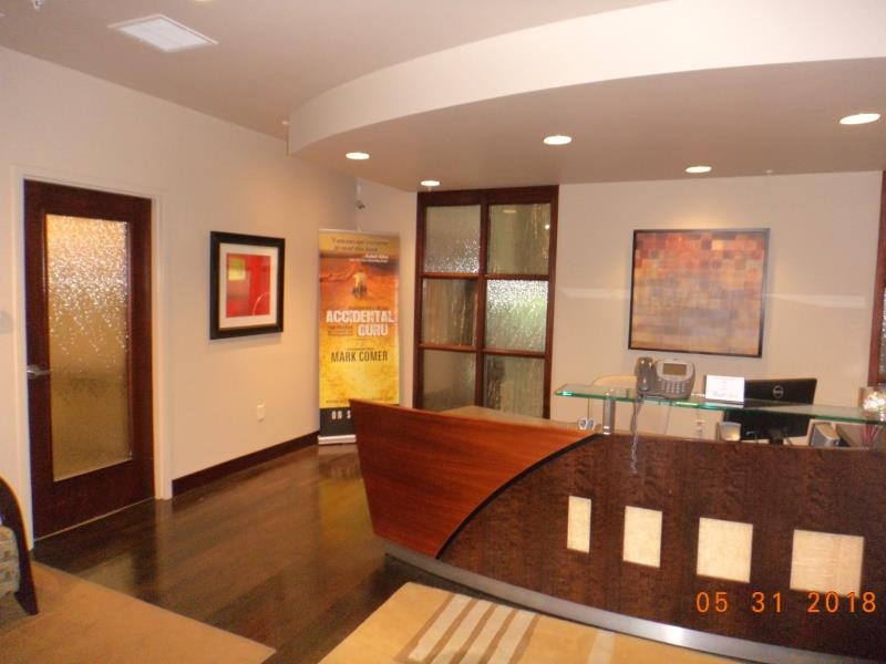 Total Photos: 6
|
| |
|
|
| Property Address: 5255 W 11000 NORTH Unit# 275 - HIGHLAND |
|
| Mailing Address: 5255 W 11000 N STE 275 HIGHLAND, UT 84003 |
|
| Acreage: 0.097735 |
|
| Last Document:
37420-2014
|
|
| Subdivision Map Filing |
|
| Taxing Description:
SUITE 275, PLAT B, HIGHLAND CORNER OFFICE CONDOS AMENDED. AREA 0.098 AC.
*Taxing description NOT FOR LEGAL DOCUMENTS
|
|
- Owner Names
- Value History
- Tax History
- Location
- Photos
- Documents
- Aerial Image
| |
----- Real Estate Values ----- |
---Improvements--- |
---Greenbelt--- |
Total |
| Year |
Com |
Res |
Agr |
Tot |
Com |
Res |
Agr |
Tot |
Land |
Homesite |
Tot |
Market Value |
| 2024 |
$139,400 |
$0 |
$0 |
$139,400 |
$978,500 |
$0 |
$0 |
$978,500 |
$0 |
$0 |
$0 |
$1,117,900 |
| 2023 |
$136,700 |
$0 |
$0 |
$136,700 |
$959,300 |
$0 |
$0 |
$959,300 |
$0 |
$0 |
$0 |
$1,096,000 |
| 2022 |
$136,700 |
$0 |
$0 |
$136,700 |
$660,400 |
$0 |
$0 |
$660,400 |
$0 |
$0 |
$0 |
$797,100 |
| 2021 |
$136,700 |
$0 |
$0 |
$136,700 |
$660,400 |
$0 |
$0 |
$660,400 |
$0 |
$0 |
$0 |
$797,100 |
| 2020 |
$136,700 |
$0 |
$0 |
$136,700 |
$660,400 |
$0 |
$0 |
$660,400 |
$0 |
$0 |
$0 |
$797,100 |
| 2019 |
$136,700 |
$0 |
$0 |
$136,700 |
$660,400 |
$0 |
$0 |
$660,400 |
$0 |
$0 |
$0 |
$797,100 |
| 2018 |
$136,700 |
$0 |
$0 |
$136,700 |
$660,400 |
$0 |
$0 |
$660,400 |
$0 |
$0 |
$0 |
$797,100 |
| 2017 |
$136,700 |
$0 |
$0 |
$136,700 |
$674,400 |
$0 |
$0 |
$674,400 |
$0 |
$0 |
$0 |
$811,100 |
| 2016 |
$136,700 |
$0 |
$0 |
$136,700 |
$674,400 |
$0 |
$0 |
$674,400 |
$0 |
$0 |
$0 |
$811,100 |
| 2015 |
$136,700 |
$0 |
$0 |
$136,700 |
$674,400 |
$0 |
$0 |
$674,400 |
$0 |
$0 |
$0 |
$811,100 |
| Year |
General Taxes |
Adjustments |
Net Taxes |
Fees |
Payments |
Tax Balance* |
Balance Due |
Tax District |
| 2025 |
$0.00 |
$0.00 |
$0.00 |
$0.00 |
|
$0.00
|
$0.00 |
045 - HIGHLAND CITY |
| 2024 |
$9,050.52 |
$0.00 |
$9,050.52 |
$0.00 |
|
$0.00
|
$0.00 |
045 - HIGHLAND CITY |
| 2023 |
$8,225.48 |
$0.00 |
$8,225.48 |
$0.00 |
|
$0.00
|
$0.00 |
045 - HIGHLAND CITY |
| 2022 |
$6,169.55 |
$0.00 |
$6,169.55 |
$0.00 |
|
$0.00
|
$0.00 |
045 - HIGHLAND CITY |
| 2021 |
$7,531.00 |
$0.00 |
$7,531.00 |
$0.00 |
|
$0.00
|
$0.00 |
045 - HIGHLAND CITY |
| 2020 |
$7,679.26 |
$0.00 |
$7,679.26 |
$0.00 |
|
$0.00
|
$0.00 |
045 - HIGHLAND CITY |
| 2019 |
$7,340.49 |
$0.00 |
$7,340.49 |
$0.00 |
|
$0.00
|
$0.00 |
045 - HIGHLAND CITY |
| 2018 |
$7,723.90 |
$0.00 |
$7,723.90 |
$0.00 |
|
$0.00
|
$0.00 |
045 - HIGHLAND CITY |
| 2017 |
$8,098.83 |
$0.00 |
$8,098.83 |
$0.00 |
|
$0.00
|
$0.00 |
045 - HIGHLAND CITY |
| 2016 |
$8,665.79 |
$0.00 |
$8,665.79 |
$0.00 |
|
$0.00
|
$0.00 |
045 - HIGHLAND CITY |
| 2015 |
$9,142.72 |
$0.00 |
$9,142.72 |
$0.00 |
|
$0.00
|
$0.00 |
045 - HIGHLAND CITY |
* Note: Original tax amount (Does not include applicable interest and/or fees).
| Entry # |
Date |
Recorded |
Type |
Party1 (Grantor) |
Party2 (Grantee) |
| 55298-2022 |
05/03/2022 |
05/04/2022 |
REC |
WELLS FARGO TRUST COMPANY TEE |
LUXSTONE LLC |
| 52790-2022 |
04/19/2022 |
04/28/2022 |
D TR |
LUXSTONE LLC BY (ET AL) |
WELLS FARGO BANK |
| 128613-2019 |
12/04/2019 |
12/05/2019 |
D TR |
LUXSTONE LLC |
WELSL FARGO BANK |
| 38468-2014 |
06/04/2014 |
06/06/2014 |
WD |
TLC HOLDINGS LLC BY (ET AL) |
LUXSTONE LLC |
| 37421-2014 |
06/03/2014 |
06/03/2014 |
DECLCON |
HIGHLAND OFFICE BUILDING J LLC (ET AL) |
WHOM OF INTEREST |
| 37420-2014 |
05/06/2014 |
06/03/2014 |
C PLAT |
HIGHLAND OFFICE BUILDING J LLC (ET AL) |
HIGHLAND CORNER OFFICE CONDO PLAT B AMD |
Main Menu Comments or Concerns on Value/Appraisal - Assessor's Office
Documents/Owner/Parcel information - Recorder's Office
Address Change for Tax Notice
This page was created on 2/20/2025 9:55:09 AM |


