Property Information
mobile view
| Serial Number: 45:594:0001 |
Serial Life: 2017... |
|
|

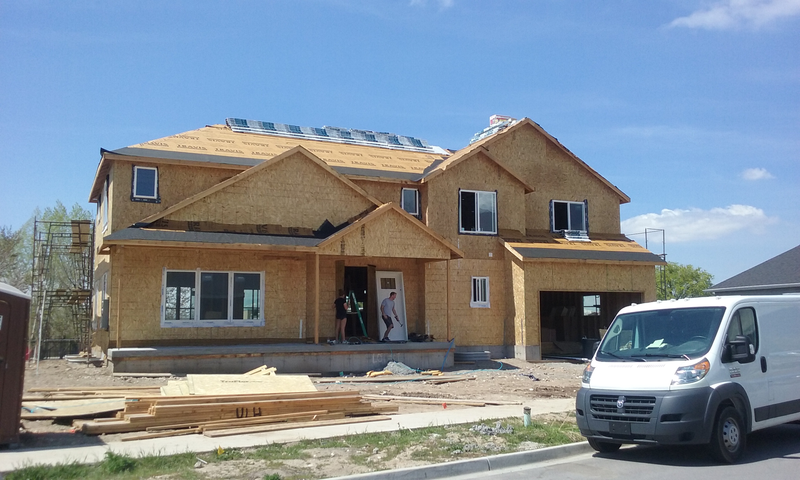
Total Photos: 2
|
| |
|
|
| Property Address: 1891 N 860 WEST - OREM
more see "Addrs" tab below..
|
|
| Mailing Address: 1891 N 860 W OREM, UT 84057 |
|
| Acreage: 0.224218 |
|
| Last Document:
127124-2017
|
|
| Subdivision Map Filing |
|
| Taxing Description:
LOT 1, PLAT A, LOTT'S LOTS SUB AREA 0.224 AC.
*Taxing description NOT FOR LEGAL DOCUMENTS
|
|
- Owner Names
- Value History
- Tax History
- Location
- Photos
- Documents
- Aerial Image
- Addrs
| |
----- Real Estate Values ----- |
---Improvements--- |
---Greenbelt--- |
Total |
| Year |
Com |
Res |
Agr |
Tot |
Com |
Res |
Agr |
Tot |
Land |
Homesite |
Tot |
Market Value |
| 2024 |
$0 |
$244,600 |
$0 |
$244,600 |
$0 |
$537,200 |
$0 |
$537,200 |
$0 |
$0 |
$0 |
$781,800 |
| 2023 |
$0 |
$244,500 |
$0 |
$244,500 |
$0 |
$557,600 |
$0 |
$557,600 |
$0 |
$0 |
$0 |
$802,100 |
| 2022 |
$0 |
$260,700 |
$0 |
$260,700 |
$0 |
$537,100 |
$0 |
$537,100 |
$0 |
$0 |
$0 |
$797,800 |
| 2021 |
$0 |
$186,200 |
$0 |
$186,200 |
$0 |
$419,600 |
$0 |
$419,600 |
$0 |
$0 |
$0 |
$605,800 |
| 2020 |
$0 |
$161,900 |
$0 |
$161,900 |
$0 |
$406,300 |
$0 |
$406,300 |
$0 |
$0 |
$0 |
$568,200 |
| 2019 |
$0 |
$161,900 |
$0 |
$161,900 |
$0 |
$0 |
$0 |
$0 |
$0 |
$0 |
$0 |
$161,900 |
| 2018 |
$0 |
$161,900 |
$0 |
$161,900 |
$0 |
$0 |
$0 |
$0 |
$0 |
$0 |
$0 |
$161,900 |
| 2017 |
$0 |
$161,900 |
$0 |
$161,900 |
$0 |
$0 |
$0 |
$0 |
$0 |
$0 |
$0 |
$161,900 |
| Year |
General Taxes |
Adjustments |
Net Taxes |
Fees |
Payments |
Tax Balance* |
Balance Due |
Tax District |
| 2025 |
$0.00 |
$0.00 |
$0.00 |
$0.00 |
|
$0.00
|
$0.00 |
090 - OREM CITY |
| 2024 |
$0.00 |
$0.00 |
$0.00 |
$0.00 |
|
$0.00
|
$0.00 |
090 - OREM CITY |
| 2023 |
$3,356.75 |
$0.00 |
$3,356.75 |
$0.00 |
|
$0.00
|
$0.00 |
090 - OREM CITY |
| 2022 |
$3,446.26 |
$0.00 |
$3,446.26 |
$0.00 |
|
$0.00
|
$0.00 |
090 - OREM CITY |
| 2021 |
$3,141.32 |
$0.00 |
$3,141.32 |
$0.00 |
|
$0.00
|
$0.00 |
090 - OREM CITY |
| 2020 |
$2,997.91 |
$0.00 |
$2,997.91 |
$0.00 |
|
$0.00
|
$0.00 |
090 - OREM CITY |
| 2019 |
$1,493.53 |
$0.00 |
$1,493.53 |
$0.00 |
|
$0.00
|
$0.00 |
090 - OREM CITY |
| 2018 |
$1,563.14 |
$0.00 |
$1,563.14 |
$0.00 |
|
$0.00
|
$0.00 |
090 - OREM CITY |
| 2017 |
$1,604.91 |
$0.00 |
$1,604.91 |
$0.00 |
|
$0.00
|
$0.00 |
090 - OREM CITY |
* Note: Original tax amount (Does not include applicable interest and/or fees).
| Entry # |
Date |
Recorded |
Type |
Party1 (Grantor) |
Party2 (Grantee) |
| 80865-2019 |
08/22/2019 |
08/22/2019 |
AF |
CITY OF OREM |
WHOM OF INTEREST |
| 80864-2019 |
11/14/2018 |
08/22/2019 |
N |
DAVIDSON, STEPHANIE T |
WHOM OF INTEREST |
| 115291-2018 |
12/04/2018 |
12/05/2018 |
D TR |
DAVIDSON, JONATHAN S & STEPHANIE D |
WASHINGTON FEDERAL |
| 115290-2018 |
12/04/2018 |
12/05/2018 |
WD |
DAVIDSON, JONATHAN & STEPHANIE |
DAVIDSON, JONATHAN S & STEPHANIE D |
| 18566-2018 |
02/23/2018 |
02/26/2018 |
WD |
CLYDE PROPERTIES LLC |
DAVIDSON, JONATHAN & STEPHANIE |
| 38157-2017 |
04/18/2017 |
04/20/2017 |
AF |
CITY OF OREM |
WHOM OF INTEREST |
| 67330-2016 |
06/01/2016 |
07/21/2016 |
S PLAT |
CLYDE PROPERTIES LLC (ET AL) |
LOTT'S LOTS PLAT A |
1891 N 860 WEST - OREM
1893 N 860 WEST - OREM
Main Menu Comments or Concerns on Value/Appraisal - Assessor's Office
Documents/Owner/Parcel information - Recorder's Office
Address Change for Tax Notice
This page was created on 8/4/2024 8:21:00 AM |