Property Information
mobile view
| Serial Number: 46:211:0086 |
Serial Life: 2004... |
|
|
Total Photos: 2
|
| |
|
|
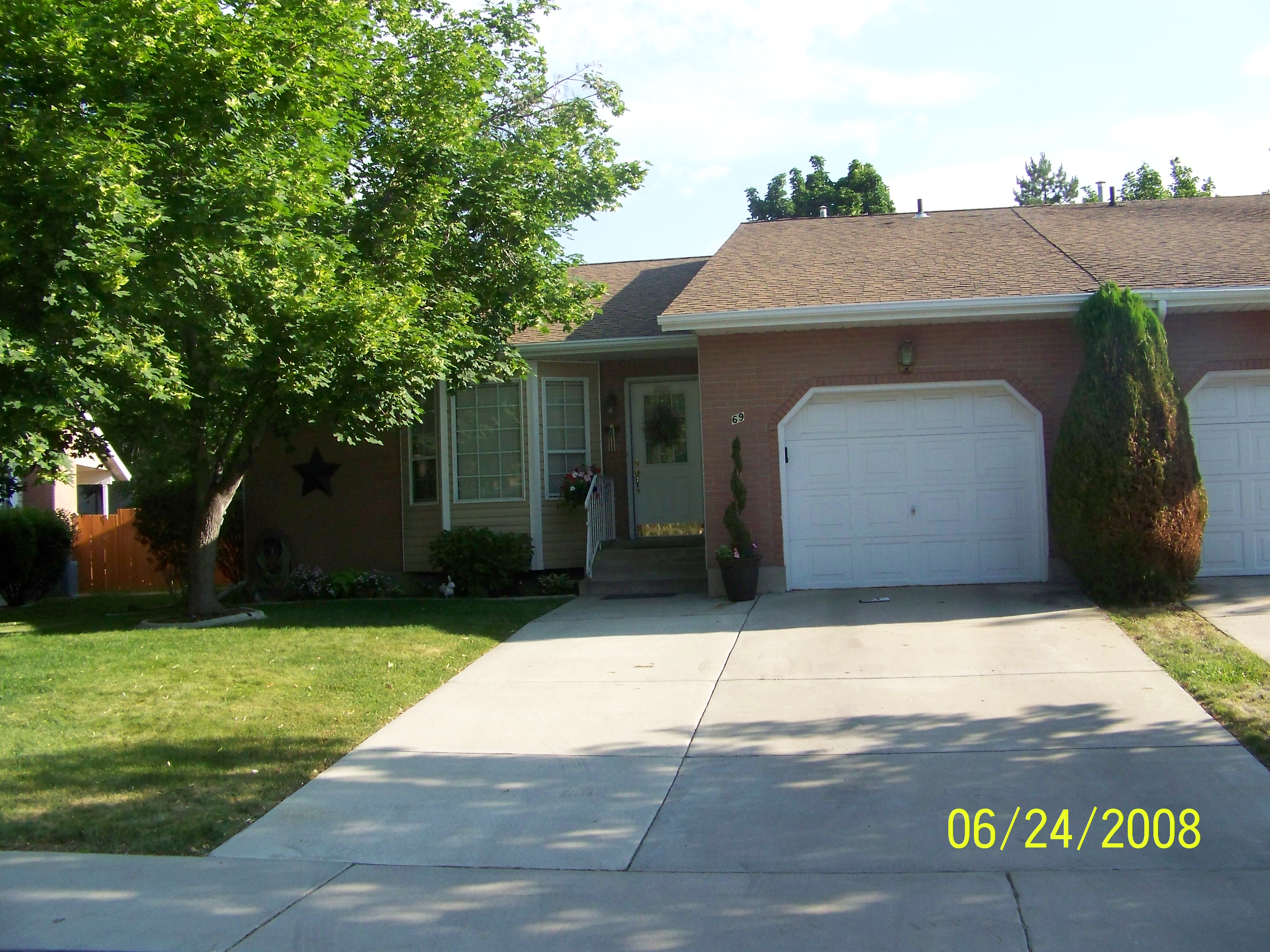
| Property Address: 69 E HANOVER DR - OREM |
|
| Mailing Address: 69 HANOVER DR OREM, UT 84058-3120 |
|
| Acreage: 0.066116 |
|
| Last Document:
121725-2003
|
|
| Subdivision Map Filing |
|
| Taxing Description:
LOT 12, PLAT A, MAIN STREET PUD SUB AREA 0.033 AC. ALSO LOT 13, PLAT A, MAIN STREET PUD SUB AREA 0.033 AC. TOTAL AREA .066 AC.
*Taxing description NOT FOR LEGAL DOCUMENTS
|
|
- Owner Names
- Value History
- Tax History
- Location
- Photos
- Documents
- Aerial Image
| |
----- Real Estate Values ----- |
---Improvements--- |
---Greenbelt--- |
Total |
| Year |
Com |
Res |
Agr |
Tot |
Com |
Res |
Agr |
Tot |
Land |
Homesite |
Tot |
Market Value |
| 2024 |
$0 |
$60,400 |
$0 |
$60,400 |
$0 |
$350,700 |
$0 |
$350,700 |
$0 |
$0 |
$0 |
$411,100 |
| 2023 |
$0 |
$60,700 |
$0 |
$60,700 |
$0 |
$352,400 |
$0 |
$352,400 |
$0 |
$0 |
$0 |
$413,100 |
| 2022 |
$0 |
$61,700 |
$0 |
$61,700 |
$0 |
$349,900 |
$0 |
$349,900 |
$0 |
$0 |
$0 |
$411,600 |
| 2021 |
$0 |
$46,400 |
$0 |
$46,400 |
$0 |
$263,100 |
$0 |
$263,100 |
$0 |
$0 |
$0 |
$309,500 |
| 2020 |
$0 |
$43,000 |
$0 |
$43,000 |
$0 |
$243,700 |
$0 |
$243,700 |
$0 |
$0 |
$0 |
$286,700 |
| 2019 |
$0 |
$41,100 |
$0 |
$41,100 |
$0 |
$232,900 |
$0 |
$232,900 |
$0 |
$0 |
$0 |
$274,000 |
| 2018 |
$0 |
$32,600 |
$0 |
$32,600 |
$0 |
$184,500 |
$0 |
$184,500 |
$0 |
$0 |
$0 |
$217,100 |
| 2017 |
$0 |
$32,600 |
$0 |
$32,600 |
$0 |
$184,500 |
$0 |
$184,500 |
$0 |
$0 |
$0 |
$217,100 |
| 2016 |
$0 |
$35,000 |
$0 |
$35,000 |
$0 |
$157,000 |
$0 |
$157,000 |
$0 |
$0 |
$0 |
$192,000 |
| 2015 |
$0 |
$30,000 |
$0 |
$30,000 |
$0 |
$148,000 |
$0 |
$148,000 |
$0 |
$0 |
$0 |
$178,000 |
| 2014 |
$0 |
$30,000 |
$0 |
$30,000 |
$0 |
$143,000 |
$0 |
$143,000 |
$0 |
$0 |
$0 |
$173,000 |
| 2013 |
$0 |
$30,000 |
$0 |
$30,000 |
$0 |
$143,000 |
$0 |
$143,000 |
$0 |
$0 |
$0 |
$173,000 |
| 2012 |
$0 |
$30,000 |
$0 |
$30,000 |
$0 |
$155,000 |
$0 |
$155,000 |
$0 |
$0 |
$0 |
$185,000 |
| 2011 |
$0 |
$30,000 |
$0 |
$30,000 |
$0 |
$155,000 |
$0 |
$155,000 |
$0 |
$0 |
$0 |
$185,000 |
| 2010 |
$0 |
$32,000 |
$0 |
$32,000 |
$0 |
$167,900 |
$0 |
$167,900 |
$0 |
$0 |
$0 |
$199,900 |
| 2009 |
$0 |
$32,000 |
$0 |
$32,000 |
$0 |
$167,900 |
$0 |
$167,900 |
$0 |
$0 |
$0 |
$199,900 |
| 2008 |
$0 |
$26,000 |
$0 |
$26,000 |
$0 |
$139,000 |
$0 |
$139,000 |
$0 |
$0 |
$0 |
$165,000 |
| 2007 |
$0 |
$26,000 |
$0 |
$26,000 |
$0 |
$139,000 |
$0 |
$139,000 |
$0 |
$0 |
$0 |
$165,000 |
| 2006 |
$0 |
$16,600 |
$0 |
$16,600 |
$0 |
$127,400 |
$0 |
$127,400 |
$0 |
$0 |
$0 |
$144,000 |
| 2005 |
$0 |
$16,600 |
$0 |
$16,600 |
$0 |
$127,400 |
$0 |
$127,400 |
$0 |
$0 |
$0 |
$144,000 |
| 2004 |
$0 |
$16,612 |
$0 |
$16,612 |
$0 |
$127,399 |
$0 |
$127,399 |
$0 |
$0 |
$0 |
$144,011 |
| Year |
General Taxes |
Adjustments |
Net Taxes |
Fees |
Payments |
Tax Balance* |
Balance Due |
Tax District |
| 2025 |
$0.00 |
$0.00 |
$0.00 |
$0.00 |
|
$0.00
|
$0.00 |
090 - OREM CITY |
| 2024 |
$0.00 |
$0.00 |
$0.00 |
$0.00 |
|
$0.00
|
$0.00 |
090 - OREM CITY |
| 2023 |
$1,728.80 |
$0.00 |
$1,728.80 |
$0.00 |
|
$0.00
|
$0.00 |
090 - OREM CITY |
| 2022 |
$1,777.99 |
$0.00 |
$1,777.99 |
$0.00 |
|
$0.00
|
$0.00 |
090 - OREM CITY |
| 2021 |
$1,604.88 |
$0.00 |
$1,604.88 |
$0.00 |
|
$0.00
|
$0.00 |
090 - OREM CITY |
| 2020 |
$1,512.67 |
$0.00 |
$1,512.67 |
$0.00 |
|
$0.00
|
$0.00 |
090 - OREM CITY |
| 2019 |
$1,390.21 |
$0.00 |
$1,390.21 |
$0.00 |
|
$0.00
|
$0.00 |
090 - OREM CITY |
| 2018 |
$1,152.86 |
$0.00 |
$1,152.86 |
$0.00 |
|
$0.00
|
$0.00 |
090 - OREM CITY |
| 2017 |
$1,183.66 |
$0.00 |
$1,183.66 |
$0.00 |
|
$0.00
|
$0.00 |
090 - OREM CITY |
| 2016 |
$1,135.20 |
$0.00 |
$1,135.20 |
$0.00 |
|
$0.00
|
$0.00 |
090 - OREM CITY |
| 2015 |
$1,112.83 |
$0.00 |
$1,112.83 |
$0.00 |
|
$0.00
|
$0.00 |
090 - OREM CITY |
| 2014 |
$1,086.52 |
$0.00 |
$1,086.52 |
$0.00 |
|
$0.00
|
$0.00 |
090 - OREM CITY |
| 2013 |
$1,171.68 |
$0.00 |
$1,171.68 |
$0.00 |
|
$0.00
|
$0.00 |
090 - OREM CITY |
| 2012 |
$1,278.79 |
$0.00 |
$1,278.79 |
$0.00 |
|
$0.00
|
$0.00 |
090 - OREM CITY |
| 2011 |
$1,272.69 |
$0.00 |
$1,272.69 |
$0.00 |
|
$0.00
|
$0.00 |
090 - OREM CITY |
| 2010 |
$1,287.46 |
$0.00 |
$1,287.46 |
$0.00 |
|
$0.00
|
$0.00 |
090 - OREM CITY |
| 2009 |
$1,193.45 |
$0.00 |
$1,193.45 |
$0.00 |
|
$0.00
|
$0.00 |
090 - OREM CITY |
| 2008 |
$912.85 |
$0.00 |
$912.85 |
$0.00 |
|
$0.00
|
$0.00 |
090 - OREM CITY |
| 2007 |
$902.42 |
$0.00 |
$902.42 |
$0.00 |
|
$0.00
|
$0.00 |
090 - OREM CITY |
| 2006 |
$838.65 |
$0.00 |
$838.65 |
$0.00 |
|
$0.00
|
$0.00 |
090 - OREM CITY |
| 2005 |
$946.60 |
$0.00 |
$946.60 |
$0.00 |
|
$0.00
|
$0.00 |
090 - OREM CITY |
| 2004 |
$929.88 |
$0.00 |
$929.88 |
$0.00 |
|
$0.00
|
$0.00 |
090 - OREM CITY |
* Note: Original tax amount (Does not include applicable interest and/or fees).
| Entry # |
Date |
Recorded |
Type |
Party1 (Grantor) |
Party2 (Grantee) |
| 147715-2021 |
08/23/2021 |
08/24/2021 |
ADECCOV |
MAIN STREET PLANNED UNIT DEVELOPMENT (HANOVER DRIVE ASSOCIATION) |
WHOM OF INTEREST |
| 91122-2015 |
09/29/2015 |
10/05/2015 |
QCD |
RAWLINGS, JANICE T TEE (ET AL) |
THOMPSON, EVA LOREEN TEE |
| 91121-2015 |
09/29/2015 |
10/05/2015 |
AF DC |
THOMPSON, ALMA EVAN & ALMA E AKA (ET AL) |
RAWLINGS, JANICE T SUCTEE (ET AL) |
| 53702-2008 |
|
05/06/2008 |
ADECCOV |
WHOM OF INTEREST |
WHOM OF INTEREST |
| 121725-2003 |
|
08/04/2003 |
N SPREC |
UTAH COUNTY RECORDER |
WHOM OF INTEREST |
Main Menu Comments or Concerns on Value/Appraisal - Assessor's Office
Documents/Owner/Parcel information - Recorder's Office
Address Change for Tax Notice
This page was created on 8/7/2024 7:42:37 AM |
