Property Information
mobile view
| Serial Number: 46:217:0002 |
Serial Life: 1986... |
|
|
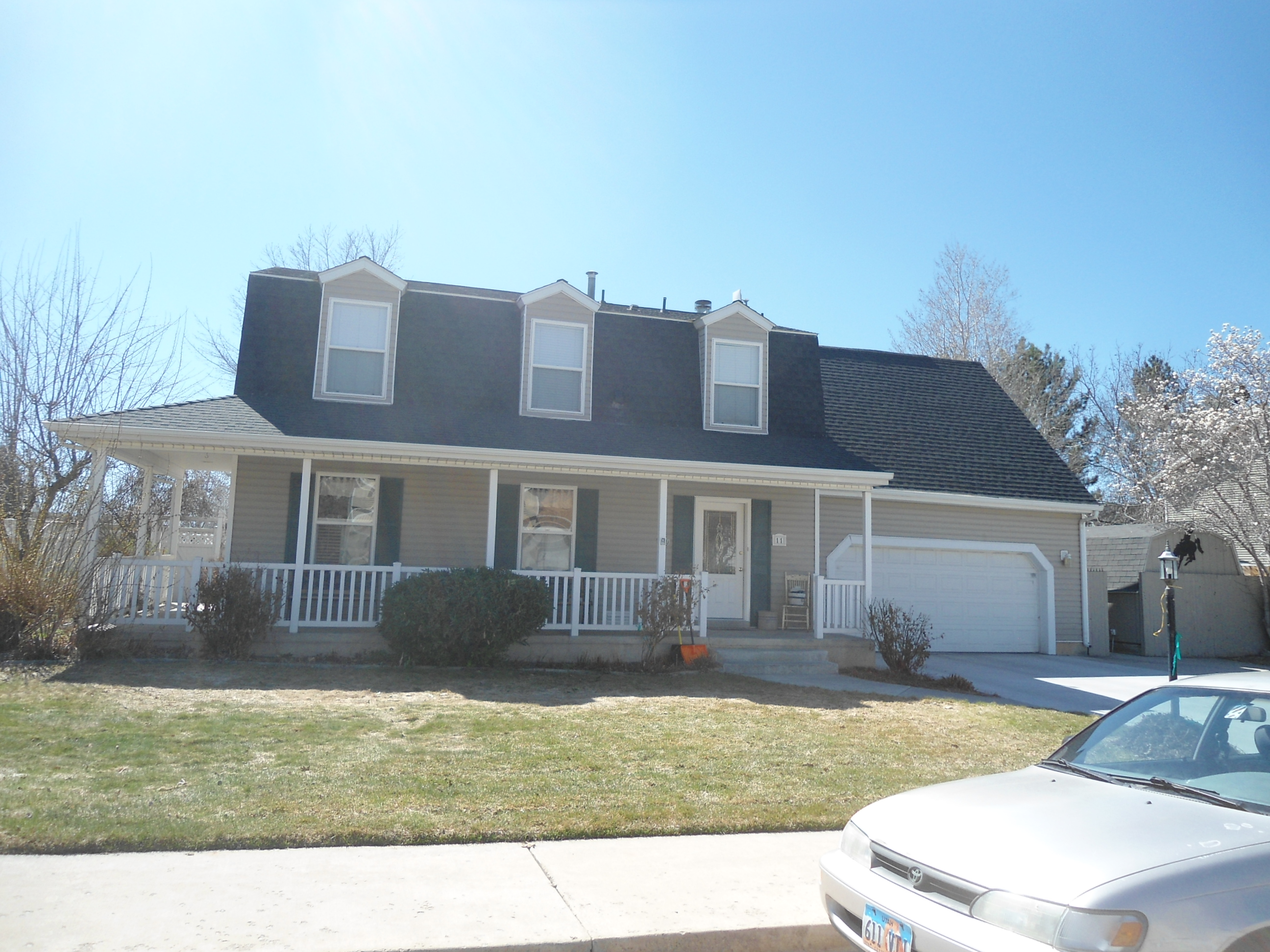 Total Photos: 3
|
| |
|
|
| Property Address: 11 W 1780 NORTH - OREM |
|
| Mailing Address: 11 W 1780 N OREM, UT 84057-2176 |
|
| Acreage: 0.22 |
|
| Last Document:
33750-1985
|
|
| Subdivision Map Filing |
|
| Taxing Description:
LOT 2, PLAT G, MAPLE TREE SUB.
*Taxing description NOT FOR LEGAL DOCUMENTS
|
|
- Owner Names
- Value History
- Tax History
- Location
- Photos
- Documents
- Aerial Image
| |
----- Real Estate Values ----- |
---Improvements--- |
---Greenbelt--- |
Total |
| Year |
Com |
Res |
Agr |
Tot |
Com |
Res |
Agr |
Tot |
Land |
Homesite |
Tot |
Market Value |
| 2024 |
$0 |
$250,000 |
$0 |
$250,000 |
$0 |
$388,800 |
$0 |
$388,800 |
$0 |
$0 |
$0 |
$638,800 |
| 2023 |
$0 |
$250,000 |
$0 |
$250,000 |
$0 |
$412,100 |
$0 |
$412,100 |
$0 |
$0 |
$0 |
$662,100 |
| 2022 |
$0 |
$266,600 |
$0 |
$266,600 |
$0 |
$351,100 |
$0 |
$351,100 |
$0 |
$0 |
$0 |
$617,700 |
| 2021 |
$0 |
$156,800 |
$0 |
$156,800 |
$0 |
$313,500 |
$0 |
$313,500 |
$0 |
$0 |
$0 |
$470,300 |
| 2020 |
$0 |
$125,400 |
$0 |
$125,400 |
$0 |
$307,400 |
$0 |
$307,400 |
$0 |
$0 |
$0 |
$432,800 |
| 2019 |
$0 |
$125,400 |
$0 |
$125,400 |
$0 |
$267,300 |
$0 |
$267,300 |
$0 |
$0 |
$0 |
$392,700 |
| 2018 |
$0 |
$118,300 |
$0 |
$118,300 |
$0 |
$267,300 |
$0 |
$267,300 |
$0 |
$0 |
$0 |
$385,600 |
| 2017 |
$0 |
$82,400 |
$0 |
$82,400 |
$0 |
$245,200 |
$0 |
$245,200 |
$0 |
$0 |
$0 |
$327,600 |
| 2016 |
$0 |
$73,800 |
$0 |
$73,800 |
$0 |
$235,800 |
$0 |
$235,800 |
$0 |
$0 |
$0 |
$309,600 |
| 2015 |
$0 |
$71,700 |
$0 |
$71,700 |
$0 |
$229,800 |
$0 |
$229,800 |
$0 |
$0 |
$0 |
$301,500 |
| 2014 |
$0 |
$69,500 |
$0 |
$69,500 |
$0 |
$194,700 |
$0 |
$194,700 |
$0 |
$0 |
$0 |
$264,200 |
| 2013 |
$0 |
$55,900 |
$0 |
$55,900 |
$0 |
$181,500 |
$0 |
$181,500 |
$0 |
$0 |
$0 |
$237,400 |
| 2012 |
$0 |
$56,800 |
$0 |
$56,800 |
$0 |
$197,600 |
$0 |
$197,600 |
$0 |
$0 |
$0 |
$254,400 |
| 2011 |
$0 |
$68,100 |
$0 |
$68,100 |
$0 |
$194,000 |
$0 |
$194,000 |
$0 |
$0 |
$0 |
$262,100 |
| 2010 |
$0 |
$80,608 |
$0 |
$80,608 |
$0 |
$198,045 |
$0 |
$198,045 |
$0 |
$0 |
$0 |
$278,653 |
| 2009 |
$0 |
$92,200 |
$0 |
$92,200 |
$0 |
$197,600 |
$0 |
$197,600 |
$0 |
$0 |
$0 |
$289,800 |
| 2008 |
$0 |
$92,200 |
$0 |
$92,200 |
$0 |
$248,700 |
$0 |
$248,700 |
$0 |
$0 |
$0 |
$340,900 |
| 2007 |
$0 |
$96,000 |
$0 |
$96,000 |
$0 |
$259,100 |
$0 |
$259,100 |
$0 |
$0 |
$0 |
$355,100 |
| 2006 |
$0 |
$52,500 |
$0 |
$52,500 |
$0 |
$189,600 |
$0 |
$189,600 |
$0 |
$0 |
$0 |
$242,100 |
| 2005 |
$0 |
$50,017 |
$0 |
$50,017 |
$0 |
$180,602 |
$0 |
$180,602 |
$0 |
$0 |
$0 |
$230,619 |
| 2004 |
$0 |
$50,017 |
$0 |
$50,017 |
$0 |
$180,602 |
$0 |
$180,602 |
$0 |
$0 |
$0 |
$230,619 |
| 2003 |
$0 |
$50,017 |
$0 |
$50,017 |
$0 |
$173,956 |
$0 |
$173,956 |
$0 |
$0 |
$0 |
$223,973 |
| 2002 |
$0 |
$50,017 |
$0 |
$50,017 |
$0 |
$173,956 |
$0 |
$173,956 |
$0 |
$0 |
$0 |
$223,973 |
| 2001 |
$0 |
$50,017 |
$0 |
$50,017 |
$0 |
$114,435 |
$0 |
$114,435 |
$0 |
$0 |
$0 |
$164,452 |
| 2000 |
$0 |
$46,745 |
$0 |
$46,745 |
$0 |
$104,938 |
$0 |
$104,938 |
$0 |
$0 |
$0 |
$151,683 |
| 1999 |
$0 |
$43,687 |
$0 |
$43,687 |
$0 |
$98,073 |
$0 |
$98,073 |
$0 |
$0 |
$0 |
$141,760 |
| 1998 |
$0 |
$43,687 |
$0 |
$43,687 |
$0 |
$98,073 |
$0 |
$98,073 |
$0 |
$0 |
$0 |
$141,760 |
| 1997 |
$0 |
$43,687 |
$0 |
$43,687 |
$0 |
$98,073 |
$0 |
$98,073 |
$0 |
$0 |
$0 |
$141,760 |
| 1996 |
$0 |
$41,273 |
$0 |
$41,273 |
$0 |
$92,653 |
$0 |
$92,653 |
$0 |
$0 |
$0 |
$133,926 |
| 1995 |
$0 |
$37,521 |
$0 |
$37,521 |
$0 |
$92,653 |
$0 |
$92,653 |
$0 |
$0 |
$0 |
$130,174 |
| 1994 |
$0 |
$21,942 |
$0 |
$21,942 |
$0 |
$74,720 |
$0 |
$74,720 |
$0 |
$0 |
$0 |
$96,662 |
| 1993 |
$0 |
$21,942 |
$0 |
$21,942 |
$0 |
$74,720 |
$0 |
$74,720 |
$0 |
$0 |
$0 |
$96,662 |
| 1992 |
$0 |
$20,130 |
$0 |
$20,130 |
$0 |
$68,550 |
$0 |
$68,550 |
$0 |
$0 |
$0 |
$88,680 |
| 1991 |
$0 |
$17,658 |
$0 |
$17,658 |
$0 |
$58,174 |
$0 |
$58,174 |
$0 |
$0 |
$0 |
$75,832 |
| 1990 |
$0 |
$17,658 |
$0 |
$17,658 |
$0 |
$55,633 |
$0 |
$55,633 |
$0 |
$0 |
$0 |
$73,291 |
| 1989 |
$0 |
$17,658 |
$0 |
$17,658 |
$0 |
$55,633 |
$0 |
$55,633 |
$0 |
$0 |
$0 |
$73,291 |
| 1988 |
$0 |
$17,658 |
$0 |
$17,658 |
$0 |
$52,618 |
$0 |
$52,618 |
$0 |
$0 |
$0 |
$70,276 |
| 1987 |
$0 |
$17,658 |
$0 |
$17,658 |
$0 |
$58,542 |
$0 |
$58,542 |
$0 |
$0 |
$0 |
$76,200 |
| 1986 |
$0 |
$0 |
$17,581 |
$17,581 |
$0 |
$0 |
$0 |
$0 |
$0 |
$0 |
$0 |
$17,581 |
| Year |
General Taxes |
Adjustments |
Net Taxes |
Fees |
Payments |
Tax Balance* |
Balance Due |
Tax District |
| 2025 |
$0.00 |
$0.00 |
$0.00 |
$0.00 |
|
$0.00
|
$0.00 |
090 - OREM CITY |
| 2024 |
$2,873.26 |
$0.00 |
$2,873.26 |
$0.00 |
|
$0.00
|
$0.00 |
090 - OREM CITY |
| 2023 |
$2,770.86 |
$0.00 |
$2,770.86 |
$0.00 |
|
$0.00
|
$0.00 |
090 - OREM CITY |
| 2022 |
$2,668.28 |
$0.00 |
$2,668.28 |
$0.00 |
|
$0.00
|
$0.00 |
090 - OREM CITY |
| 2021 |
$2,438.69 |
$0.00 |
$2,438.69 |
$0.00 |
|
$0.00
|
$0.00 |
090 - OREM CITY |
| 2020 |
$2,283.52 |
$0.00 |
$2,283.52 |
$0.00 |
|
$0.00
|
$0.00 |
090 - OREM CITY |
| 2019 |
$1,992.46 |
$0.00 |
$1,992.46 |
$0.00 |
|
$0.00
|
$0.00 |
090 - OREM CITY |
| 2018 |
$2,047.63 |
$0.00 |
$2,047.63 |
$0.00 |
|
$0.00
|
$0.00 |
090 - OREM CITY |
| 2017 |
$1,786.12 |
$0.00 |
$1,786.12 |
$0.00 |
|
$0.00
|
$0.00 |
090 - OREM CITY |
| 2016 |
$1,830.51 |
$0.00 |
$1,830.51 |
$0.00 |
|
$0.00
|
$0.00 |
090 - OREM CITY |
| 2015 |
$1,884.93 |
$0.00 |
$1,884.93 |
$0.00 |
|
$0.00
|
$0.00 |
090 - OREM CITY |
| 2014 |
$1,659.29 |
$0.00 |
$1,659.29 |
$0.00 |
|
$0.00
|
$0.00 |
090 - OREM CITY |
| 2013 |
$1,607.84 |
$0.00 |
$1,607.84 |
$0.00 |
|
$0.00
|
$0.00 |
090 - OREM CITY |
| 2012 |
$1,758.51 |
$0.00 |
$1,758.51 |
$0.00 |
|
$0.00
|
$0.00 |
090 - OREM CITY |
| 2011 |
$1,803.09 |
$0.00 |
$1,803.09 |
$0.00 |
|
$0.00
|
$0.00 |
090 - OREM CITY |
| 2010 |
$1,794.66 |
$0.00 |
$1,794.66 |
$0.00 |
|
$0.00
|
$0.00 |
090 - OREM CITY |
| 2009 |
$1,730.18 |
$0.00 |
$1,730.18 |
$0.00 |
|
$0.00
|
$0.00 |
090 - OREM CITY |
| 2008 |
$1,886.01 |
$0.00 |
$1,886.01 |
$0.00 |
|
$0.00
|
$0.00 |
090 - OREM CITY |
| 2007 |
$1,942.11 |
$0.00 |
$1,942.11 |
$0.00 |
|
$0.00
|
$0.00 |
090 - OREM CITY |
| 2006 |
$1,409.98 |
$0.00 |
$1,409.98 |
$0.00 |
|
$0.00
|
$0.00 |
090 - OREM CITY |
| 2005 |
$1,515.99 |
$0.00 |
$1,515.99 |
$0.00 |
|
$0.00
|
$0.00 |
090 - OREM CITY |
| 2004 |
$1,489.10 |
$0.00 |
$1,489.10 |
$0.00 |
|
$0.00
|
$0.00 |
090 - OREM CITY |
| 2003 |
$1,403.32 |
$0.00 |
$1,403.32 |
$0.00 |
|
$0.00
|
$0.00 |
090 - OREM CITY |
| 2002 |
$1,282.48 |
$0.00 |
$1,282.48 |
$0.00 |
|
$0.00
|
$0.00 |
090 - OREM CITY |
| 2001 |
$932.61 |
$0.00 |
$932.61 |
$0.00 |
|
$0.00
|
$0.00 |
090 - OREM CITY |
| 2000 |
$889.40 |
$0.00 |
$889.40 |
$0.00 |
|
$0.00
|
$0.00 |
090 - OREM CITY |
| 1999 |
$855.78 |
$0.00 |
$855.78 |
$0.00 |
|
$0.00
|
$0.00 |
090 - OREM CITY |
| 1998 |
$808.06 |
$0.00 |
$808.06 |
$0.00 |
|
$0.00
|
$0.00 |
090 - OREM CITY |
| 1997 |
$804.71 |
$0.00 |
$804.71 |
$0.00 |
|
$0.00
|
$0.00 |
090 - OREM CITY |
| 1996 |
$694.53 |
$0.00 |
$694.53 |
$0.00 |
|
$0.00
|
$0.00 |
090 - OREM CITY |
| 1995 |
$763.93 |
$0.00 |
$763.93 |
$0.00 |
|
$0.00
|
$0.00 |
090 - OREM CITY |
| 1994 |
$903.80 |
$0.00 |
$903.80 |
$0.00 |
|
$0.00
|
$0.00 |
090 - OREM CITY |
| 1993 |
$799.86 |
$0.00 |
$799.86 |
$0.00 |
|
$0.00
|
$0.00 |
090 - OREM CITY |
| 1992 |
$739.85 |
$0.00 |
$739.85 |
$0.00 |
|
$0.00
|
$0.00 |
090 - OREM CITY |
| 1991 |
$661.46 |
$0.00 |
$661.46 |
$0.00 |
|
$0.00
|
$0.00 |
090 - OREM CITY |
| 1990 |
$614.55 |
$0.00 |
$614.55 |
$0.00 |
|
$0.00
|
$0.00 |
090 - OREM CITY |
| 1989 |
$626.34 |
$0.00 |
$626.34 |
$0.00 |
|
$0.00
|
$0.00 |
090 - OREM CITY |
| 1988 |
$599.14 |
$0.00 |
$599.14 |
$0.00 |
|
$0.00
|
$0.00 |
090 - OREM CITY |
| 1987 |
$638.89 |
$0.00 |
$638.89 |
$0.00 |
|
$0.00
|
$0.00 |
090 - OREM CITY |
| 1986 |
$193.90 |
$0.00 |
$193.90 |
$0.00 |
|
$0.00
|
$0.00 |
090 - OREM CITY |
* Note: Original tax amount (Does not include applicable interest and/or fees).
| Entry # |
Date |
Recorded |
Type |
Party1 (Grantor) |
Party2 (Grantee) |
| 97161-2013 |
10/16/2013 |
10/16/2013 |
WD |
SANDERS, DANIEL SPAUGH & KELLI CLARK |
SANDERS, DANIEL & KELLI TEE |
| 72077-1999 |
06/21/1999 |
06/21/1999 |
REC |
RELIANCE ABSTRACT COMPANY SUCTEE |
SANDERS, DANIEL & KELLI |
| 72076-1999 |
06/11/1999 |
06/21/1999 |
SUB TEE |
GMAC MORTGAGE CORPORATION FKA (ET AL) |
RELIANCE ABSTRACT COMPANY SUCTEE |
| 66904-1995 |
09/19/1995 |
10/04/1995 |
AS |
ITT RESIDENTIAL CAPITAL SERVICING CORPORATION FKA (ET AL) |
GMAC MORTGAGE CORPORATION |
| 65270-1994 |
04/11/1994 |
08/16/1994 |
AS |
MEDALLION MORTGAGE COMPANY INC |
ITT RESIDENTIAL CAPITAL CORPORATION |
| 19600-1993 |
03/29/1993 |
04/02/1993 |
REC |
PROVO LAND TITLE COMPANY TEE |
SANDERS, DANIEL SPAUGH & KELLI CLARK |
| 5819-1993 |
01/29/1993 |
02/02/1993 |
REC |
PROVO LAND TITLE COMPANY TEE |
SANDERS, DANIEL SPAUGH & KELLI CLARK |
| 50591-1992 |
09/21/1992 |
09/25/1992 |
D TR |
SANDERS, DANIEL & KELLI |
MEDALLION MORTGAGE COMPANY |
| 3665-1989 |
02/09/1989 |
02/10/1989 |
REC |
AMERICAN SAVINGS & LOAN ASSOCIATION TEE |
LUCK, WAYNE R |
| 14310-1988 |
02/26/1988 |
05/19/1988 |
R LN |
HEATON, GERRY (ET AL) |
WHOM OF INTEREST |
| 14302-1988 |
02/26/1988 |
05/19/1988 |
R LP |
HEATON, GERRY (ET AL) |
DESTER & LUCK INC |
| 39319-1987 |
09/29/1987 |
10/22/1987 |
R LP |
INTERMOUNTAIN PRECISION-BILT HOMES INC (ET AL) |
NATURES ESTATES & ASSOCIATES (ET AL) |
| 6778-1987 |
01/23/1987 |
02/24/1987 |
REC |
ASSOCIATED TITLE COMPANY TEE |
DESTER AND LUCK INC |
| 41749-1986 |
12/05/1986 |
12/05/1986 |
N LN |
LAIDLER, ROBERT J & JOY L (ET AL) |
GENEVA ROCK PRODUCTS INC |
| 41223-1986 |
11/25/1986 |
12/02/1986 |
R LN |
ANDERSON LUMBER COMPANY |
WHOM OF INTEREST |
| 38798-1986 |
11/12/1986 |
11/12/1986 |
LP |
DESTER & LUCK INC |
ANDERSON LUMBER COMPANY |
| 38695-1986 |
11/12/1986 |
11/12/1986 |
LP |
DESTER & LUCK INC |
HEATON, GERRY (ET AL) |
| 31057-1986 |
08/11/1986 |
09/17/1986 |
AS |
HOME OWNERS FEDERAL SAVINGS AND LOAN ASSOC |
FEDERAL HOME LOAN MORTGAGE CORPORATION |
| 31056-1986 |
08/11/1986 |
09/17/1986 |
AS |
KNUTSON MORTGAGE AND FINANCIAL CORPORATION |
HOME OWNERS FEDERAL SAVINGS AND LOAN ASSOCIATION |
| 23966-1986 |
07/25/1986 |
07/25/1986 |
N LN |
DESTER & LUCK INC |
ANDERSON LUMBER COMPANY |
| 23636-1986 |
07/16/1986 |
07/23/1986 |
P REC |
AMERICAN SAVINGS & LOAN ASSOCIATION TEE |
LUCK, WAYNE R |
| 22373-1986 |
07/14/1986 |
07/15/1986 |
N LN |
DESTER & LUCK INC |
HEATON, GERRY (ET AL) |
| 15636-1986 |
05/13/1986 |
05/21/1986 |
D TR |
SANDERS, DANIEL SPAUGH & KELLI CLARK |
KNUTSON MORTGAGE AND FINANCIAL CORPORATION |
| 15385-1986 |
|
05/20/1986 |
WD |
LUCK, WAYNE R |
DESTER & LUCK INC |
| 14859-1986 |
05/13/1986 |
05/15/1986 |
D TR |
SANDERS, DANIEL & KELLI CLARK |
KNUTSON MORTGAGE AND FINANCIAL CORPORATION |
| 14858-1986 |
05/13/1986 |
05/15/1986 |
WD |
DESTER & LUCK INC |
SANDERS, DANIEL SPAUGH & KELLI CLARK |
| 5819-1986 |
02/24/1986 |
02/27/1986 |
RC |
OREM GENEVA FEDERAL CREDIT UNION |
WHOM OF INTEREST |
| 33751-1985 |
11/14/1985 |
11/18/1985 |
D TR |
LUCK, WAYNE R |
AMERICAN SAVINGS & LOAN ASSOCIATION |
| 33750-1985 |
11/15/1985 |
11/18/1985 |
WD |
DESTER AND LUCK INC |
LUCK, WAYNE R |
| 33749-1985 |
11/14/1985 |
11/18/1985 |
DECLCOV |
DESTER & LUCK INC |
WHOM OF INTEREST |
| 33748-1985 |
06/26/1984 |
11/18/1985 |
S PLAT |
DESTER & LUCK INC |
MAPLE TREE PLAT G |
Main Menu Comments or Concerns on Value/Appraisal - Assessor's Office
Documents/Owner/Parcel information - Recorder's Office
Address Change for Tax Notice
This page was created on 4/22/2025 10:03:10 PM |

