Property Information
mobile view
| Serial Number: 46:990:0001 |
Serial Life: 2018... |
|
|
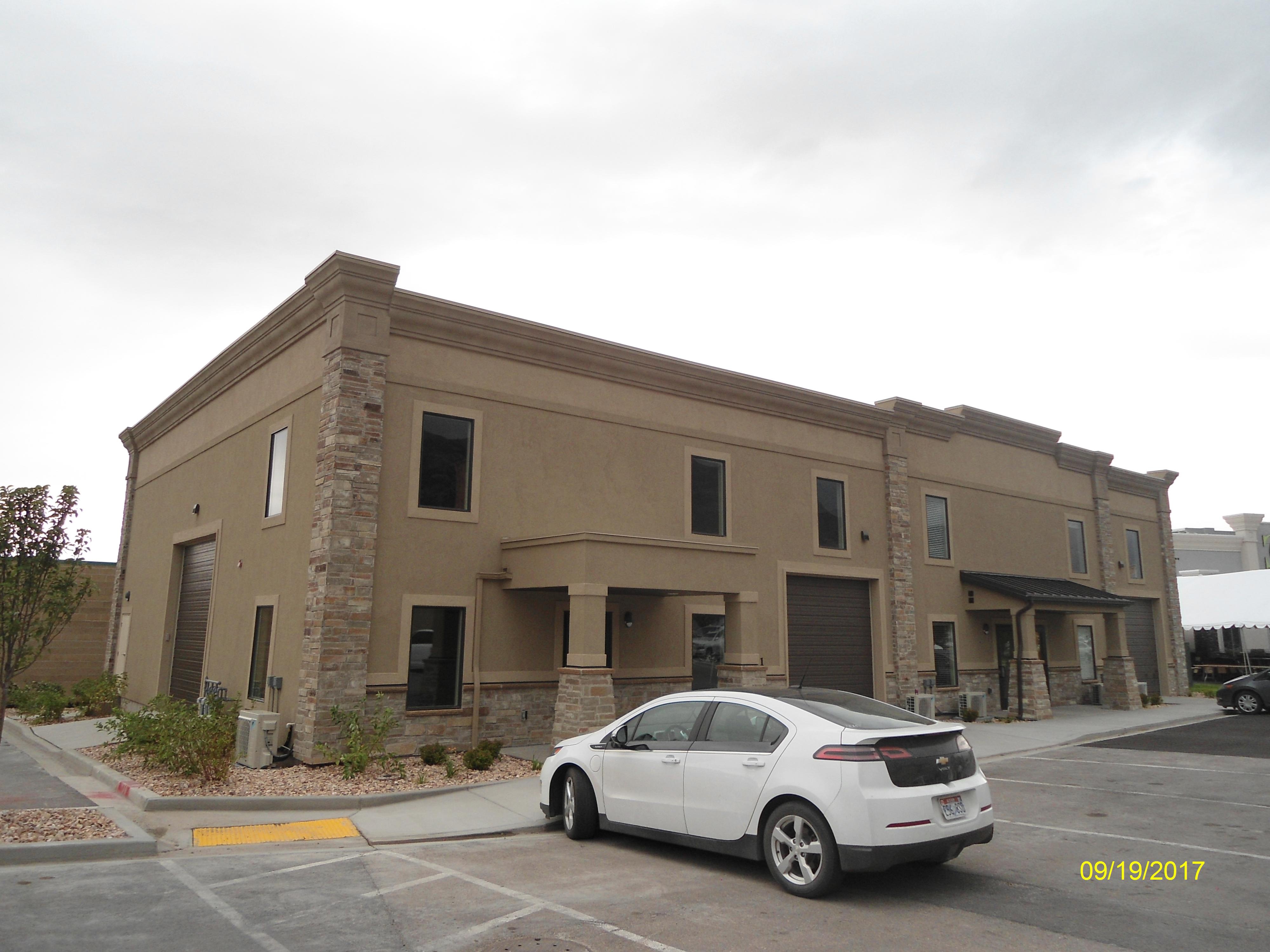
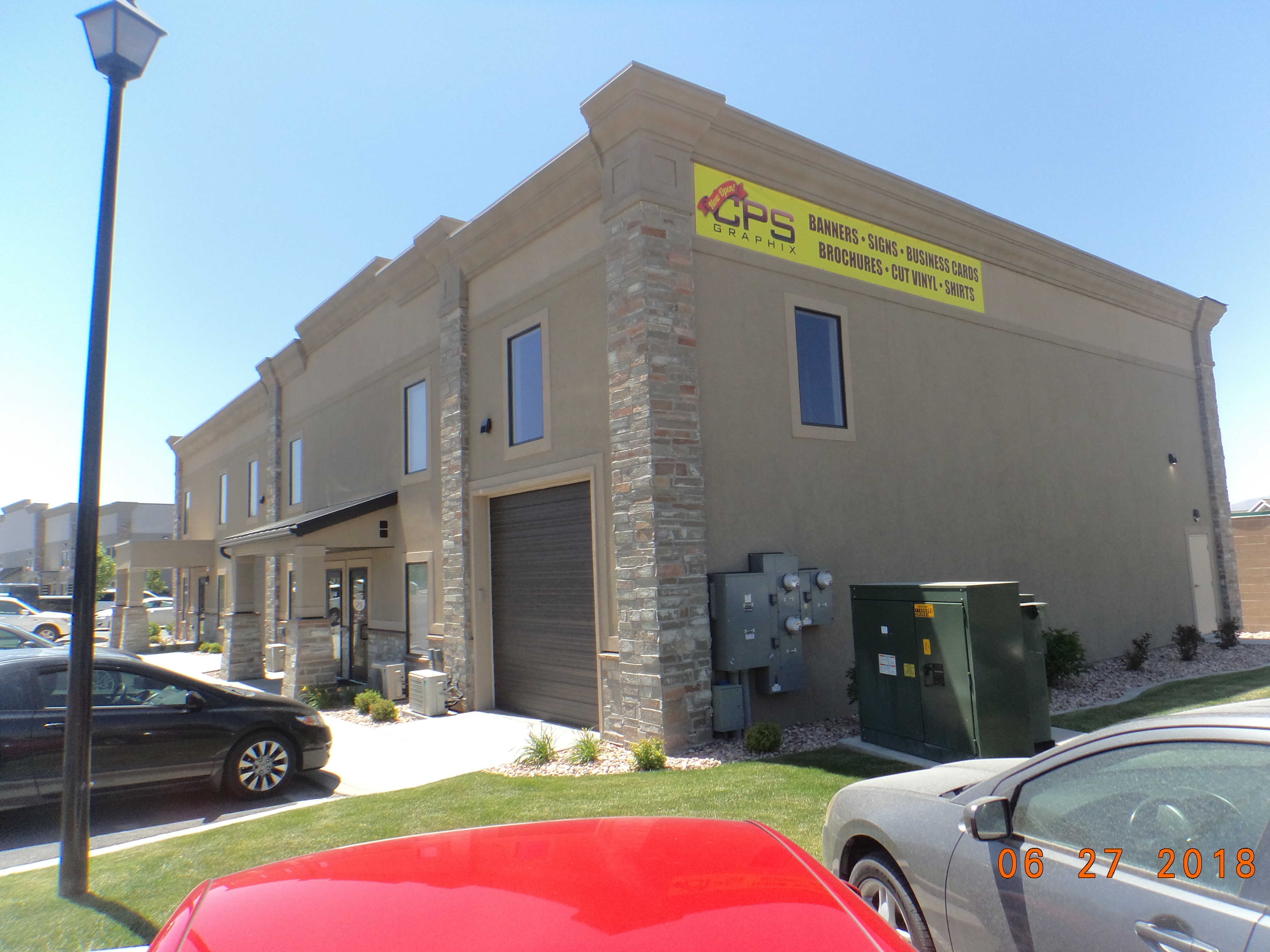
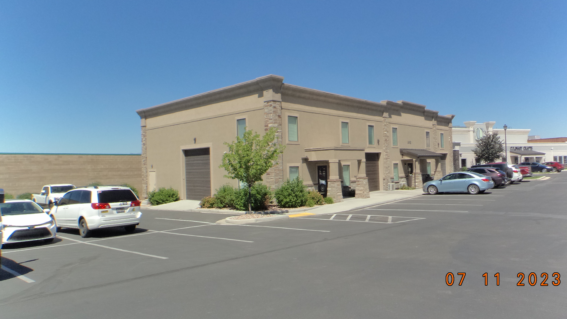 Total Photos: 6
|
| |
|
|
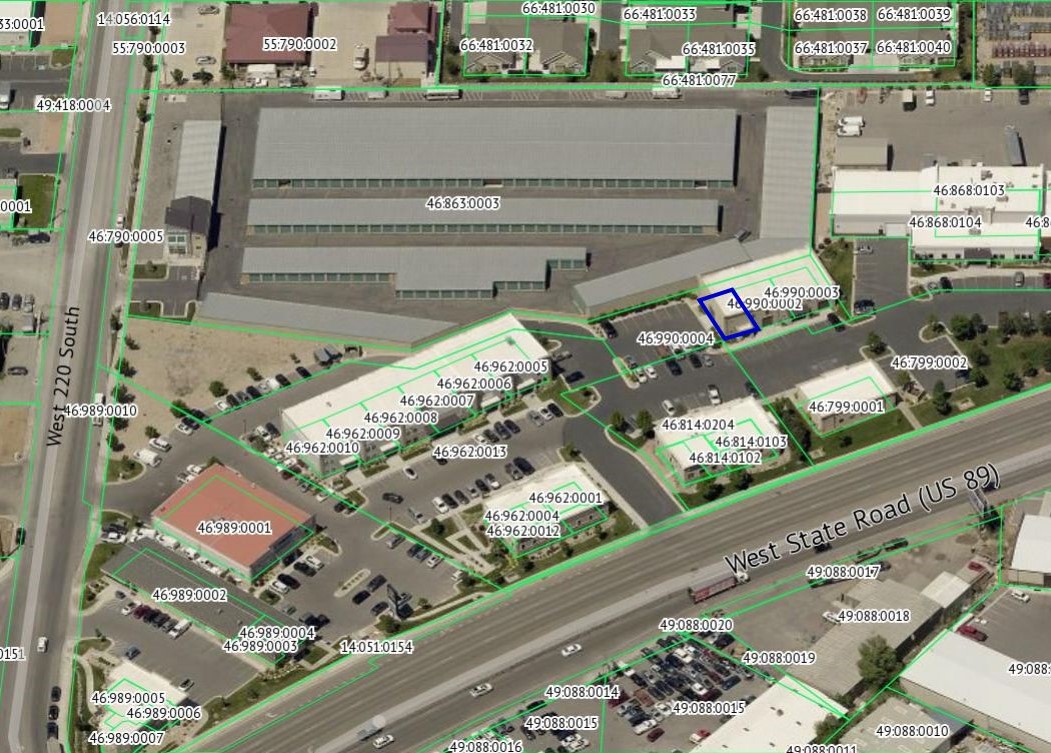
| Property Address: 541 W STATE ST Unit# I-101 - PLEASANT GROVE |
|
| Mailing Address: 10821 N 5750 W HIGHLAND, UT 84003-9036 |
|
| Acreage: 0.032245 |
|
| Last Document:
90614-2017
|
|
| Subdivision Map Filing |
|
| Taxing Description:
UNIT I-101, PLAT F, MAJESTIC MEADOWS CONDOMINIUMS. AREA 0.032 AC.
*Taxing description NOT FOR LEGAL DOCUMENTS
|
|
- Owner Names
- Value History
- Tax History
- Location
- Photos
- Documents
- Aerial Image
| |
----- Real Estate Values ----- |
---Improvements--- |
---Greenbelt--- |
Total |
| Year |
Com |
Res |
Agr |
Tot |
Com |
Res |
Agr |
Tot |
Land |
Homesite |
Tot |
Market Value |
| 2024 |
$84,500 |
$0 |
$0 |
$84,500 |
$154,700 |
$0 |
$0 |
$154,700 |
$0 |
$0 |
$0 |
$239,200 |
| 2023 |
$82,800 |
$0 |
$0 |
$82,800 |
$151,700 |
$0 |
$0 |
$151,700 |
$0 |
$0 |
$0 |
$234,500 |
| 2022 |
$82,800 |
$0 |
$0 |
$82,800 |
$122,800 |
$0 |
$0 |
$122,800 |
$0 |
$0 |
$0 |
$205,600 |
| 2021 |
$82,800 |
$0 |
$0 |
$82,800 |
$122,800 |
$0 |
$0 |
$122,800 |
$0 |
$0 |
$0 |
$205,600 |
| 2020 |
$82,800 |
$0 |
$0 |
$82,800 |
$122,800 |
$0 |
$0 |
$122,800 |
$0 |
$0 |
$0 |
$205,600 |
| 2019 |
$82,800 |
$0 |
$0 |
$82,800 |
$103,600 |
$0 |
$0 |
$103,600 |
$0 |
$0 |
$0 |
$186,400 |
| 2018 |
$55,200 |
$0 |
$0 |
$55,200 |
$101,500 |
$0 |
$0 |
$101,500 |
$0 |
$0 |
$0 |
$156,700 |
| Year |
General Taxes |
Adjustments |
Net Taxes |
Fees |
Payments |
Tax Balance* |
Balance Due |
Tax District |
| 2025 |
$0.00 |
$0.00 |
$0.00 |
$0.00 |
|
$0.00
|
$0.00 |
070 - PLEASANT GROVE CITY |
| 2024 |
$2,049.70 |
$0.00 |
$2,049.70 |
$0.00 |
|
|
Click for Payoff
|
070 - PLEASANT GROVE CITY |
| 2023 |
$1,919.38 |
($44.55) |
$1,874.83 |
$0.00 |
|
$0.00
|
$0.00 |
070 - PLEASANT GROVE CITY |
| 2022 |
$1,691.27 |
$0.00 |
$1,691.27 |
$0.00 |
|
$0.00
|
$0.00 |
070 - PLEASANT GROVE CITY |
| 2021 |
$2,019.61 |
$0.00 |
$2,019.61 |
$0.00 |
|
$0.00
|
$0.00 |
070 - PLEASANT GROVE CITY |
| 2020 |
$2,060.11 |
$0.00 |
$2,060.11 |
$0.00 |
|
$0.00
|
$0.00 |
070 - PLEASANT GROVE CITY |
| 2019 |
$1,806.03 |
$0.00 |
$1,806.03 |
$0.00 |
|
$0.00
|
$0.00 |
070 - PLEASANT GROVE CITY |
| 2018 |
$1,605.70 |
$0.00 |
$1,605.70 |
$0.00 |
|
$0.00
|
$0.00 |
070 - PLEASANT GROVE CITY |
* Note: Original tax amount (Does not include applicable interest and/or fees).
| Entry # |
Date |
Recorded |
Type |
Party1 (Grantor) |
Party2 (Grantee) |
| 83742-2020 |
06/20/2020 |
06/17/2020 |
SP WD |
ABE PROPERTIES LLC |
ABE MEADOWS A SERIEES OF ABE PROPERTIES LLC |
| 104090-2017 |
10/13/2017 |
10/20/2017 |
REC |
BANK OF AMERICAN FORK TEE |
AA DEVELOPMENT INC |
| 90615-2017 |
09/15/2017 |
09/15/2017 |
D TR |
ABE PROPERTIES LLC |
UTAH COMMUNITY FEDERAL CREDIT UNION |
| 90614-2017 |
09/15/2017 |
09/15/2017 |
WD |
AA DEVELOPMENT INC |
ABE PROPERTIES LLC |
| 84348-2017 |
08/10/2017 |
08/29/2017 |
DECLSUP |
AA DEVELOPMENT INC |
WHOM OF INTEREST |
| 84347-2017 |
08/11/2017 |
08/29/2017 |
C PLAT |
AA DEVELOPMENT INC |
MAJESTIC MEADOWS CONDO PLAT F |
Main Menu Comments or Concerns on Value/Appraisal - Assessor's Office
Documents/Owner/Parcel information - Recorder's Office
Address Change for Tax Notice
This page was created on 10/11/2024 5:20:36 PM |