Property Information
mobile view
| Serial Number: 47:010:0063 |
Serial Life: 2019... |
|
|
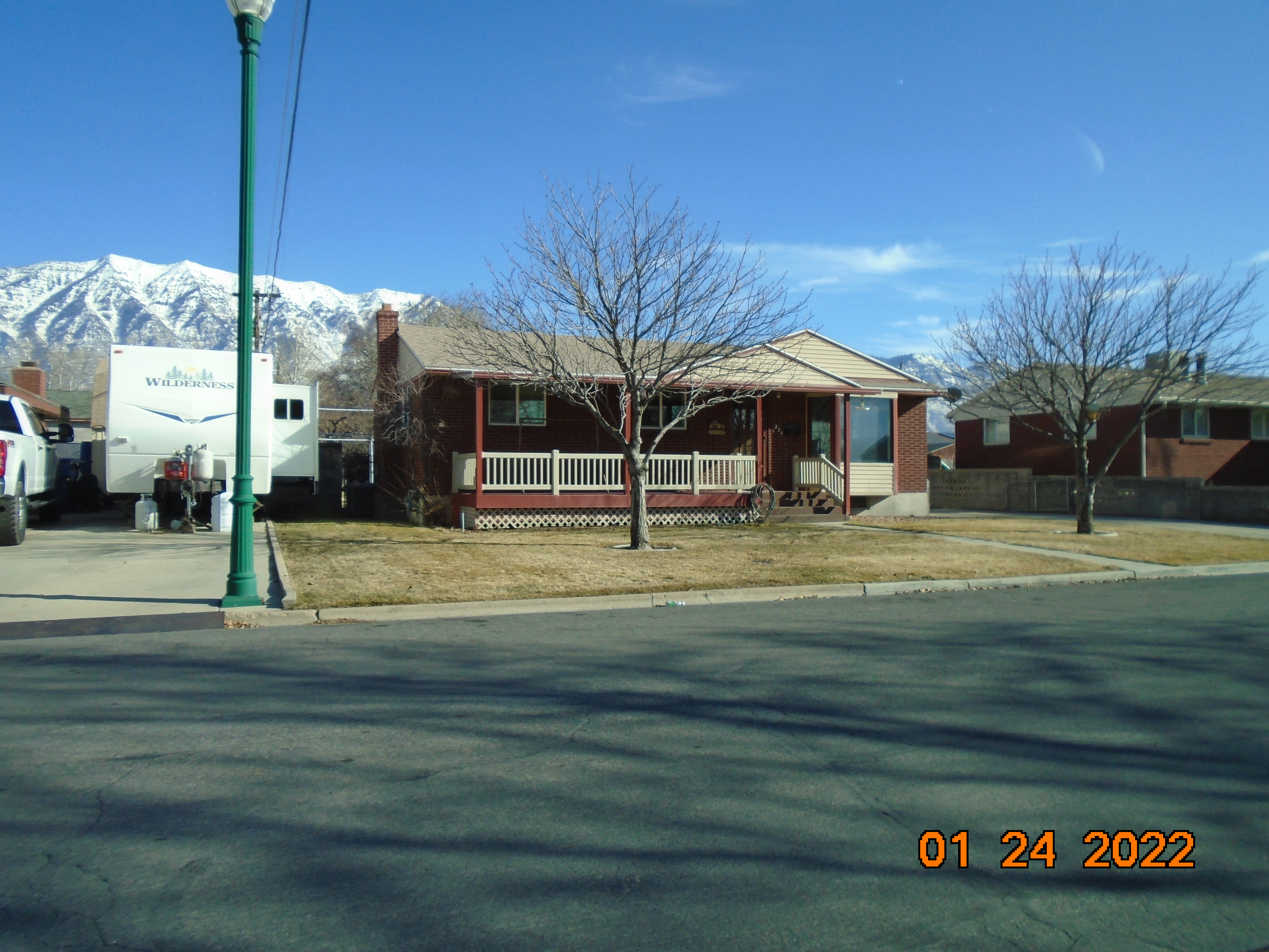 Total Photos: 1
|
| |
|
|
| Property Address: 274 N 250 EAST - OREM |
|
| Mailing Address: 274 N 250 E OREM, UT 84057-4709 |
|
| Acreage: 0.262 |
|
| Last Document:
101213-2018
|
|
| Subdivision Map Filing |
|
| Taxing Description:
PART LOT 5, BLK 3, PLAT A, NINETTA TRACT SUB DESRICBED AS FOLLOWS; COM S 0 DEG 16' 18" W 762.93 FT & N 89 DEG 43' 42" W 791.9 FT FR N1/4 COR. SEC. 14, T6S, R2E, SLB&M.; N 89 DEG 38' 0" W 32 FT; S 0 DEG 1' 0" E 65 FT; S 89 DEG 38' 0" E 32 FT ACTUAL COURSE EQ S89-37-59E 35; N 0 DEG 1' 0" W 65 FT TO BEG. AREA 0.048 AC. ALSO LOT 10, BLK 3, PLAT A, NINETTA TRACT SUBDV. AREA 0.210 AC. TOTAL AREA .258 AC.
*Taxing description NOT FOR LEGAL DOCUMENTS
|
|
- Owner Names
- Value History
- Tax History
- Location
- Photos
- Documents
- Aerial Image
| |
----- Real Estate Values ----- |
---Improvements--- |
---Greenbelt--- |
Total |
| Year |
Com |
Res |
Agr |
Tot |
Com |
Res |
Agr |
Tot |
Land |
Homesite |
Tot |
Market Value |
| 2024 |
$0 |
$215,800 |
$0 |
$215,800 |
$0 |
$238,300 |
$0 |
$238,300 |
$0 |
$0 |
$0 |
$454,100 |
| 2023 |
$0 |
$215,800 |
$0 |
$215,800 |
$0 |
$233,600 |
$0 |
$233,600 |
$0 |
$0 |
$0 |
$449,400 |
| 2022 |
$0 |
$230,100 |
$0 |
$230,100 |
$0 |
$206,100 |
$0 |
$206,100 |
$0 |
$0 |
$0 |
$436,200 |
| 2021 |
$0 |
$143,800 |
$0 |
$143,800 |
$0 |
$170,300 |
$0 |
$170,300 |
$0 |
$0 |
$0 |
$314,100 |
| 2020 |
$0 |
$115,000 |
$0 |
$115,000 |
$0 |
$167,000 |
$0 |
$167,000 |
$0 |
$0 |
$0 |
$282,000 |
| 2019 |
$0 |
$104,300 |
$0 |
$104,300 |
$0 |
$161,300 |
$0 |
$161,300 |
$0 |
$0 |
$0 |
$265,600 |
| Year |
General Taxes |
Adjustments |
Net Taxes |
Fees |
Payments |
Tax Balance* |
Balance Due |
Tax District |
| 2025 |
$0.00 |
$0.00 |
$0.00 |
$0.00 |
|
$0.00
|
$0.00 |
090 - OREM CITY |
| 2024 |
$2,042.50 |
($2,042.50) |
$0.00 |
$0.00 |
|
$0.00
|
$0.00 |
090 - OREM CITY |
| 2023 |
$1,880.72 |
($1,880.72) |
$0.00 |
$0.00 |
|
$0.00
|
$0.00 |
090 - OREM CITY |
| 2022 |
$1,884.25 |
($1,527.18) |
$357.07 |
$0.00 |
|
$0.00
|
$0.00 |
090 - OREM CITY |
| 2021 |
$1,628.73 |
($1,628.73) |
$0.00 |
$0.00 |
|
$0.00
|
$0.00 |
090 - OREM CITY |
| 2020 |
$1,487.87 |
($1,487.87) |
$0.00 |
$0.00 |
|
$0.00
|
$0.00 |
090 - OREM CITY |
| 2019 |
$1,347.59 |
($1,347.59) |
$0.00 |
$0.00 |
|
$0.00
|
$0.00 |
090 - OREM CITY |
* Note: Original tax amount (Does not include applicable interest and/or fees).
| Entry # |
Date |
Recorded |
Type |
Party1 (Grantor) |
Party2 (Grantee) |
| 55482-2020 |
04/23/2020 |
04/27/2020 |
WD |
PRESTWICH, DEAN C & HOPE |
PRESTWICH, DEAN C & HOPE R TEE (ET AL) |
| 53272-2020 |
04/16/2020 |
04/22/2020 |
REC |
AMERICA FIRST FEDERAL CREDIT UNION TEE |
PRESTWICH, DEAN C & HOPE |
| 44061-2020 |
04/03/2020 |
04/06/2020 |
REC |
FIRST AMERICAN TITLE INSURANCE COMPANY TEE |
PRESTWICH, DEAN C & HOPE R |
| 44060-2020 |
04/03/2020 |
04/06/2020 |
SUB TEE |
US BANK NATIONAL ASSOCIATION |
FIRST AMERICAN TITLE INSURANCE COMPANY SUBTEE |
| 38067-2020 |
03/20/2020 |
03/25/2020 |
D TR |
PRESTWICH, DEAN C & HOPE |
UNITED WHOLESALE MORTGAGE LLC |
| 101213-2018 |
10/22/2018 |
10/22/2018 |
N SPREC |
UTAH COUNTY RECORDER |
WHOM OF INTEREST |
Main Menu Comments or Concerns on Value/Appraisal - Assessor's Office
Documents/Owner/Parcel information - Recorder's Office
Address Change for Tax Notice
This page was created on 2/12/2025 9:00:46 AM |