Property Information
mobile view
| Serial Number: 48:462:0121 |
Serial Life: 2017... |
|
|
 Total Photos: 4
|
| |
|
|
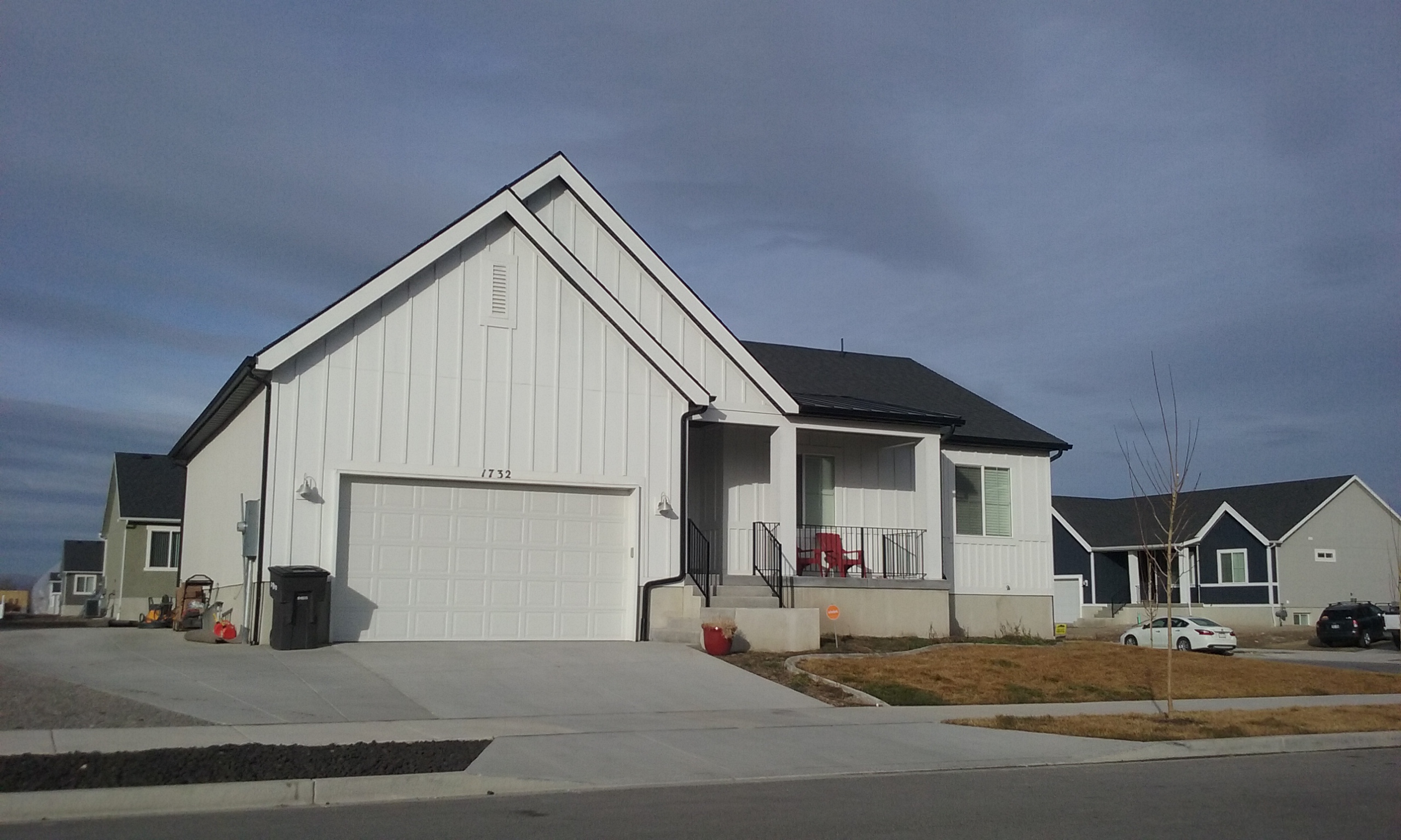
| Property Address: 1732 S 570 WEST - PROVO
more see "Addrs" tab below..
|
|
| Mailing Address: 1732 S 570 W PROVO, UT 84601 |
|
| Acreage: 0.230374 |
|
| Last Document:
107886-2022
|
|
| Subdivision Map Filing |
|
| Taxing Description:
LOT 121, PLAT A, OSPREY POINT AMENDED SUB AREA 0.230 AC.
*Taxing description NOT FOR LEGAL DOCUMENTS
|
|
- Owner Names
- Value History
- Tax History
- Location
- Photos
- Documents
- Aerial Image
- Addrs
| |
----- Real Estate Values ----- |
---Improvements--- |
---Greenbelt--- |
Total |
| Year |
Com |
Res |
Agr |
Tot |
Com |
Res |
Agr |
Tot |
Land |
Homesite |
Tot |
Market Value |
| 2024 |
$0 |
$224,900 |
$0 |
$224,900 |
$0 |
$358,000 |
$0 |
$358,000 |
$0 |
$0 |
$0 |
$582,900 |
| 2023 |
$0 |
$224,900 |
$0 |
$224,900 |
$0 |
$335,000 |
$0 |
$335,000 |
$0 |
$0 |
$0 |
$559,900 |
| 2022 |
$0 |
$239,800 |
$0 |
$239,800 |
$0 |
$337,600 |
$0 |
$337,600 |
$0 |
$0 |
$0 |
$577,400 |
| 2021 |
$0 |
$133,200 |
$0 |
$133,200 |
$0 |
$312,600 |
$0 |
$312,600 |
$0 |
$0 |
$0 |
$445,800 |
| 2020 |
$0 |
$115,800 |
$0 |
$115,800 |
$0 |
$236,800 |
$0 |
$236,800 |
$0 |
$0 |
$0 |
$352,600 |
| 2019 |
$0 |
$115,800 |
$0 |
$115,800 |
$0 |
$205,900 |
$0 |
$205,900 |
$0 |
$0 |
$0 |
$321,700 |
| 2018 |
$0 |
$108,600 |
$0 |
$108,600 |
$0 |
$179,000 |
$0 |
$179,000 |
$0 |
$0 |
$0 |
$287,600 |
| 2017 |
$0 |
$97,700 |
$0 |
$97,700 |
$0 |
$118,400 |
$0 |
$118,400 |
$0 |
$0 |
$0 |
$216,100 |
| Year |
General Taxes |
Adjustments |
Net Taxes |
Fees |
Payments |
Tax Balance* |
Balance Due |
Tax District |
| 2025 |
$0.00 |
$0.00 |
$0.00 |
$0.00 |
|
$0.00
|
$0.00 |
110 - PROVO CITY |
| 2024 |
$0.00 |
$0.00 |
$0.00 |
$0.00 |
|
$0.00
|
$0.00 |
110 - PROVO CITY |
| 2023 |
$3,173.37 |
$0.00 |
$3,173.37 |
$0.00 |
|
$0.00
|
$0.00 |
110 - PROVO CITY |
| 2022 |
$3,245.57 |
$0.00 |
$3,245.57 |
$0.00 |
|
$0.00
|
$0.00 |
110 - PROVO CITY |
| 2021 |
$2,612.25 |
$0.00 |
$2,612.25 |
$0.00 |
|
$0.00
|
$0.00 |
110 - PROVO CITY |
| 2020 |
$2,204.01 |
$0.00 |
$2,204.01 |
$0.00 |
|
$0.00
|
$0.00 |
110 - PROVO CITY |
| 2019 |
$1,933.55 |
$0.00 |
$1,933.55 |
$0.00 |
|
$0.00
|
$0.00 |
110 - PROVO CITY |
| 2018 |
$1,704.39 |
$0.00 |
$1,704.39 |
$0.00 |
|
$0.00
|
$0.00 |
110 - PROVO CITY |
| 2017 |
$1,281.85 |
$0.00 |
$1,281.85 |
$0.00 |
|
$0.00
|
$0.00 |
110 - PROVO CITY |
* Note: Original tax amount (Does not include applicable interest and/or fees).
| Entry # |
Date |
Recorded |
Type |
Party1 (Grantor) |
Party2 (Grantee) |
| 346-2023 |
|
01/03/2023 |
FN ST |
MOSSMAN, BOYD P |
GOODLEAP LLC |
| 107886-2022 |
09/29/2022 |
10/06/2022 |
WD |
MOSSMAN, BOYD P & MARVALEE MAILE |
MOSSMAN, BOYD P TEE (ET AL) |
| 208038-2020 |
12/28/2020 |
12/28/2020 |
RSUBTEE |
JUAB TITLE & ABSTRACT COMPANY (ET AL) |
JOHNSON, CARSON & SHAMRI |
| 189843-2020 |
11/24/2020 |
11/30/2020 |
WD |
JOHNSON, CARSON DALE & SHAMRI ANN TEE (ET AL) |
MOSSMAN, BOYD P & MARVALEE MAILE |
| 112685-2020 |
06/12/2020 |
08/03/2020 |
QCD |
JOHNSON, CARSON & SHAMRI |
JOHNSON, CARSON DALE & SHAMRI ANN TEE (ET AL) |
| 27785-2017 |
03/22/2017 |
03/22/2017 |
TR D |
JOHNSON, CARSON & SHAMRI |
WRIGHT CHILDREN'S TRUST THE |
| 27784-2017 |
03/03/2017 |
03/22/2017 |
SP WD |
D R HORTON INC |
JOHNSON, CARSON & SHAMRI |
| 120776-2016 |
10/03/2016 |
12/01/2016 |
GEO HAZ |
SORENSEN, SID |
WHOM OF INTEREST |
| 82493-2016 |
08/26/2016 |
08/26/2016 |
REC |
COTTONWOOD TITLE INSURANCE AGENCY INC TEE |
MITCHELL DEVELOPMENT LC |
| 82492-2016 |
08/17/2016 |
08/26/2016 |
REC |
COTTONWOOD TITLE INSURANCE AGENCY INC TEE |
MITCHELL DEVELOPMENT LC |
| 64737-2016 |
07/06/2016 |
07/14/2016 |
S PLAT |
DR HORTON INC |
OSPREY, POINT PLAT A AMD |
1732 S 570 WEST - PROVO
595 W 1820 SOUTH - PROVO
Main Menu Comments or Concerns on Value/Appraisal - Assessor's Office
Documents/Owner/Parcel information - Recorder's Office
Address Change for Tax Notice
This page was created on 9/7/2024 3:18:57 AM |


