Property Information
mobile view
| Serial Number: 49:646:0008 |
Serial Life: 2007... |
|
|
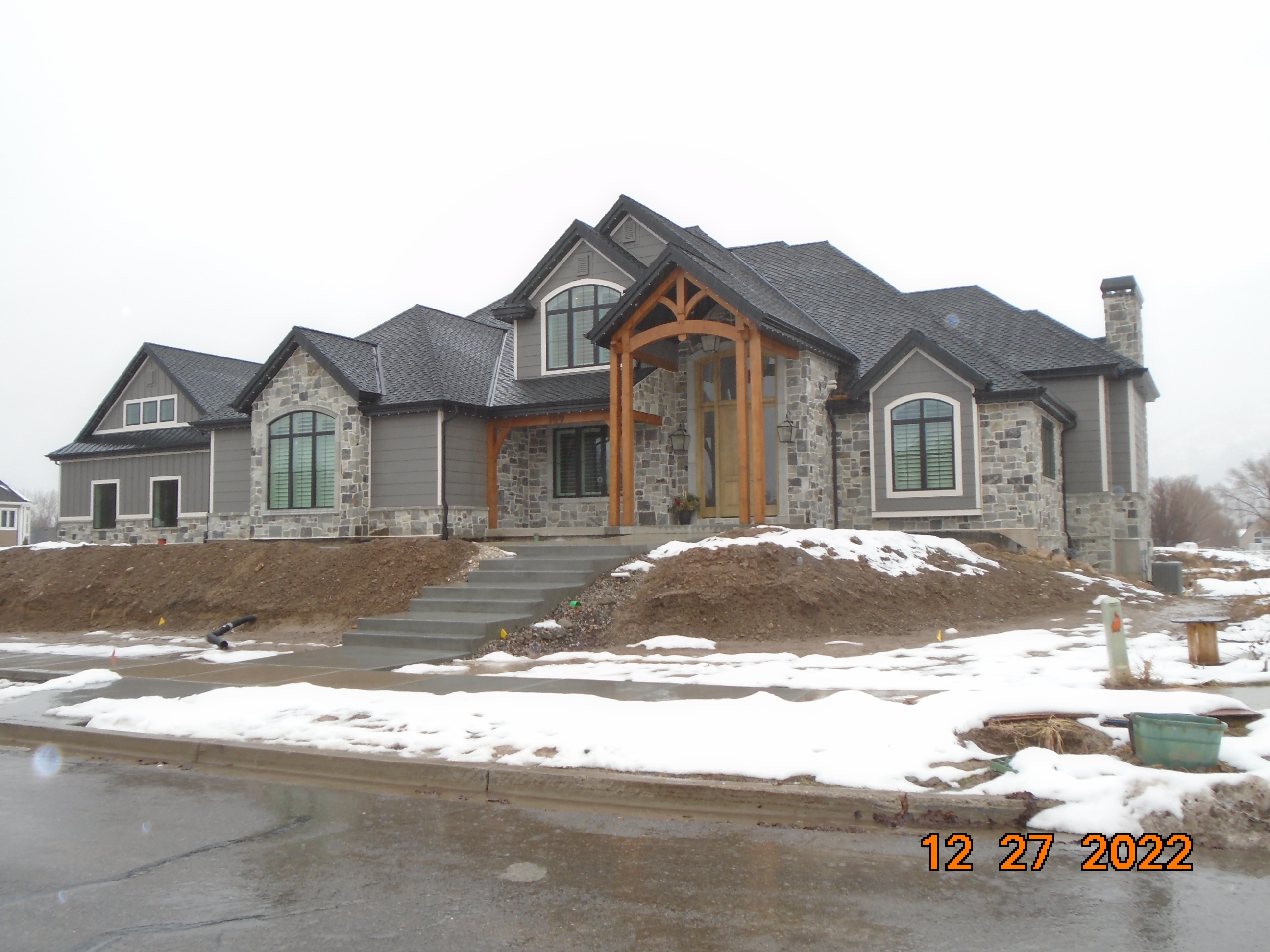
 Total Photos: 2
|
| |
|
|
| Property Address: 189 E 1300 SOUTH - MAPLETON |
|
| Mailing Address: 189 E 1300 S MAPLETON, UT 84664 |
|
| Acreage: 1 |
|
| Last Document:
122874-2006
|
|
| Subdivision Map Filing |
|
| Taxing Description:
LOT 8, PLAT A, PERRY HOLLOW SUBDV. AREA 1.000 AC.
*Taxing description NOT FOR LEGAL DOCUMENTS
|
|
- Owner Names
- Value History
- Tax History
- Location
- Photos
- Documents
- Aerial Image
| |
----- Real Estate Values ----- |
---Improvements--- |
---Greenbelt--- |
Total |
| Year |
Com |
Res |
Agr |
Tot |
Com |
Res |
Agr |
Tot |
Land |
Homesite |
Tot |
Market Value |
| 2024 |
$0 |
$458,900 |
$0 |
$458,900 |
$0 |
$2,355,500 |
$0 |
$2,355,500 |
$0 |
$0 |
$0 |
$2,814,400 |
| 2023 |
$0 |
$458,900 |
$0 |
$458,900 |
$0 |
$1,787,700 |
$0 |
$1,787,700 |
$0 |
$0 |
$0 |
$2,246,600 |
| 2022 |
$0 |
$489,300 |
$0 |
$489,300 |
$0 |
$0 |
$0 |
$0 |
$0 |
$0 |
$0 |
$489,300 |
| 2021 |
$0 |
$315,700 |
$0 |
$315,700 |
$0 |
$0 |
$0 |
$0 |
$0 |
$0 |
$0 |
$315,700 |
| 2020 |
$0 |
$295,000 |
$0 |
$295,000 |
$0 |
$0 |
$0 |
$0 |
$0 |
$0 |
$0 |
$295,000 |
| 2019 |
$0 |
$285,000 |
$0 |
$285,000 |
$0 |
$0 |
$0 |
$0 |
$0 |
$0 |
$0 |
$285,000 |
| 2018 |
$0 |
$270,000 |
$0 |
$270,000 |
$0 |
$0 |
$0 |
$0 |
$0 |
$0 |
$0 |
$270,000 |
| 2017 |
$0 |
$240,000 |
$0 |
$240,000 |
$0 |
$0 |
$0 |
$0 |
$0 |
$0 |
$0 |
$240,000 |
| 2016 |
$0 |
$205,000 |
$0 |
$205,000 |
$0 |
$0 |
$0 |
$0 |
$0 |
$0 |
$0 |
$205,000 |
| 2015 |
$0 |
$170,000 |
$0 |
$170,000 |
$0 |
$0 |
$0 |
$0 |
$0 |
$0 |
$0 |
$170,000 |
| 2014 |
$0 |
$157,000 |
$0 |
$157,000 |
$0 |
$0 |
$0 |
$0 |
$0 |
$0 |
$0 |
$157,000 |
| 2013 |
$0 |
$127,000 |
$0 |
$127,000 |
$0 |
$0 |
$0 |
$0 |
$0 |
$0 |
$0 |
$127,000 |
| 2012 |
$0 |
$93,000 |
$0 |
$93,000 |
$0 |
$0 |
$0 |
$0 |
$0 |
$0 |
$0 |
$93,000 |
| 2011 |
$0 |
$93,000 |
$0 |
$93,000 |
$0 |
$0 |
$0 |
$0 |
$0 |
$0 |
$0 |
$93,000 |
| 2010 |
$0 |
$98,000 |
$0 |
$98,000 |
$0 |
$0 |
$0 |
$0 |
$0 |
$0 |
$0 |
$98,000 |
| 2009 |
$0 |
$98,000 |
$0 |
$98,000 |
$0 |
$0 |
$0 |
$0 |
$0 |
$0 |
$0 |
$98,000 |
| 2008 |
$0 |
$230,000 |
$0 |
$230,000 |
$0 |
$0 |
$0 |
$0 |
$0 |
$0 |
$0 |
$230,000 |
| 2007 |
$0 |
$115,000 |
$0 |
$115,000 |
$0 |
$0 |
$0 |
$0 |
$0 |
$0 |
$0 |
$115,000 |
| Year |
General Taxes |
Adjustments |
Net Taxes |
Fees |
Payments |
Tax Balance* |
Balance Due |
Tax District |
| 2025 |
$0.00 |
$0.00 |
$0.00 |
$0.00 |
|
$0.00
|
$0.00 |
140 - MAPLETON CITY |
| 2024 |
$15,801.17 |
$0.00 |
$15,801.17 |
$0.00 |
|
$0.00
|
$0.00 |
140 - MAPLETON CITY |
| 2023 |
$12,534.23 |
$0.00 |
$12,534.23 |
$0.00 |
|
$0.00
|
$0.00 |
140 - MAPLETON CITY |
| 2022 |
$5,019.73 |
$0.00 |
$5,019.73 |
$0.00 |
|
$0.00
|
$0.00 |
140 - MAPLETON CITY |
| 2021 |
$3,835.44 |
$0.00 |
$3,835.44 |
$0.00 |
|
$0.00
|
$0.00 |
140 - MAPLETON CITY |
| 2020 |
$3,705.20 |
$0.00 |
$3,705.20 |
$0.00 |
|
$0.00
|
$0.00 |
140 - MAPLETON CITY |
| 2019 |
$3,506.93 |
$0.00 |
$3,506.93 |
$0.00 |
|
$0.00
|
$0.00 |
140 - MAPLETON CITY |
| 2018 |
$3,490.02 |
$0.00 |
$3,490.02 |
$0.00 |
|
$0.00
|
$0.00 |
140 - MAPLETON CITY |
| 2017 |
$3,215.04 |
$0.00 |
$3,215.04 |
$0.00 |
|
$0.00
|
$0.00 |
140 - MAPLETON CITY |
| 2016 |
$2,762.58 |
$0.00 |
$2,762.58 |
$0.00 |
|
$0.00
|
$0.00 |
140 - MAPLETON CITY |
| 2015 |
$2,304.86 |
$0.00 |
$2,304.86 |
$0.00 |
|
$0.00
|
$0.00 |
140 - MAPLETON CITY |
| 2014 |
$2,167.54 |
$0.00 |
$2,167.54 |
$0.00 |
|
$0.00
|
$0.00 |
140 - MAPLETON CITY |
| 2013 |
$1,866.52 |
$0.00 |
$1,866.52 |
$0.00 |
|
$0.00
|
$0.00 |
140 - MAPLETON CITY |
| 2012 |
$1,398.07 |
$0.00 |
$1,398.07 |
$0.00 |
|
$0.00
|
$0.00 |
140 - MAPLETON CITY |
| 2011 |
$1,368.77 |
$0.00 |
$1,368.77 |
$0.00 |
|
$0.00
|
$0.00 |
140 - MAPLETON CITY |
| 2010 |
$1,401.79 |
$0.00 |
$1,401.79 |
$0.00 |
|
$0.00
|
$0.00 |
140 - MAPLETON CITY |
| 2009 |
$1,312.12 |
$0.00 |
$1,312.12 |
$0.00 |
|
$0.00
|
$0.00 |
140 - MAPLETON CITY |
| 2008 |
$2,805.08 |
$0.00 |
$2,805.08 |
$0.00 |
|
$0.00
|
$0.00 |
140 - MAPLETON CITY |
| 2007 |
$1,312.38 |
$0.00 |
$1,312.38 |
$0.00 |
|
$0.00
|
$0.00 |
140 - MAPLETON CITY |
* Note: Original tax amount (Does not include applicable interest and/or fees).
| Entry # |
Date |
Recorded |
Type |
Party1 (Grantor) |
Party2 (Grantee) |
| 1236-2023 |
01/03/2023 |
01/06/2023 |
SP WD |
JACKSON, RICHARD O & JULIE R |
JACKSON, RICHARD ORRIN TEE (ET AL) |
| 53161-2009 |
05/05/2009 |
05/13/2009 |
REC |
FAR WEST BANK TEE |
PERRY HOLLOW LLC |
| 45306-2009 |
04/06/2009 |
04/28/2009 |
REC |
FAR WEST BANK TEE |
PERRY HOLLOW LLC |
| 81069-2007 |
05/29/2007 |
06/01/2007 |
P REC |
FAR WEST BANK TEE |
PERRY HOLLOW LLC |
| 77247-2007 |
05/24/2007 |
05/24/2007 |
WD |
PERRY HOLLOW LLC |
JACKSON, RICHARD O & JULIE R |
| 162970-2006 |
12/01/2006 |
12/04/2006 |
D TR |
PERRY HOLLOW LLC |
FAR WEST BANK |
| 124505-2006 |
09/21/2006 |
09/21/2006 |
EAS |
PERRY, DON & COLETTE (ET AL) |
ROCKY MOUNTAIN POWER (ET AL) |
| 122874-2006 |
09/06/2006 |
09/18/2006 |
S PLAT |
PERRY HOLLOW LLC (ET AL) |
PERRY HOLLOW PLAT A |
Main Menu Comments or Concerns on Value/Appraisal - Assessor's Office
Documents/Owner/Parcel information - Recorder's Office
Address Change for Tax Notice
This page was created on 12/2/2024 5:54:41 PM |