Property Information
mobile view
| Serial Number: 49:869:0001 |
Serial Life: 2018... |
|
|
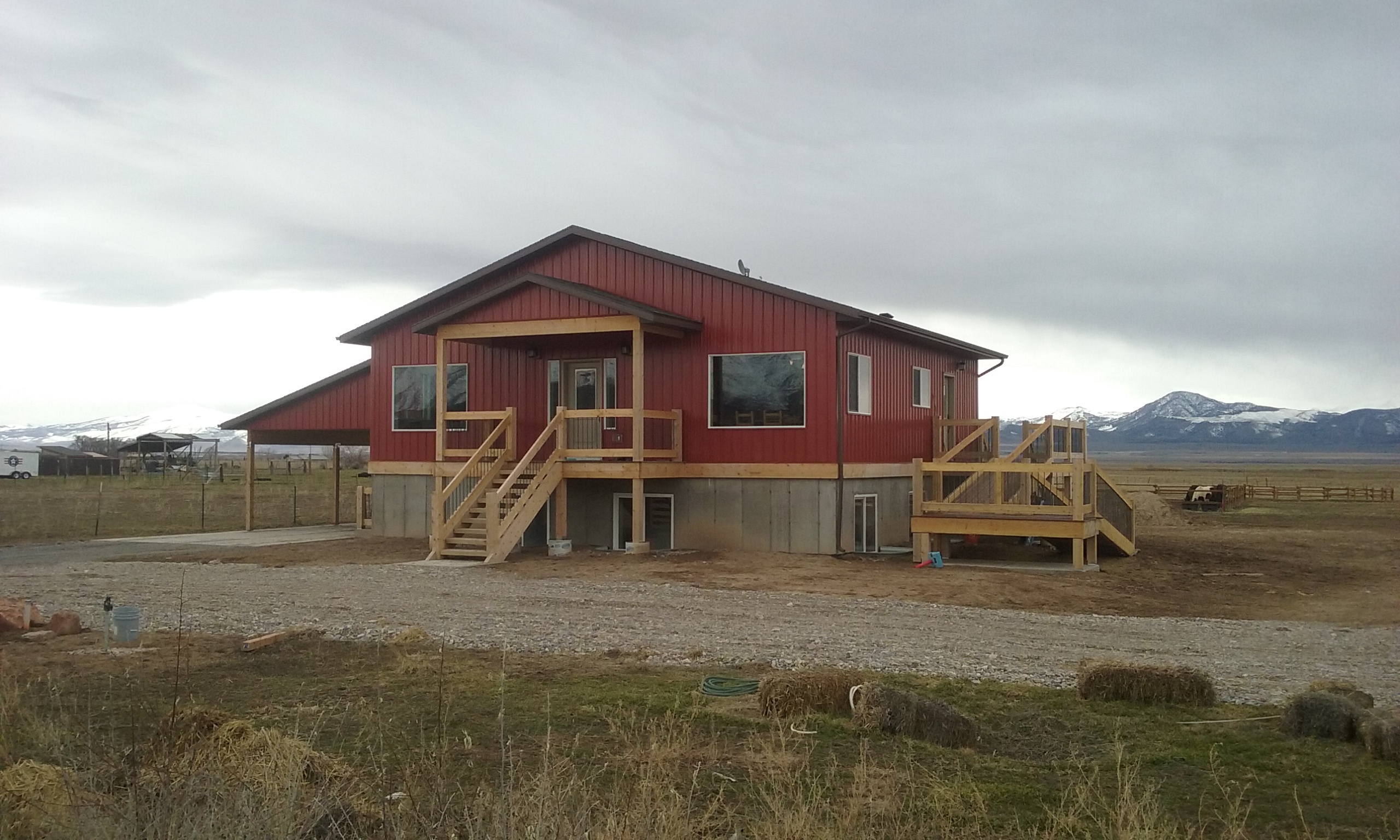
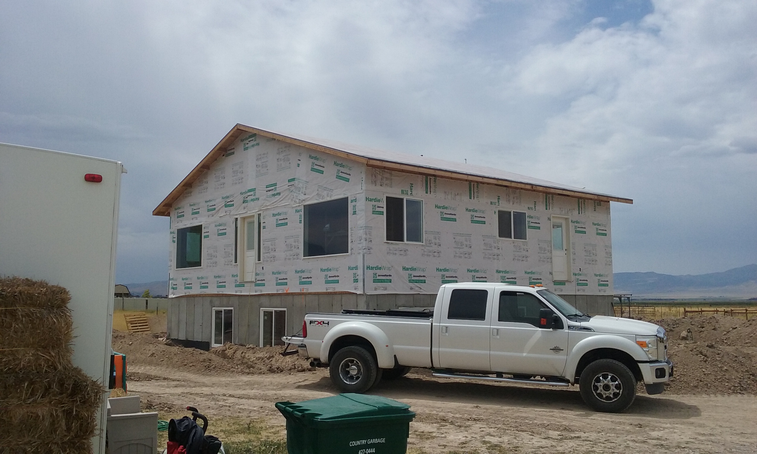
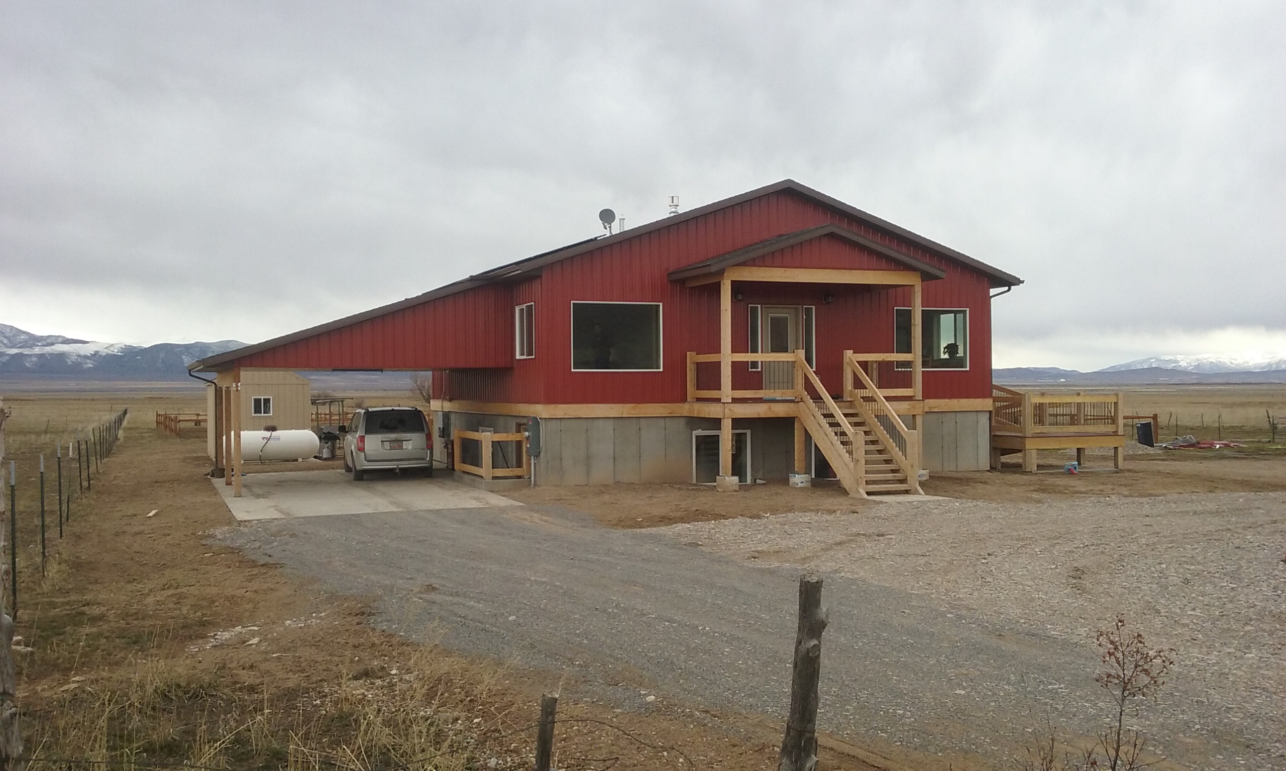
Total Photos: 2
|
| |
|
|
| Property Address: 879 N MAIN - GENOLA |
|
| Mailing Address: 879 N MAIN ST SANTAQUIN, UT 84655 |
|
| Acreage: 2.358083 |
|
| Last Document:
100449-2017
|
|
| Subdivision Map Filing |
|
| Taxing Description:
LOT 1, PLAT A, PERRY ESTATES SUB AREA 2.358 AC.
*Taxing description NOT FOR LEGAL DOCUMENTS
|
|
- Owner Names
- Value History
- Tax History
- Location
- Photos
- Documents
- Aerial Image
| |
----- Real Estate Values ----- |
---Improvements--- |
---Greenbelt--- |
Total |
| Year |
Com |
Res |
Agr |
Tot |
Com |
Res |
Agr |
Tot |
Land |
Homesite |
Tot |
Market Value |
| 2024 |
$0 |
$246,900 |
$37,600 |
$284,500 |
$0 |
$311,700 |
$0 |
$311,700 |
$0 |
$0 |
$0 |
$596,200 |
| 2023 |
$0 |
$246,900 |
$37,600 |
$284,500 |
$0 |
$340,300 |
$0 |
$340,300 |
$0 |
$0 |
$0 |
$624,800 |
| 2022 |
$0 |
$263,300 |
$40,100 |
$303,400 |
$0 |
$299,400 |
$0 |
$299,400 |
$0 |
$0 |
$0 |
$602,800 |
| 2021 |
$0 |
$175,500 |
$33,400 |
$208,900 |
$0 |
$245,200 |
$0 |
$245,200 |
$0 |
$0 |
$0 |
$454,100 |
| 2020 |
$0 |
$135,000 |
$29,000 |
$164,000 |
$0 |
$238,100 |
$0 |
$238,100 |
$0 |
$0 |
$0 |
$402,100 |
| 2019 |
$0 |
$130,000 |
$26,300 |
$156,300 |
$0 |
$216,000 |
$0 |
$216,000 |
$0 |
$0 |
$0 |
$372,300 |
| 2018 |
$0 |
$110,000 |
$26,300 |
$136,300 |
$0 |
$0 |
$0 |
$0 |
$0 |
$0 |
$0 |
$136,300 |
| Year |
General Taxes |
Adjustments |
Net Taxes |
Fees |
Payments |
Tax Balance* |
Balance Due |
Tax District |
| 2025 |
$0.00 |
$0.00 |
$0.00 |
$0.00 |
|
$0.00
|
$0.00 |
200 - GENOLA CITY |
| 2024 |
$0.00 |
$0.00 |
$0.00 |
$0.00 |
|
$0.00
|
$0.00 |
200 - GENOLA CITY |
| 2023 |
$3,479.76 |
$0.00 |
$3,479.76 |
$0.00 |
|
$0.00
|
$0.00 |
200 - GENOLA CITY |
| 2022 |
$3,396.57 |
$0.00 |
$3,396.57 |
$0.00 |
|
$0.00
|
$0.00 |
200 - GENOLA CITY |
| 2021 |
$2,916.61 |
$0.00 |
$2,916.61 |
$0.00 |
|
$0.00
|
$0.00 |
200 - GENOLA CITY |
| 2020 |
$2,658.46 |
$0.00 |
$2,658.46 |
$0.00 |
|
$0.00
|
$0.00 |
200 - GENOLA CITY |
| 2019 |
$2,389.75 |
$0.00 |
$2,389.75 |
$0.00 |
|
$0.00
|
$0.00 |
200 - GENOLA CITY |
| 2018 |
$1,560.36 |
$0.00 |
$1,560.36 |
$0.00 |
|
$0.00
|
$0.00 |
200 - GENOLA CITY |
* Note: Original tax amount (Does not include applicable interest and/or fees).
| Entry # |
Date |
Recorded |
Type |
Party1 (Grantor) |
Party2 (Grantee) |
| 40083-2020 |
03/23/2020 |
03/30/2020 |
REC |
MORAN, KEVIN P TEE |
ROBERTS, RYAN & CHELSEA |
| 40082-2020 |
03/14/2020 |
03/30/2020 |
SUB TEE |
UTAH COMMUNITY FEDERAL CREDIT UNION |
MORAN, KEVIN P SUBTEE |
| 2629-2020 |
01/03/2020 |
01/08/2020 |
D TR |
ROBERTS, RYAN & CHELSEA |
UTAH COMMUNITY FEDERAL CREDIT UNION |
| 123376-2017 |
12/12/2017 |
12/13/2017 |
D TR |
ROBERTS, RYAN & CHELSEA |
UTAH COMMUNITY FEDERAL CREDIT UNION |
| 106666-2017 |
10/27/2017 |
10/27/2017 |
R FARM |
UTAH COUNTY TREASURER |
PERRY, DON & DON B (ET AL) |
| 106665-2017 |
10/27/2017 |
10/27/2017 |
R FARM |
UTAH COUNTY TREASURER |
PERRY, DON & DON B (ET AL) |
| 106664-2017 |
10/27/2017 |
10/27/2017 |
R FARM |
UTAH COUNTY TREASURER |
PERRY, DON & DON B (ET AL) |
| 100449-2017 |
10/09/2017 |
10/11/2017 |
WD |
PERRY, DON & COLETTE |
ROBERTS, RYAN & CHELSEA |
| 100448-2017 |
10/09/2017 |
10/11/2017 |
W FARM |
PERRY, DON & COLETTE |
WHOM OF INTEREST |
| 99023-2017 |
05/31/2017 |
10/06/2017 |
S PLAT |
JACOBSEN, SPENCER & SARAH (ET AL) |
PERRY ESTATES PLAT A |
Main Menu Comments or Concerns on Value/Appraisal - Assessor's Office
Documents/Owner/Parcel information - Recorder's Office
Address Change for Tax Notice
This page was created on 7/11/2024 2:32:35 AM |