Property Information
mobile view
| Serial Number: 52:090:0020 |
Serial Life: 1981... |
|
|
 Total Photos: 6
|
| |
|
|
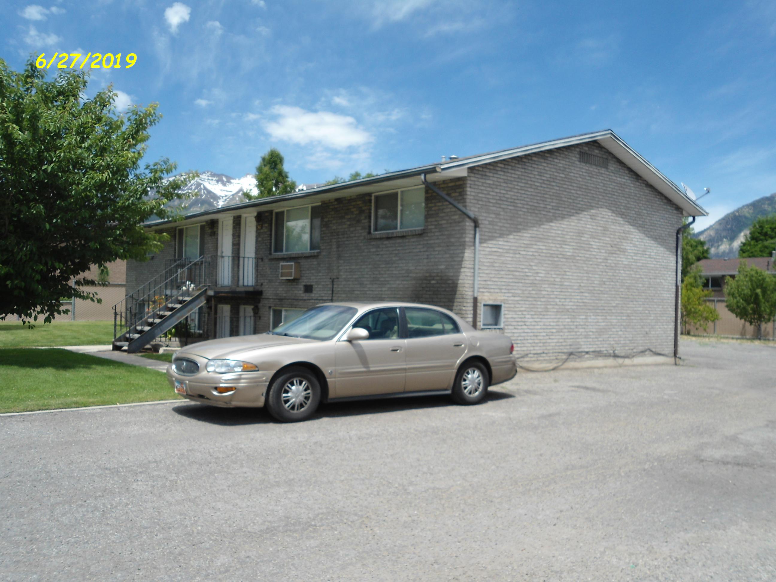
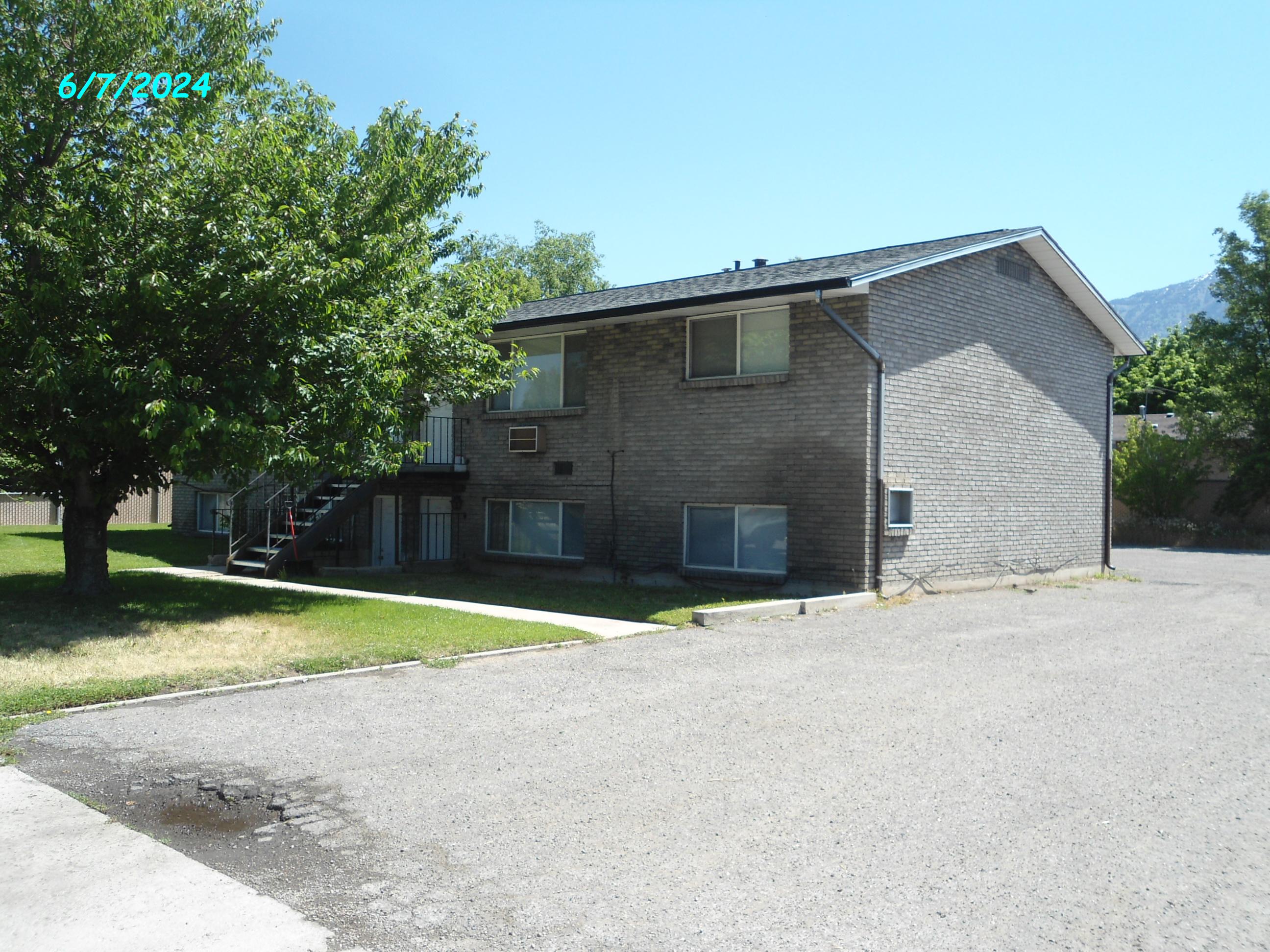
| Property Address: 357 S 150 WEST - OREM
more see "Addrs" tab below..
|
|
| Mailing Address: 2038 E 9060 S SANDY, UT 84093-2528 |
|
| Acreage: 0.24 |
|
| Last Document:
18587-2005
|
|
| Subdivision Map Filing |
|
| Taxing Description:
LOT 20, PAT A, SUMMERTREE SUBD.
*Taxing description NOT FOR LEGAL DOCUMENTS
|
|
- Owner Names
- Value History
- Tax History
- Location
- Photos
- Documents
- Aerial Image
- Addrs
| 2025... |
|
HFB&S 611 E LLC |
|
| 2024 |
|
NIELSEN FAMILY TRUST 08-04-1999 |
|
| 2024 |
|
NIELSEN, NORMAN LEROY |
|
| 2024 |
|
NIELSEN, ROSANNE TUELLER |
|
| 2016-2023 |
|
NIELSEN, NORMAN LEROY |
|
| 2016-2023 |
|
NIELSEN, ROSANNE TUELLER |
|
| 2010-2015 |
|
NORMAN L NIELSEN PROPERTIES #5 LLC |
|
| 2010NV |
|
NIELSEN, NORMAN L |
|
| 2010NV |
|
NIELSEN, ROSANNE T |
|
| 2007-2009 |
|
NORMAN L NIELSEN PROPERTIES #5 LLC |
|
| 2006 |
|
NIELSEN, NORMAN LEROY |
|
| 2006 |
|
NIELSEN, ROSANNE TUELLER |
|
| 2004-2005 |
|
NIELSEN, NORMAN LEROY |
|
| 2004-2005 |
|
NIELSEN, ROSANNE TUELLER |
|
| 2004NV |
|
NIELSEN, NORMAN L |
|
| 2004NV |
|
NIELSEN, ROSANNE T |
|
| 2000-2003 |
|
NIELSEN, NORMAN LEROY |
|
| 2000-2003 |
|
NIELSEN, ROSANNE TUELLER |
|
| 1994-1999 |
|
NIELSEN, NORMAN L |
|
| 1992-1993 |
|
NIELSEN, NORMAN L |
|
| 1992-1993 |
|
NIELSEN, ROSANNE T |
|
| 1989-1991 |
|
LEAFTY, DEBRA L |
|
| 1989-1991 |
|
LEAFTY, MARLOW V |
|
| 1984-1988 |
|
LEAFTY, DEBRA L |
|
| 1984-1988 |
|
LEAFTY, MARLOW V |
|
| 1983 |
|
ALLRED, DAWN G |
|
| 1983 |
|
ALLRED, JAMES J |
|
| 1982 |
|
ALLRED, DAWN G |
|
| 1982 |
|
ALLRED, JAMES J |
|
| 1981 |
|
ALLRED, DAWN G |
|
| 1981 |
|
ALLRED, JAMES J |
|
| |
----- Real Estate Values ----- |
---Improvements--- |
---Greenbelt--- |
Total |
| Year |
Com |
Res |
Agr |
Tot |
Com |
Res |
Agr |
Tot |
Land |
Homesite |
Tot |
Market Value |
| 2024 |
$0 |
$208,400 |
$0 |
$208,400 |
$0 |
$625,100 |
$0 |
$625,100 |
$0 |
$0 |
$0 |
$833,500 |
| 2023 |
$0 |
$206,300 |
$0 |
$206,300 |
$0 |
$618,900 |
$0 |
$618,900 |
$0 |
$0 |
$0 |
$825,200 |
| 2022 |
$0 |
$188,500 |
$0 |
$188,500 |
$0 |
$572,000 |
$0 |
$572,000 |
$0 |
$0 |
$0 |
$760,500 |
| 2021 |
$0 |
$145,000 |
$0 |
$145,000 |
$0 |
$440,000 |
$0 |
$440,000 |
$0 |
$0 |
$0 |
$585,000 |
| 2020 |
$0 |
$135,500 |
$0 |
$135,500 |
$0 |
$406,500 |
$0 |
$406,500 |
$0 |
$0 |
$0 |
$542,000 |
| 2019 |
$0 |
$132,700 |
$0 |
$132,700 |
$0 |
$372,200 |
$0 |
$372,200 |
$0 |
$0 |
$0 |
$504,900 |
| 2018 |
$0 |
$263,700 |
$0 |
$263,700 |
$0 |
$175,300 |
$0 |
$175,300 |
$0 |
$0 |
$0 |
$439,000 |
| 2017 |
$0 |
$96,300 |
$0 |
$96,300 |
$0 |
$288,800 |
$0 |
$288,800 |
$0 |
$0 |
$0 |
$385,100 |
| 2016 |
$0 |
$94,100 |
$0 |
$94,100 |
$0 |
$282,400 |
$0 |
$282,400 |
$0 |
$0 |
$0 |
$376,500 |
| 2015 |
$0 |
$85,600 |
$0 |
$85,600 |
$0 |
$256,700 |
$0 |
$256,700 |
$0 |
$0 |
$0 |
$342,300 |
| 2014 |
$0 |
$84,500 |
$0 |
$84,500 |
$0 |
$253,500 |
$0 |
$253,500 |
$0 |
$0 |
$0 |
$338,000 |
| 2013 |
$0 |
$54,300 |
$0 |
$54,300 |
$0 |
$265,300 |
$0 |
$265,300 |
$0 |
$0 |
$0 |
$319,600 |
| 2012 |
$0 |
$54,300 |
$0 |
$54,300 |
$0 |
$265,300 |
$0 |
$265,300 |
$0 |
$0 |
$0 |
$319,600 |
| 2011 |
$0 |
$54,300 |
$0 |
$54,300 |
$0 |
$247,200 |
$0 |
$247,200 |
$0 |
$0 |
$0 |
$301,500 |
| 2010 |
$0 |
$58,996 |
$0 |
$58,996 |
$0 |
$260,214 |
$0 |
$260,214 |
$0 |
$0 |
$0 |
$319,210 |
| 2009 |
$0 |
$60,200 |
$0 |
$60,200 |
$0 |
$279,800 |
$0 |
$279,800 |
$0 |
$0 |
$0 |
$340,000 |
| 2008 |
$0 |
$60,200 |
$0 |
$60,200 |
$0 |
$279,800 |
$0 |
$279,800 |
$0 |
$0 |
$0 |
$340,000 |
| 2007 |
$0 |
$60,200 |
$0 |
$60,200 |
$0 |
$279,800 |
$0 |
$279,800 |
$0 |
$0 |
$0 |
$340,000 |
| 2006 |
$0 |
$60,200 |
$0 |
$60,200 |
$0 |
$168,100 |
$0 |
$168,100 |
$0 |
$0 |
$0 |
$228,300 |
| 2005 |
$0 |
$57,318 |
$0 |
$57,318 |
$0 |
$160,064 |
$0 |
$160,064 |
$0 |
$0 |
$0 |
$217,382 |
| 2004 |
$0 |
$57,318 |
$0 |
$57,318 |
$0 |
$160,064 |
$0 |
$160,064 |
$0 |
$0 |
$0 |
$217,382 |
| 2003 |
$0 |
$57,318 |
$0 |
$57,318 |
$0 |
$160,064 |
$0 |
$160,064 |
$0 |
$0 |
$0 |
$217,382 |
| 2002 |
$0 |
$57,318 |
$0 |
$57,318 |
$0 |
$160,064 |
$0 |
$160,064 |
$0 |
$0 |
$0 |
$217,382 |
| 2001 |
$0 |
$57,318 |
$0 |
$57,318 |
$0 |
$153,908 |
$0 |
$153,908 |
$0 |
$0 |
$0 |
$211,226 |
| 2000 |
$0 |
$53,568 |
$0 |
$53,568 |
$0 |
$137,418 |
$0 |
$137,418 |
$0 |
$0 |
$0 |
$190,986 |
| 1999 |
$0 |
$50,064 |
$0 |
$50,064 |
$0 |
$128,428 |
$0 |
$128,428 |
$0 |
$0 |
$0 |
$178,492 |
| 1998 |
$0 |
$50,064 |
$0 |
$50,064 |
$0 |
$128,428 |
$0 |
$128,428 |
$0 |
$0 |
$0 |
$178,492 |
| 1997 |
$0 |
$50,064 |
$0 |
$50,064 |
$0 |
$128,428 |
$0 |
$128,428 |
$0 |
$0 |
$0 |
$178,492 |
| 1996 |
$0 |
$49,295 |
$0 |
$49,295 |
$0 |
$126,455 |
$0 |
$126,455 |
$0 |
$0 |
$0 |
$175,750 |
| 1995 |
$0 |
$44,814 |
$0 |
$44,814 |
$0 |
$126,455 |
$0 |
$126,455 |
$0 |
$0 |
$0 |
$171,269 |
| 1994 |
$0 |
$26,207 |
$0 |
$26,207 |
$0 |
$101,980 |
$0 |
$101,980 |
$0 |
$0 |
$0 |
$128,187 |
| 1993 |
$0 |
$26,207 |
$0 |
$26,207 |
$0 |
$101,980 |
$0 |
$101,980 |
$0 |
$0 |
$0 |
$128,187 |
| 1992 |
$0 |
$24,043 |
$0 |
$24,043 |
$0 |
$93,560 |
$0 |
$93,560 |
$0 |
$0 |
$0 |
$117,603 |
| 1991 |
$0 |
$21,090 |
$0 |
$21,090 |
$0 |
$82,070 |
$0 |
$82,070 |
$0 |
$0 |
$0 |
$103,160 |
| 1990 |
$0 |
$21,090 |
$0 |
$21,090 |
$0 |
$82,070 |
$0 |
$82,070 |
$0 |
$0 |
$0 |
$103,160 |
| 1989 |
$0 |
$21,090 |
$0 |
$21,090 |
$0 |
$82,070 |
$0 |
$82,070 |
$0 |
$0 |
$0 |
$103,160 |
| 1988 |
$0 |
$21,090 |
$0 |
$21,090 |
$0 |
$82,070 |
$0 |
$82,070 |
$0 |
$0 |
$0 |
$103,160 |
| 1987 |
$0 |
$21,742 |
$0 |
$21,742 |
$0 |
$84,608 |
$0 |
$84,608 |
$0 |
$0 |
$0 |
$106,350 |
| 1986 |
$0 |
$21,742 |
$0 |
$21,742 |
$0 |
$84,610 |
$0 |
$84,610 |
$0 |
$0 |
$0 |
$106,352 |
| 1985 |
$0 |
$21,742 |
$0 |
$21,742 |
$0 |
$84,608 |
$0 |
$84,608 |
$0 |
$0 |
$0 |
$106,350 |
| 1984 |
$0 |
$21,958 |
$0 |
$21,958 |
$0 |
$99,542 |
$0 |
$99,542 |
$0 |
$0 |
$0 |
$121,500 |
| Year |
General Taxes |
Adjustments |
Net Taxes |
Fees |
Payments |
Tax Balance* |
Balance Due |
Tax District |
| 2025 |
$0.00 |
$0.00 |
$0.00 |
$0.00 |
|
$0.00
|
$0.00 |
090 - OREM CITY |
| 2024 |
$3,749.00 |
$0.00 |
$3,749.00 |
$0.00 |
|
$0.00
|
$0.00 |
090 - OREM CITY |
| 2023 |
$3,453.42 |
$0.00 |
$3,453.42 |
$0.00 |
|
$0.00
|
$0.00 |
090 - OREM CITY |
| 2022 |
$3,285.13 |
$0.00 |
$3,285.13 |
$0.00 |
|
$0.00
|
$0.00 |
090 - OREM CITY |
| 2021 |
$3,033.46 |
$0.00 |
$3,033.46 |
$0.00 |
|
$0.00
|
$0.00 |
090 - OREM CITY |
| 2020 |
$2,859.67 |
$0.00 |
$2,859.67 |
$0.00 |
|
$0.00
|
$0.00 |
090 - OREM CITY |
| 2019 |
$2,561.74 |
$0.00 |
$2,561.74 |
$0.00 |
|
$0.00
|
$0.00 |
090 - OREM CITY |
| 2018 |
$2,331.20 |
$0.00 |
$2,331.20 |
$0.00 |
|
$0.00
|
$0.00 |
090 - OREM CITY |
| 2017 |
$2,099.62 |
$0.00 |
$2,099.62 |
$0.00 |
|
$0.00
|
$0.00 |
090 - OREM CITY |
| 2016 |
$2,226.06 |
$0.00 |
$2,226.06 |
$0.00 |
|
$0.00
|
$0.00 |
090 - OREM CITY |
| 2015 |
$2,140.01 |
$0.00 |
$2,140.01 |
$0.00 |
|
$0.00
|
$0.00 |
090 - OREM CITY |
| 2014 |
$2,122.79 |
$0.00 |
$2,122.79 |
$0.00 |
|
$0.00
|
$0.00 |
090 - OREM CITY |
| 2013 |
$2,164.55 |
$0.00 |
$2,164.55 |
$0.00 |
|
$0.00
|
$0.00 |
090 - OREM CITY |
| 2012 |
$2,209.20 |
$0.00 |
$2,209.20 |
$0.00 |
|
$0.00
|
$0.00 |
090 - OREM CITY |
| 2011 |
$2,074.14 |
$0.00 |
$2,074.14 |
$0.00 |
|
$0.00
|
$0.00 |
090 - OREM CITY |
| 2010 |
$2,055.88 |
$0.00 |
$2,055.88 |
$0.00 |
|
$0.00
|
$0.00 |
090 - OREM CITY |
| 2009 |
$2,029.89 |
$0.00 |
$2,029.89 |
$0.00 |
|
$0.00
|
$0.00 |
090 - OREM CITY |
| 2008 |
$1,881.03 |
$0.00 |
$1,881.03 |
$0.00 |
|
$0.00
|
$0.00 |
090 - OREM CITY |
| 2007 |
$1,869.47 |
$0.00 |
$1,869.47 |
$0.00 |
|
$0.00
|
$0.00 |
090 - OREM CITY |
| 2006 |
$1,340.20 |
$0.00 |
$1,340.20 |
$0.00 |
|
$0.00
|
$0.00 |
090 - OREM CITY |
| 2005 |
$1,440.93 |
$0.00 |
$1,440.93 |
$0.00 |
|
$0.00
|
$0.00 |
090 - OREM CITY |
| 2004 |
$1,415.37 |
$0.00 |
$1,415.37 |
$0.00 |
|
$0.00
|
$0.00 |
090 - OREM CITY |
| 2003 |
$1,373.42 |
$0.00 |
$1,373.42 |
$0.00 |
|
$0.00
|
$0.00 |
090 - OREM CITY |
| 2002 |
$1,255.15 |
$0.00 |
$1,255.15 |
$0.00 |
|
$0.00
|
$0.00 |
090 - OREM CITY |
| 2001 |
$1,208.18 |
$0.00 |
$1,208.18 |
$0.00 |
|
$0.00
|
$0.00 |
090 - OREM CITY |
| 2000 |
$1,130.51 |
$0.00 |
$1,130.51 |
$0.00 |
|
$0.00
|
$0.00 |
090 - OREM CITY |
| 1999 |
$1,088.49 |
$0.00 |
$1,088.49 |
$0.00 |
|
$0.00
|
$0.00 |
090 - OREM CITY |
| 1998 |
$1,027.80 |
$0.00 |
$1,027.80 |
$0.00 |
|
$0.00
|
$0.00 |
090 - OREM CITY |
| 1997 |
$1,023.53 |
$0.00 |
$1,023.53 |
$0.00 |
|
$0.00
|
$0.00 |
090 - OREM CITY |
| 1996 |
$920.85 |
$0.00 |
$920.85 |
$0.00 |
|
$0.00
|
$0.00 |
090 - OREM CITY |
| 1995 |
$1,015.76 |
$0.00 |
$1,015.76 |
$0.00 |
|
$0.00
|
$0.00 |
090 - OREM CITY |
| 1994 |
$1,212.30 |
$0.00 |
$1,212.30 |
$0.00 |
|
$0.00
|
$0.00 |
090 - OREM CITY |
| 1993 |
$1,073.07 |
$0.00 |
$1,073.07 |
$0.00 |
|
$0.00
|
$0.00 |
090 - OREM CITY |
| 1992 |
$993.65 |
$0.00 |
$993.65 |
$0.00 |
|
$0.00
|
$0.00 |
090 - OREM CITY |
| 1991 |
$912.89 |
$0.00 |
$912.89 |
$0.00 |
|
$0.00
|
$0.00 |
090 - OREM CITY |
| 1990 |
$878.97 |
$0.00 |
$878.97 |
$0.00 |
|
$0.00
|
$0.00 |
090 - OREM CITY |
| 1989 |
$895.83 |
$0.00 |
$895.83 |
$0.00 |
|
$0.00
|
$0.00 |
090 - OREM CITY |
| 1988 |
$893.69 |
$0.00 |
$893.69 |
$0.00 |
|
$0.00
|
$0.00 |
090 - OREM CITY |
| 1987 |
$905.65 |
$0.00 |
$905.65 |
$0.00 |
|
$0.00
|
$0.00 |
090 - OREM CITY |
| 1986 |
$893.47 |
$0.00 |
$893.47 |
$0.00 |
|
$0.00
|
$0.00 |
090 - OREM CITY |
| 1985 |
$898.79 |
$0.00 |
$898.79 |
$0.00 |
|
$0.00
|
$0.00 |
090 - OREM CITY |
| 1984 |
$1,005.19 |
$0.00 |
$1,005.19 |
$0.00 |
|
$0.00
|
$0.00 |
090 - OREM CITY |
* Note: Original tax amount (Does not include applicable interest and/or fees).
| Entry # |
Date |
Recorded |
Type |
Party1 (Grantor) |
Party2 (Grantee) |
| 50939-2024 |
07/29/2024 |
07/31/2024 |
WD |
NIELSEN, NORMAN LEROY & ROSANNE TUELLER TEE (ET AL) |
HFB&S 611 E LLC |
| 74549-2023 |
11/14/2023 |
11/15/2023 |
C QCD |
NIELSEN, NORMAN LEROY & ROSANNE TUELLER TEE (ET AL) |
NIELSEN, NORMAN LEROY & ROSANNE TUELLER TEE (ET AL) |
| 66386-2023 |
10/09/2023 |
10/09/2023 |
QCD |
NIELSEN, NORMAN L & ROSANNE T |
NIELSEN, NORMAN LEROY & ROSANNE TUELLER TEE (ET AL) |
| 95462-2017 |
09/19/2017 |
09/27/2017 |
REC |
AMERICA FIRST FEDERAL CREDIT UNION TEE |
NIELSEN, NORMAN LEROY & ROSANNE TUELLER TEE |
| 49471-2015 |
05/21/2015 |
06/08/2015 |
REC |
DRISCOLL, B J TEE |
NIELSEN, NORMAN L & ROSANNE T |
| 49470-2015 |
05/19/2015 |
06/08/2015 |
SUB TEE |
MORTGAGE ELECTRONIC REGISTRATION SYSTEMS INC |
DRISCOLL, B J SUCTEE |
| 40445-2015 |
05/08/2015 |
05/11/2015 |
D TR |
NIELSEN, NORMAN LEROY & ROSANNE TUELLER TEE (ET AL) |
AMERICA FIRST FEDERAL CREDIT UNION |
| 32298-2015 |
04/17/2015 |
04/17/2015 |
WD |
NORMAN L NIELSEN PROPERTIES #5 LLC |
NIELSEN, NORMAN LEROY & ROSANNE TUELLER TEE |
| 57192-2009 |
05/18/2009 |
05/22/2009 |
RSUBTEE |
MORTGAGE ELECTRONIC REGISTRATION SYSTEMS INC (ET AL) |
NIELSEN, NORMAN LEROY & ROSANNE TUELLER |
| 52858-2009 |
04/30/2009 |
05/13/2009 |
WD |
NIELSEN, NORMAN L & ROSANNE T |
NORMAN L NIELSEN PROPERTIES #5 LLC |
| 47802-2009 |
04/29/2009 |
05/01/2009 |
D TR |
NIELSEN, NORMAN L & ROSANNE T |
INDYMAC FEDERAL BANK |
| 35031-2009 |
04/02/2009 |
04/02/2009 |
WD |
NORMAN L NIELSEN PROPERTIES #5 LLC |
NIELSEN, NORMAN L & ROSANNE T |
| 84151-2006 |
06/27/2006 |
07/05/2006 |
WD |
NIELSEN, NORMAN LEROY & ROSANNE TUELLER TEE (ET AL) |
NORMAN L NIELSEN PROPERTIES #5 LLC |
| 48778-2005 |
03/14/2005 |
05/06/2005 |
RSUBTEE |
MORTGAGE ELECTRONIC REGISTRATION SYSTEMS INC (ET AL) |
NIELSEN, NORMAN L & ROSANNE T |
| 18587-2005 |
02/18/2005 |
02/23/2005 |
WD |
NIELSEN, NORMAN LEROY & ROSANNE TUELLER |
NIELSEN, NORMAN LEROY & ROSANNE TUELLER TEE |
| 18586-2005 |
02/18/2005 |
02/23/2005 |
D TR |
NIELSEN, NORMAN LEROY & ROSANNE TUELLER |
INDYMAC BANK |
| 18581-2005 |
02/18/2005 |
02/23/2005 |
WD |
NIELSEN, NORMAN LE ROY & ROSANNE TUELLER TEE (ET AL) |
NIELSEN, NORMAN LEROY & ROSANNE TUELLER |
| 70220-2003 |
02/03/2003 |
05/09/2003 |
REC |
WELLS FARGO FINANCIAL NATIONAL BANK TEE |
NIELSEN, NORMAN L |
| 70219-2003 |
02/03/2003 |
05/09/2003 |
SUC TEE |
WELLS FARGO HOME MORTGAGE INC |
NIELSEN, NORMAN L |
| 7373-2003 |
01/10/2003 |
01/15/2003 |
QCD |
NIELSEN, NORMAN L & ROSANNE T |
NIELSEN, NORMAN LEROY & ROSANNE TUELLER TEE |
| 5787-2003 |
01/10/2003 |
01/13/2003 |
D TR |
NIELSEN, NORMAN L & ROSANNE T |
TAYLOR BEAN & WHITAKER MORTGAGE CORP |
| 5784-2003 |
01/10/2003 |
01/13/2003 |
QCD |
NIELSEN FAMILY TRUST (ET AL) |
NIELSEN, NORMAN L & ROSANNE T |
| 69247-2001 |
06/29/2001 |
07/16/2001 |
AS |
WASHINGTON MUTUAL HOME LOANS INC SUC TO (ET AL) |
MORTGAGE ELECTRONIC REGISTRATION SYSTEMS INC |
| 88413-1999 |
08/06/1999 |
08/06/1999 |
QCD |
NIELSEN, NORMAN L & ROSANNE T |
NIELSEN, NORMAN LEROY & ROSANNE TUELLER TEE |
| 54353-1994 |
03/31/1994 |
07/01/1994 |
AS |
AMERICAN RESIDENTIAL MORTGAGE CORPORATION |
FLEET REAL ESTATE FUNDING CORPORATION |
| 15796-1994 |
02/16/1994 |
02/25/1994 |
REC |
RIVERS, ROD SUBTEE |
NIELSEN, NORMAN L & ROSANNE T |
| 15795-1994 |
02/08/1994 |
02/25/1994 |
SUB TEE |
AMERICAN RESIDENTIAL MORTGAGE CORPORATION FOR (ET AL) |
RIVERS, ROD SUBTEE |
| 67238-1993 |
09/22/1993 |
09/27/1993 |
D TR |
NIELSEN, NORMAN L |
AMERICAN RESIDENTIAL MORTGAGE CORPORATION |
| 67237-1993 |
09/22/1993 |
09/27/1993 |
QCD |
NIELSEN, NORMAN L & ROSANNE T |
NIELSEN, NORMAN L |
| 44910-1991 |
11/04/1991 |
11/12/1991 |
REC |
MOUNTAIN WEST TITLE CO TEE |
LEAFTY, MARLOWE V & DEBRA L |
| 44909-1991 |
10/28/1991 |
11/12/1991 |
SUB TEE |
GREAT FINANCIAL FEDERAL |
MOUNTAIN WEST TITLE CO SUBTEE |
| 40799-1991 |
08/28/1991 |
10/15/1991 |
AS |
AMERICAN RESIDENTIAL MORTGAGE CORPORATION |
FEDERAL NATIONAL MORTGAGE ASSOCIATION |
| 35268-1991 |
08/26/1991 |
09/05/1991 |
REC |
ASSOCIATED TITLE COMPANY TEE |
LEAFTY, MARLOWE V |
| 31446-1991 |
08/02/1991 |
08/09/1991 |
D TR |
NIELSEN, NORMAN L & ROSANNE T |
AMERICAN RESIDENTIAL MORTGAGE CORPORATION |
| 31445-1991 |
08/06/1991 |
08/09/1991 |
WD |
LEAFTY, MARLOWE V & DEBRA L |
NIELSEN, NORMAN L & ROSANNE T |
| 31639-1983 |
04/04/1983 |
10/17/1983 |
TR D |
LEAFTY, MARLOWE V |
JACOBSON, WENDALL |
| 18699-1983 |
06/23/1983 |
06/24/1983 |
REC |
WASATCH BANK |
ALLRED, JAMES J & DAWN G |
| 15401-1983 |
05/12/1983 |
05/25/1983 |
SP PA |
LEAFTY, DEBRA L |
LEAFTY, JOHN M |
| 15400-1983 |
05/12/1983 |
05/25/1983 |
SP PA |
LEAFTY, MARLOWE V |
LEAFTY, JOHN M |
| 15399-1983 |
05/20/1983 |
05/25/1983 |
D TR |
LEAFTY, MARLOWE V & DEBRA L BY ATY |
GREAT FINANCIAL FEDERAL |
| 15398-1983 |
05/19/1983 |
05/25/1983 |
WD |
JACOBSON, WENDELL A |
LEAFTY, MARLOWE V & DEBRA L |
| 15397-1983 |
05/21/1983 |
05/25/1983 |
WD |
ALLRED, JAMES J & DAWN G |
JACOBSON, WENDELL A |
| 12582-1983 |
04/29/1983 |
04/29/1983 |
CAN ND |
WASATCH BANK TEE |
ALLRED, JAMES J & DAWN G |
| 1389-1983 |
01/17/1983 |
01/17/1983 |
ND |
WASATCH BANK TEE |
ALLRED, JAMES J & DAWN G |
| 26370-1981 |
10/17/1980 |
09/09/1981 |
D TR |
ALLRED, JAMES J & DAWN G |
WASATCH BANK |
| 4864-1981 |
02/18/1981 |
02/19/1981 |
WD |
LOCKHART COMPANY THE |
ALLRED, JAMES J & DAWN G |
| 42815-1980 |
11/21/1980 |
12/11/1980 |
WD |
LOCKHART COMPANY THE |
ALLRED, JAMES J & DAWN G |
| 41690-1980 |
11/20/1980 |
12/03/1980 |
REC |
DESERET FEDERAL SAVINGS & LOAN ASSOCIATION TEE |
JOHNSON, R KAY & JOYCE W (ET AL) |
| 36748-1980 |
10/17/1980 |
10/21/1980 |
D TR |
ALLRED, JAMES J & DAWN G |
WASATCH BANK |
357 S 150 WEST - OREM
359 S 150 WEST - OREM
361 S 150 WEST - OREM
363 S 150 WEST - OREM
Main Menu Comments or Concerns on Value/Appraisal - Assessor's Office
Documents/Owner/Parcel information - Recorder's Office
Address Change for Tax Notice
This page was created on 4/11/2025 6:25:03 AM |